Tornadoes, Large Hail and Damaging Wind Threat
Top Stories
11 Apr 2022 8:10 PM
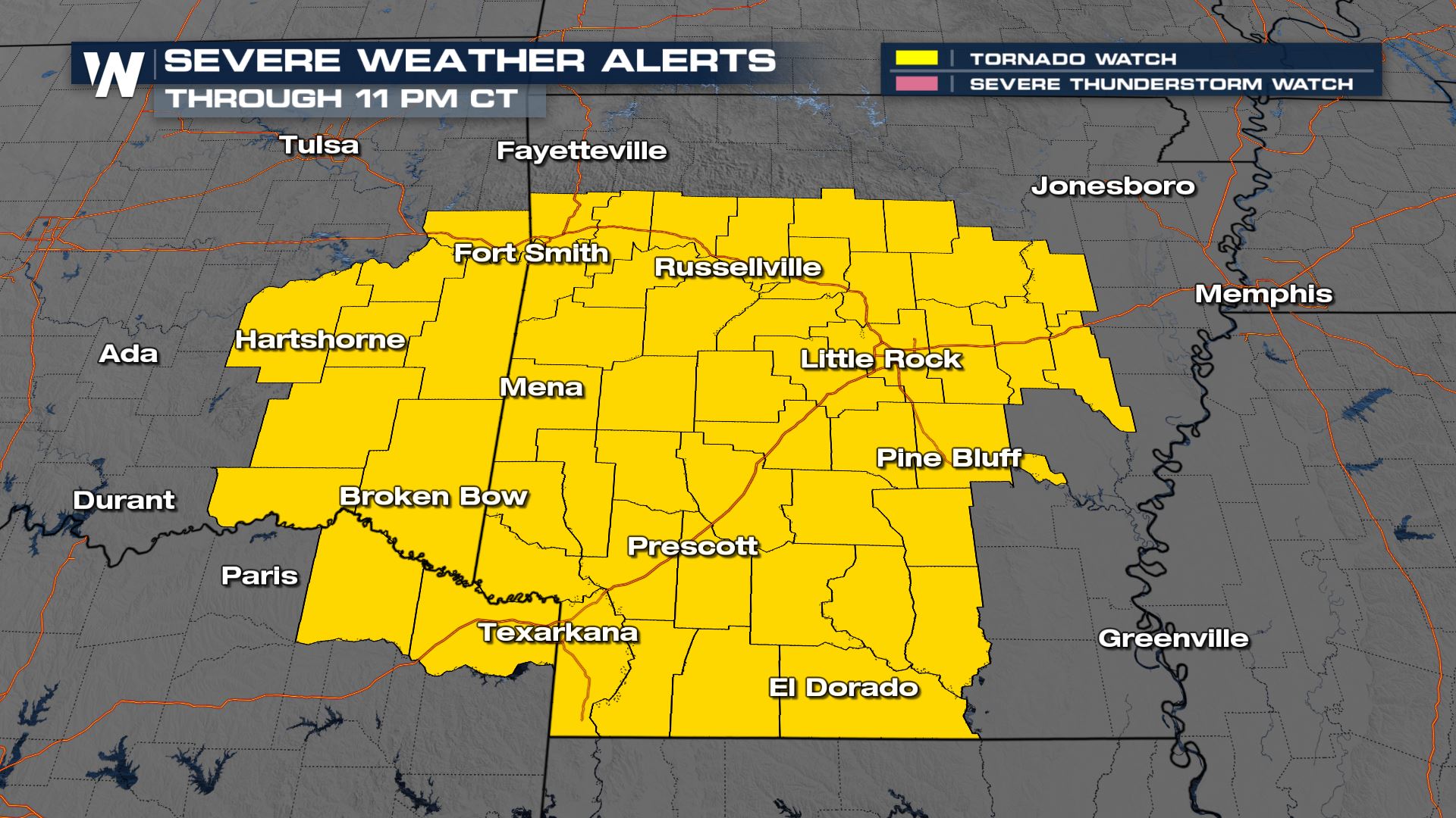
A tornado watch has been issued for portions of Arkansas, Texas and Oklahoma through 11 PM CDT. The main threats will be a few tornadoes, very large hail up to apple in size (3"+ diameter), and damaging winds to 70 mph+.
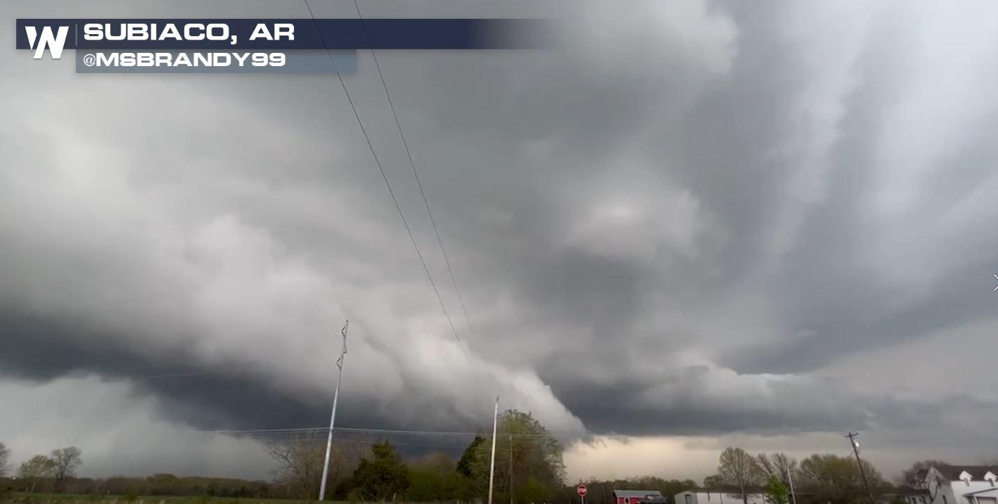
 Tornadoes and large (damaging) hail have been a result of Monday's storms and the threat is not over yet. Strong thunderstorms will be possible for the overnight hours. Here's what we've seen so far:
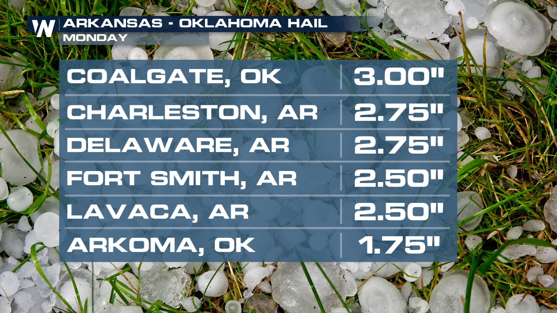
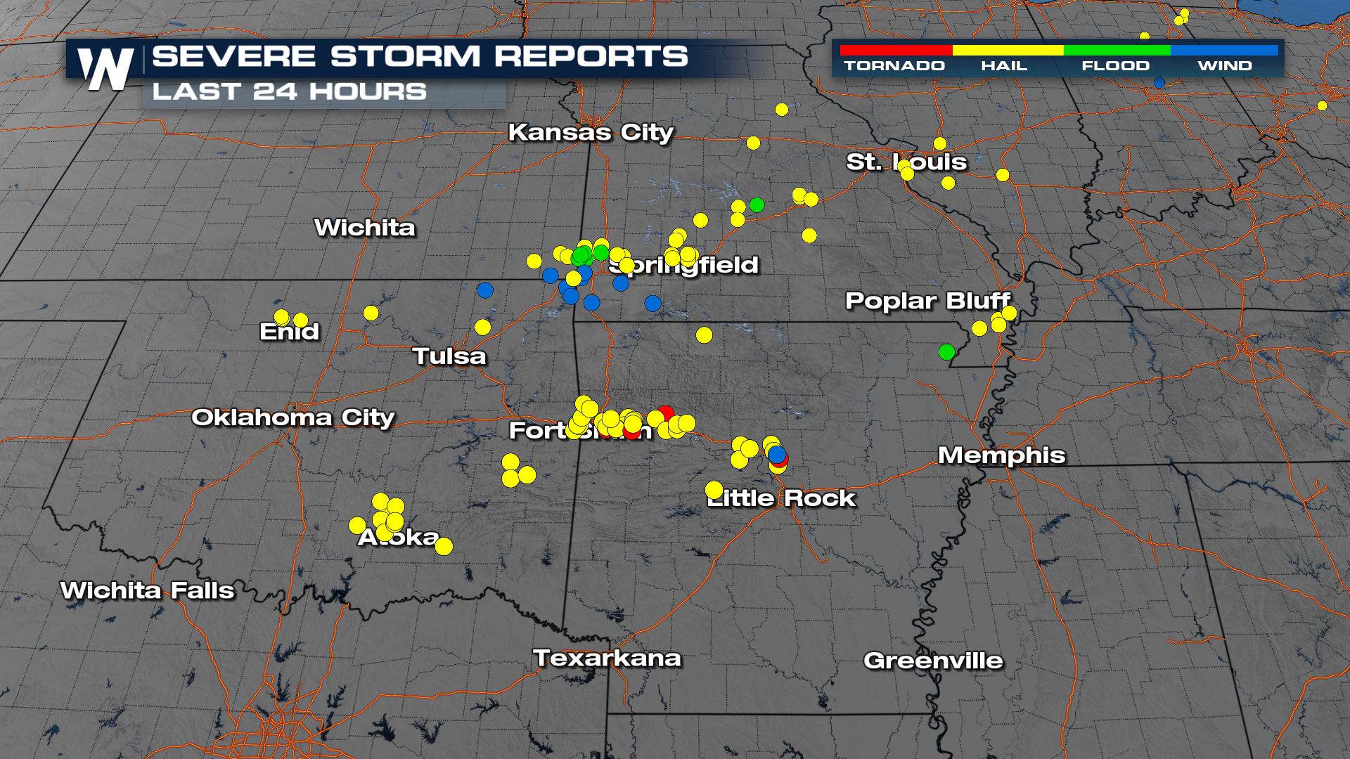 Numerous hail reports alongside tornado-warned storms have been reported across Arkansas and Oklahoma. Some up to 3" in diameter.
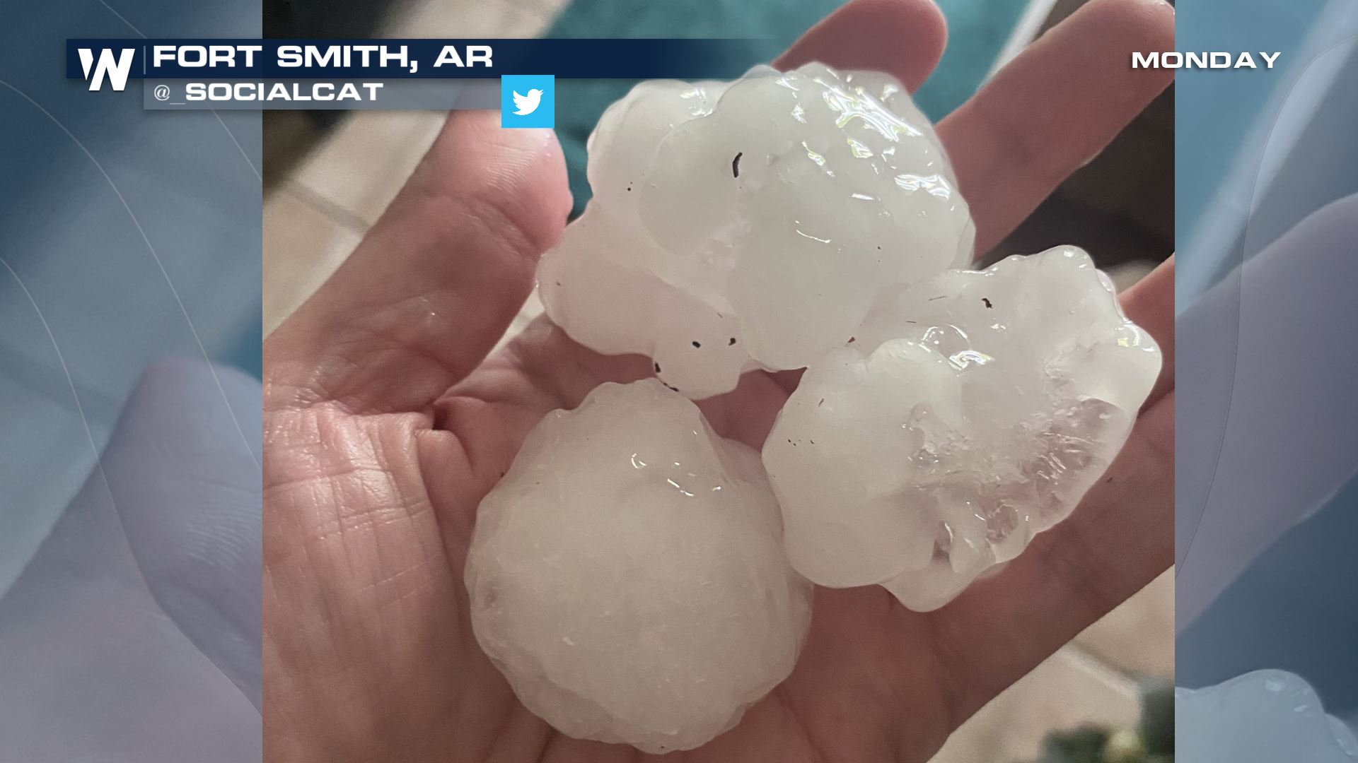
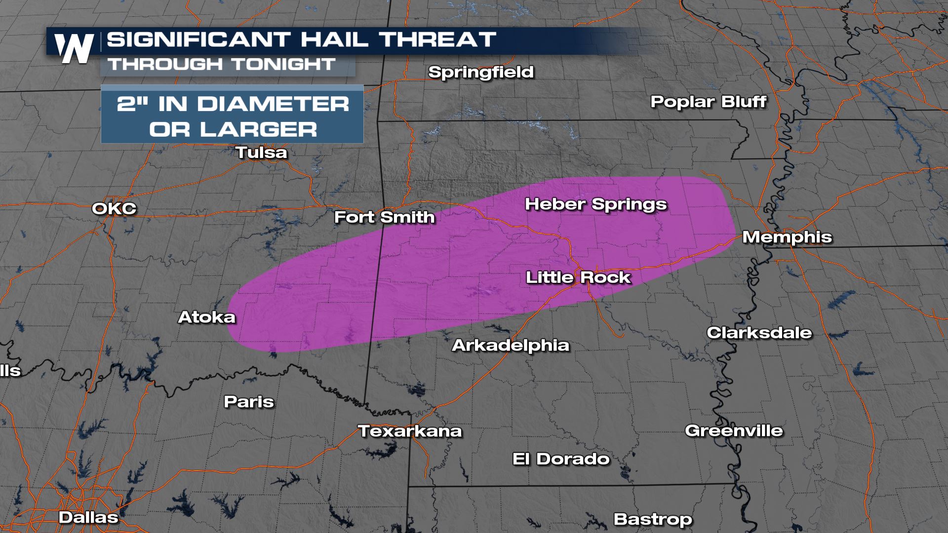
 Hail and tornadoes will likely continue. After seeing 3" hail stones have been observed, there is still the risk overnight to see large to damaging hail.
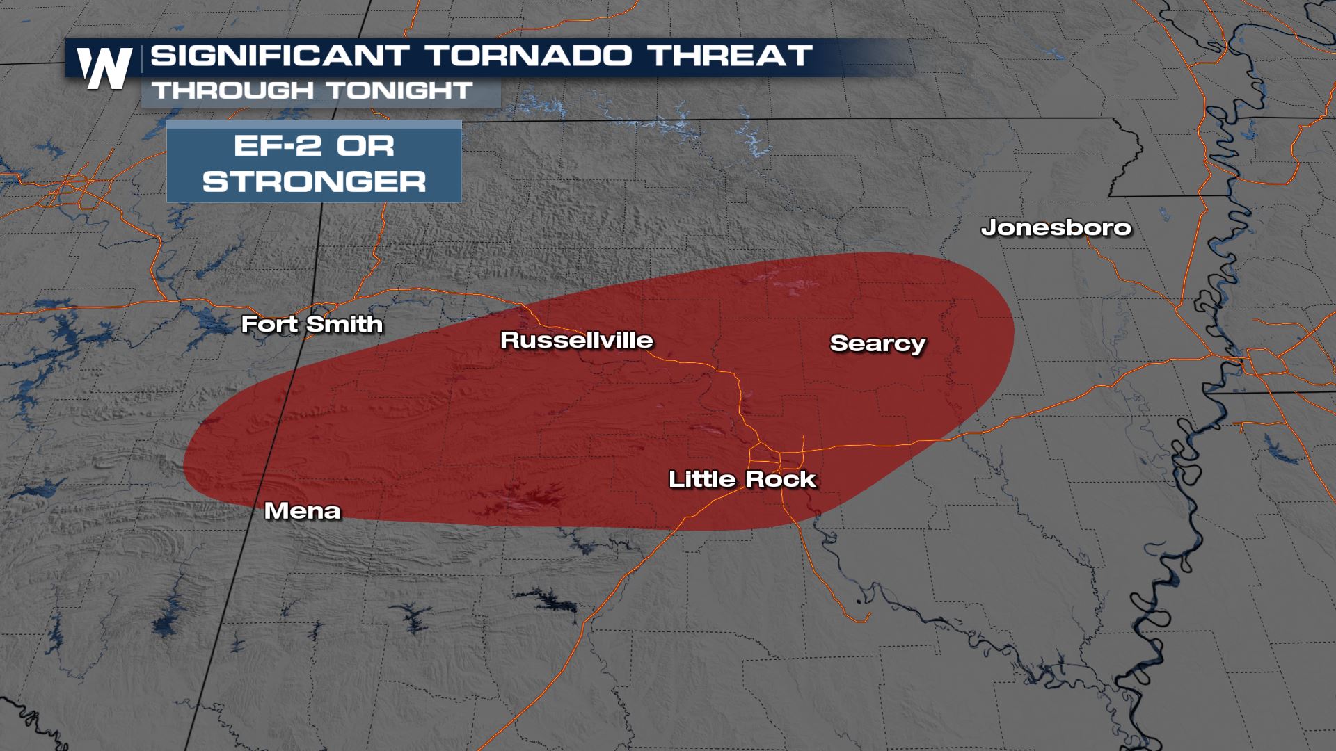
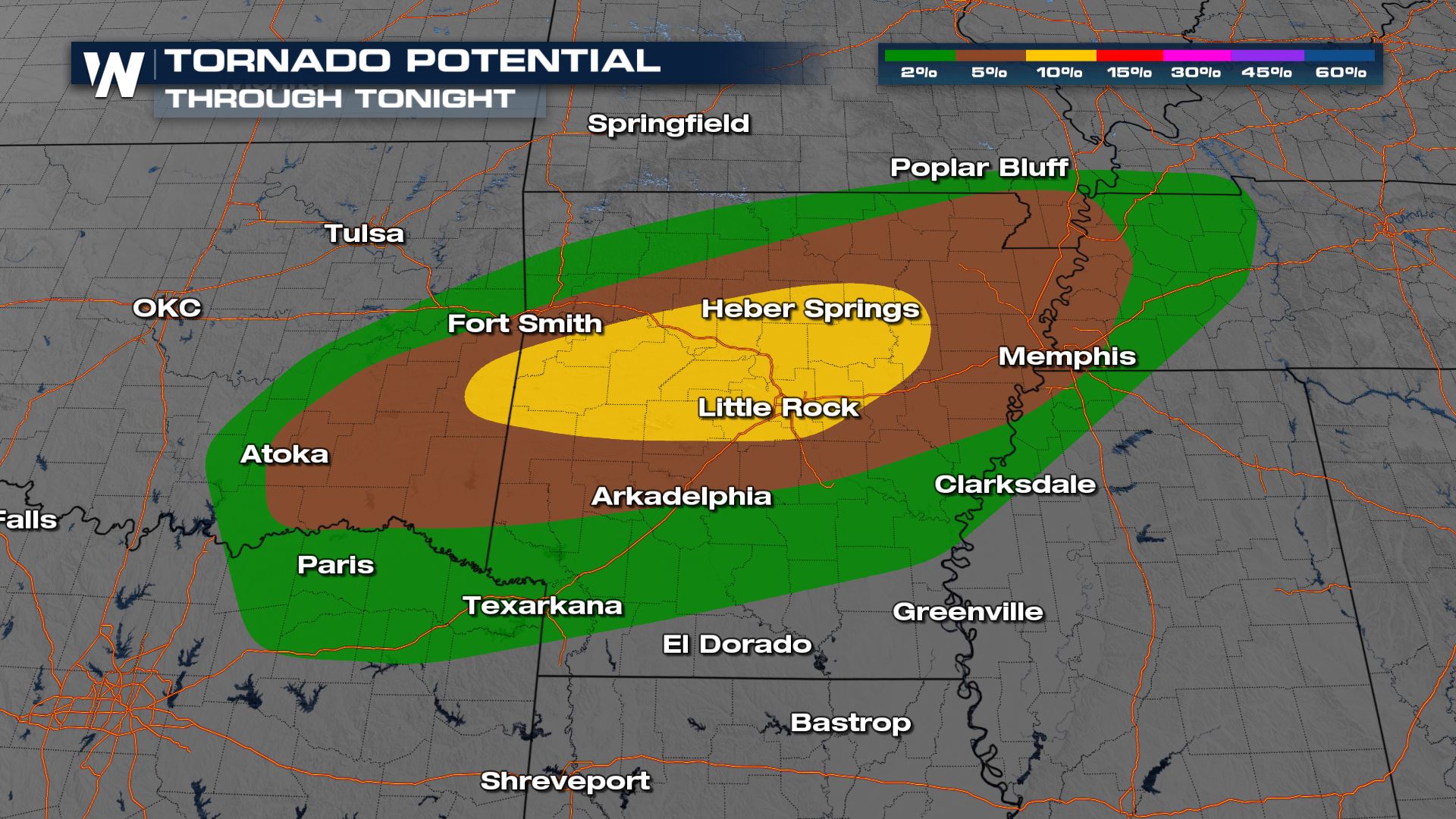 A significant tornado (EF-2 or stronger) is possible in the area of highest tornado potential. We will be watching the storms very closely this evening.
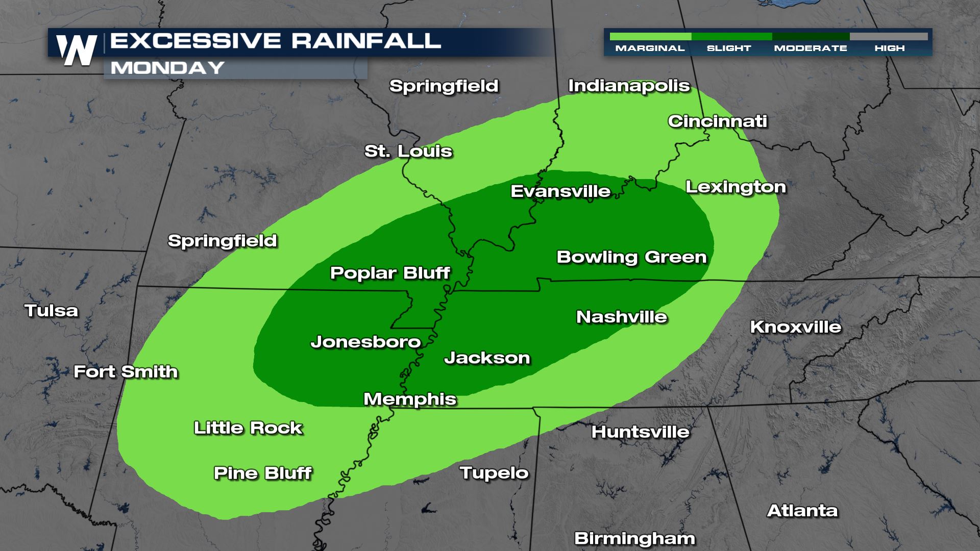
 Still, the Weather Prediction Center (WPC) has highlighted these locations for the risk of flooding.
 More updates on the severe weather threats are coming up all day on WeatherNation.
Tornadoes and large (damaging) hail have been a result of Monday's storms and the threat is not over yet. Strong thunderstorms will be possible for the overnight hours. Here's what we've seen so far:
Numerous hail reports alongside tornado-warned storms have been reported across Arkansas and Oklahoma. Some up to 3" in diameter.
Overnight Outlook
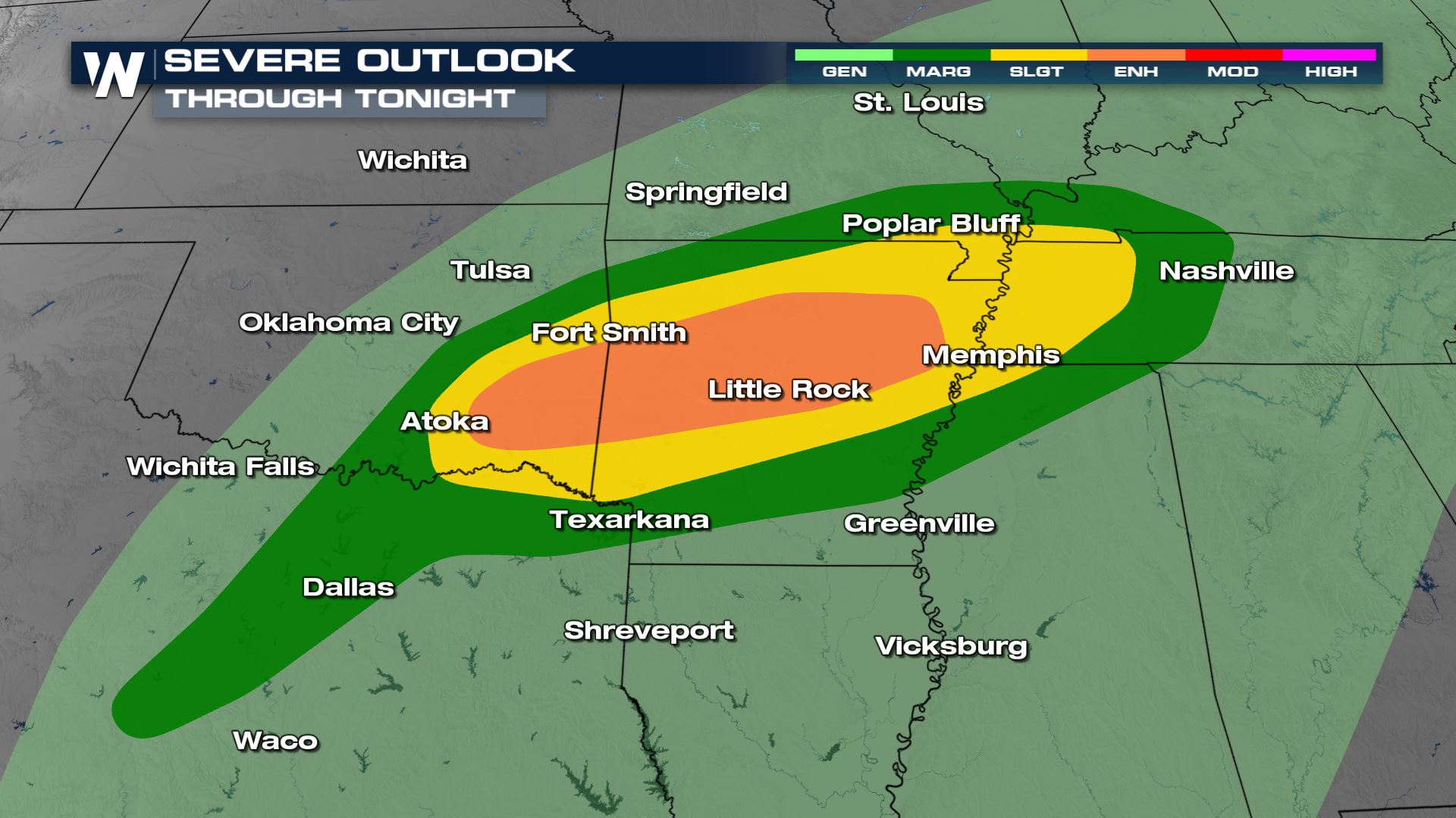
The Storm Prediction Center has continued the enhanced (level 3 out of 5) threat for severe storms through the overnight hours.
Hail and tornadoes will likely continue. After seeing 3" hail stones have been observed, there is still the risk overnight to see large to damaging hail.
A significant tornado (EF-2 or stronger) is possible in the area of highest tornado potential. We will be watching the storms very closely this evening.
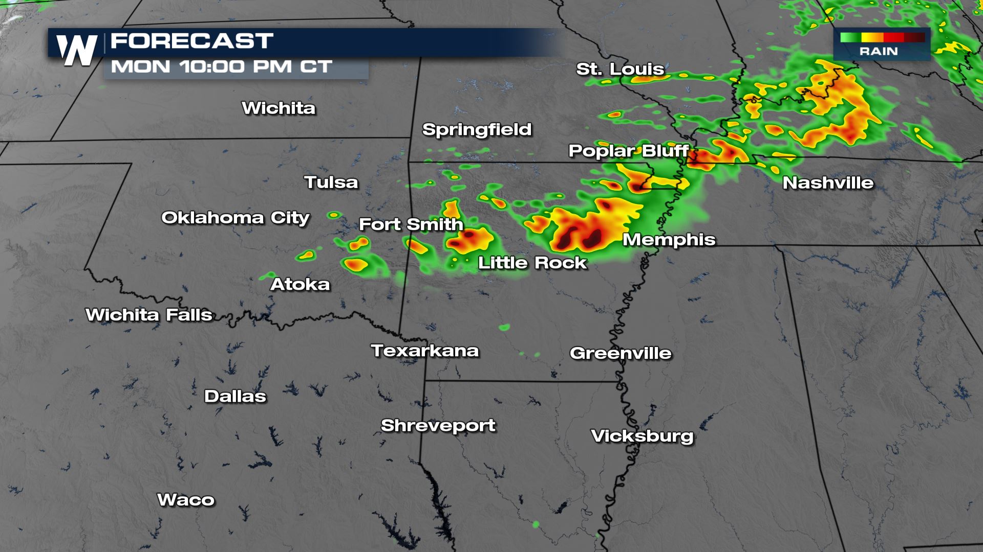
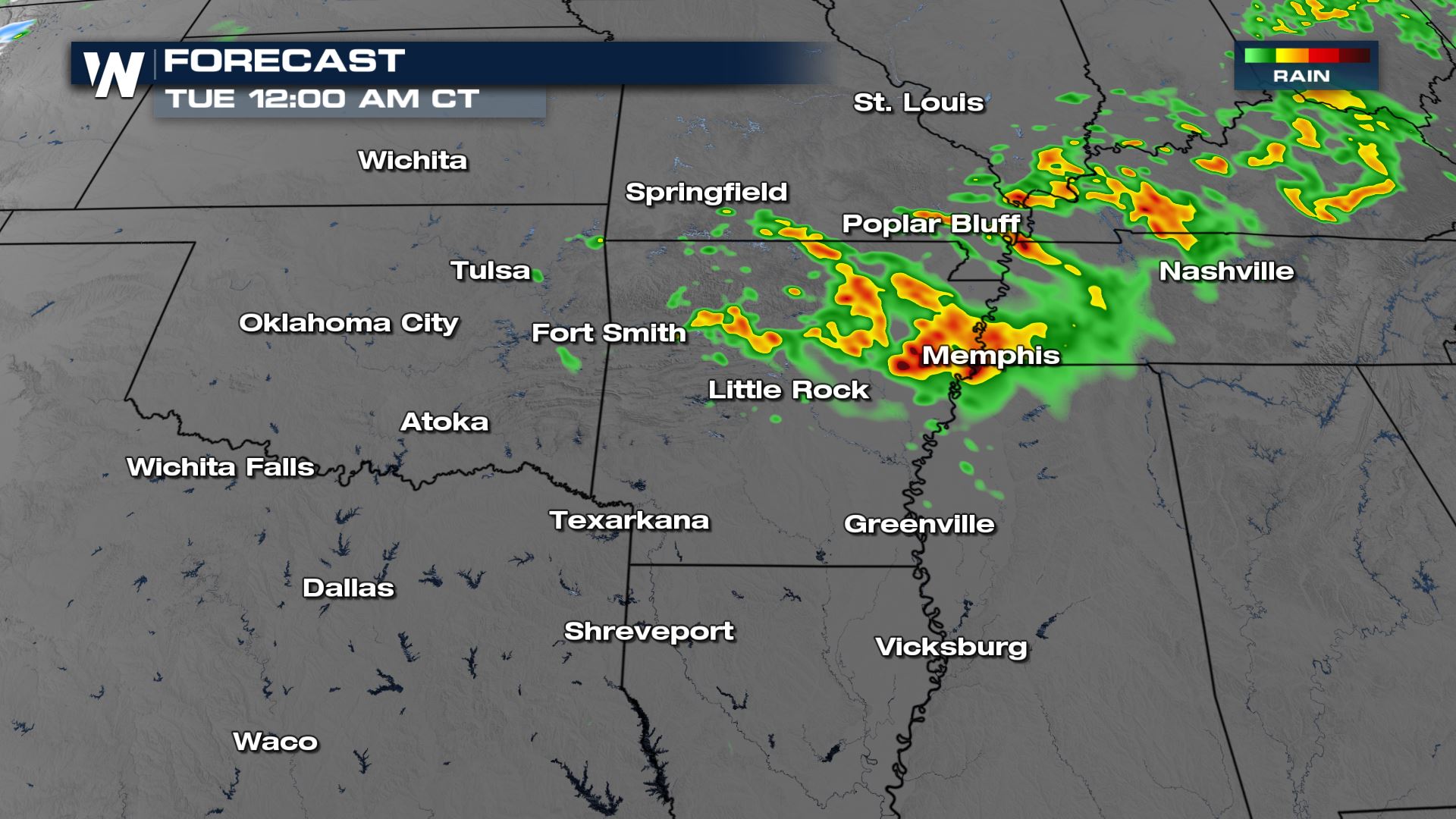
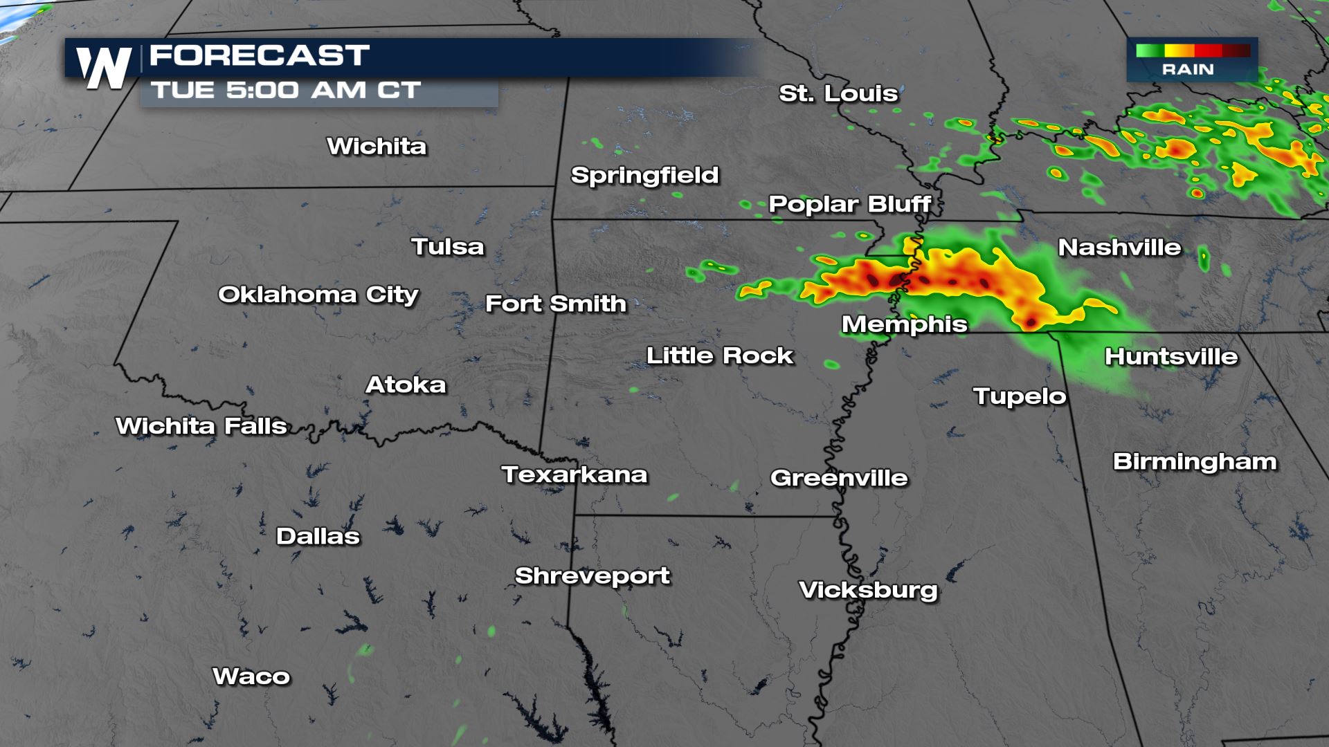
Forecast Timing
Overnight, storms will still likely hold strength and trend towards the Tennessee Valley. The chance of seeing new developing storms is less likely, we will likely continue to see the storms we have now progress east.
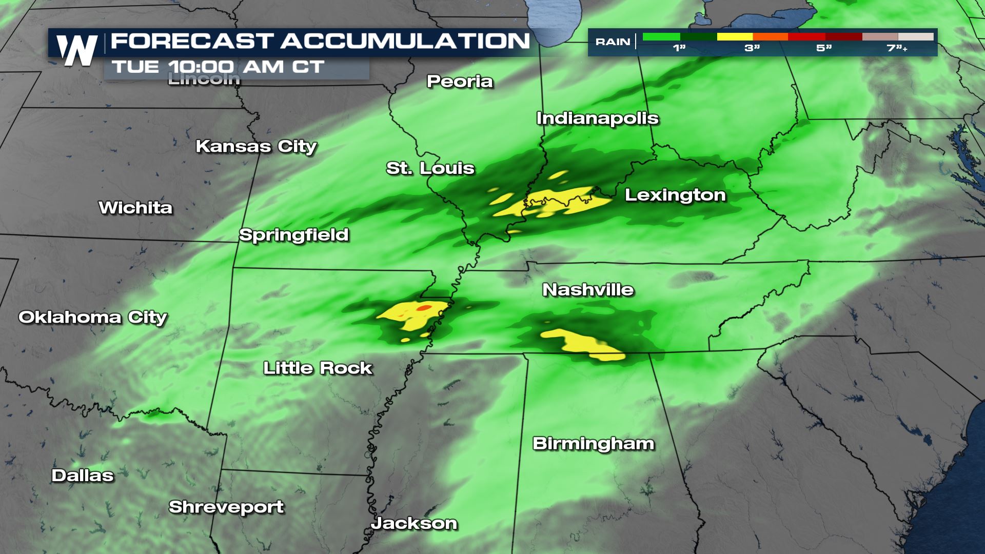
Rainfall
Heavy rain will accompany Monday's storms and this will lead to a risk for flash flooding. The factor that we have going for us in these areas is that the ground is not overly saturated like it is in the south.
Still, the Weather Prediction Center (WPC) has highlighted these locations for the risk of flooding.
More updates on the severe weather threats are coming up all day on WeatherNation.All Weather News
More
Wildfire Outbreak in the Pacific Northwest
SPOKANE, WA - On Saturday, August 1st, the Ol
3 Aug 2026 1:55 AM

More Storms for the East Through Monday
A low-pressure system that moved through the
3 Aug 2026 1:50 AM


After Reaching Category 5, Genevieve Weakens in the Pacific
PacificGenevieve formed last Friday south of
3 Aug 2026 12:30 AM

Flooding, Severe Storms Target the Midwest Again
After an active week of storms across the nor
1 Aug 2026 1:40 AM

Flooding Risk Increases as Heavy Rain Targets the Tri-State Area
Tuesday, heavy rainfall moved across the Nort
30 Jul 2026 12:25 AM

Severe Weather: Energy From the Midwest Now in the Southeast
UPPER MIDWEST - Through Monday, dangerous tor
29 Jul 2026 10:30 PM