Severe Storms Likely for South Dakota and Nebraska Friday
Special Stories
8 Jun 2018 5:28 AM
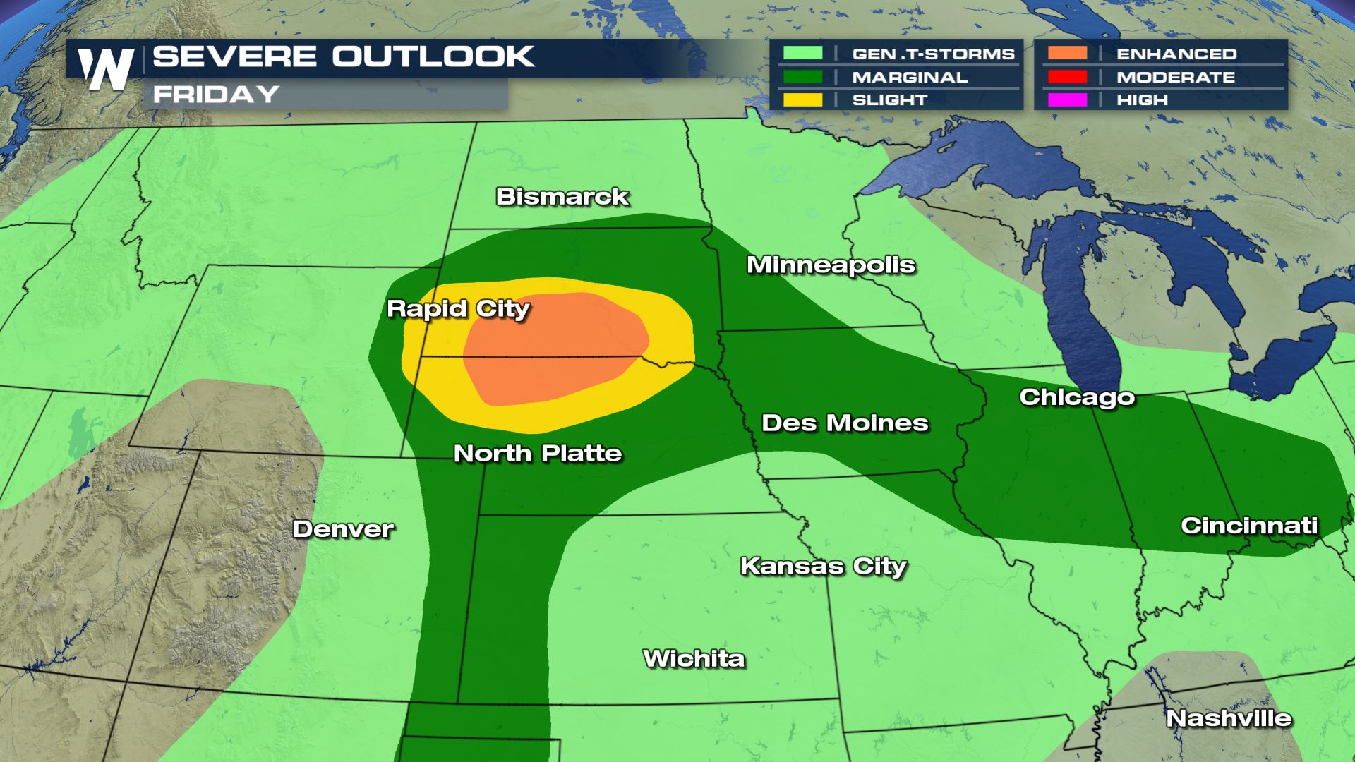
We are looking at a strong chance for large hail, damaging winds and isolated tornadoes over parts of South Dakota and Nebraska for Friday afternoon and evening. The tornado risk could actually impact parts of Minnesota and Iowa as well.
You can see a slight and enhanced risk of severe storms today for southern South Dakota and northern Nebraska. Cities like Rapid City, Pierre and Valentine will need to be weather aware today.
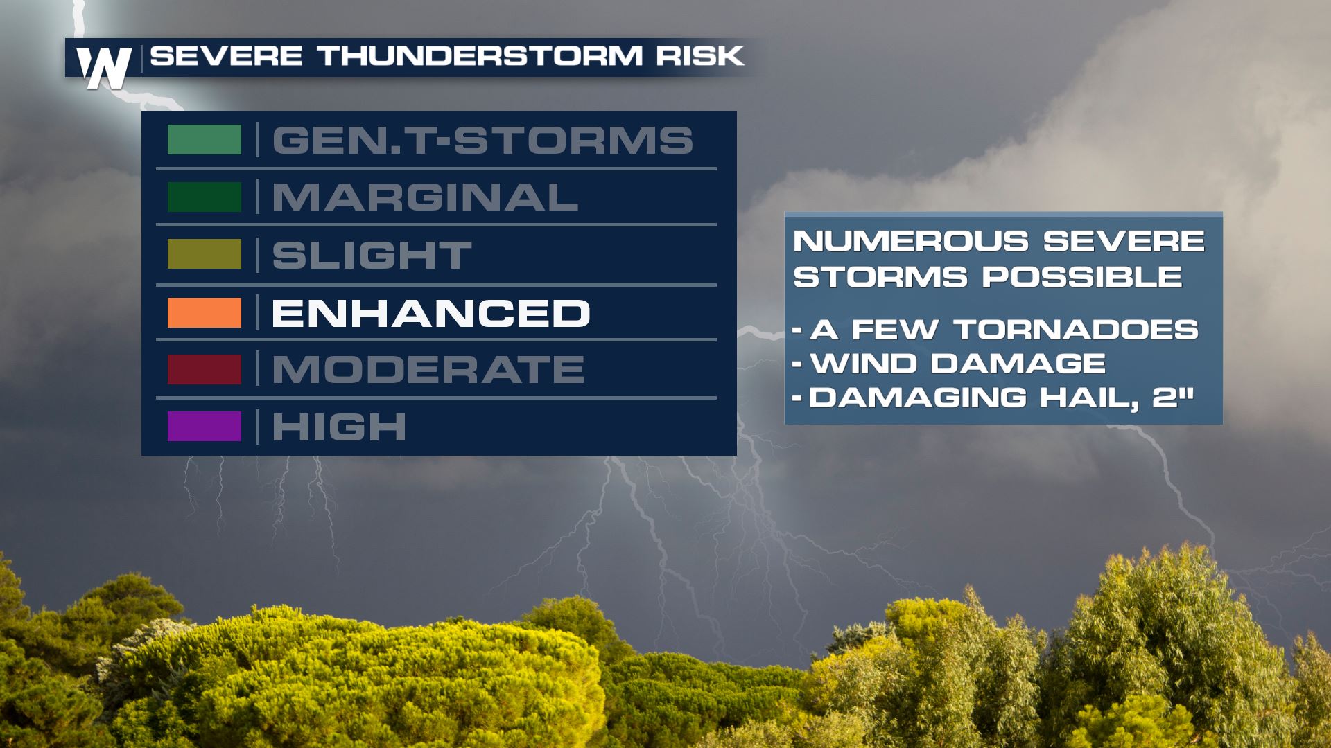
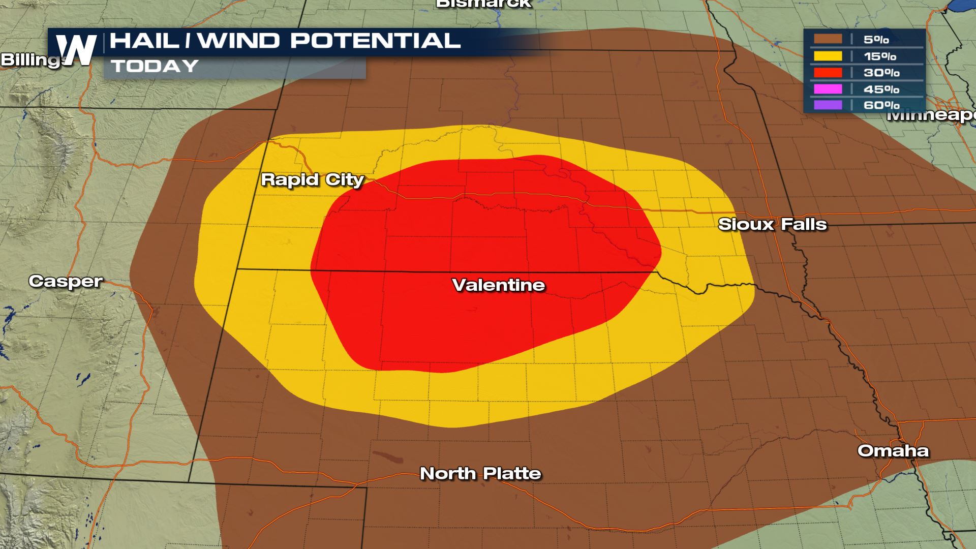
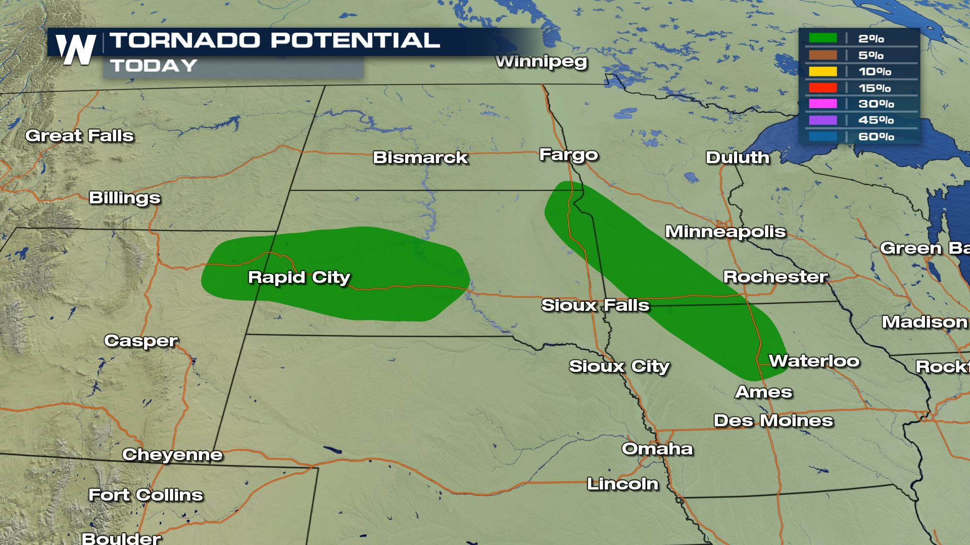 The area that is under the Enhanced risk will have a very high chance for hail 2" in diameter or greater and wind speeds in excess of 58 mph. The tornado risk is not as high, but it is there for these areas as well as parts of Minnesota and Iowa.
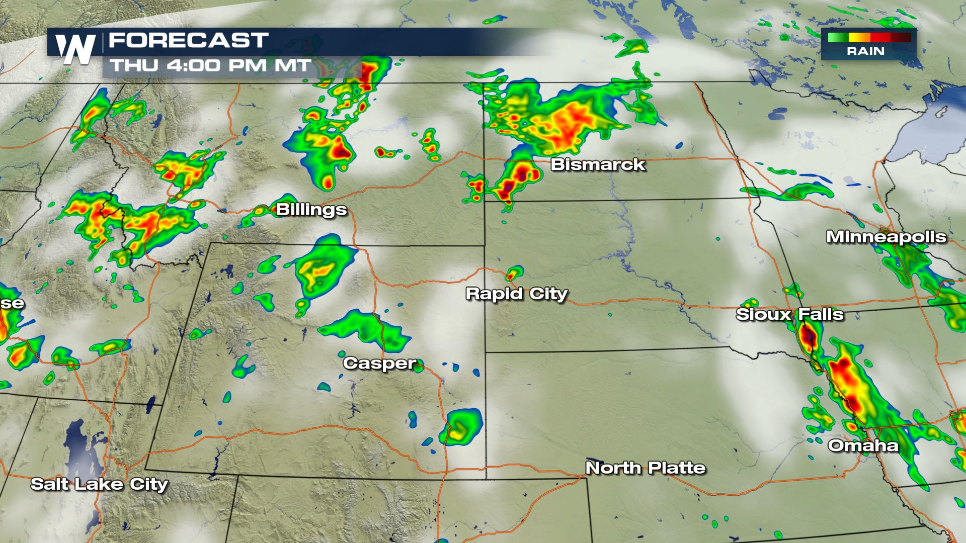
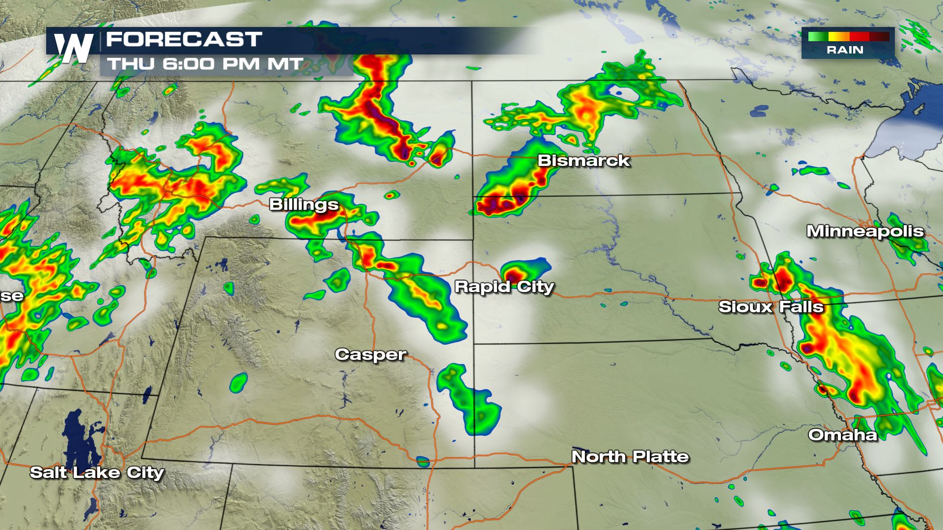
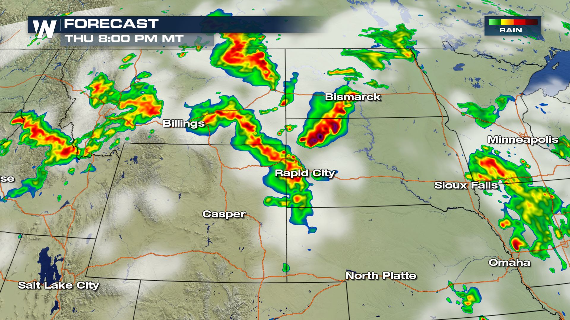 You can see the timing for today's severe storms will be during the afternoon and evening hours. Keep checking WeatherNation for the very latest updates.
Meteorologist Patrick Crawford
Severe Outlook
Enhanced Risk Definition

Severe Risks

 The area that is under the Enhanced risk will have a very high chance for hail 2" in diameter or greater and wind speeds in excess of 58 mph. The tornado risk is not as high, but it is there for these areas as well as parts of Minnesota and Iowa.
Forecast


 You can see the timing for today's severe storms will be during the afternoon and evening hours. Keep checking WeatherNation for the very latest updates.
Meteorologist Patrick Crawford
All Weather News
More