Tropical System Brings Flood Risk to the Central Gulf

Time has run out for notable tropical development of an unorganized low (Invest 93L) in the Gulf waters. The forecast has not changed in regards to heavy rain and flooding, which still looks likely between Texas and Alabama through Friday.
Rainfall and Flooding Concerns
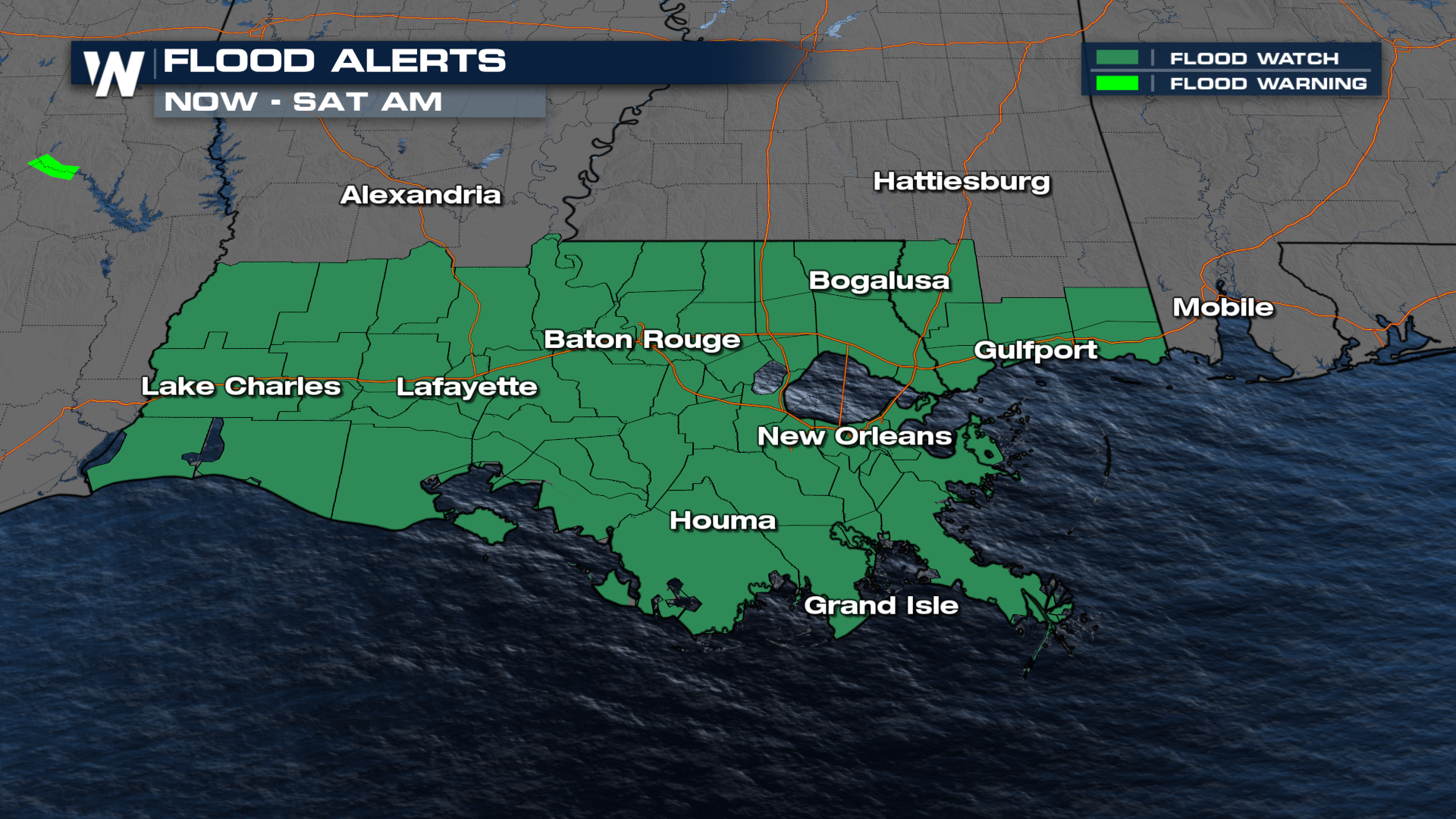
Regardless of whether it develops into a tropical cyclone, the system is capable of producing heavy rainfall. Flood Watches are in effect for portions of Louisiana and Mississippi.
 Many forecast models have the potential of 2-6"+ of rainfall over the next several days for the Gulf Coast. Isolated totals of 6-12" are not out of the question, which could lead to a localized high-end flooding risk.
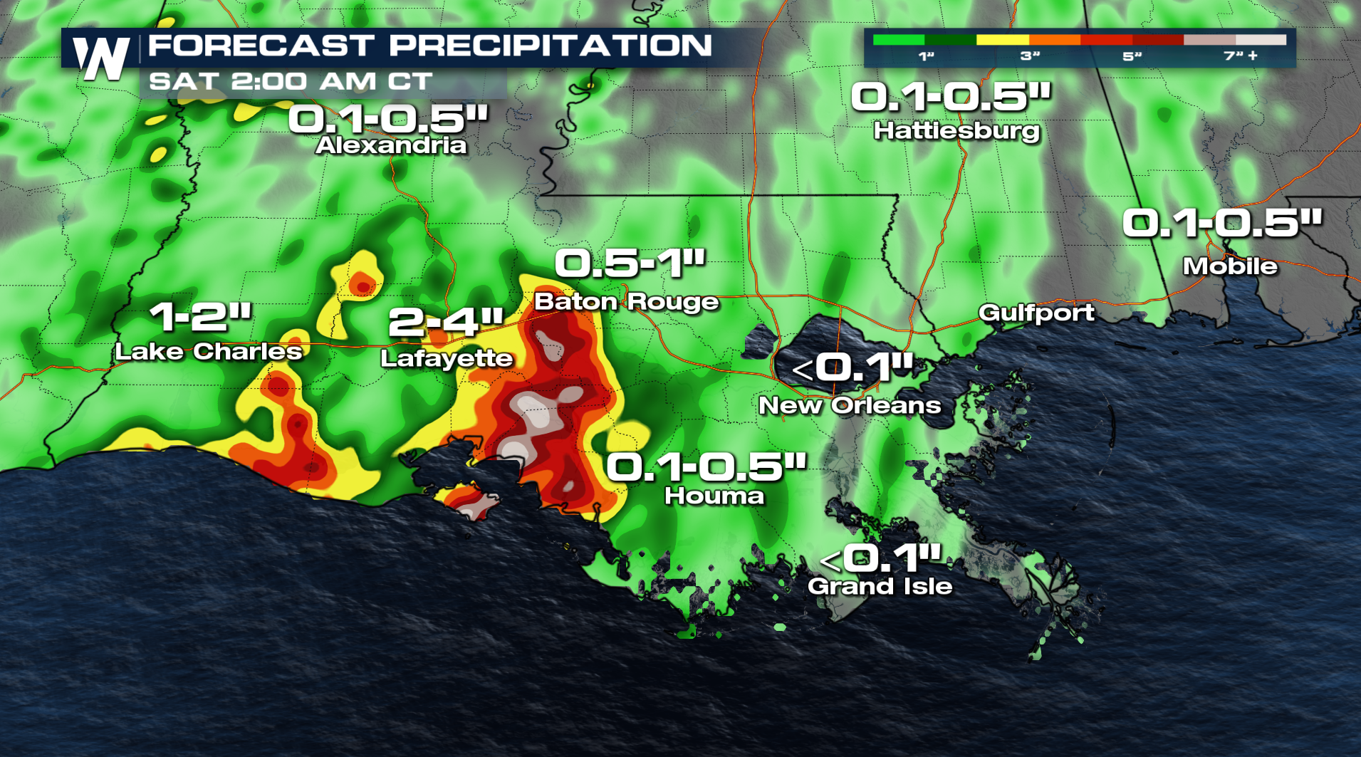
The risk of flash flooding is down a level for Friday and will drop to a Marginal risk on Saturday as the low moves north. If you come across water over the road, remember TURN AROUND AND DON'T DROWN.


