Gulf Low turns Coastal Low as Millions Brace for Plowable Snow

We're hoping many Thanksgiving travelers have made it home, because this next system has brought rain, ice, and snowfall from the Mid-South to the Northeast. The combination of an upper-level low drawing in cold air and a surface low pulling in warm Gulf moisture will set some of us up for ice, others for rain, and many for heavy snowfall. So gear up for what you can expect in your neighborhood. Kansas and Nebraska already saw 2-4" of snowfall on Monday morning.
Overall Set-Up
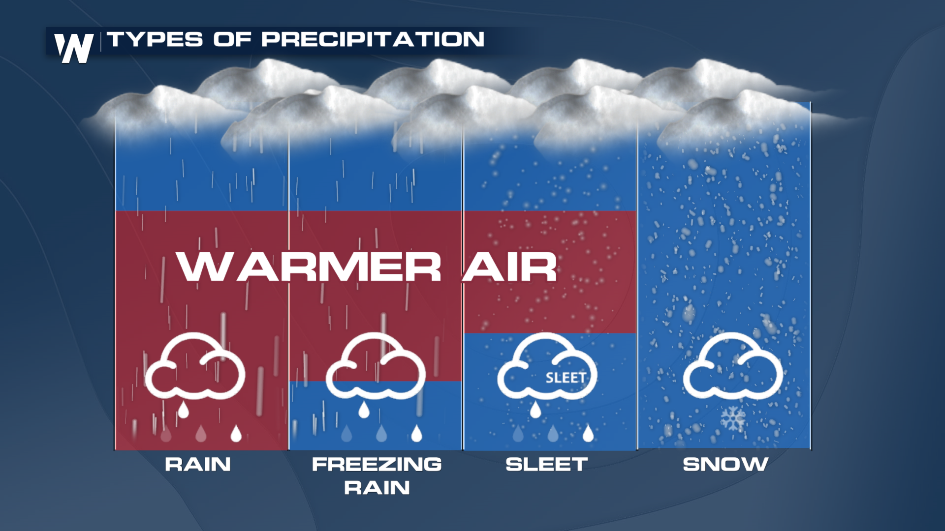
Several components come into play when we talk about different types of wintry precipitation, and the temperature profile of the atmosphere is one of the most important. In this forecast, a strong upper-level low will draw in cold air aloft. At the surface, a low will pull in warm Gulf moisture. What happens between these layers determines whether precipitation falls as rain, freezing rain, sleet, a rain/snow mix, or snow.
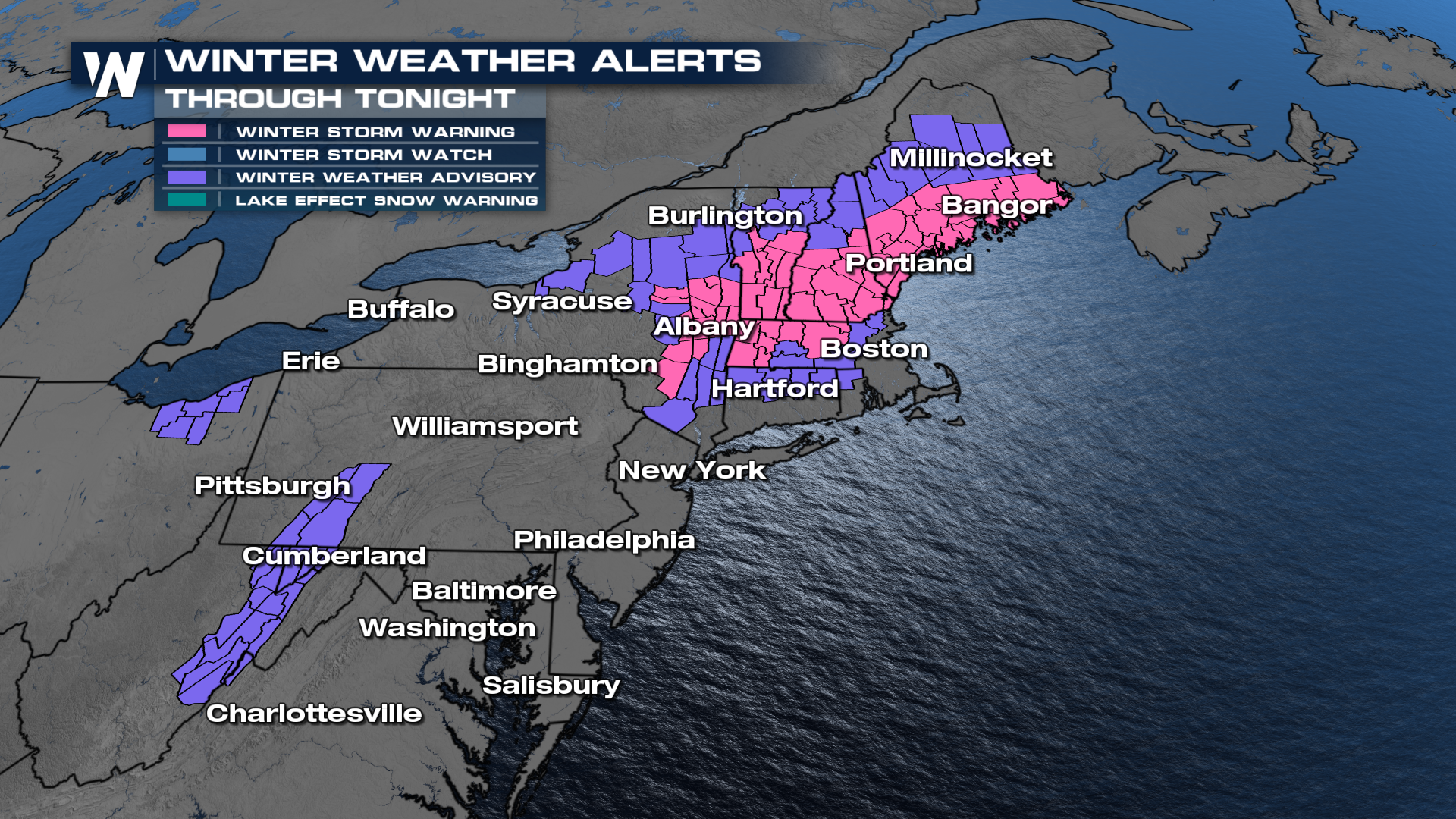
 Winter alerts are starting to trim back as the low pressure system pushes farther north and east, but many remain in effect through tonight.
Forecast Timing
Based on current timing, snow will reach the Northeast through Tuesday night before the system exits offshore early Wednesday morning.
Snowfall totals will vary depending on how cold the temperatures get throughout the event. The heaviest totals are expected to climb over 6 inches in the Northeast. Our forecast models are topping out closer to a foot for northern New England.
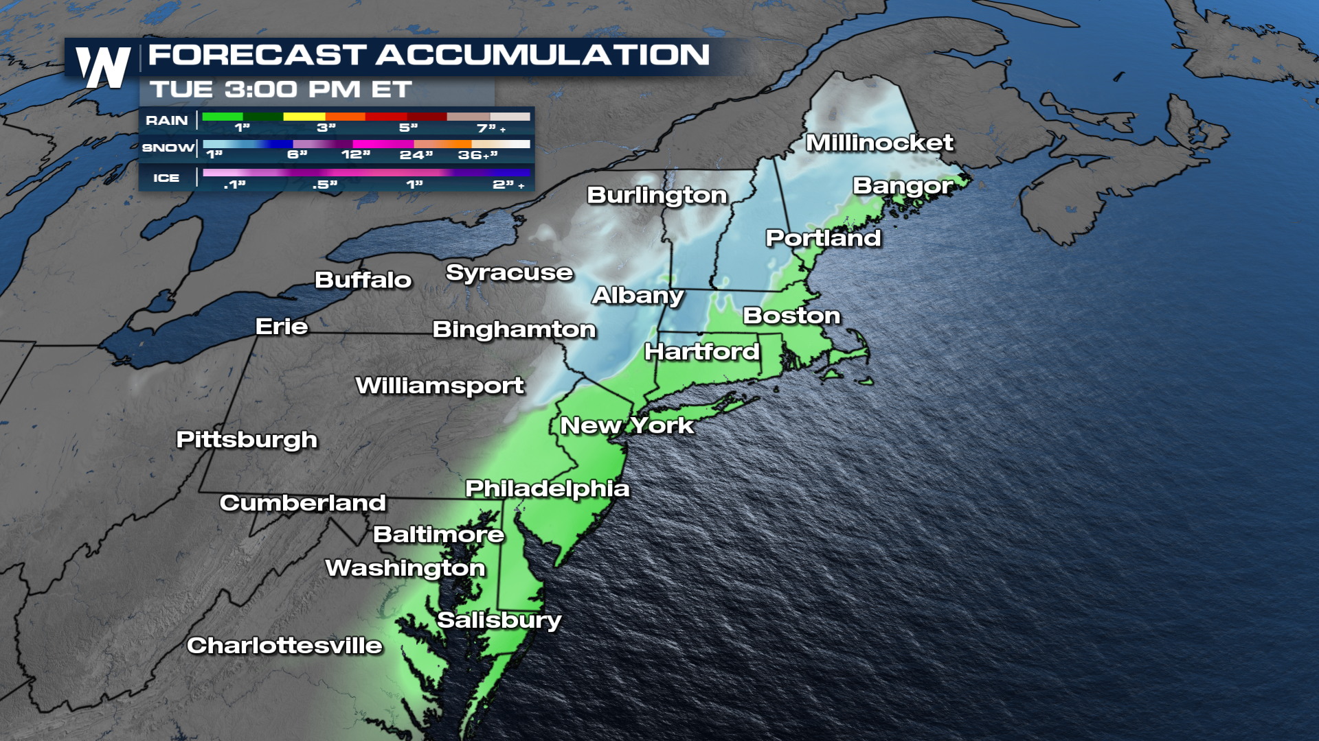
Ice accumulations generally range from a light glaze up to 0.1". When forecasts show totals approaching 0.25" or more, power outages become possible, and travel can become nearly impossible.


