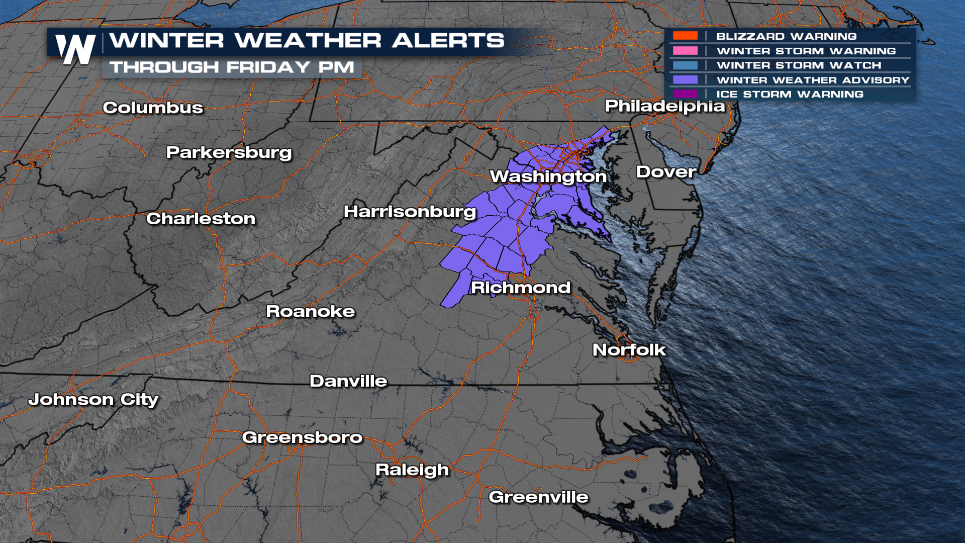
Snow & Ice Lingers for the Mid-Atlantic & Appalachians

Multiple low-pressure systems moving across the country will bring heavy rain to the Gulf Coast through the end of the week, but on the northern periphery of these lows, cold air will linger, turning rain into snow and ice! The snow started falling Thursday morning in Texas and Oklahoma before moving east Thursday afternoon.
Winter weather advisories are in effect through Friday afternoon from North Carolina through eastern Maryland for light/moderate snow and some light icing. Expect roads to be slick with temperatures in the 20s.
Virginia into North Carolina and some areas around the Chesapeake Bay will see a round of mostly snow on Friday morning, with moderate ice accretions possible along the Blue Ridge Escarpment in Western North Carolina. Some snow may linger along the Mid-Atlantic coast into New Jersey and Delaware into the afternoon and early evening.
Snow accumulations look mostly minor, generally 1-3 inches, but higher elevations in the Blue Ridge Mountains could see some 3-6 inch totals. Freezing rain and sleet aren't expected to cause major issues, but elevated surfaces (like bridges and overpasses) could be slick, primarily in North Carolina Friday morning.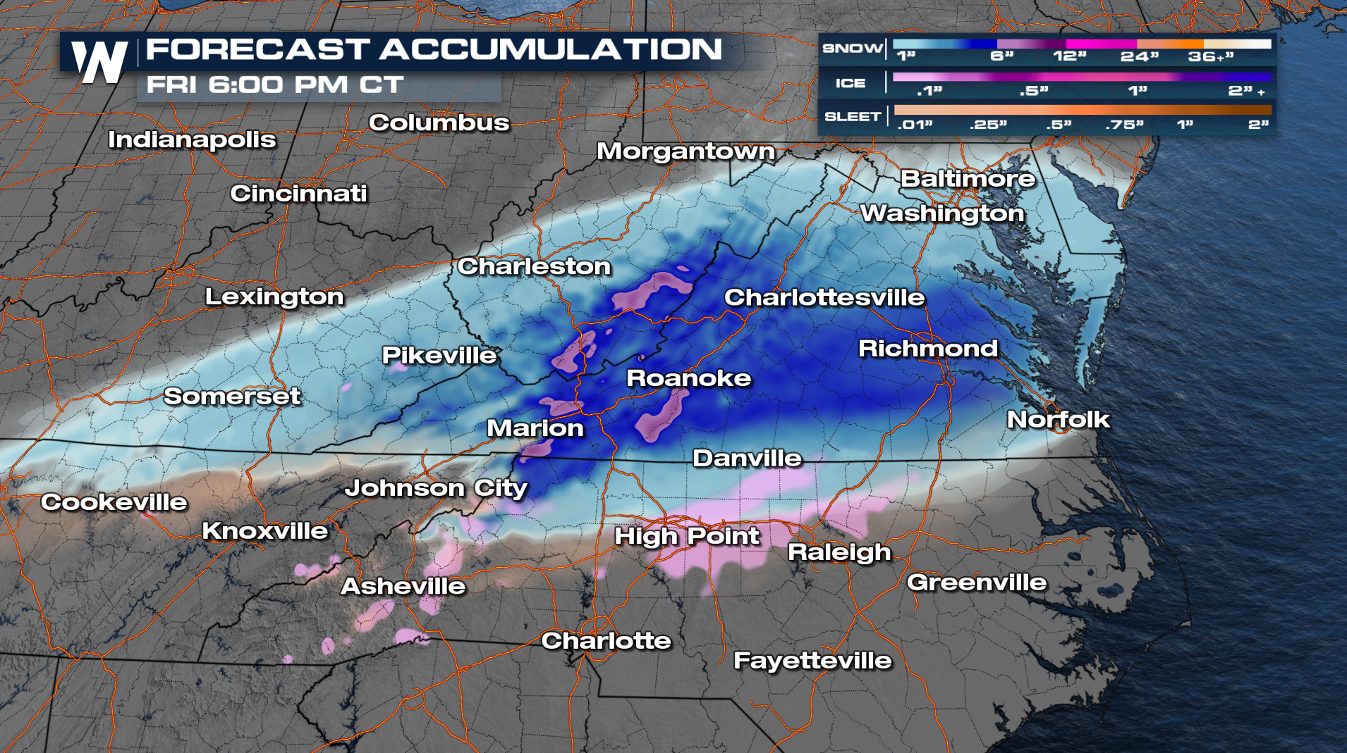 T
T


