Northwest Storms Bring Snowy, Rainy Weather

NORTHWEST - We're in for a stormy and snowy pattern from the Pacific Coast to the Rocky Mountains. Rain starts to push onshore early Thursday morning across the Pacific Coast and spreads east throughout the day to the Intermountain West. This will fall as snow over the mountains. By Thursday night, the frontal boundary moves onshore, bringing another push of rain and snow.
With a couple of rounds of rain and snow, totals could be quite high across the west. Our forecast models have totals along the coast and in the foothills of the Cascades reaching upwards of 5 inches.
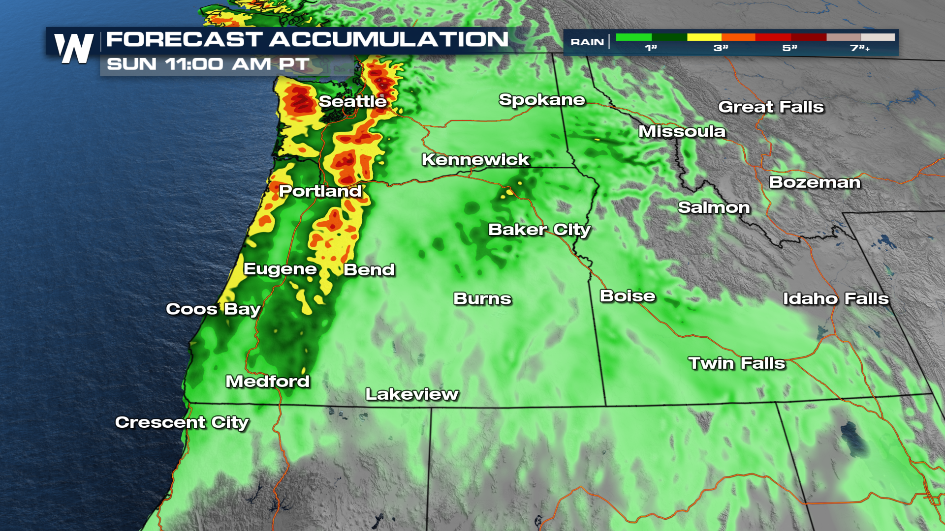 As this moisture moves up the mountains, snowfall totals will climb. The heaviest looks to happen in the Cascades of Washington and the Rockies. The Blue Mountains and Tetons also get a decent amount too.
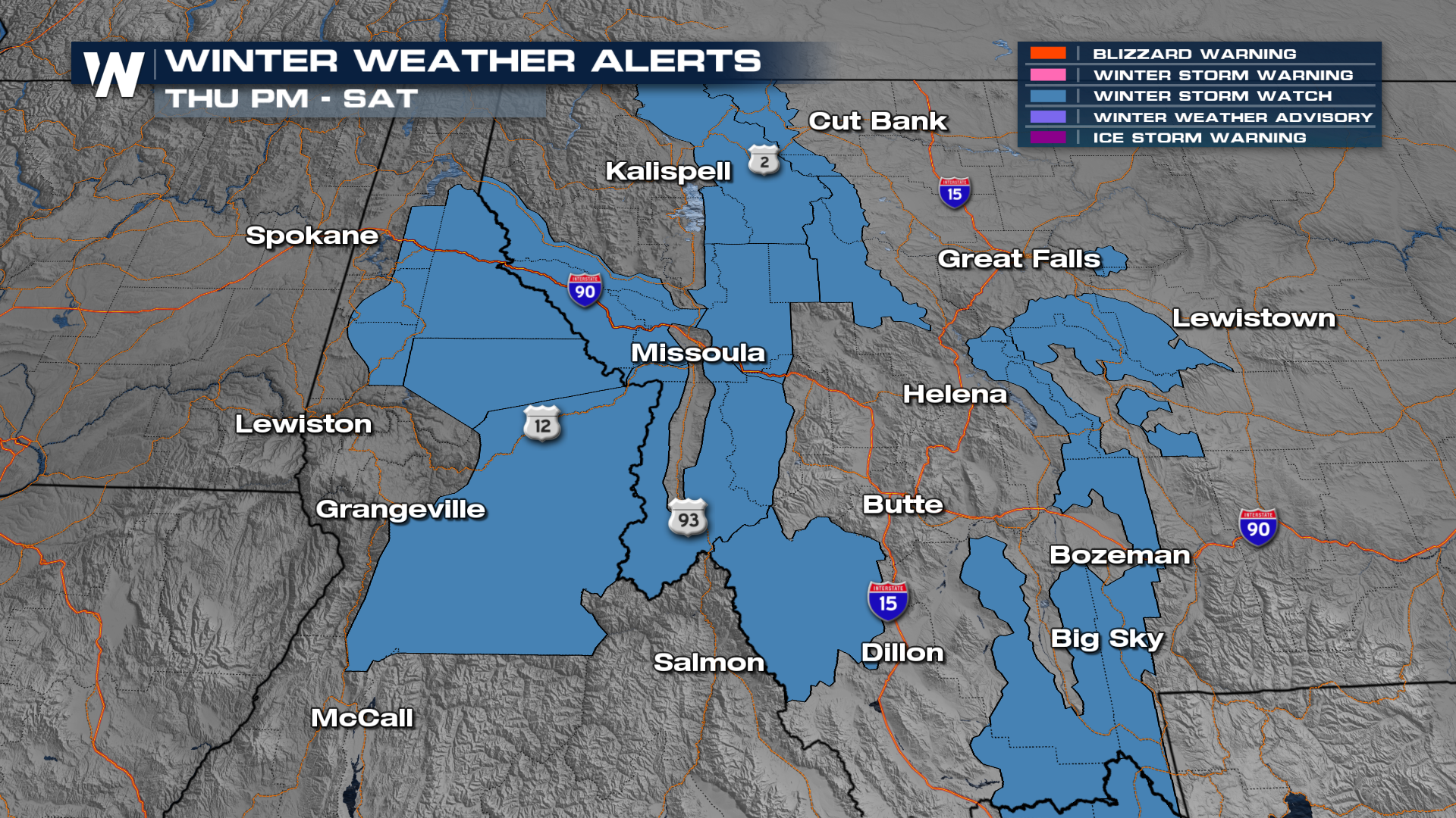
 Winter weather alerts have been issued for portions of Montana, Idaho, and Wyoming for upwards of 8-14" of snowfall.
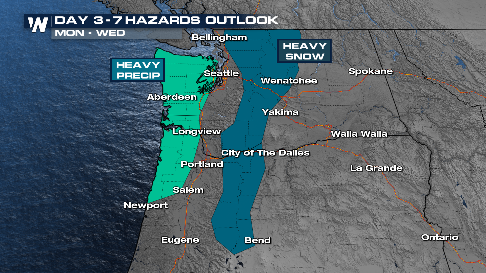
 Additional rain and snow is in the forecast for next week as a potential atmospheric river sets up yet again.
 For more details be sure to join us at :50 past the hour!


