Gulf Low To Produce Rain & Storms Along Coast

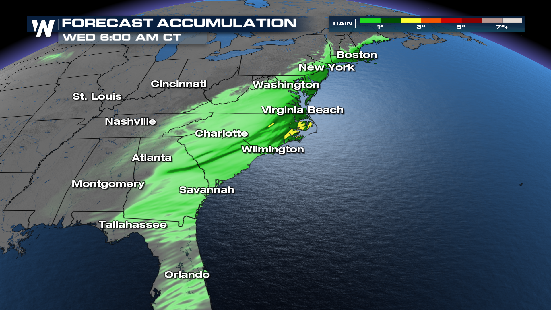
GULF COAST - Starting along the Gulf coast, a low-pressure system has emerged to bring soaking rain to our Gulf states through the overnight hours, to the Southeast Coast on Tuesday morning, and through the Atlantic Seaboard on Tuesday.
This surface low will pull in tropical moisture and produce downpours across the South and Southeast, where temperatures will be warm enough to support rain and even a few thunderstorms. On the northern side of the system, ice and snow will become an issue across portions of the Mid-South, which you can read more about here. As mentioned above, rain has begun and will continue to saturate the south into Tuesday before paralleling the Atlantic Coast on Tuesday.
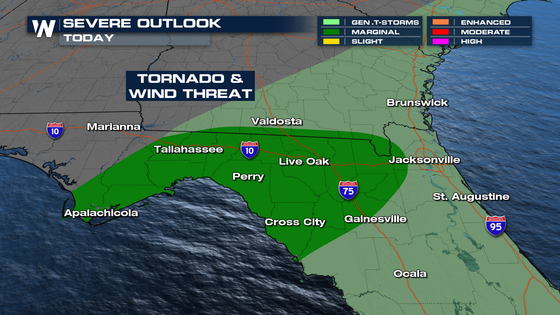
The Storm Prediction Center has kept a MARGINAL risk for severe storms in the panhandle of Florida through Tuesday. The risk of a tornado or two will be there, along with damaging straight-line winds.
With deep Gulf moisture and embedded thunderstorms, heavy rain may oversaturate soils and lead to isolated flash flooding. However, this is largely beneficial rainfall as these areas have been struggling to get much rain recently. Severe to exceptional drought has developed because of the lack of rainfall.