Next Round: More Snow for the Ohio Valley and Appalachians Overnight

A series of clipper systems continues to track from the Midwest into the Ohio Valley and Mid-Atlantic through Sunday. The first system brought around 2-6" of snow from Iowa into Virginia last Thursday night into early Friday.
The next system is trekking east with another round of snow and much colder air, bringing some snowy impacts to the coast through Sunday. Alerts are in place for snowfall that's expected to be slightly heavier than the first round! With colder temperatures in place, fluffier snow is expected, which could add up more quickly.
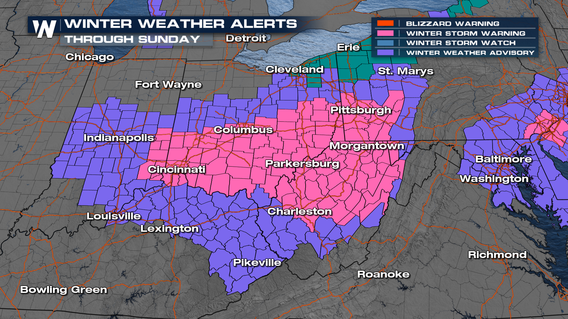
Snowfall is gradually winding down from west to east and will continue to do so overnight, with continued snow and gusty winds over the spine of the Appalachians for Sunday.
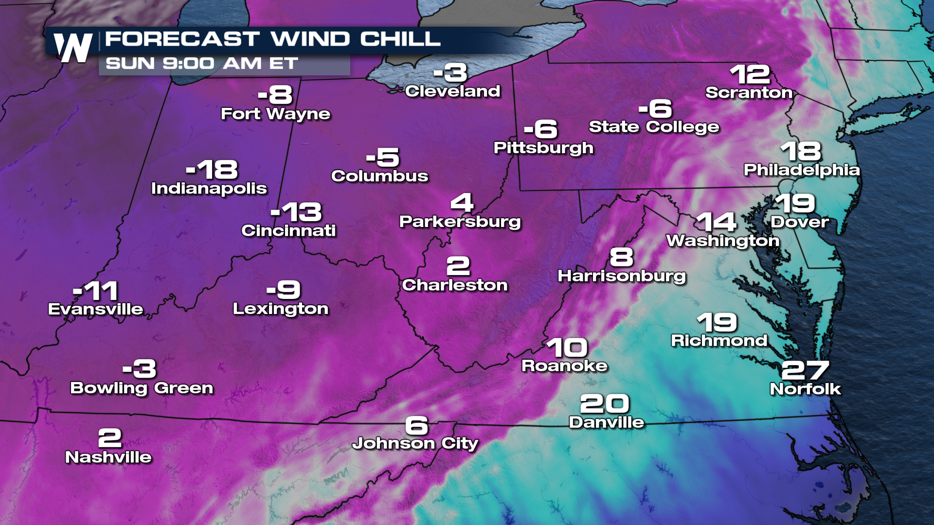
Snowfall totals could top 4-6" in numerous areas (dark blue/purple colors - top of page) with 1-3" for areas outside of the main bands. BRUTALLY cold air will settle in during and behind the snowfall, with wind chills to nearly -20° in Indiana Sunday morning.
For more information on this, be sure to join us on WeatherNation at :10 past the hour for your east regional and :30 past the hour for your central regional.


