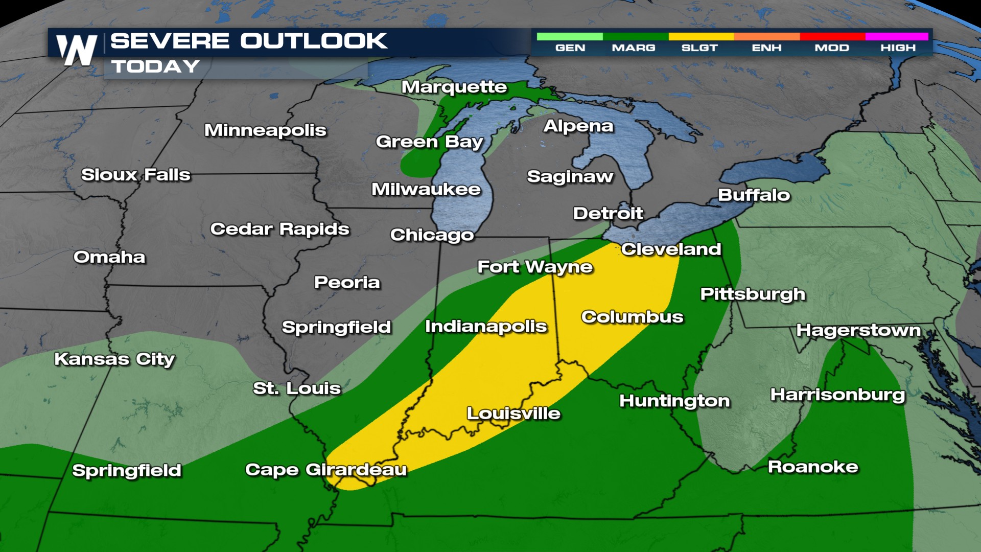
Severe Storm Risk Pushes into the Great Lakes, Ohio Valley

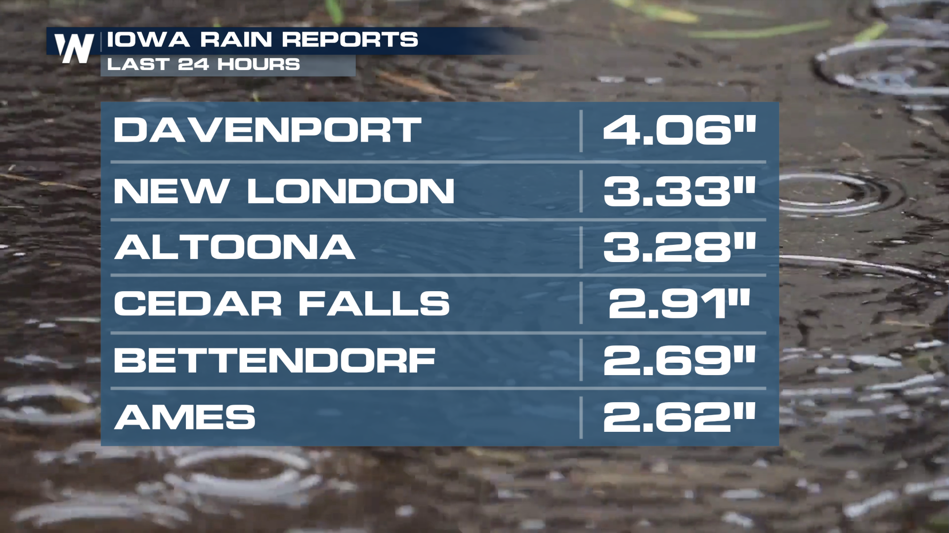
Friday was another busy day with severe weather and flash flooding. A Flash Flood Emergency was issued for Davenport, IA after they picked up over four inches of rain. The winds from Friday's storms were over 70 plus mph!
Timing
Friday's leftover storms will be the catalyst for additional shower and thunderstorm development across parts of the Ohio Valley and Great Lakes region on Saturday, as will the frontal boundary that moves into the region. The surface low could also help to spur a few supercells, capable of producing a tornado or two in eastern Michigan, primarily from the late morning through mid-afternoon.
SATURDAY
As the front continues to move, strong thunderstorms may redevelop early Saturday over the central High Plains. Behind the front, a high-pressure system ushering in cooler, drier air from western Canada will settle over the northern High Plains, bringing a temporary break from the stormy conditions.
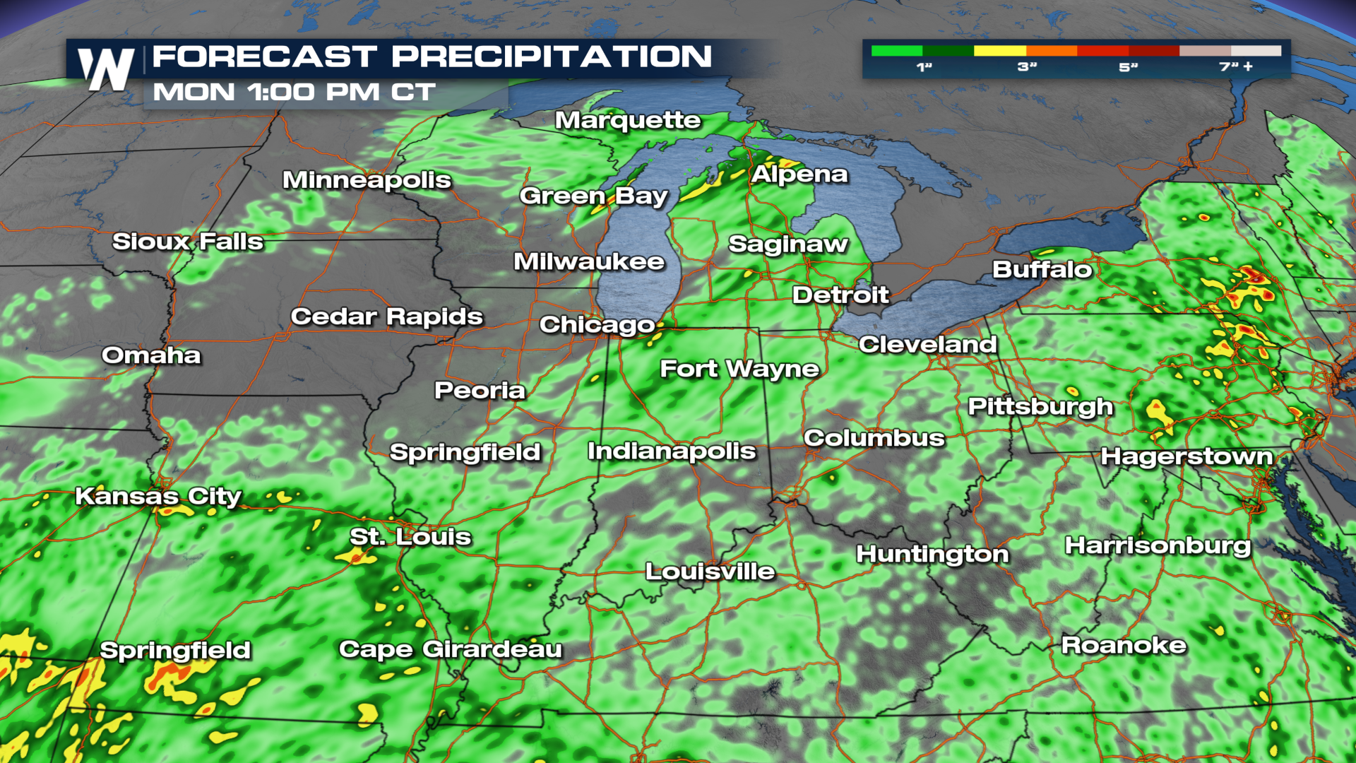
 Rainfall rates will remain high, with 1-2" of rain per hour possible. This could lead to rain totals surpassing 4-5 inches in some areas that see multiple rounds of storms or slow moving storms.