Flooding Threat Remains Elevated in the East

A cold front pushing through the Eastern Seaboard was responsible for dozens of reports of flash flooding on Monday, so much so that the Governor of New Jersey declared a State of Emergency for flash flooding. The subway system in New York City saw quickly rising waters.
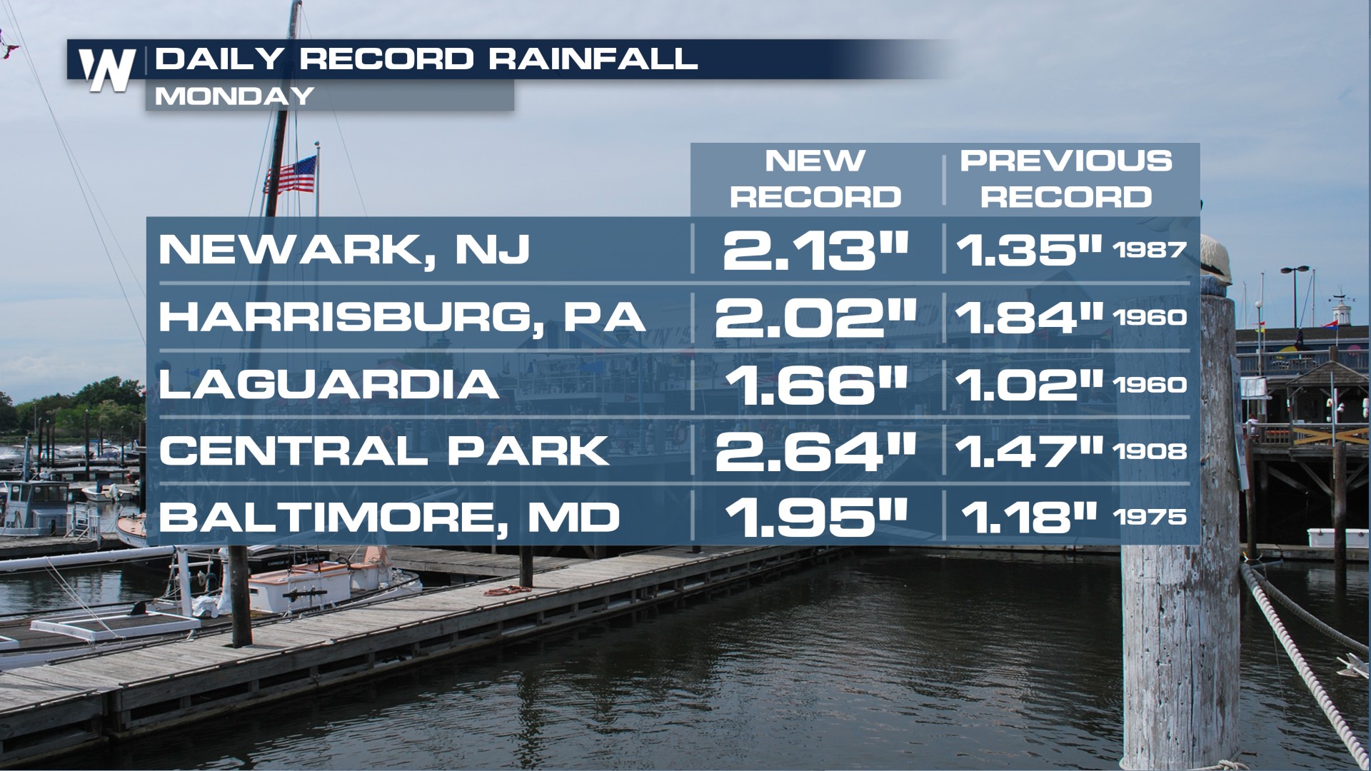
Many areas broke numerous records for the day! NYC's Central Park clocked in 2.07" of rainfall in one hour. That makes it the second-highest one-hour rainfall total to ever be recorded in Central Park.
More Flooding is Possible: Through Sunday
A cold front is now moving through the Northeast. Most of New England is expected to be dry on Friday. However, the Mid-Atlantic and Ohio Valley regions remain very muggy as the front stalls and the storm system rolls in. A Flood Watch has been issued from SE Ohio through the Outer Banks of North Carolina.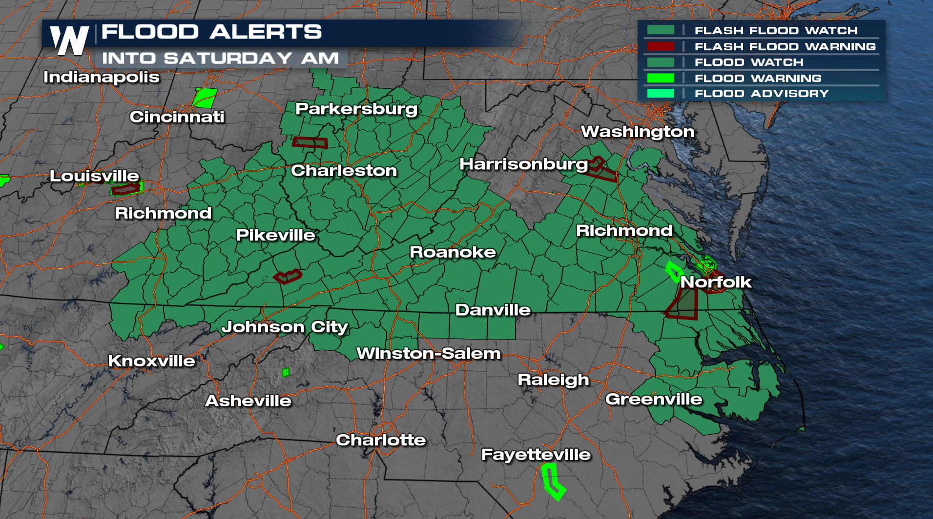
For the upcoming weekend, the Northeast can expect more scattered showers and thunderstorms as the next system from the Midwest swings eastward, bringing the severe weather threat back to the north (to Boston) by Sunday.
Heavy rain will be possible with many of the stronger storms through the weekend.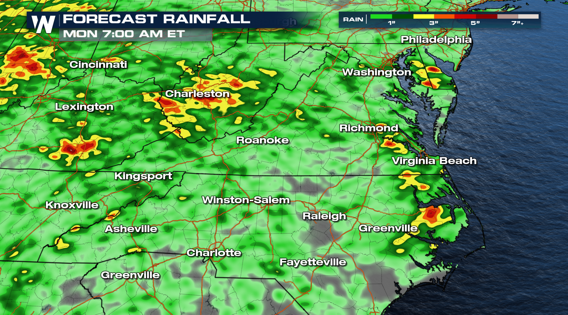
Severe Threat
Sunday, the threat of severe weather will return. Damaging wind gusts are the primary threat, so be prepared for the potential of downed trees and powerlines.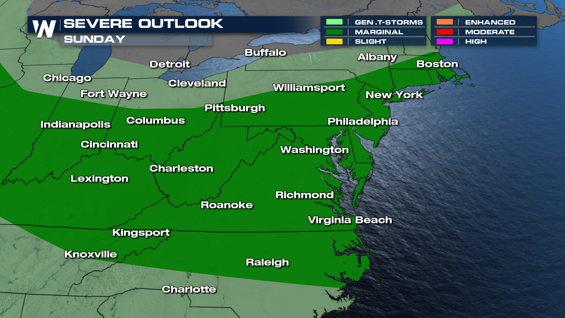
More on your Eastern Regional Forecast can be found 10 past the hour on WeatherNation.


