Snow and Ice in the Plains and Great Lakes
Special Stories
22 Jan 2019 8:32 AM
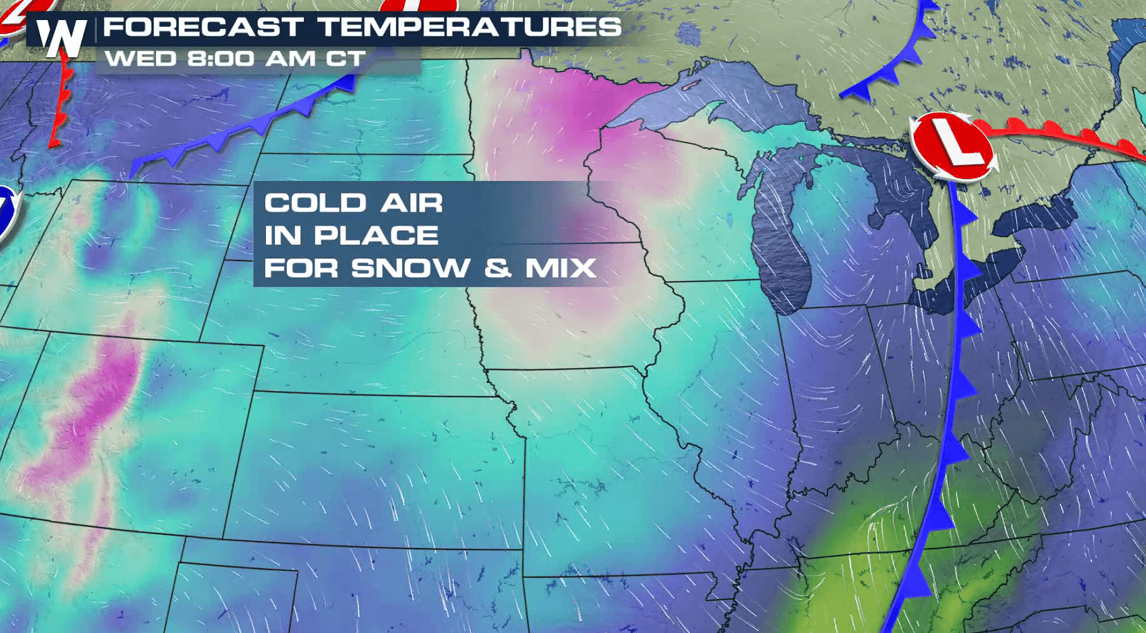
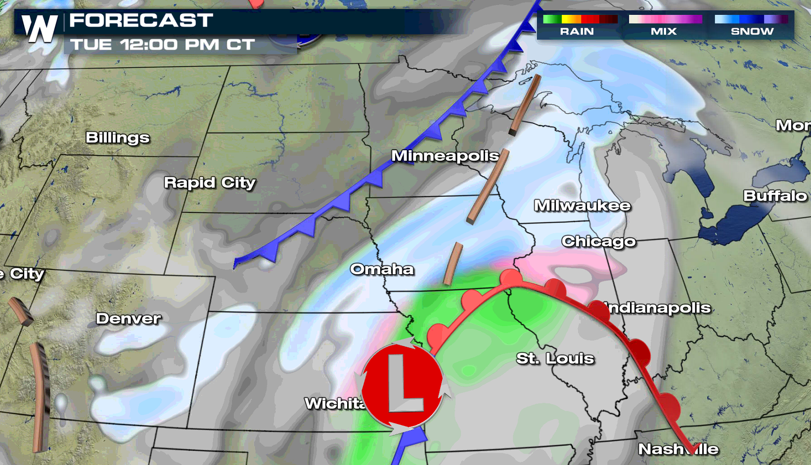
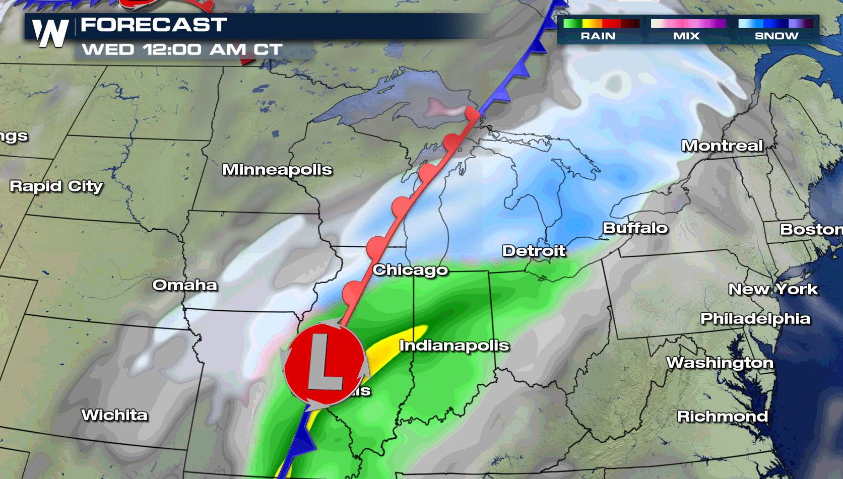
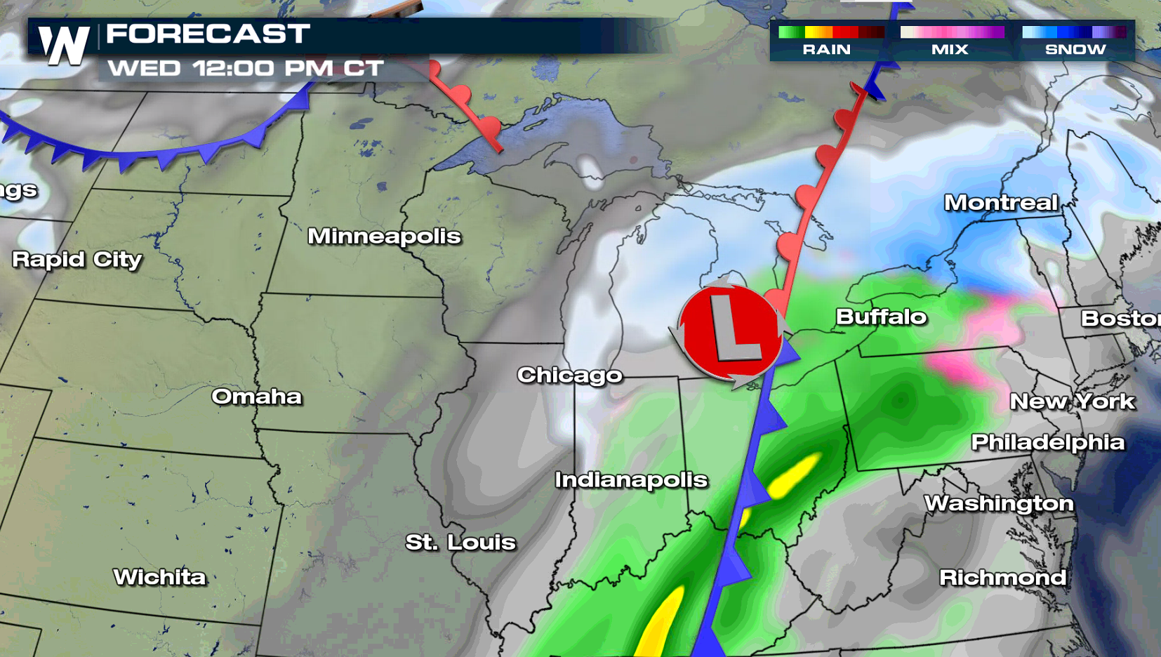
A storm system producing blizzard conditions on the Front Range will create a mess on the roadways in the Upper Midwest and Great Lakes. Ice and snow is ahead through Wednesday. Winter weather alerts are in effect from the mountains in the West to the Great Lakes. Up to a .10" of an inch of ice is possible in some areas. In the colder air, 6" to 12" of snow may accumulate.
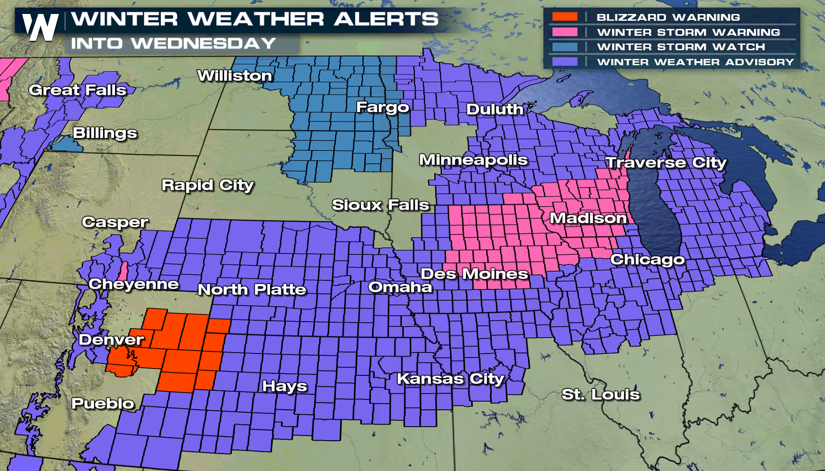
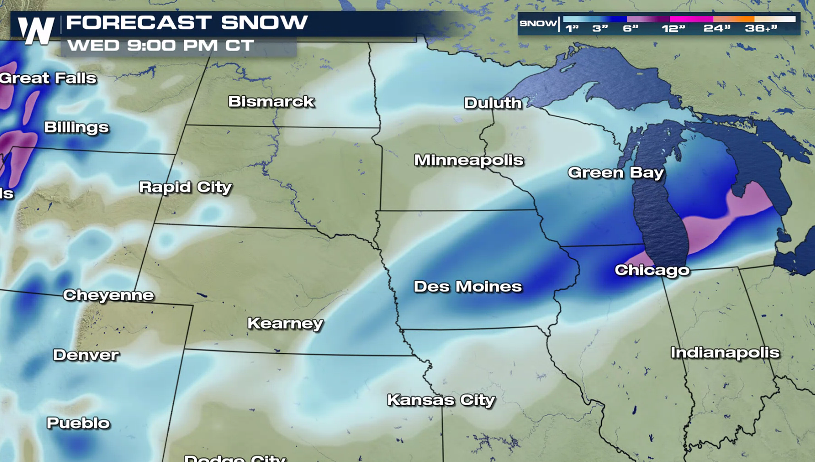
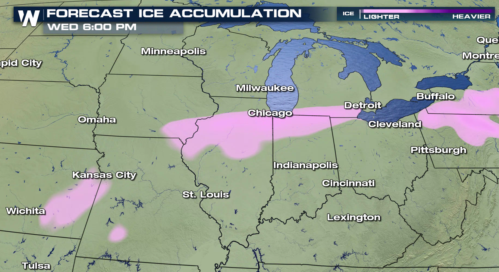 The low pressure center will push from the Front Range to the Great Lakes over the next 24 hours. Bands of heavy snow will fall further to the north, with a mix of freezing rain, sleet, and snow for locations to the south. As the system moves east by Wednesday, the wintry mixed precipitation will come to an end in the Plains but snow will continue for the Great Lakes.
 For WeatherNation: Meteorologist Mace Michaels
The low pressure center will push from the Front Range to the Great Lakes over the next 24 hours. Bands of heavy snow will fall further to the north, with a mix of freezing rain, sleet, and snow for locations to the south. As the system moves east by Wednesday, the wintry mixed precipitation will come to an end in the Plains but snow will continue for the Great Lakes.
For WeatherNation: Meteorologist Mace MichaelsAll Weather News
More
Fronts Continue To Spark Severe Weather Across the Plains
A cold front that brought record lows to the
18 Jul 2025 10:40 PM

Extreme Heat Impacts for the East Coast & South
Extreme heat continues to impact several area
18 Jul 2025 10:05 PM

Flooding Threat Remains Elevated in the East
A cold front pushing through the Eastern Seab
18 Jul 2025 9:10 PM

EF-2 Firenado from the Deer Creek Fire in Utah
A fire tornado was spotted near La Sal, Utah
18 Jul 2025 7:30 AM

Tropical System Brings Flood Risk to the Central Gulf
Time has run out for notable tropical develop
18 Jul 2025 3:05 AM

Heavy Rain, Flooding Threat Returns to Florida
Keep the rain boots handy in Florida - heavy
13 Jul 2025 12:50 PM

Severe Storm Risk Pushes into the Great Lakes, Ohio Valley
Friday was another busy day with severe weath
12 Jul 2025 8:00 PM