National Weather Service at 150: 7 Inventions That Improved Forecasting
Since then, weather forecasting has become far more accurate and timely. As NWS celebrates its 150th birthday, let’s take a look at 7 tech advancements that changed the way we do weather forecasting:
1. Weather balloons
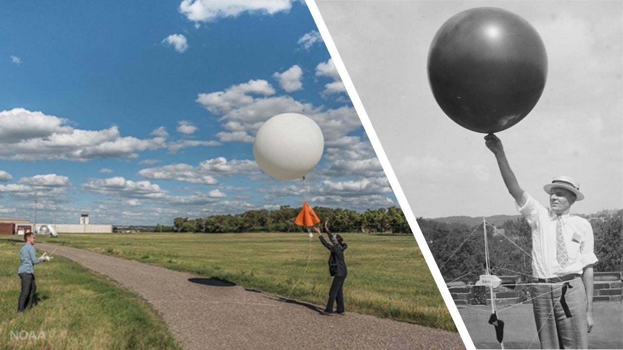 [Left: An NWS weather balloon is launched from Bismarck, North Dakota on June 24, 2017. Credit: NOAA. Right: Early testing of hydrogen filled balloons for upper air measurements. Theodolites - a surveying tool that measures horizontal and vertical angles - were used to track balloons to the limit of visibility. Credit: NOAA Photo Library. (NOAA)]
Testing of unmanned balloons to carry weather instruments into the atmosphere began in 1906, and in 1909 the Weather Bureau — a predecessor of the National Weather Service — began using free-rising balloons. A free-rising balloon launched from Omaha, Nebraska, reached a height of 15 miles on October 12, 1909. Daily balloon observations began in the 1940s. Today, NWS launches weather balloons twice daily from 92 stations across the U.S. to observe the upper atmosphere and provide valuable data for weather forecasting.
2. Aircraft
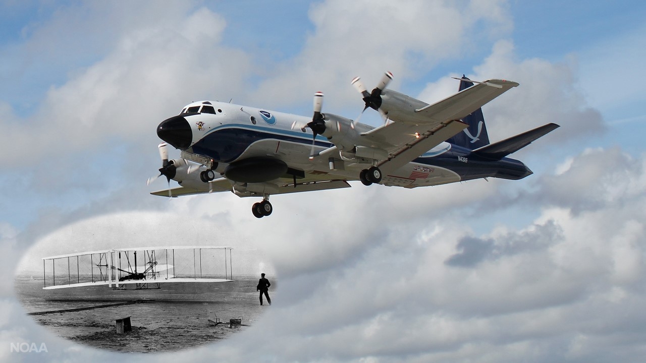 [NOAA Lockheed WP-3D Orion "hurricane hunter" aircraft (N43RF) departing Lakeland Linder International Airport in Lakeland, Florida, in 2019. Credit: NOAA. Inset: Original Wright Brothers' 1903 Aeroplane ("Kitty Hawk") in first flight, December 17, 1903 at Kitty Hawk, N.C. (National Archives and Records Administration)]
Here's a fun fact: The Wright Brothers consulted with the Weather Bureau before deciding to launch their test flights from Kitty Hawk, North Carolina. Airplanes were first used to observe weather in the United States in 1925. Today, NOAA provides weather forecasts for both commercial and general aviation, quickly communicating drastic changes in weather to pilots in flight. In other words, if you recently made it safely through a domestic flight, a specialized team of meteorologists helped make that happen. In addition, NOAA Hurricane Hunter aircraft play an important role in hurricane research and forecasting.
3. Computers
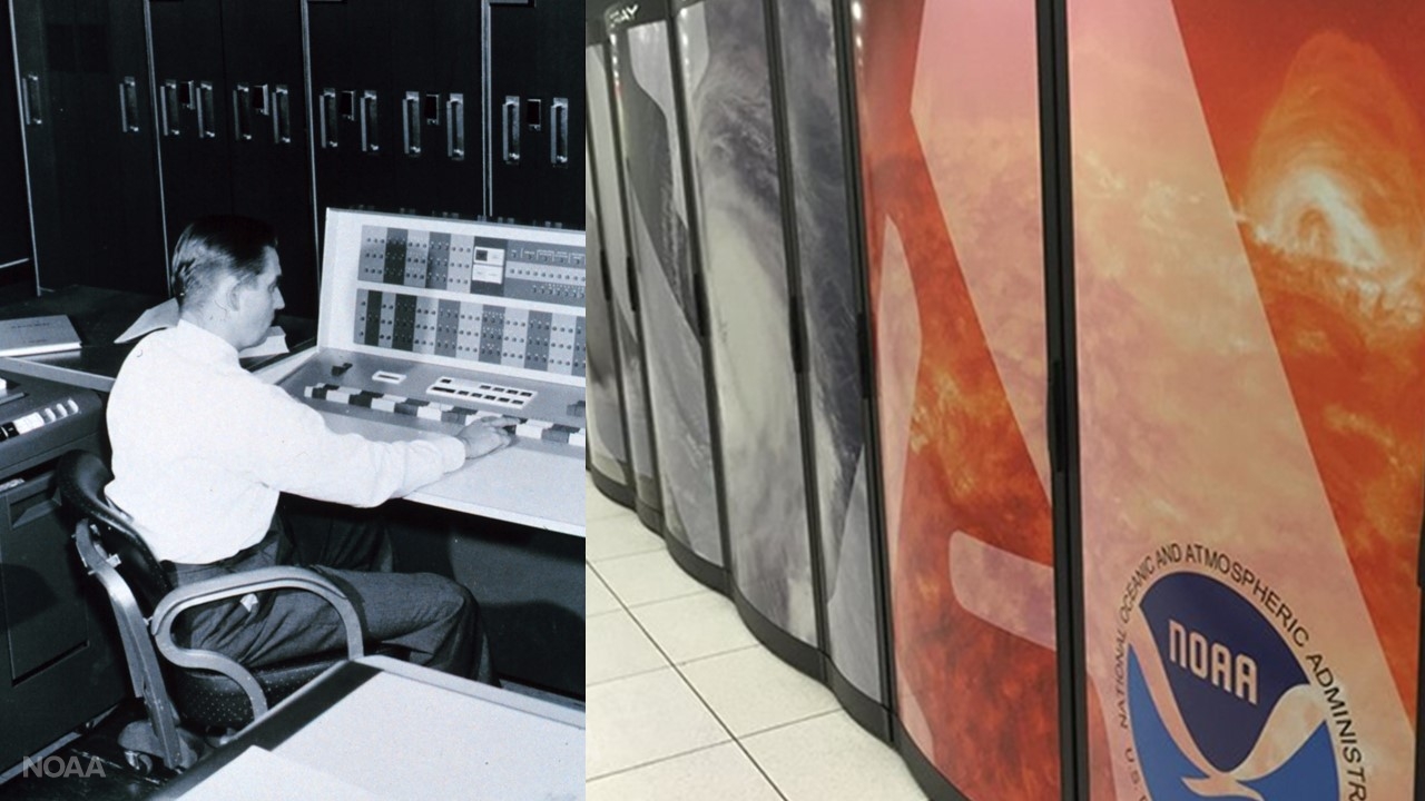 [Left: An early IBM computer at the Joint Numerical Forecast Unit in Suitland, Maryland, circa 1965 from the U.S. Weather Bureau. Right: Two NOAA supercomputers in Reston, Virginia and Orlando, Florida, collect, process and analyze billions of observations daily. (NOAA)]
In the 1940s, scientists began experiments using computers to predict weather, making possible numerical weather prediction proposed in the 20th century. Today, NOAA operates supercomputers that collect, process and analyze billions of observations from weather satellites, weather balloons, buoys and surface stations around the world.
4. Radar
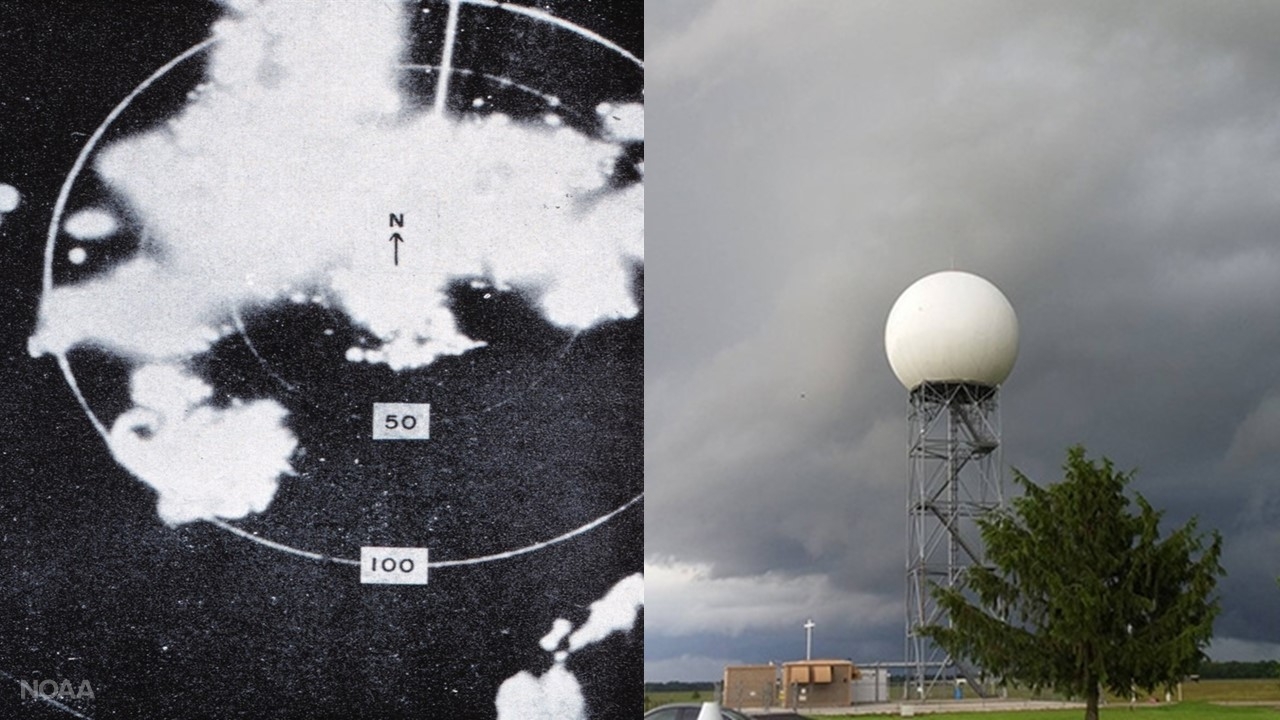 [An early radar image (left) and a current operational radar dome (right) in Tampa, Florida. (NOAA NWS)]
In 1946, the U.S. Navy donated 25 aeronautical radars to the Weather Bureau to be adapted for meteorological purposes. The first of these radars, the WSR-1, was deployed to then Washington (DC) National Airport in early 1947. Today, the National Weather Service operates Next-Generation Radar (NEXRAD) with dual-pol technology to provide more in-depth information to forecasters with better estimates of size, shape, precipitation type and overall severity of incoming weather.
5. NOAA All-Hazards Weather Radio
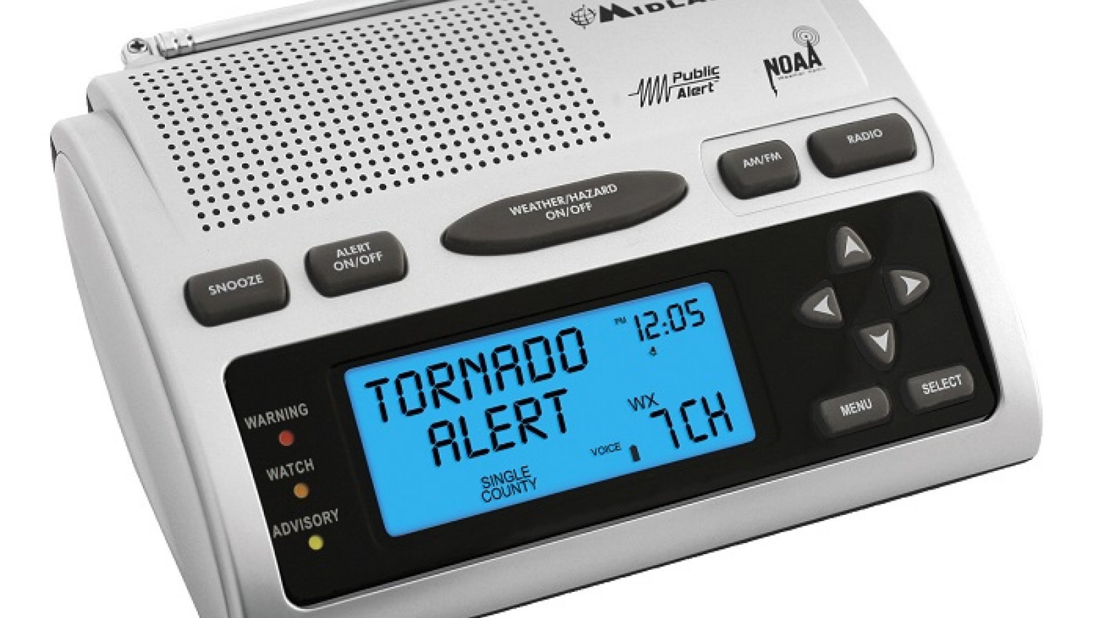 [You can find this and other brands of NOAA weather radios in electronics stores and online. (Credit: Midland)]
The first experiments using wireless telegraphy, or radio, to broadcast forecasts began in 1900, and the Weather Bureau first initiated aviation radio broadcasts for weather in 1951. After the 1965 Palm Sunday tornado outbreak, one recommendation was to establish a nationwide radio network to distribute warnings. Initially known as "ESSA VHF Weather Radio Network," the network was renamed NOAA Weather Radio in 1970. There are now more than 1,000 transmitters broadcasting official weather service warnings, watches, and other hazard information around-the-clock.
6. Weather satellites
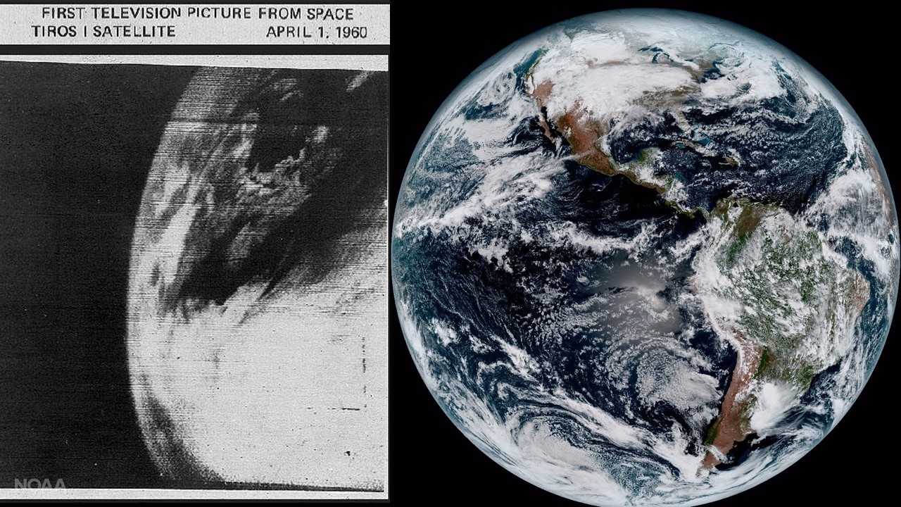 [Left: First image from TIROS-1 on April 1, 1960, (Credit: NASA) alongside the first composite color full-disk visible image of the Western Hemisphere captured from NOAA GOES-16 satellite at 1:07 pm EST on Jan. 15, 2017. (NOAA)]
On April 1, 1960, the first weather satellite called the Television InfraRed Observational Satellite (TIROS-1) was launched. It operated for just 78 days, but sent back 19,389 usable pictures of the Earth. Today, NOAA operates a fleet of sophisticated environmental satellites that provide real-time views of weather on Earth as it develops and billions of bytes of data used in weather forecasting.
7. Automated Surface Observing System (ASOS)
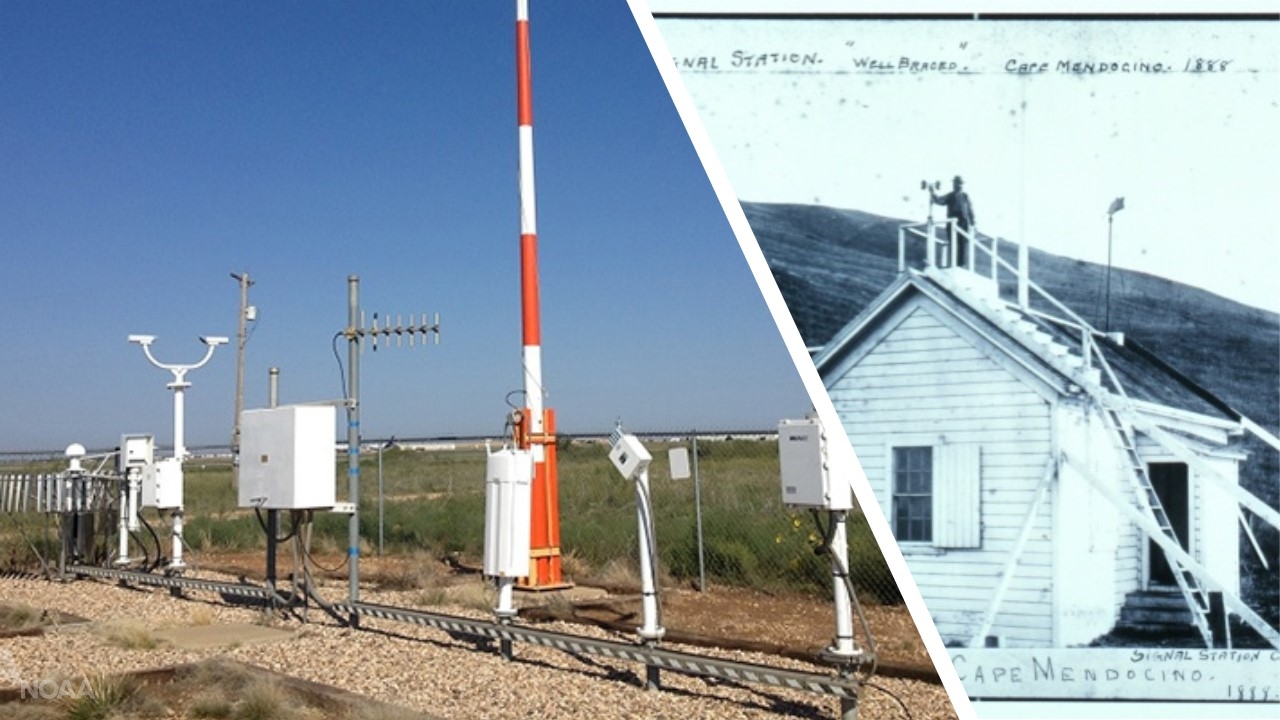 [Left: The ASOS (Automated Surface Observing System) at the Childress Municipal Airport in Childress, Texas. Right: Signal Station, Army Camp Mendocino in California, 1888. (NOAA)]
In 1991, NWS began working with the Federal Aviation Administration and Department of Defense to deploy the system that is the nation’s primary surface weather observing network. Located at airports around the country, each station captures sky conditions, visibility, precipitation, pressure, temperature, dew point, and wind speed and direction. The stations providevaluable information for meteorologists as they develop forecasts.
[Left: The ASOS (Automated Surface Observing System) at the Childress Municipal Airport in Childress, Texas. Right: Signal Station, Army Camp Mendocino in California, 1888. (NOAA)]
In 1991, NWS began working with the Federal Aviation Administration and Department of Defense to deploy the system that is the nation’s primary surface weather observing network. Located at airports around the country, each station captures sky conditions, visibility, precipitation, pressure, temperature, dew point, and wind speed and direction. The stations providevaluable information for meteorologists as they develop forecasts.


