Rain, Snow & Winds for the Western U.S.

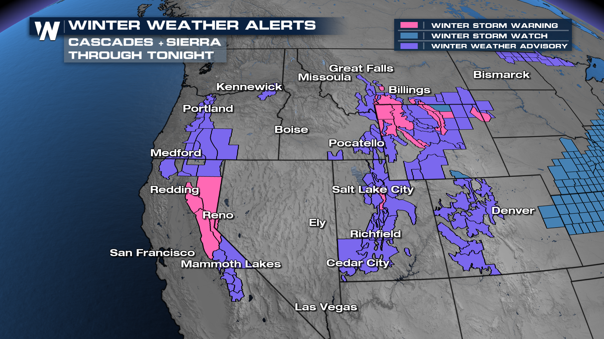
WESTERN U.S. - Winter weather alerts remain in effect through tomorrow morning for up to 2 feet of snowfall. This system is expected to bring high winds, heavy rain, and heavy snow to the mountains.
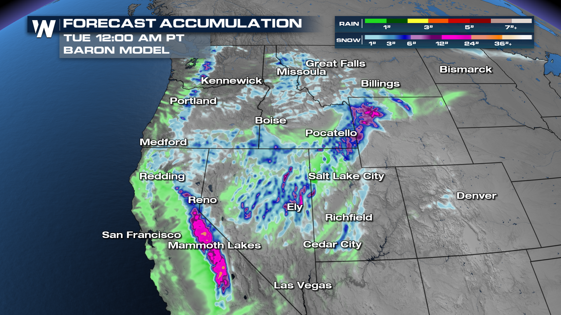
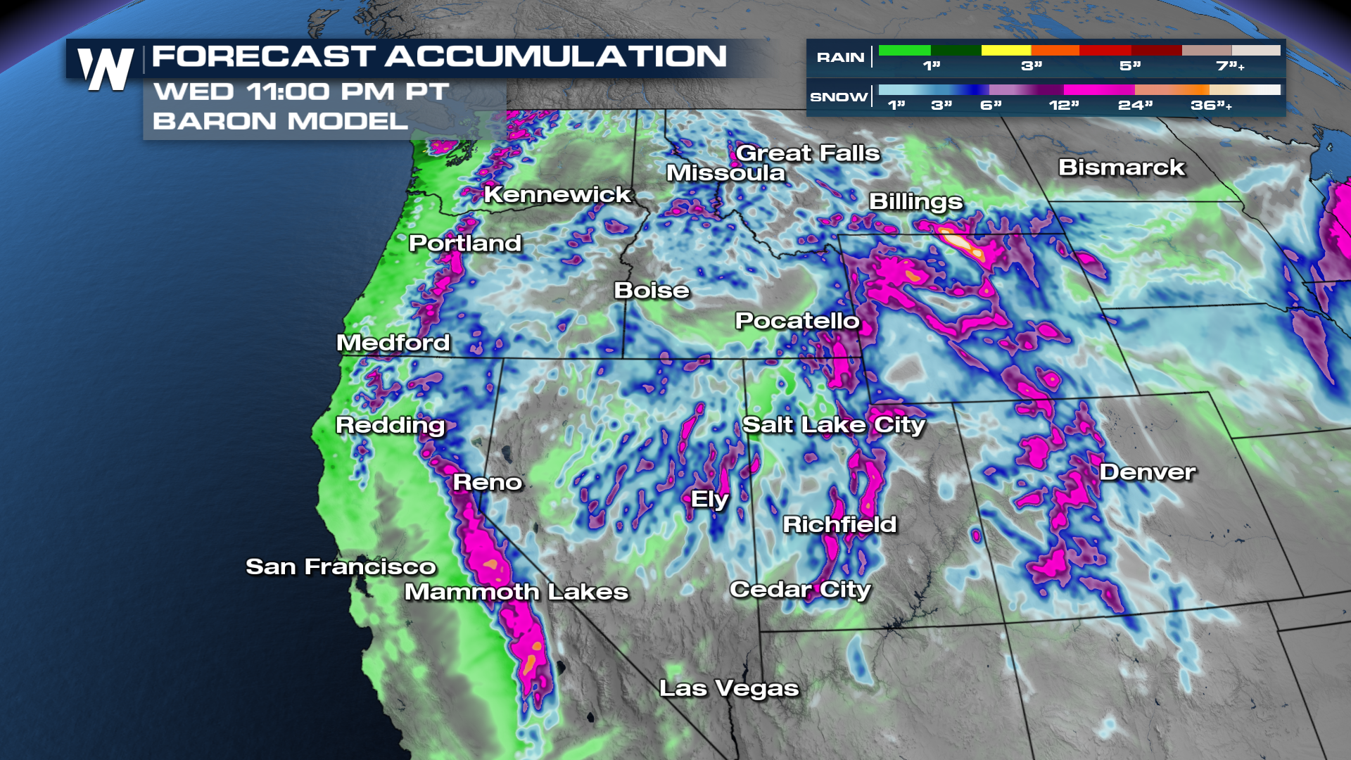
 A reinforcing system is helping to bring additional moisture to the West Coast, but the heaviest rain and snow will follow the front inland to the Four Corners. Snow levels remain fairly high with this system, but many mountain passes will be difficult through into Tuesday morning. Our next round of rain and snow quickly moves in by Wednesday to add to the mountain snowpack and moisten up the valleys.
Precipitation Forecast
Recent storms have helped immensely with the Sierra snowpack, we are now up to 92% of the statewide average. Through tomorrow, snowfall looks to be heaviest in the Sierra Nevada.
 Our next round will add to some of these totals into the Cascades and Rockies, with upwards of 2 feet of snowfall likely.
Long Range
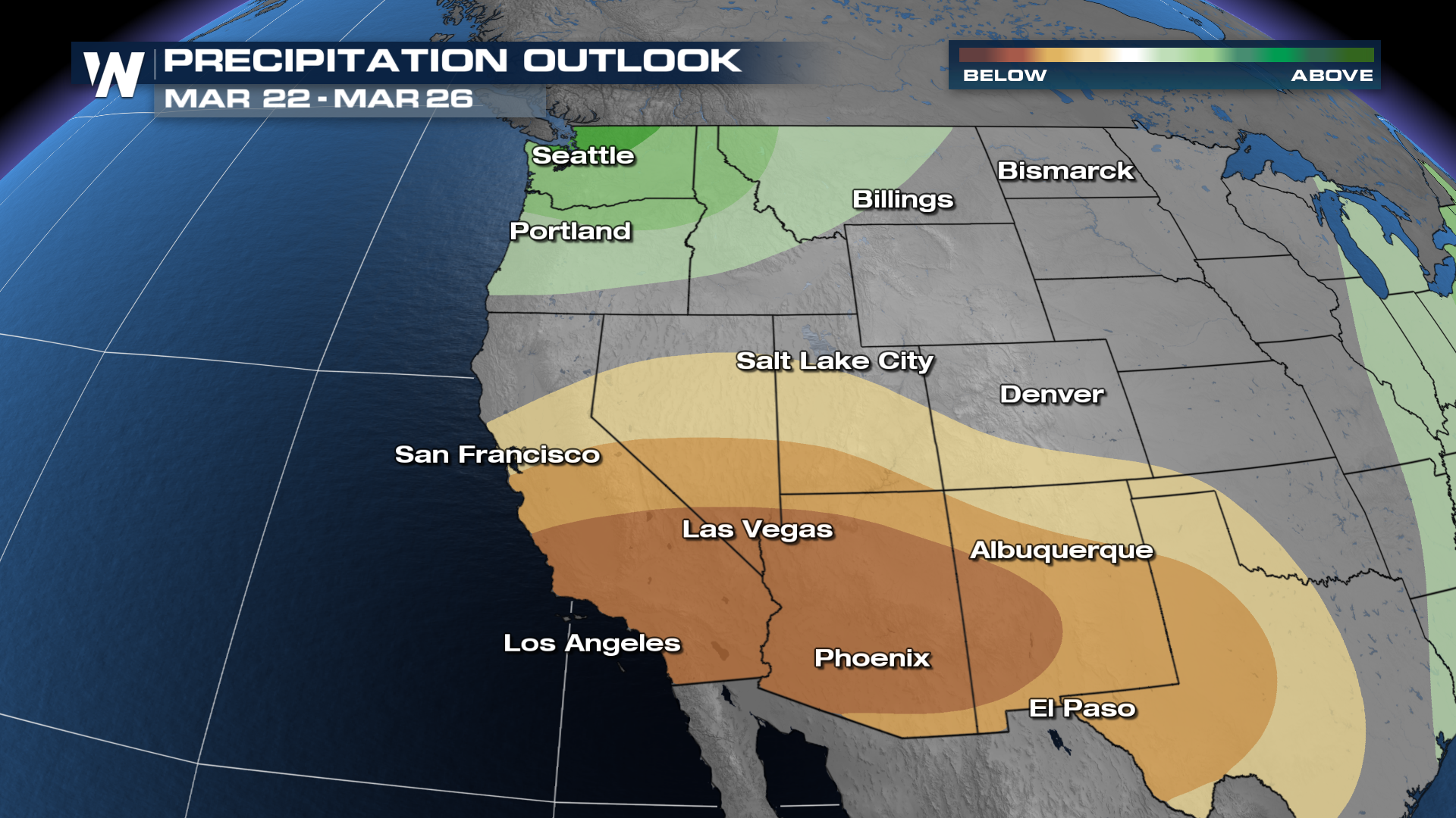
The Climate Prediction Center has highlighted confidence for above-average precipitation in the northwestern U.S. within the next 6-10 days, whereas drier than average conditions are expected for the southwestern U.S.
For the latest updates, join us :50 past the hour for your Western regional forecast on WeatherNation.


