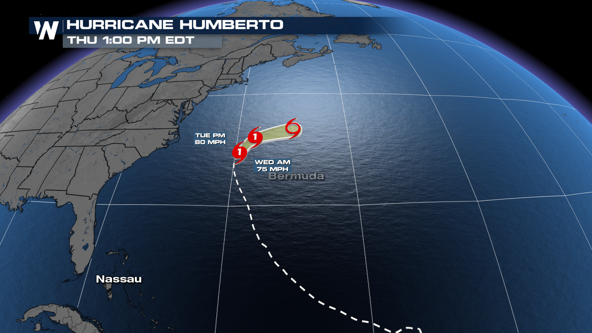
Humberto Merges with a Front in the Atlantic

Tropical activity in the Atlantic has increased significantly over the last week. We're now tracking two named storms, Imelda and Humberto. On Saturday, Humberto reached Category 5 status, with sustained winds topping out at 160 mph! Since then, it has backed off to 80 mph winds, making it a category 1 storm.
LOOKING BACK
Humberto was named a week ago, last Wednesday afternoon, and gained hurricane status early Friday morning. This is the first time in nearly 100 years that we have had 2 Category 5 hurricanes in back-to-back seasons!
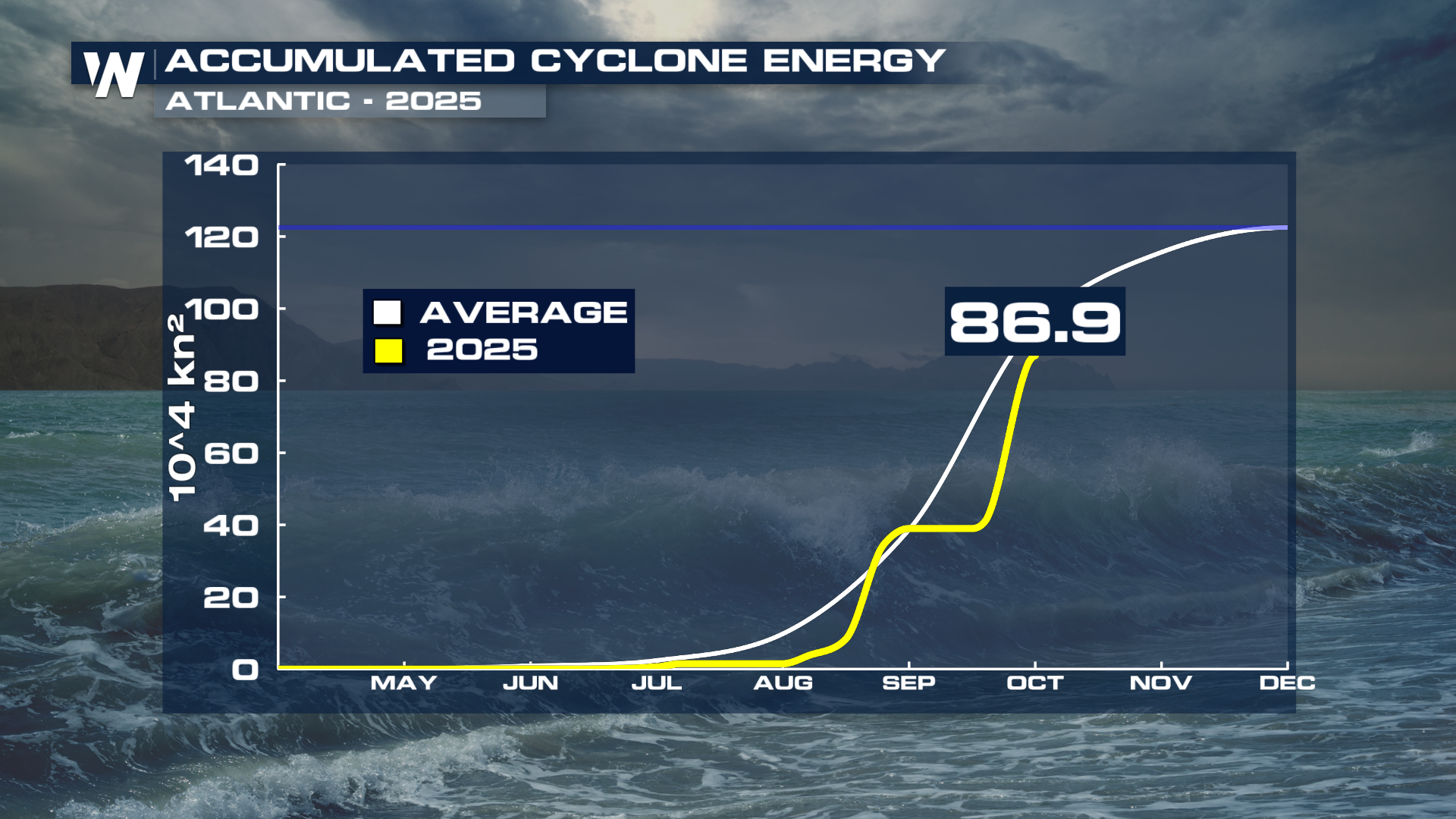
We are now past the climatological peak of Atlantic Hurricane Season, but still have a ways to go for the season. For being such a quiet season, the normal amount of Accumulated Cyclone Energy, a metric to quantify activity, is not far off. Two category 5 hurricanes will boost those numbers, though.
 September is historically the peak of hurricane season, and ocean conditions remain favorable for additional development. However, the NHC urges residents along the Atlantic basin to monitor updates closely.
As always, preparedness is key. Whether or not this particular system develops into a named storm, it serves as a reminder that the Atlantic remains active and that the window for tropical threats is far from closed. Tune into WeatherNation TV for the latest updates.


