ATMOSPHERIC RIVER: Winds Topping 100 MPH In the Northwest

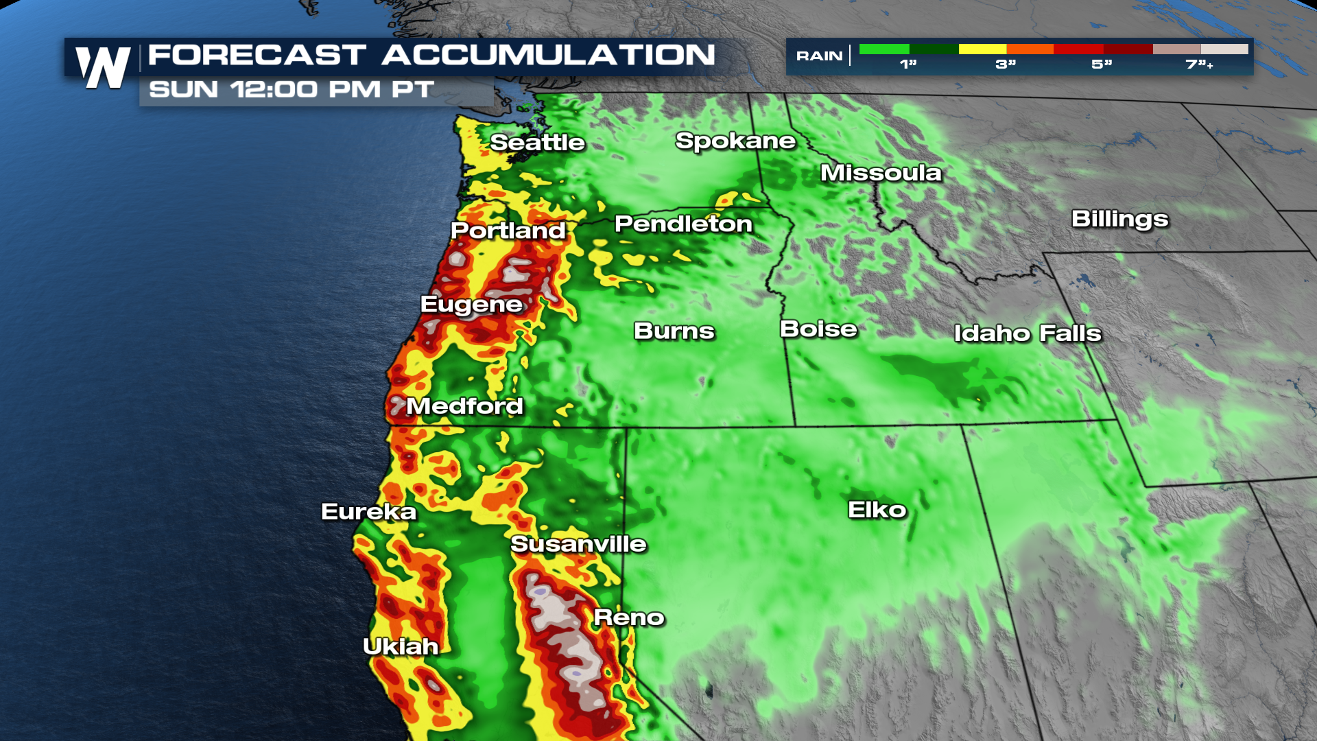
WEST - A river of moisture has been directed towards the western United States for the last week, bringing record rainfall, historic river flooding, and damage to homes and property. While this river will shift to California through some of the early weekend, we're still not out of the woods in the Pacific Northwest.
Forecast Timing
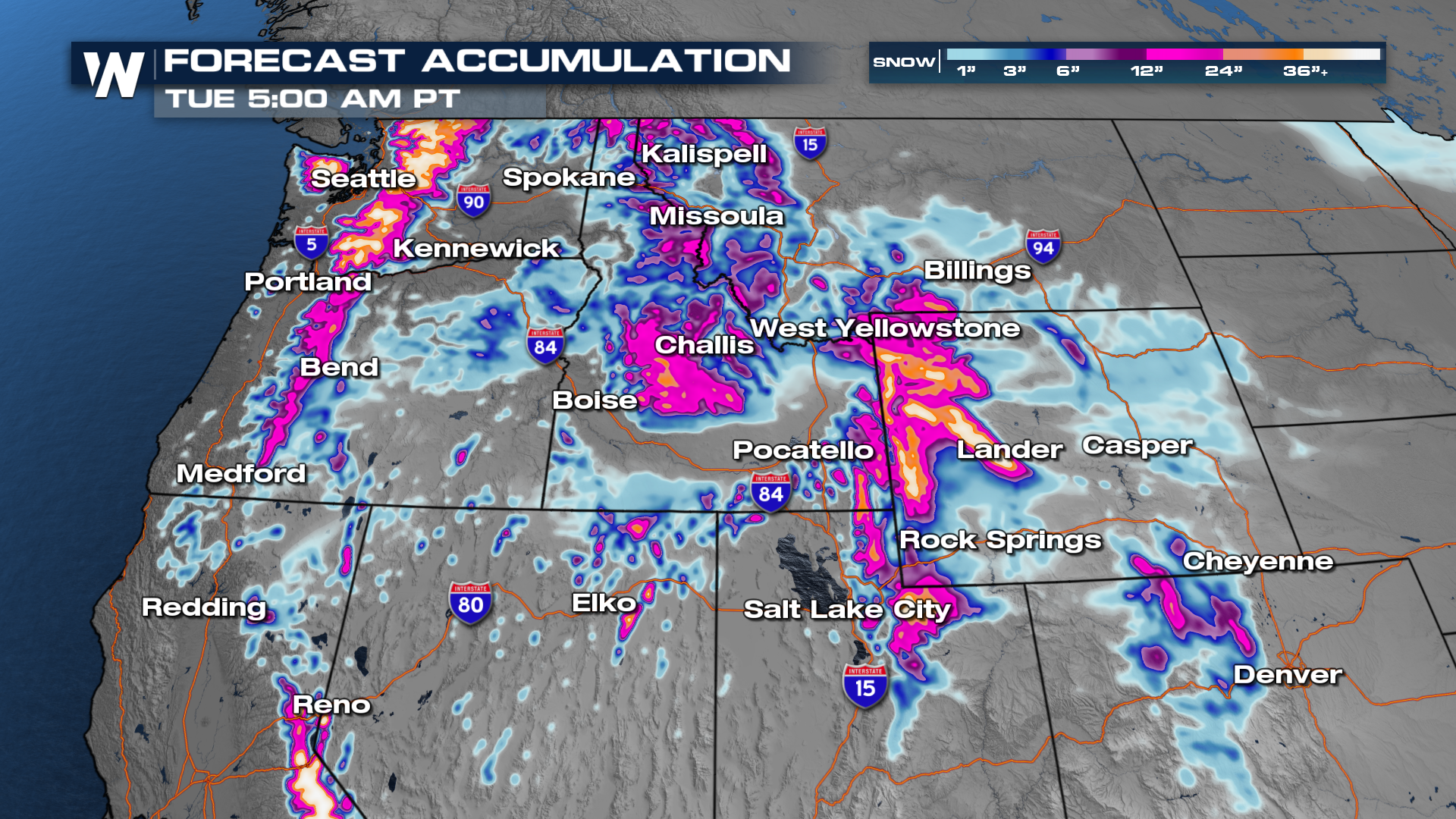
Moving forward, the heaviest of the rain will be focused in on California. However, our northwestern mountains will be stuck in the clouds so we can expect heavy snowfall totals to start to accumulate. Most of these systems have been seeing warm moisture as opposed to cold moisture, so snow levels have been quite high. With the cooler Pacific air behind the system, it should be could enough to keep accumulating snowfall.
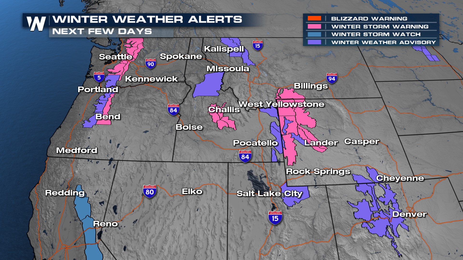
As snow levels drop, winter weather will complete the trifecta of weather hazards with this system. Some winter alerts continue through the weekend.
Rainfall totals have surpassed 7-8 inches already, with more on the way. The heaviest of the rain looks to line up farther south, aiming at Oregon and northern California.
 Additional rounds of heavy rain and snow are expected into the week. We won't have a lot of new snow when temperatures begin to drop.
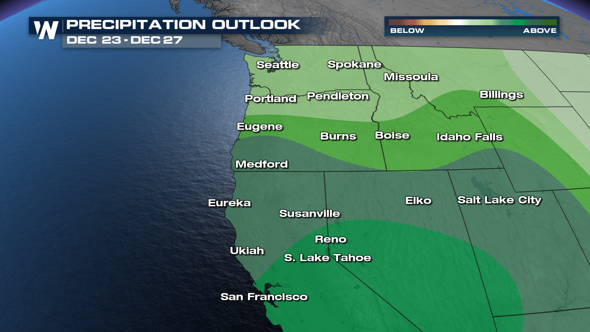
Through Christmas, the Climate Prediction Center has a higher confidence that conditions will stay wetter than normal.
 For more details, be sure to join us live at :50 past the hour for your Western Regional forecast.


