Intense Heat & Severe Storms for the Central Gulf
The heat has been unbearable in the central U.S. basically all summer, especially for the central and southern Plains that have been baking in high dew points and temperatures above 100° for weeks on end. In the south, records continue to be broken.
An incoming front combined with moisture and cloud cover from Idalia will help to cool us off through the middle and end of this week. Though the air will be "cooler" it will actually be right around if not slightly below average through the middle and end of next week!
 Later tonight we should start to slow down the new development of storms. Damaging winds will be the biggest threat with these storms. Watch for low-lying areas, streams, and creeks to have the potential for flooding as up to 4" of rain may be possible. The heaviest rainfall will be along the frontal boundary, where the best lift and instability will be.
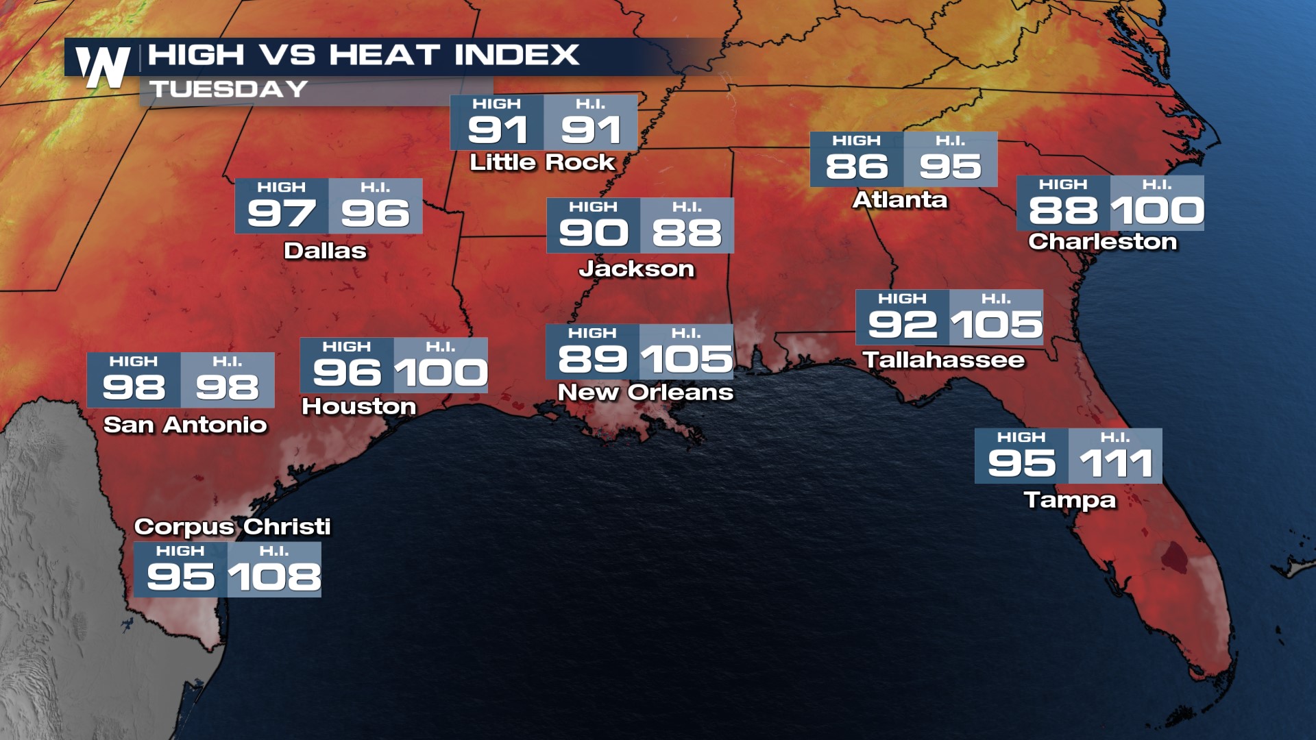
The heat backs off slightly into Tuesday with highs in the 80s and low 90s for most. While still hot, it is trending back towards average.

Stay weather aware and weather ready this weekend, especially if you have outdoor plans! Stay with WeatherNation for the latest updates on the storms.