Wintry Mess Moves East on Thursday

Ice Storm warnings have been issued for portions of the Northeast, as a winter storm is moving across the region Thursday. Low pressure brings an abundant amount of moisture towards cold high pressure, which will lead to various winter weather, from freezing rain to snow. The most concerning form of winter weather will be the threat of ice accretion. However, snow and ice can bring dangerous travel concerns, especially for bustling cities.
Major Metros included:
Baltimore
Washington
Philadelphia
Pittsburgh
Hartford
Boston
Winter Alerts and Ice Storm Warnings last through Thursday afternoon for many. Cumberland, MD is under an Ice Storm Warning while Boston, MA is under a Winter Weather Advisory. Additional Ice Storm Warnings have been issued for the Appalachians, northern Virginia, Maryland, and Central Pennsylvania.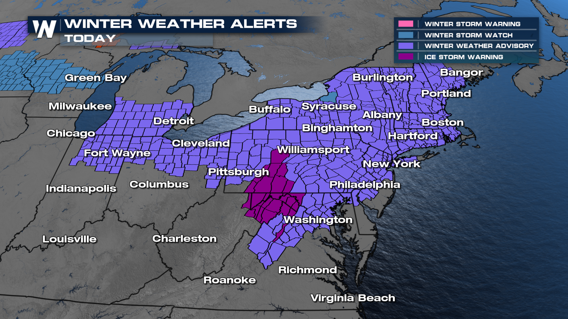 As moisture gets pushed eastward temperatures will hold below freezing until a warm front passes through. Once the warm front passes this should stop the wintry weather. Until then, freezing rain and sleet will continue to move across the Mid-Atlantic into the Northeast. Many locations can pick up a glace to a quarter inch of ice.
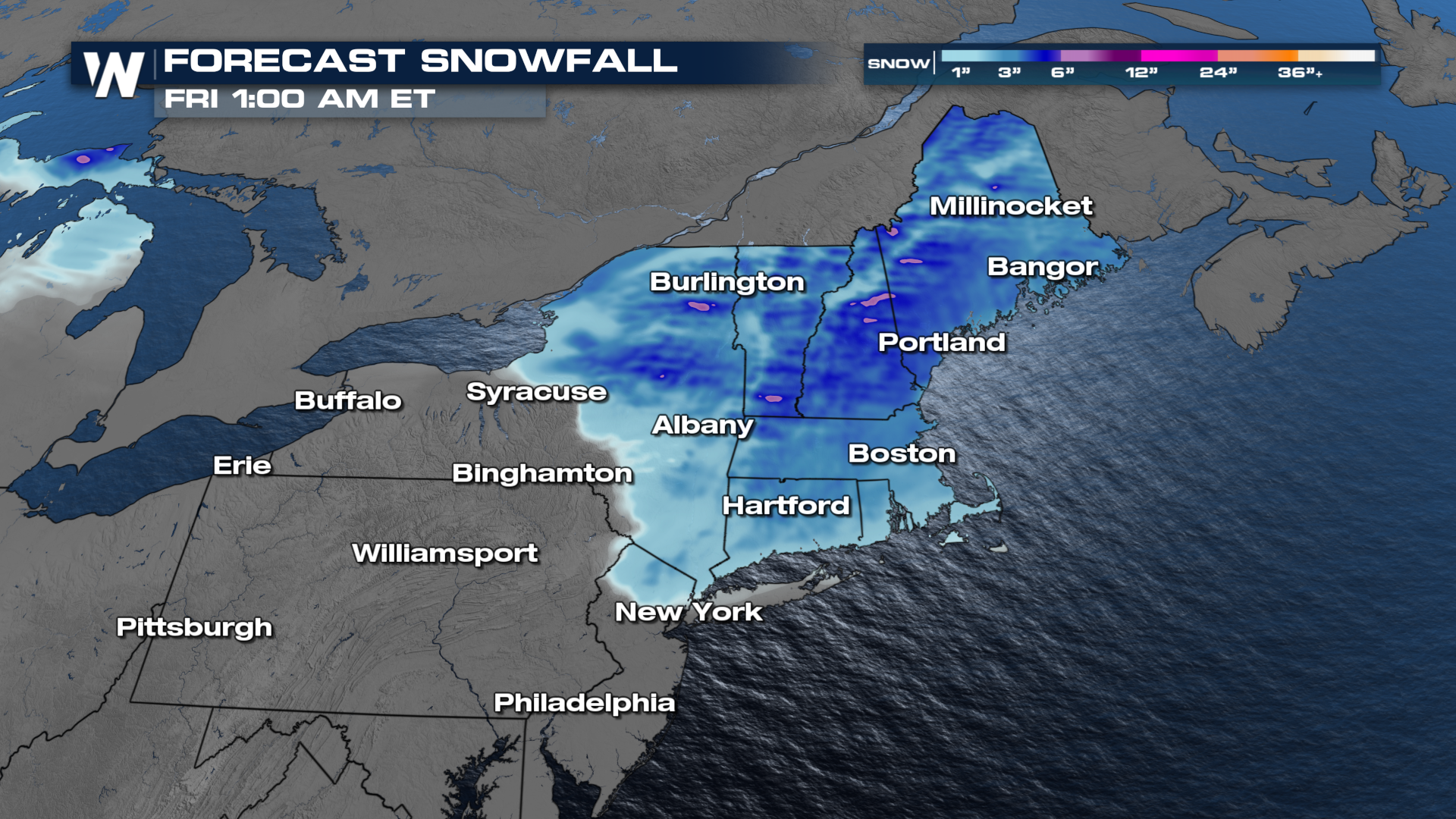
Roads could become slick with even a glaze of ice, so assume the roads will be dicey anywhere freezing rain is reported. Expect issues into Thursday afternoon, but the window might be short-lived in some places as warmer temperatures build in. 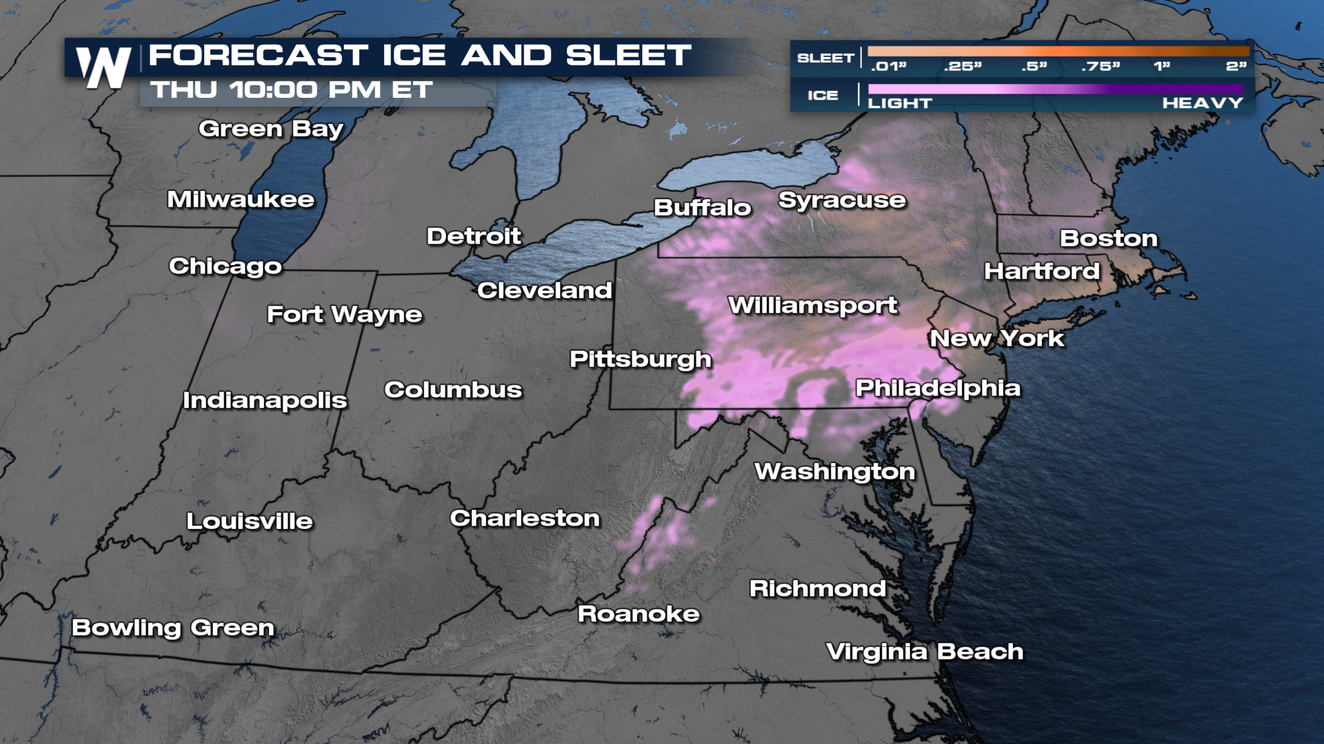 Due to the warmer air aloft, heavy snowfall (6"+) is not expected with this system outside of higher terrain, but the Northeast can get over 3" in some areas. This system is expected to exit the region by Thursday night.
 Stay tuned to Weather Nation for the latest details.


