Hurricane Kiko Tracking Toward Hawaii, Lorena Dissipates

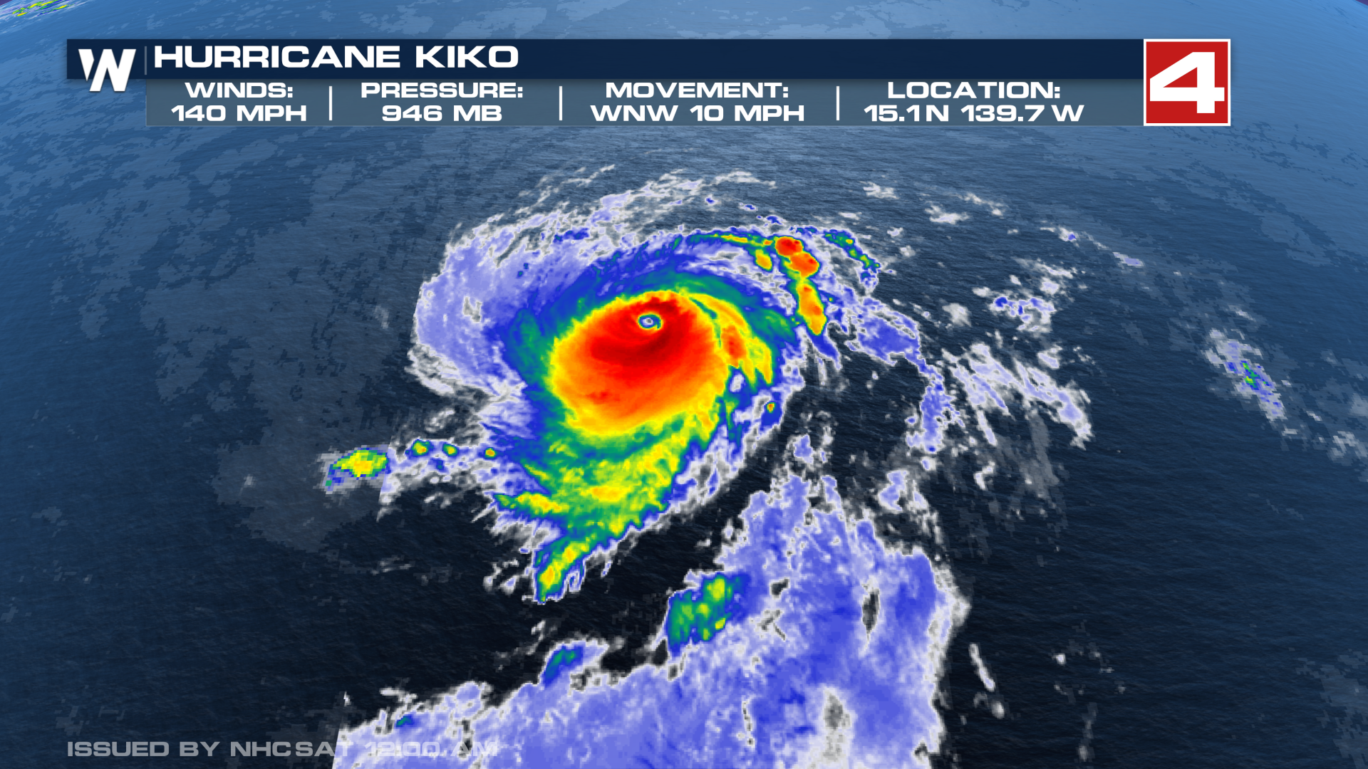
The Eastern Pacific Basin has been active over the past week, with Hurricane Lorena dissipated near Baja but still causing flooding issues. Kiko has reached category 4 status twice now, but thankfully is expected to weaken as it approaches the Hawaiian Islands.
KIKO
Hurricane Kiko continues to churn west as an impressive major hurricane. It's expected to gradually weaken through early next week but is still expected to bring impacts to Hawaii, including high surf and gusty winds.
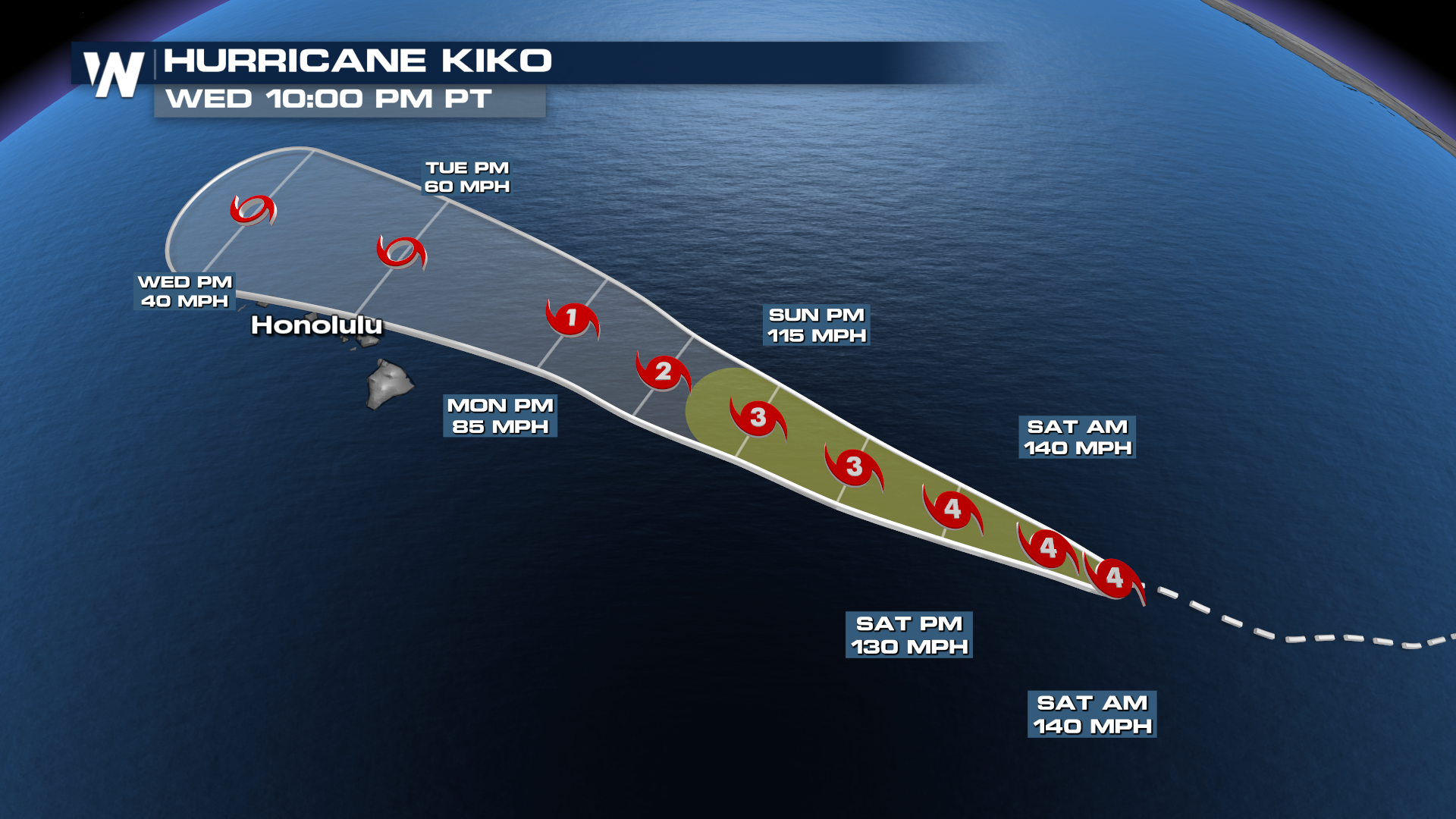
 The forecast cone brings Kiko close to the Hawaiian Islands. Residents should monitor this forecast closely over the next day or two, making preparations as necessary over the next several days. Expect rainfall as it passes, but the larger impacts will be high surf expected to reach the Hawaiian Islands towards the end of this weekend. These swells could cause life-threatening surf and rip currents.
 While Kiko is relatively small at the moment, it could grow significantly in size as it weakens, which is common for tropical systems. This means tropical storm force winds will have a chance to impact the islands, despite the center of the storm likely passing to the north.
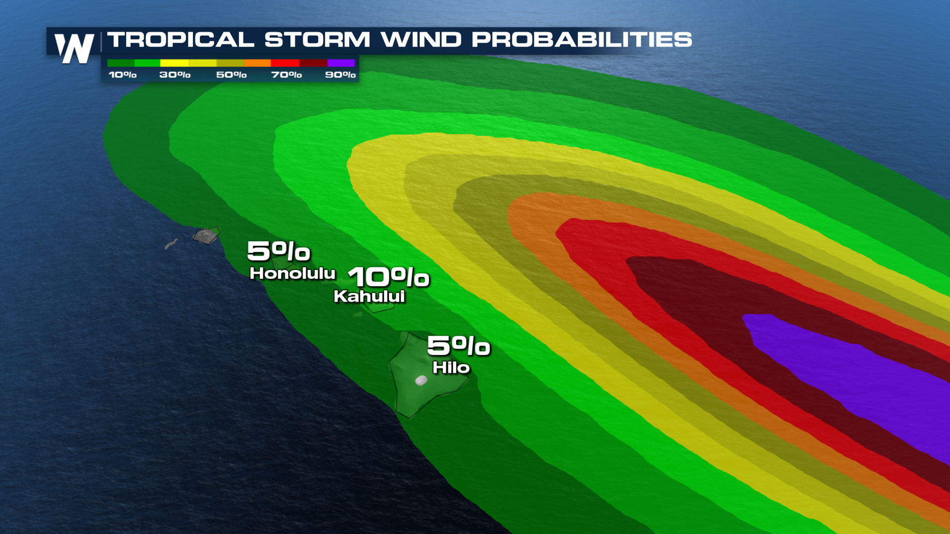 Big wells and strong currents are the most likely impacts to Hawaii from Kiko. Dangerous currents could begin on Sunday and last through much of the week as Kiko's growing wind field continues to generate large waves.
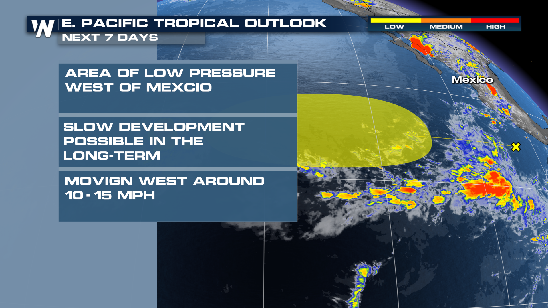
Another potential area of development over the open waters has a low chance of developing in the next seven days. A center of low pressure has formed but any development in the short or mid-range is not expected.