Another Taste of Fall: Cooler Air and Rain for the Northern Plains

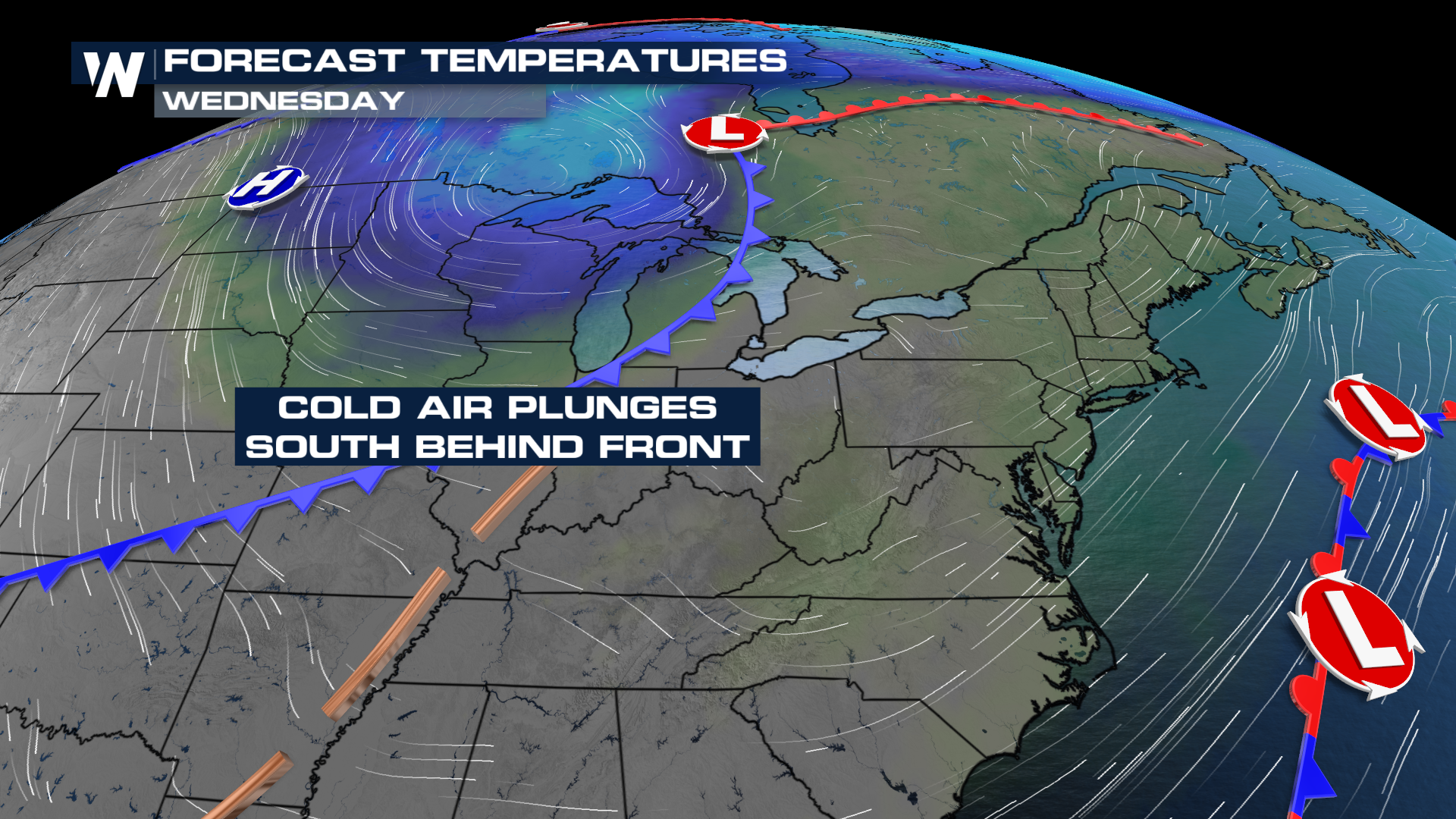
NORTHERN PLAINS - A series of cold fronts will move through the Midwest to the northeast over the next several days. First, a cold front that moved down from Canada on Tuesday will continue to bring strong storms, gusty winds, and cooler temperatures across the Northern tier of the country through the end of the week. Then, this weekend, a second cold front arrives from Canada to reinforce the cooler air.
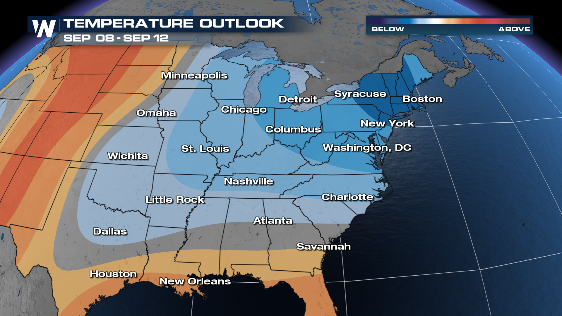
Temperatures
Behind the front, temperatures will drop significantly as winds shift to the north.
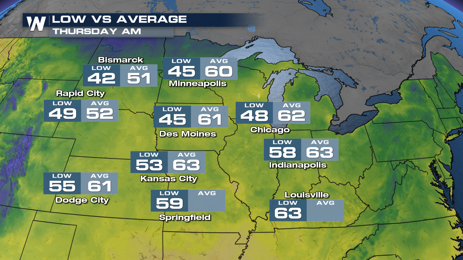
For many areas, this will be the coolest air since spring, even cooler than the most recent bout of chilly temperatures. Morning lows are expected to dip into the 40s on Thursday, Friday, and Saturday, with Friday likely to be the coldest morning across the Northern Plains.
Long-range trends keep the eastern U.S. with high confidence in temperatures being below average. Fall is here! If you're curious when the Autumnal Equinox arrives, also known as astronomical fall, this year it is on September 22nd.