Big Hail Targets the Central Plains Today; More Storms on the Way

COLORADO - Severe warned storms have been moving through the I-25 corridor of Colorado today, including this funnel cloud spotted in Castle Rock, a southern suburb of Denver.
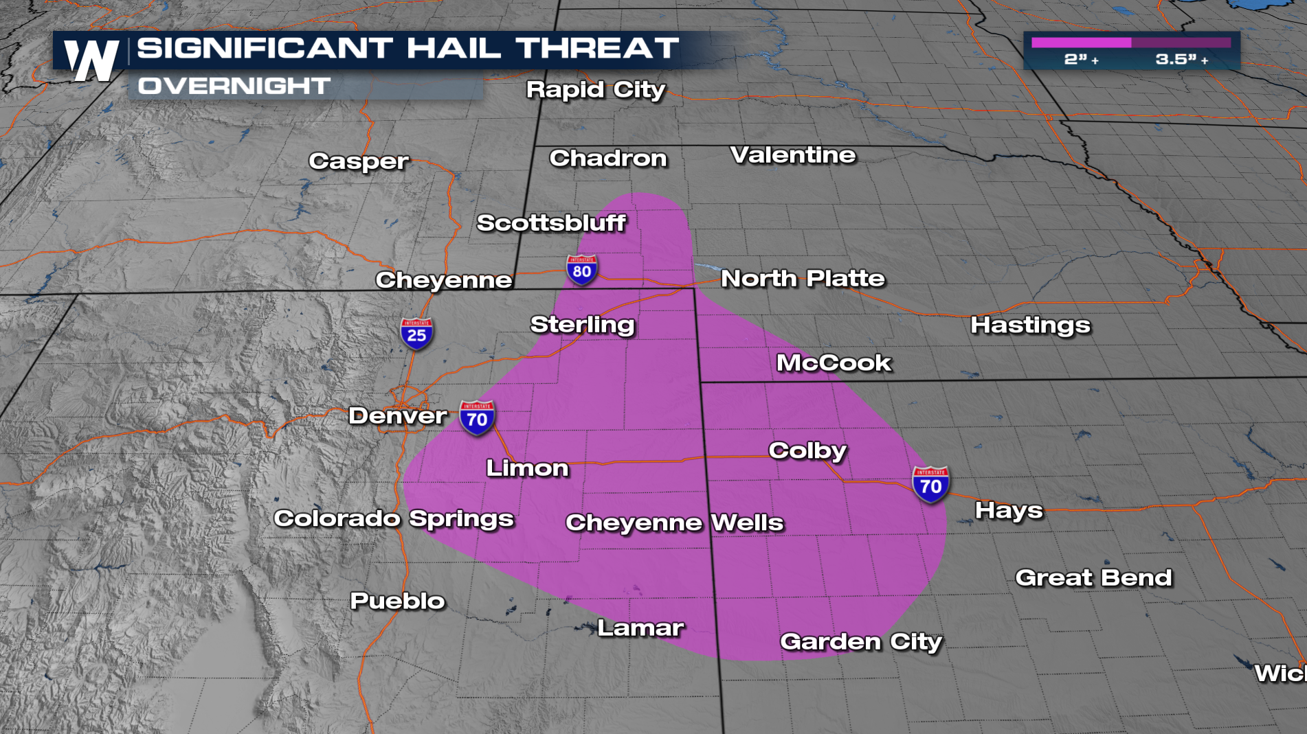
An area of low pressure will bring strong and severe storms across portions of the Plains over the next few days. Overnight, there is a SLIGHT risk for severe storms across eastern Colorado, Kansas, and portions of Nebraska. Thunderstorms capable of producing severe wind gusts and large hail are likely. There is a significant hail threat, meaning hailstones of 2 inches or larger will be possible with these storms. Make sure to have a plan in place as these storms continue through the overnight hours.
Timing:
Storms have fired up this afternoon and evening, and some storms will hold together overnight. Some of these storms will be strong to severe.
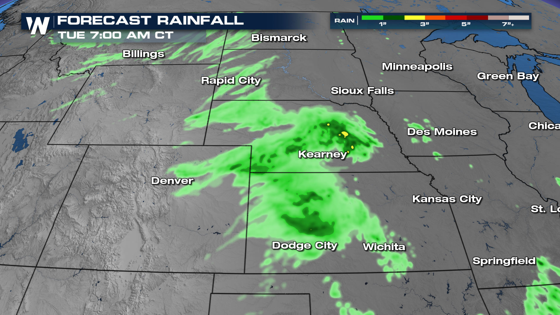
RAINFALL TOTALS:
There will be some isolated heavy rain as these storms develop. Localized heavy rain up to 2 inches will be possible.
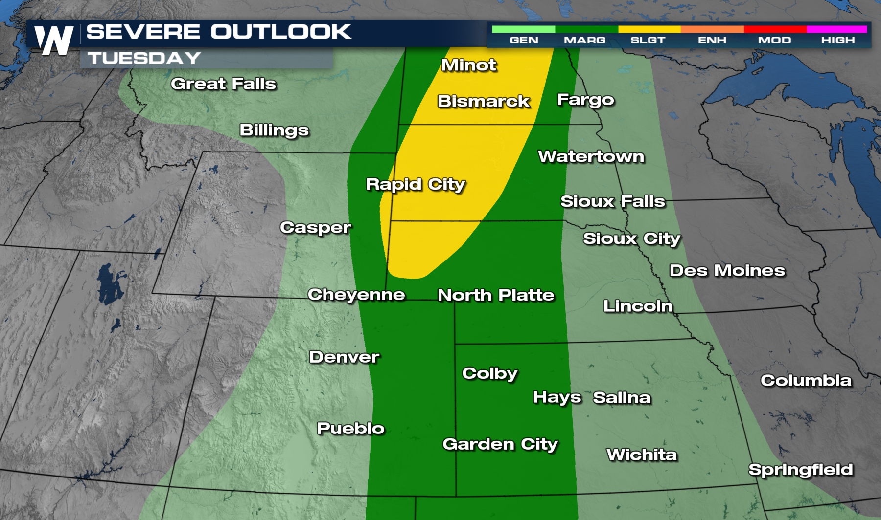
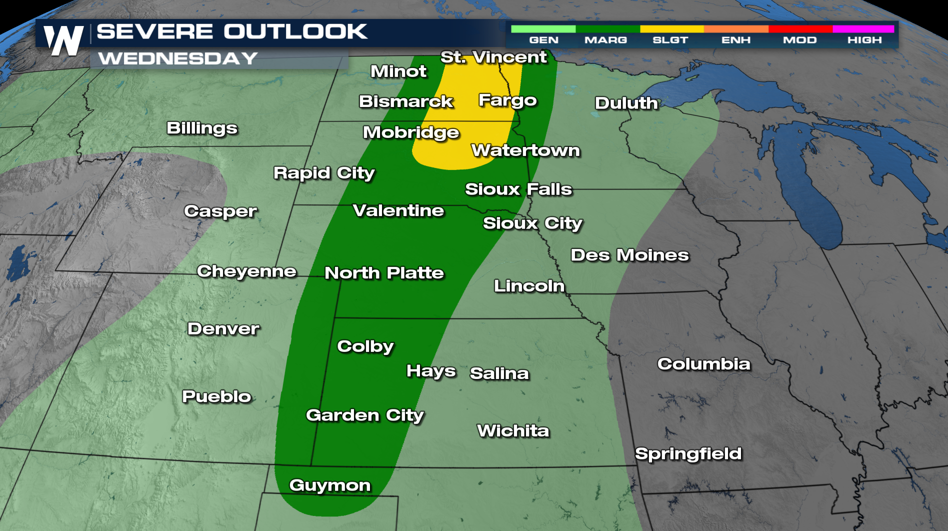
 MORE SEVERE:
On Tuesday and Wednesday, the severe threat moves north, bringing a risk for damaging winds and hail from Oklahoma to North Dakota. A few tornadoes will be possible as well.
 For more on the severe threat, tune into WeatherNation at :30 and :50 past the hour.


