Slow Monsoon Season Making Up for Lost Time

Until the past week, has anyone been impressed by the monsoon season this year?
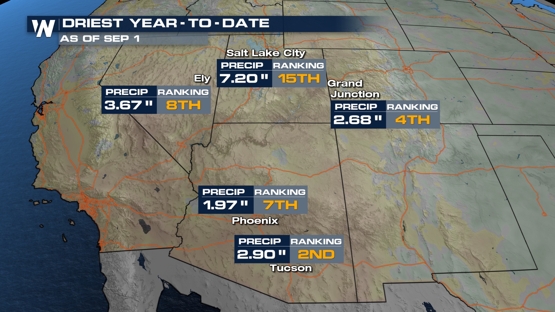
Compared to normal, many locations that see most of their rain this time of the year have been left high and dry. All of that dry time has played a pivotal role in the wildfire threat that is seemingly never-ending. This has been the second driest start to a calendar year in the city of Tucson!
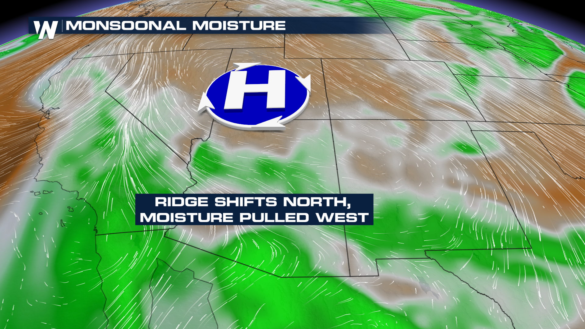
 While some headline-hooking haboobs have brought desert storms to the forefront, many are still pretty far behind, rainfall-wise. However, this week the same high pressure that is baking the Pacific Northwest will also open the door to fling a little moisture westward. Some of this Monsoon moisture will curl around an area of high pressure and move through Southern California.
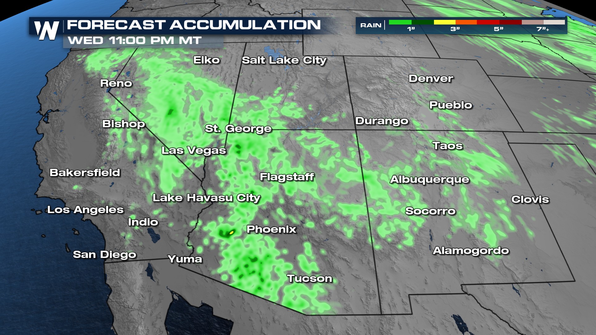
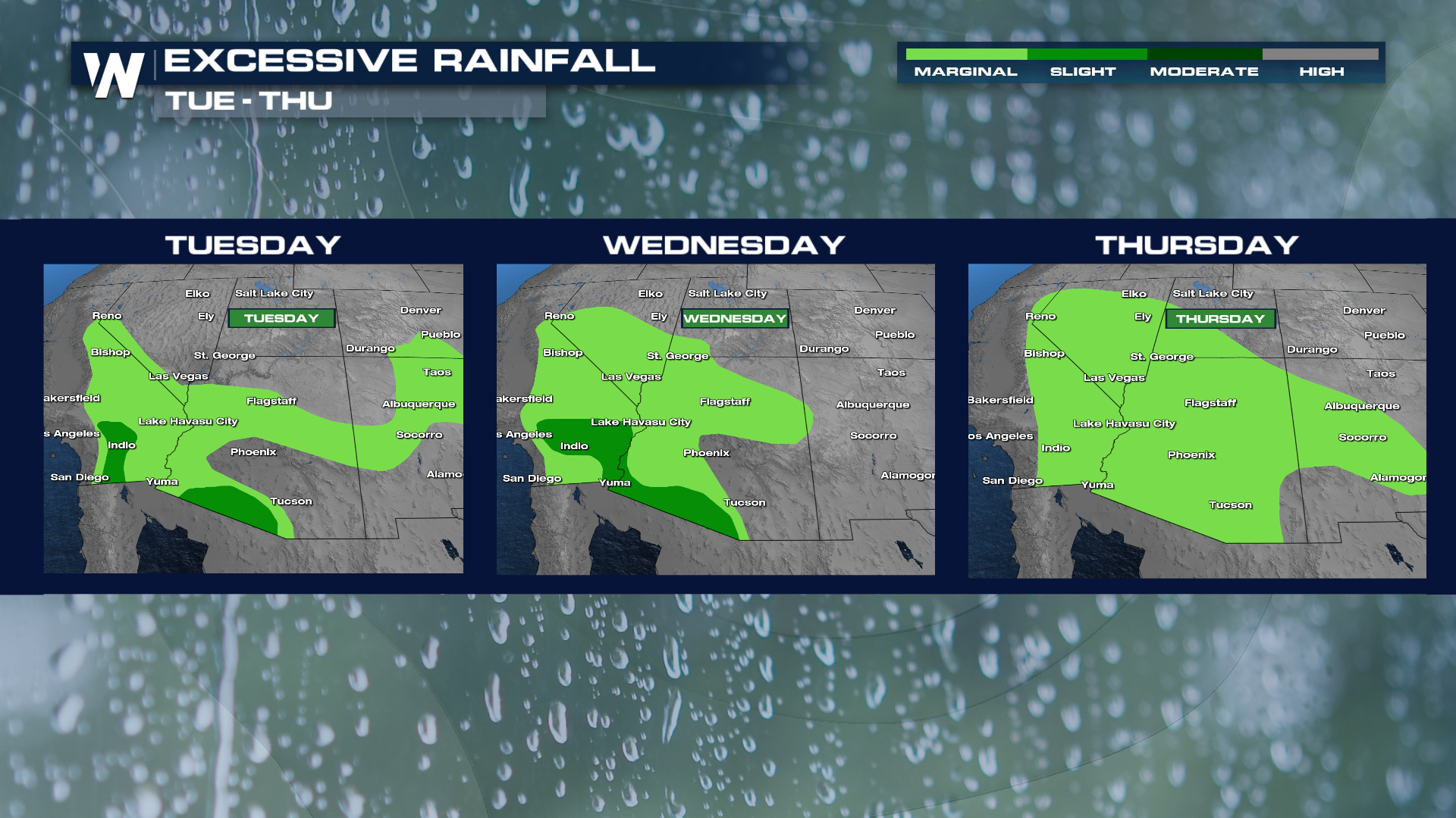
This moisture leaves the southwest under an excessive rainfall outlook for the next 5 days!
Related articles:
Haboob Blows Through Phoenix
Late Summer Heatwave
That added moisture will help bolster rain chances as far southwest as southern California! Will it be a drought-busting downpour? Probably not. But chipping away at the lackluster season is all we can ask for. That and a break from the mid 90's anticipated in Los Angeles would be nice.
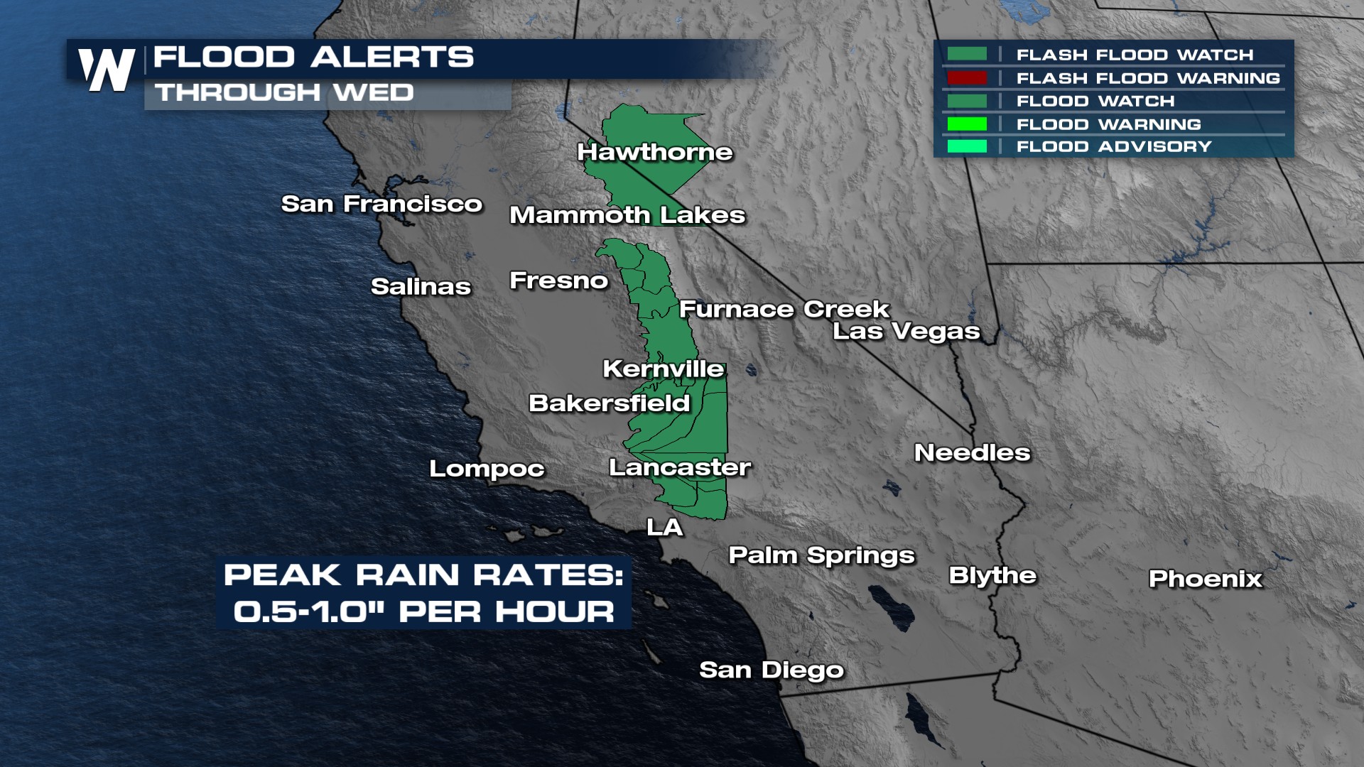
Flood alerts have been added for California for rainfall rates that may reach upwards of 0.5-1" per hour!