La Niña Still Spilling Into Spring Outlook

NOAA has released its latest look at the forecast for Meteorological Spring. As climate forecasters look ahead to March, April, and May, the most likely outcomes are driven by the current La Niña pattern.
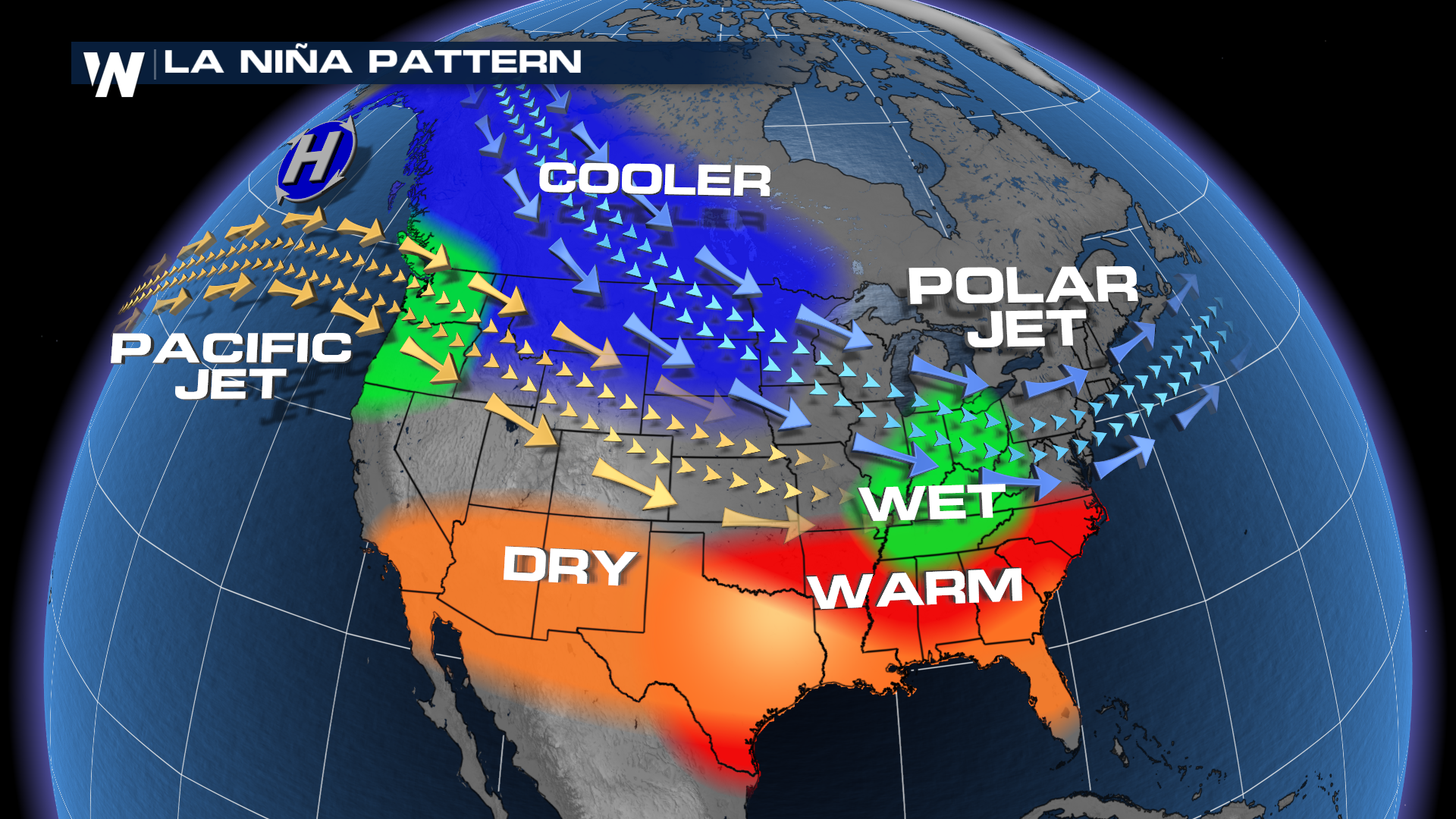
La Niña is marked by cooler-than-average waters in the equatorial Pacific. For the U.S. in a traditional winter La Niña pattern, the southern half of the country is traditionally warmer and drier. The Pacific Jet keeps the northwest pattern soggy, while the Polar jet dips south and brings in cooler air.
 Forecasters at the Climate Prediction Center expect the El Niño/Southern Oscillation (ENSO) pattern to shift to a more ENSO-neutral pattern by this summer. But until that transition, we will likely see the effects/impacts of La Niña spill over for the next few months.
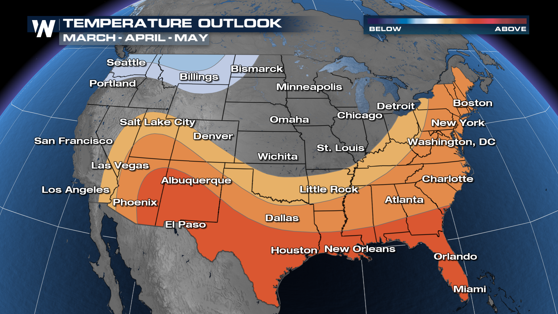
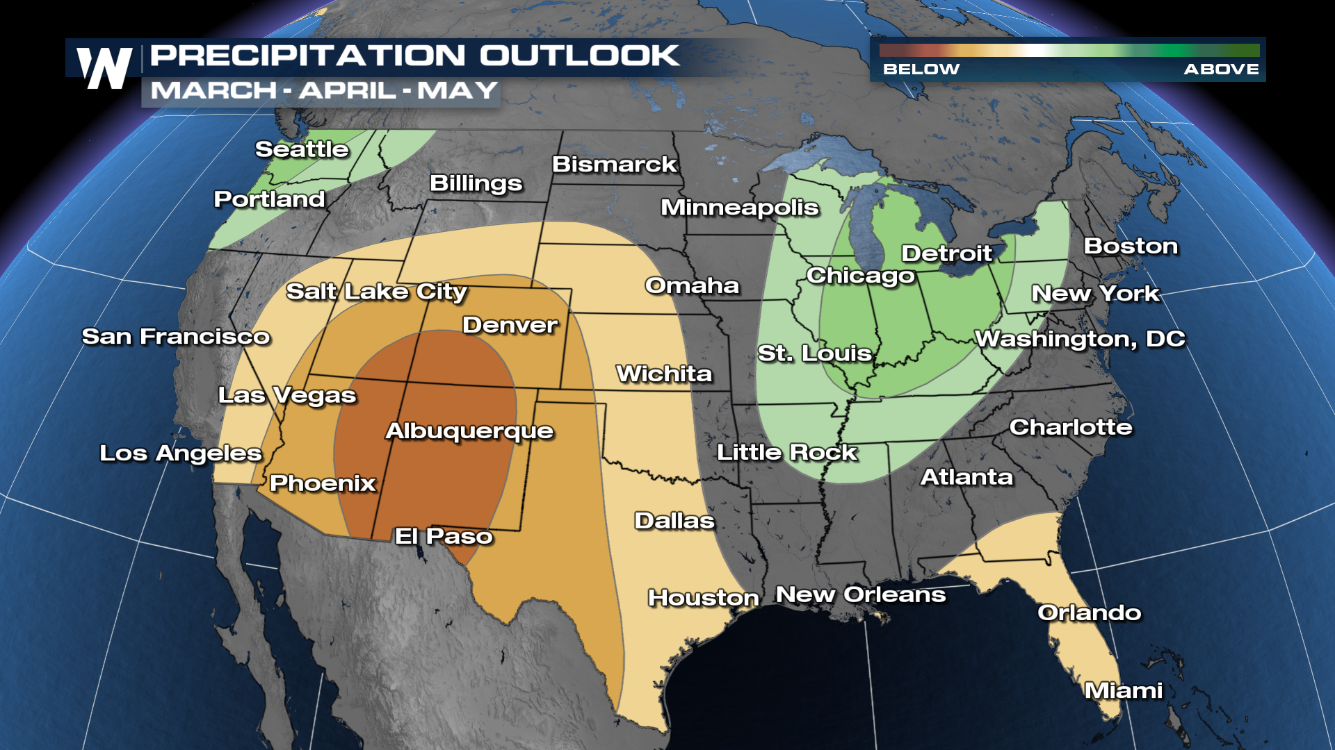
Factoring that in, the desert southwest has the most likely chances of seeing below-average precipitation and above-average temperatures. The Southeast and East have a good chance of above-average temperatures as well. The Great Lakes and the Ohio Valley look to have a soggier pattern for the spring, as does the Pacific Northwest.