Lingering Rainfall from PTC-8 Keeps the East Coast Active

On Monday afternoon, the NHC issued its last update on what was PTC (Potential Tropical Cyclone) 8, as it made its way onshore. The system did not show enough tropical attributes to be given a name, however, its impacts are long lasting in the Carolinas. Impressive rainfall totals surpassed a foot and a half near Carolina Beach, North Carolina. Rainfall totals from 15"-20" caused multiple areas of flooding.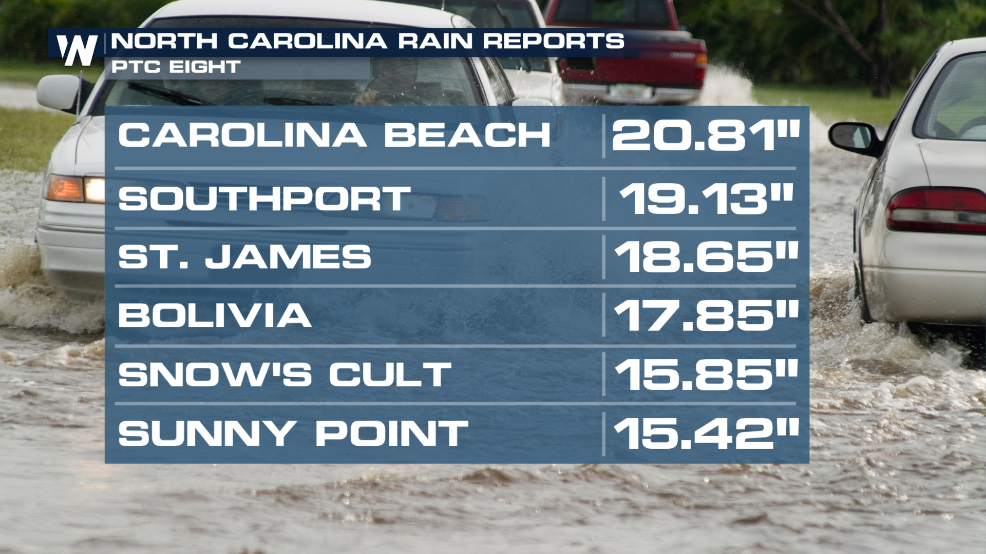 Strong winds were recorded in North Carolina on Monday. Gusts exceeded 75 mph in Sunny Point.
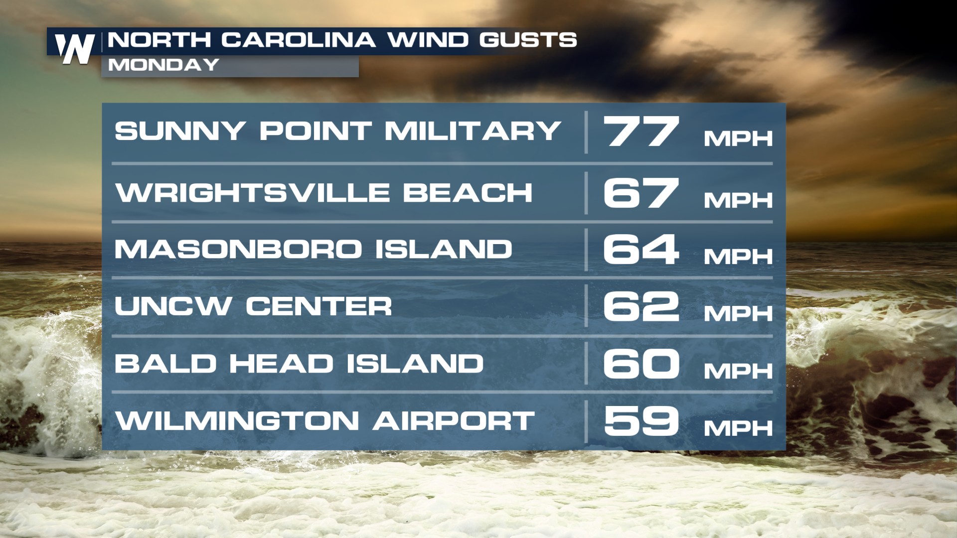
Visitor and residents say they were caught off guard by the extent of the impacts to the coastal city of Carolina Beach.
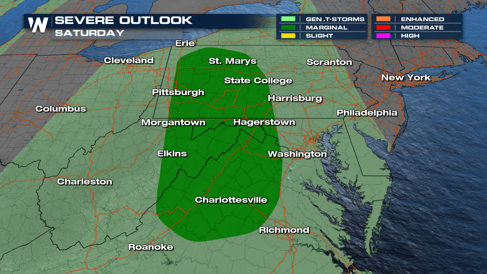
Now, the Northeast is expected to receive some rain, gusty winds, and coastal flooding from this area of low pressure. Along with the incoming coastal low, rain and thunderstorms will be increasing from the west with the upcoming storm system from the Great Lakes moving in. This could spur a few severe storms on Saturday from PA through VA.
Rainfall could be heavy at times, with totals surpassing 2-3" in some areas! Flash flooding is not expected, but nuisance and urban flooding is certainly possible.
Flooding along the coast remains with Coastal Flood Advisories through Friday. Areas that typically flood during higher than normal tides will likely be inundated with 1-2 feet of sea water when the tide is in.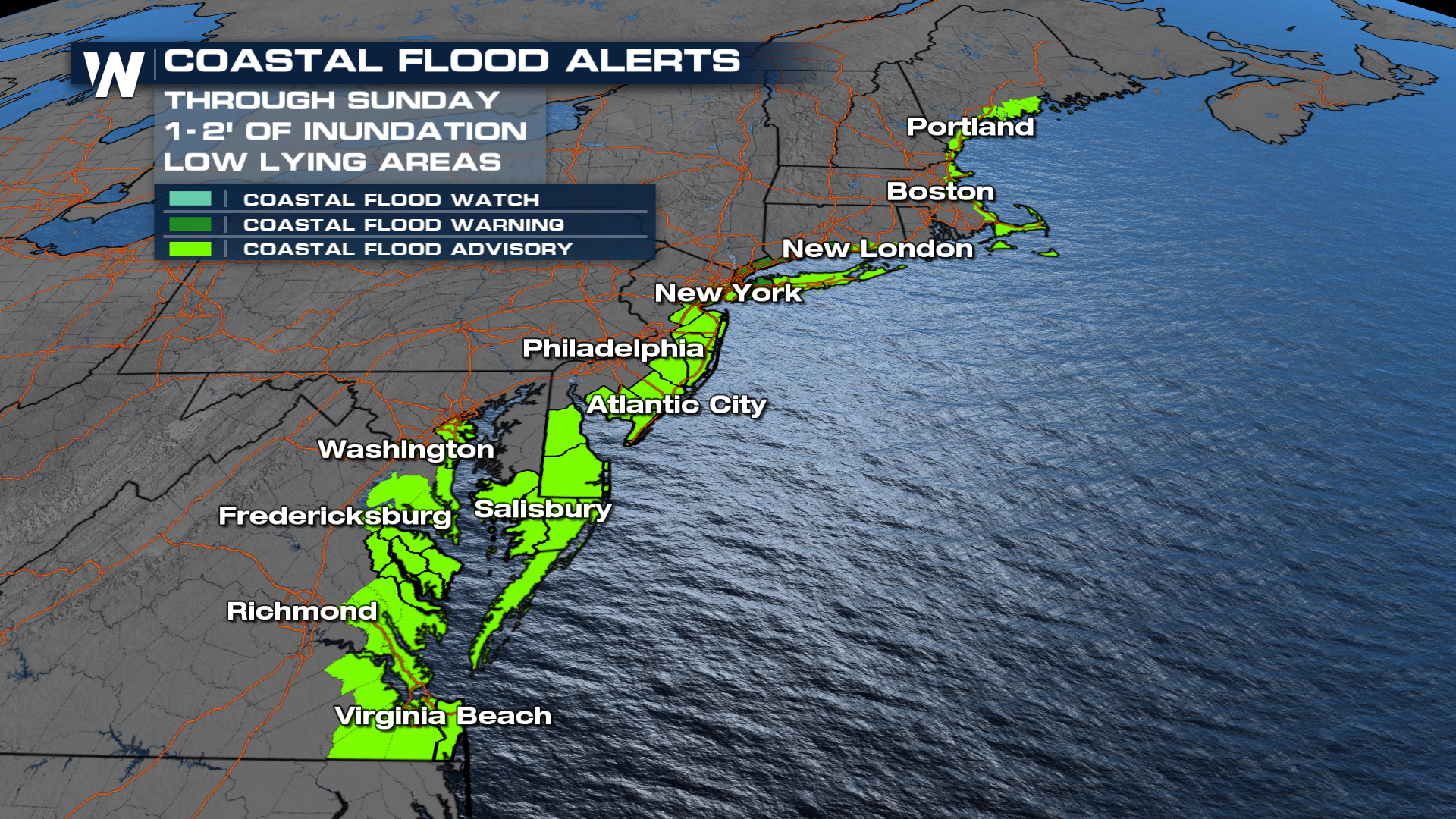 More updates on this forecast can also be found during your Eastern Regional, :10 past the hour on WeatherNation.


