Severe Storms Blast the Plains and Midwest, A Few Storms Tonight
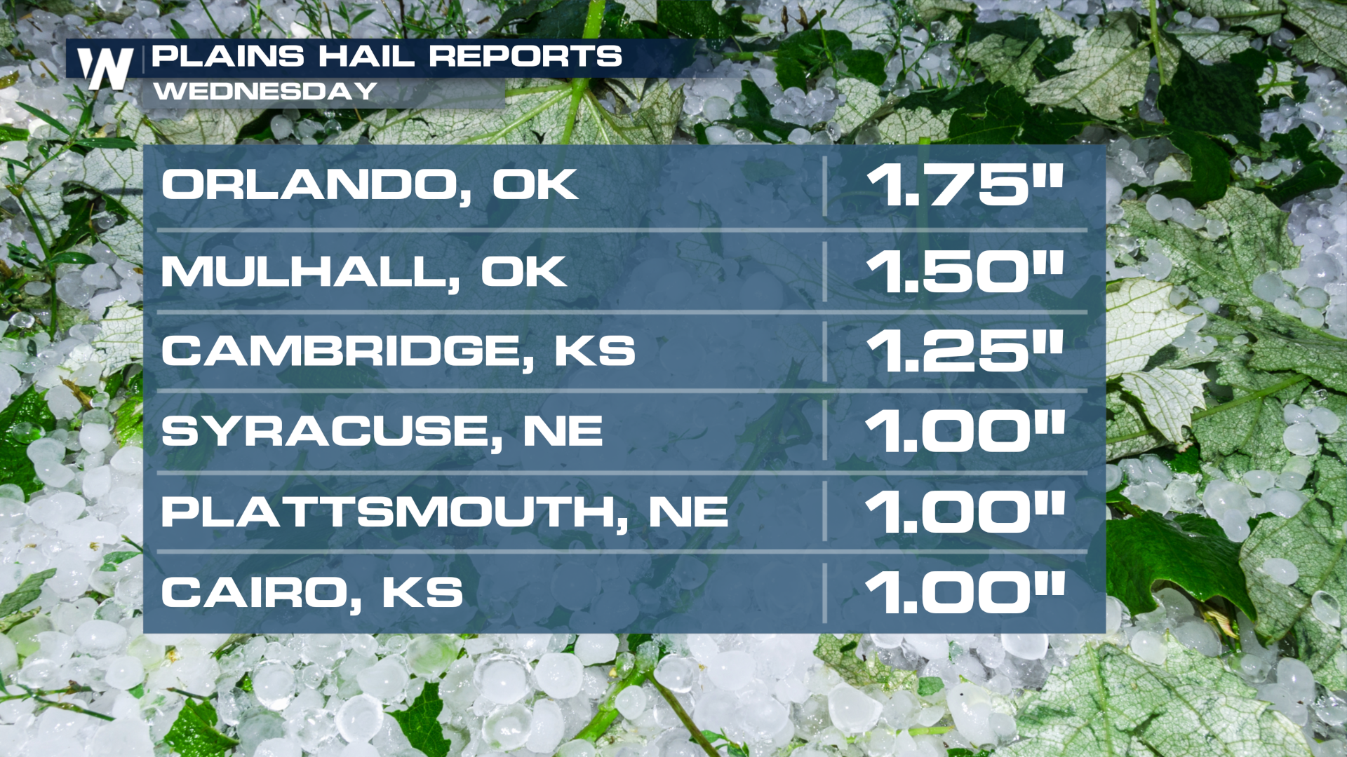
A cold front spawned a large thunderstorm complex Wednesday afternoon and evening in the Plains and Midwest, producing hurricane-force winds and hail to the size of golf balls! The line of storms will push east on Friday with a few additional severe storms possible.
The line of storms was notable for widespread strong winds, with a gust to 96 mph recorded in Marshall, OK! Orlando, OK recorded gusts to 80 mph WITH golf ball size hail.

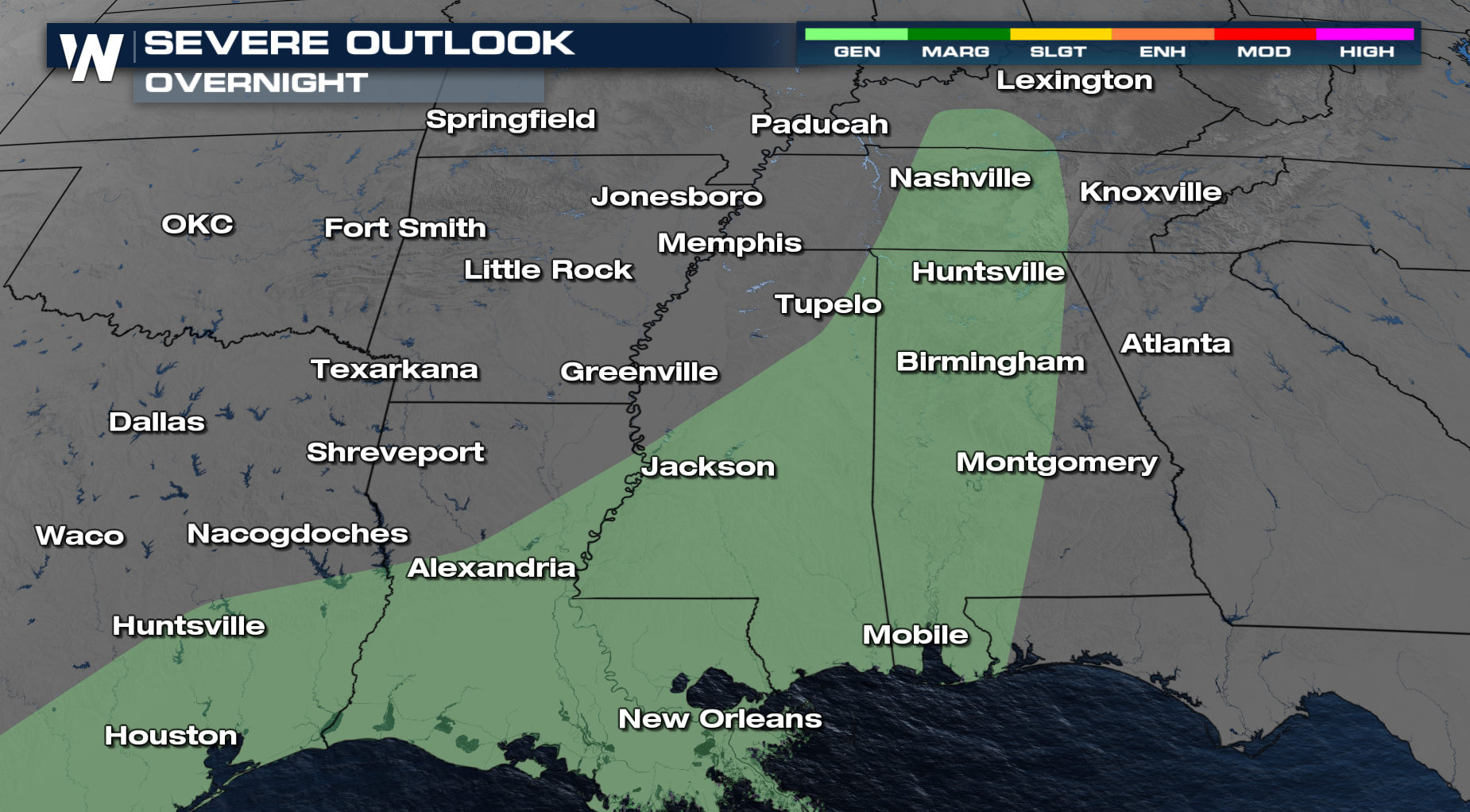
SPC OUTLOOK
There was a severe threat earlier today ( a marginal risk for isolated severe), however, the storms have lost some of their energy, and the severe threat has decreased. For tonight, we see a general risk of thunderstorms.
TIMING
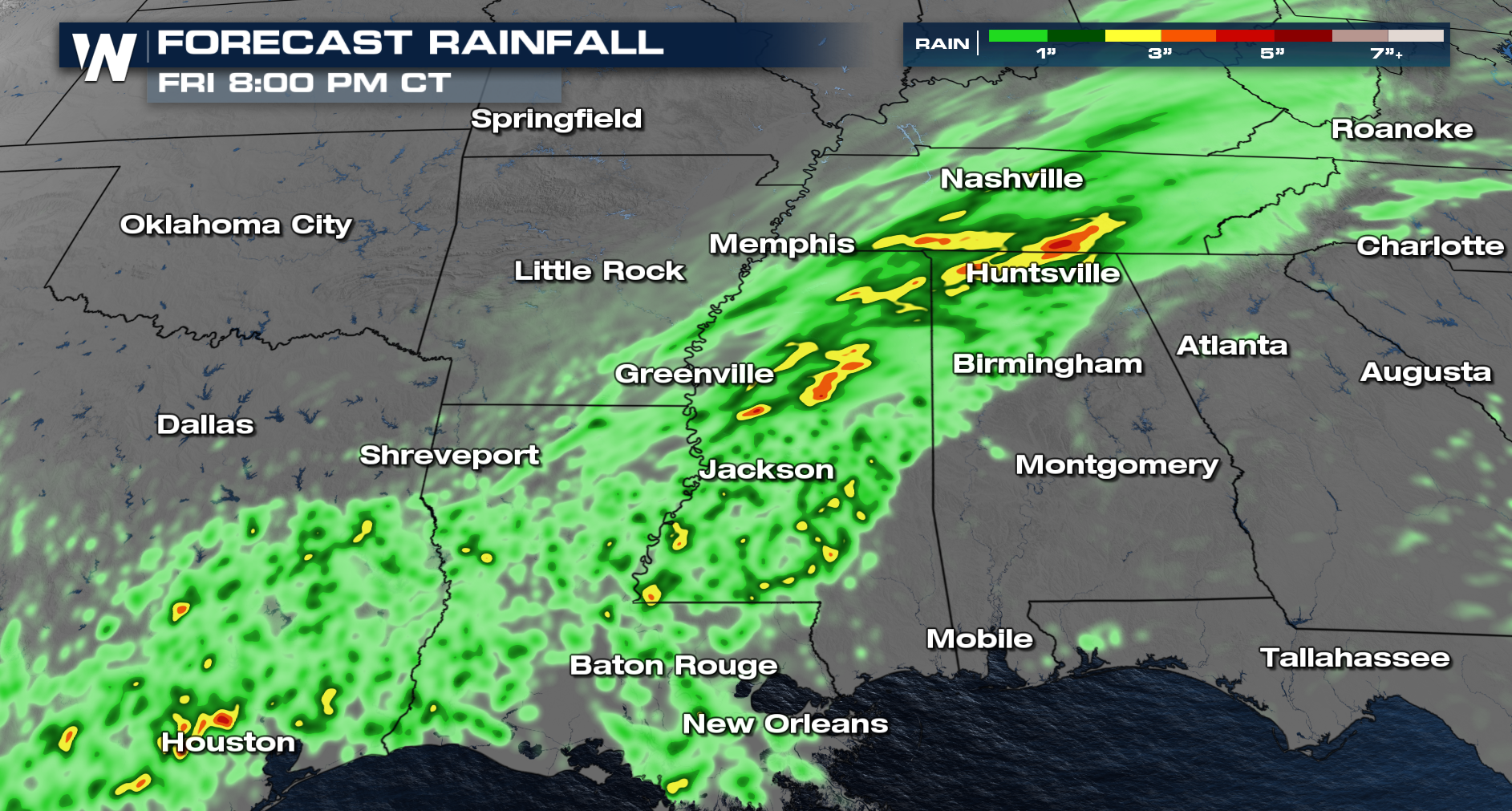
As the frontal boundary continues to linger, we see storms continue into the overnight hours and again on Friday. This system has been producing localized flash flooding as well. Heavy rainfall is embedded within some of these storms, so flooding will be a concern.
 Forecasts for these areas can be found in our top weather headlines, as well as in the Central and Eastern Regionals, at :30 and :10 past the hour.