Severe Thunderstorms Expected Across The South Friday

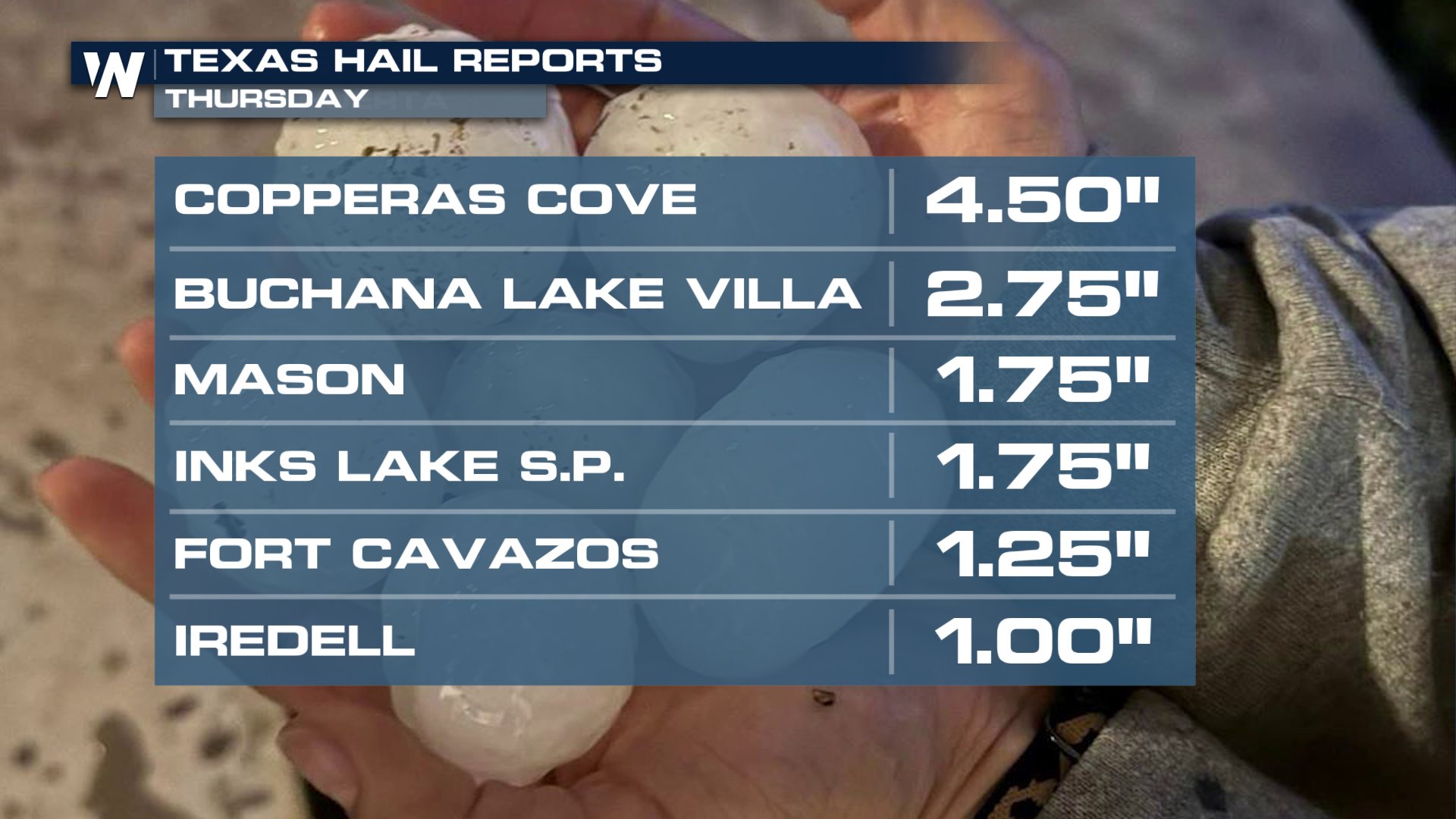
A frontal boundary stretched across half of the country will continue to bring episodes of severe thunderstorms and heavy rain as it stalls out. Significant hail has impacted Texas over the last few days, and Thursday was no different. Hail up to the size of grapefruits was produced in severe storms earlier this afternoon! This pattern will continue again Friday.
FRIDAY SEVERE OUTLOOK
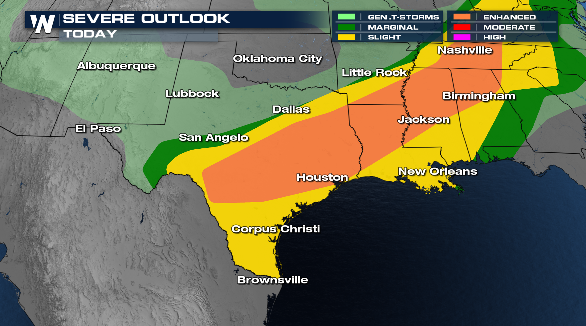
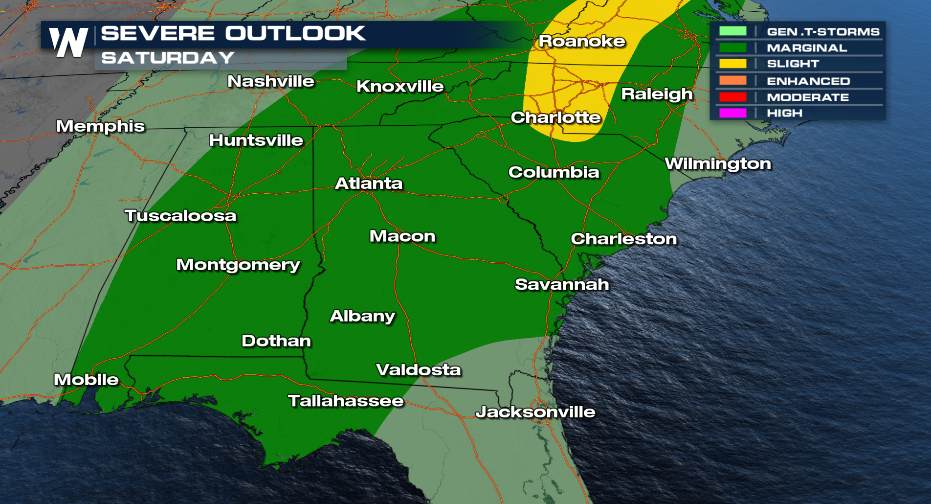
The severe threat has been expansive from the Mid South west to the Rio Grande of Texas producing hail, damaging winds, and heavy rain. The severe threat will continue after sunset all across the South. We aren't done with the severe threat heading into the weekend as isolated severe storms will be possible along the East Coast.
The combination of repeated rounds of thunderstorms, especially earlier in the week, has left soils saturated in portions of eastern Oklahoma, northeast Texas, and western Arkansas. More heavy rain and flooding is possible with these future storms.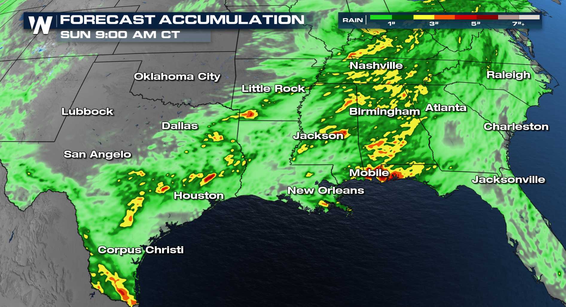
For the latest information, tune into WeatherNation!


