Flooding Threat Takes Aim at the Gulf Coast

The forecast remains wet in the southern plains and towards the Gulf Coast as we head into the next few days ahead. The area is still recovering from the record-breaking rain in the month of April. Oklahoma City recorded its wettest April ever on record.
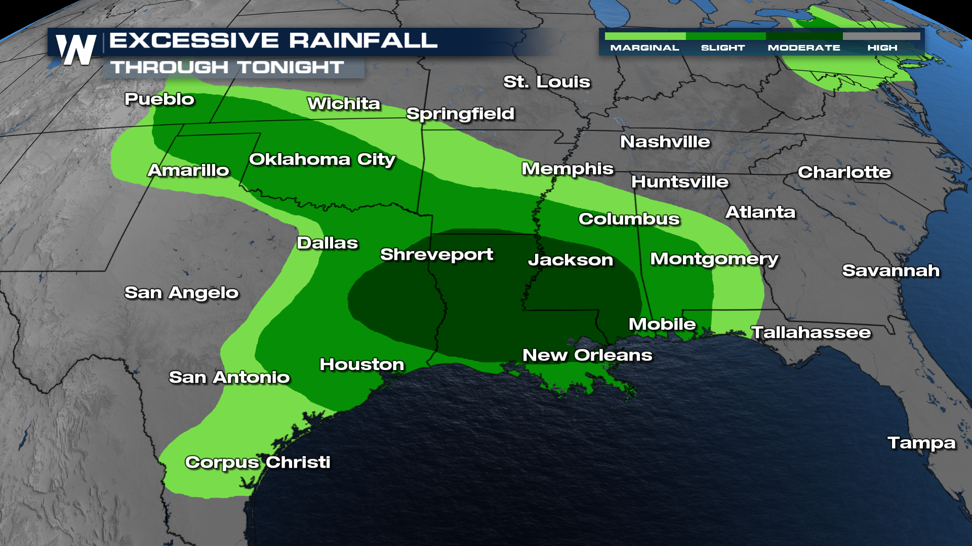
Excessive Rainfall Outlooks will remain in place over the next several days as all this moisture slowly moves east. Through tonight, a MODERATE outlook is in place for flooding.
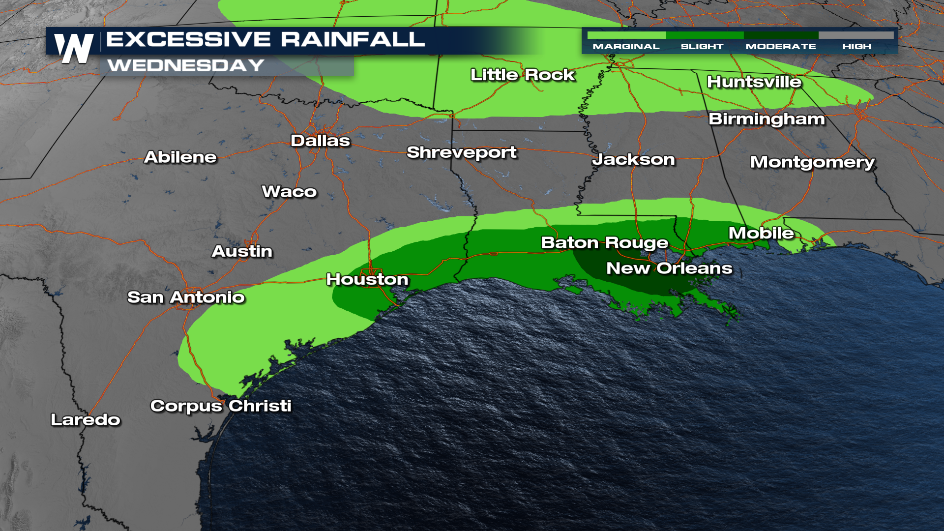
 Another MODERATE risk for flooding has been added for portions of Louisiana on Wednesday. This level 3 out of 4 risk is centered around New Orleans, LA.
 The next week has the potential to bring 4"+ of additional rainfall to the southern U.S. As this moisture moves east, Florida could see a decent amount of moisture.
 For more details on the severe weather component of this forecast, please be sure to read this related article: Severe Storms from TX to LA through Wednesday
For more details, be sure to join us on WeatherNation!


