Severe Thunderstorms and Flooding Back in the Forecast for New Mexico and Texas

We've had a little break across Texas from active weather, but it will quickly come to an end as we see the next upper-level system emerge from the west.
While the upper low moves closer, surface low pressure will deepen, bringing in plenty of moisture from the Gulf. As this occurs, instability will grow each afternoon as temperatures warm. As these ingredients come together, severe thunderstorms are expected to erupt, with all hazards possible.
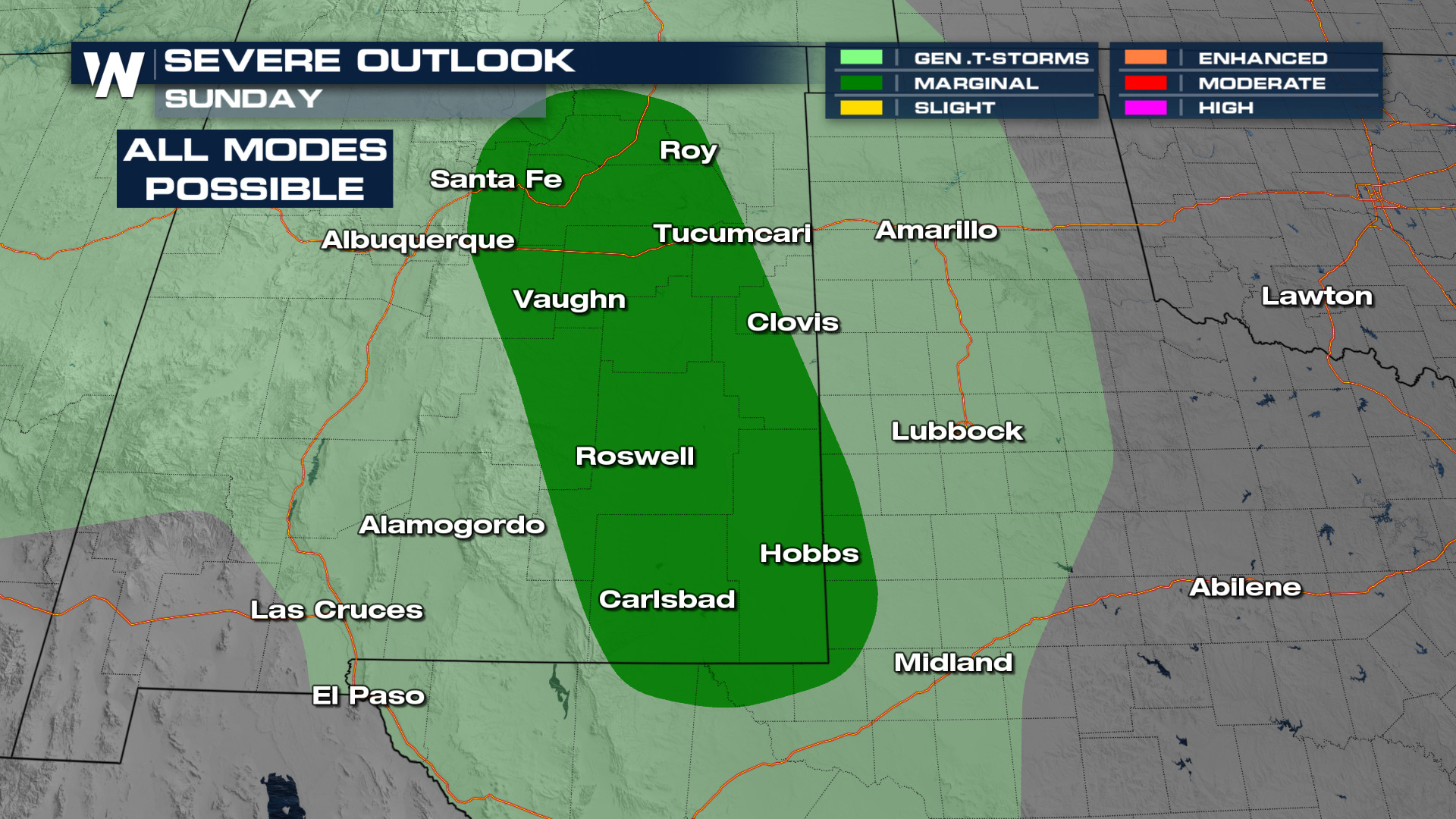
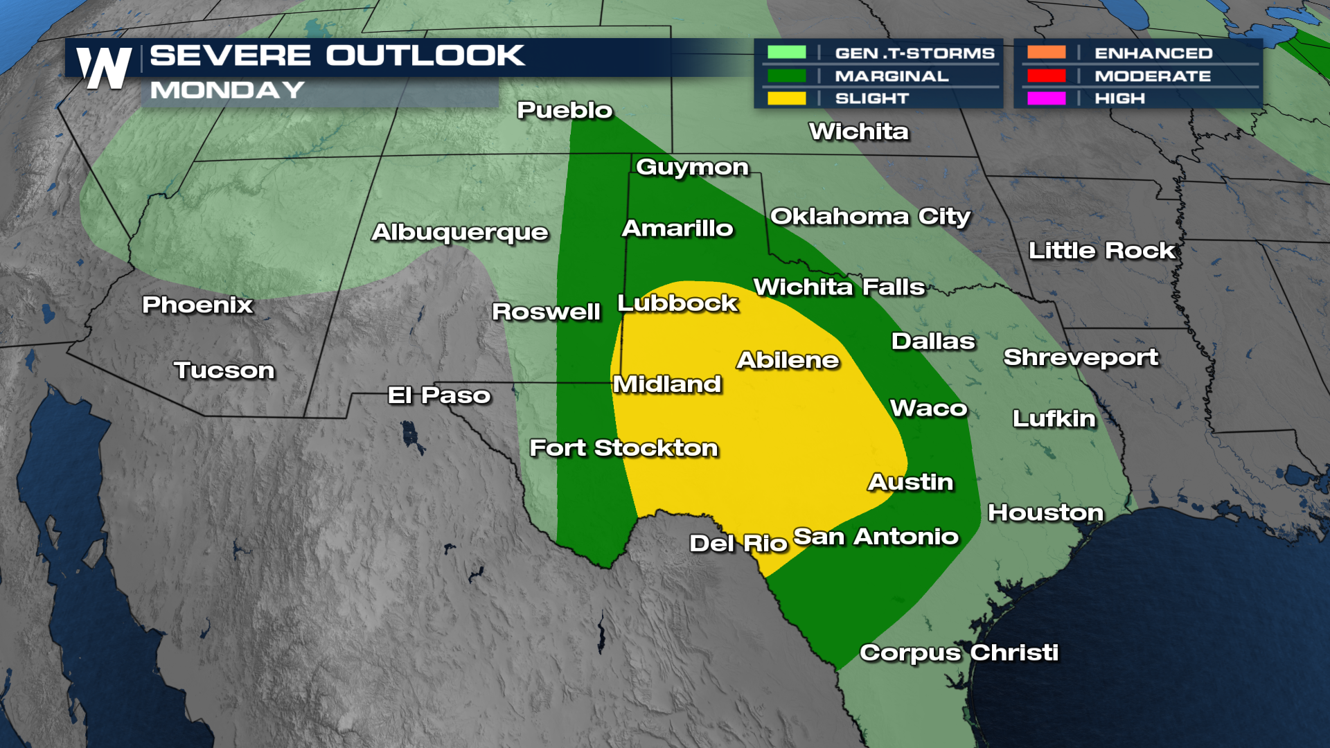
On Sunday afternoon, isolated severe storms will form across the High Plains of New Mexico, moving east into the Texas Panhandle by late in the day. For Monday, more widespread development is expected. With more time for moisture advection, instability will be stronger, and significant severe weather will be possible. This will be especially true across the southern Texas Panhandle south to the Rio Grande.
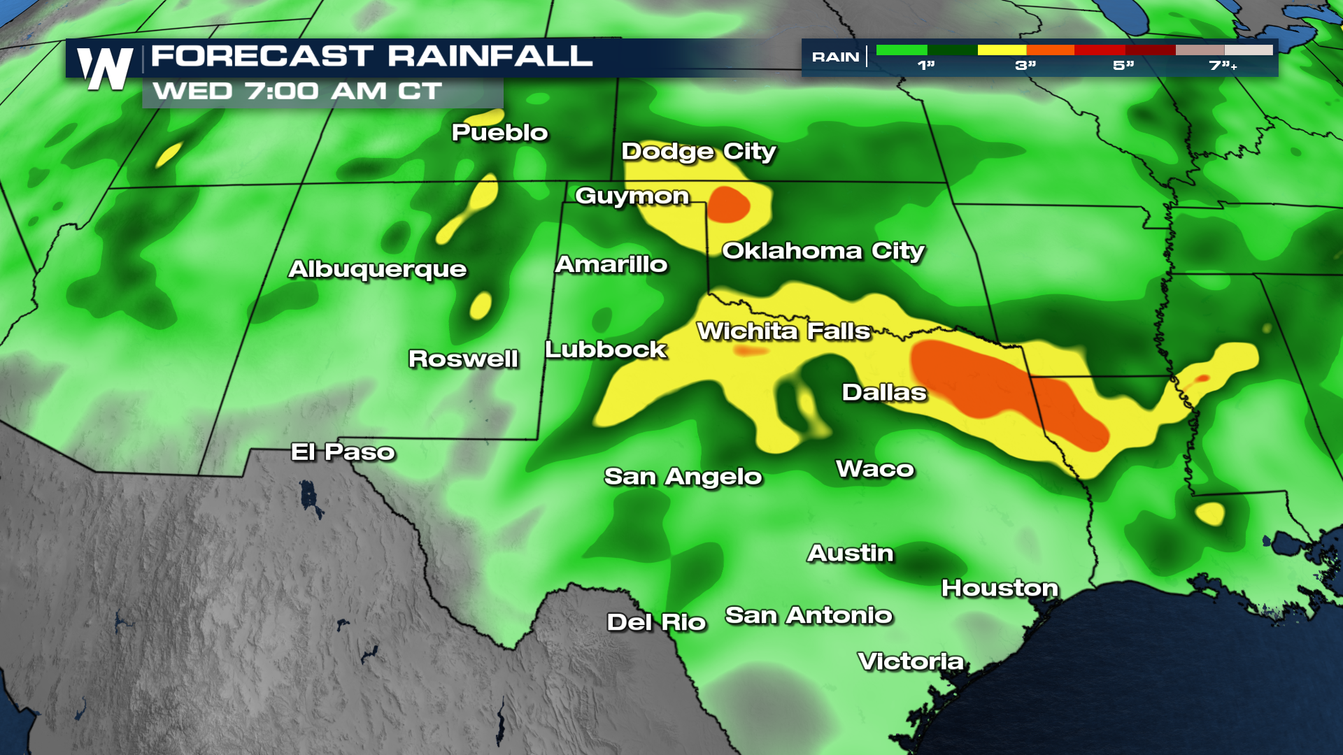
Unfortunately, further heavy rain is anticipated through Tuesday, with the highest totals across Oklahoma and the Arklatex. As we've had significant rain here as of late, the flooding threat will quickly rise.
Stay with WeatherNation for the latest on this developing situation!


