Severe and Flood Continues For the Northeast

Top Stories
4 May 2025 2:30 AM
By the weekend, the risk for severe thunderstorms is again SLIGHT (level 2 out of 5) for the Mid Atlantic states, where instability will be greater and the front stalls. The greatest risk will be damaging winds and large hail potential.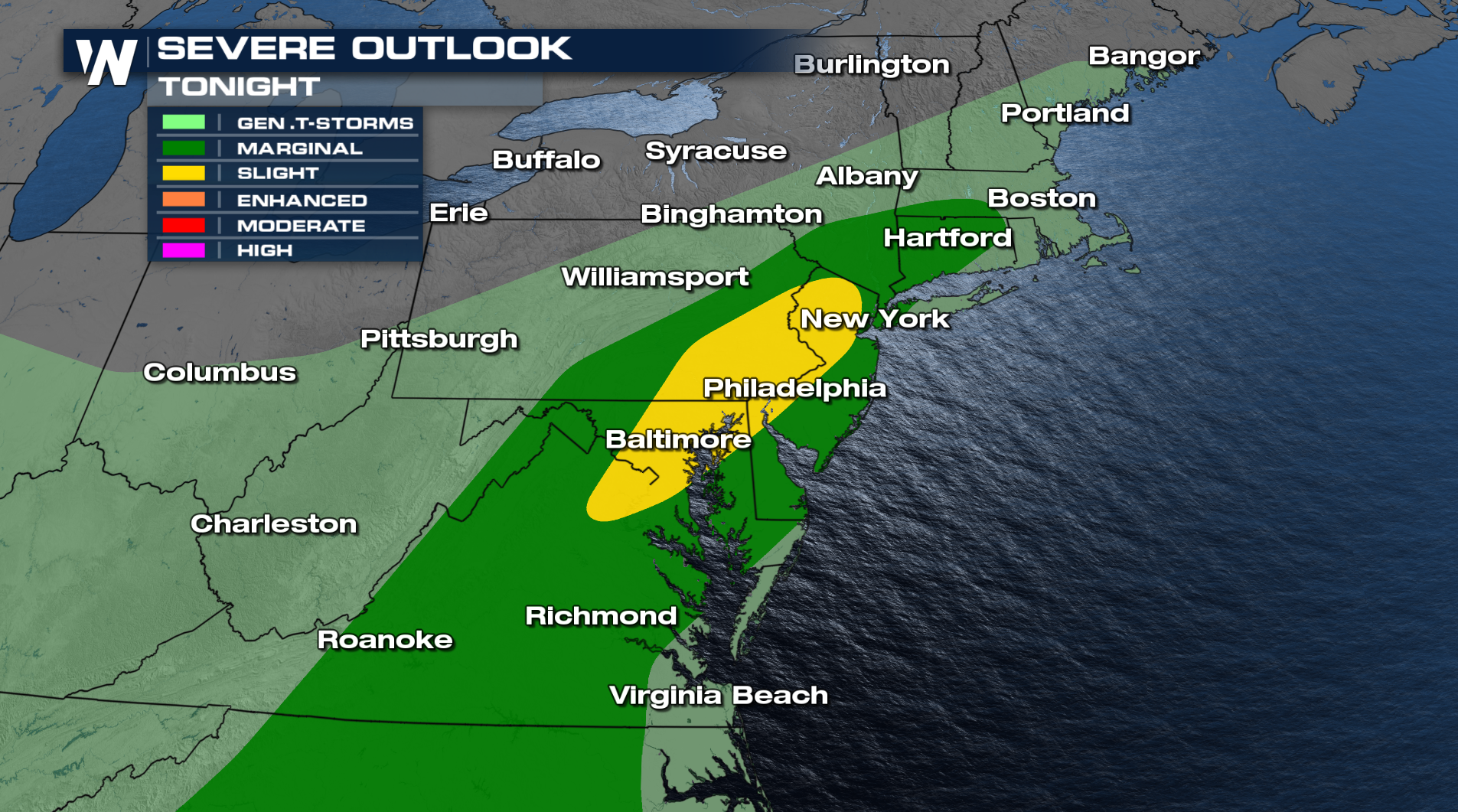
On Sunday, there is a Marginal risk for isolated severe thunderstorms across the Mid Atlantic.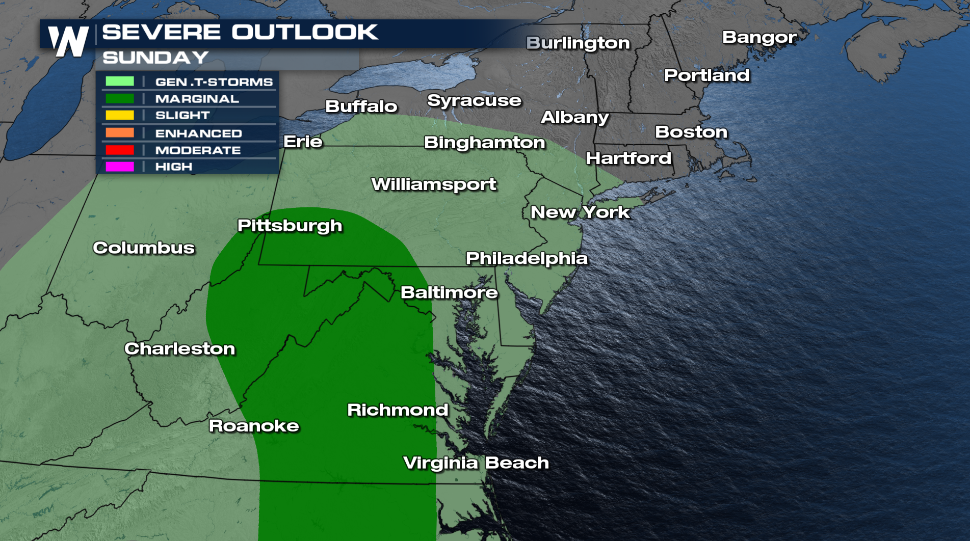
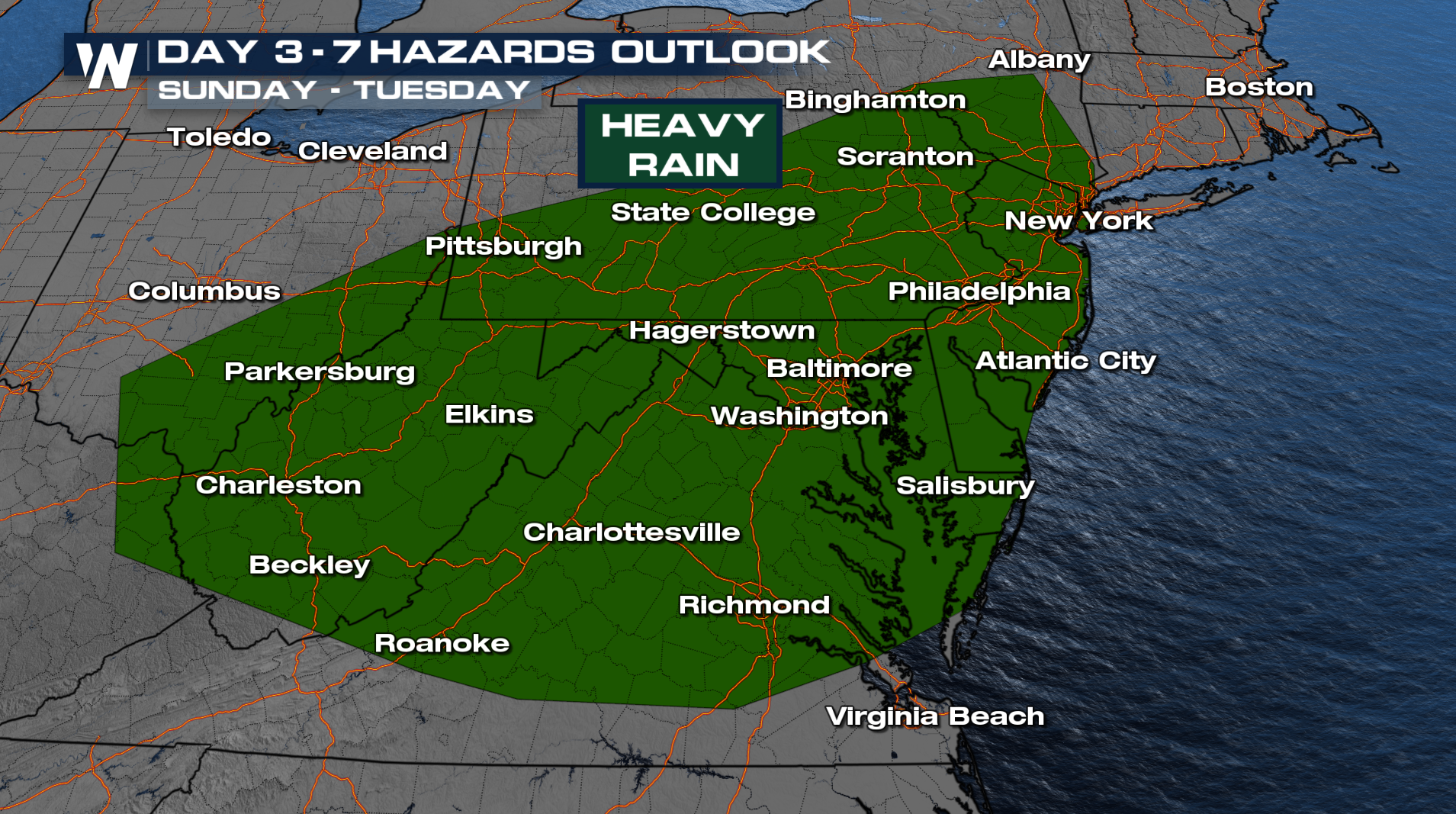
As we now focus on the heavy rain side, the low pressure will meander across the Northeast heading into next week. You can expect to see several inches of rain across the Northeast which isn't the worst thing for parts of Interstate 95. Severe drought is located for this region! Meanwhile cities along the Ohio River don't need more rain because of how wet April was.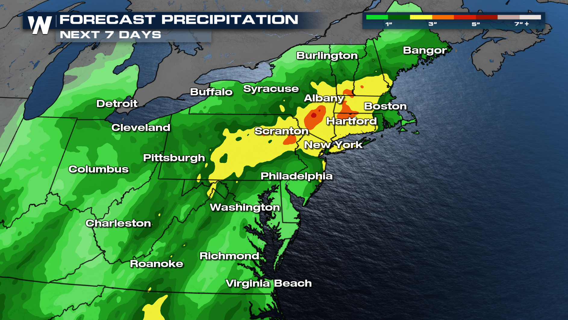
All Weather News
More
Severe Thunderstorms and Flooding Back in the Forecast for New Mexico and Texas
We've had a little break across Texas from ac
4 May 2025 2:53 AM

Big Pattern Shake Up for the West Upcoming
A huge digging upper level low is heading fro
4 May 2025 2:50 AM

Severe Thunderstorms Expected Across the South Sunday
A frontal boundary stretched across half of t
4 May 2025 2:40 AM

Severe and Flood Continues For the Northeast
By the weekend, the risk for severe thunderst
4 May 2025 2:30 AM

Rainy Forecast Could Disrupt Kentucky Derby
Louisville is gearing up for the 151st Kentuc
3 May 2025 4:30 PM

Flooding Threat Continues in Oklahoma Friday Morning
The forecast remains wet in the southern plai
2 May 2025 3:00 AM

Rain For Denver, Snow For The Mountains
A cold front and area of low pressure slide t
1 May 2025 12:25 AM