Severe Weather Threat Shifts Eastward Across Central U.S. to Great Lakes

A frontal boundary stretched across the half of the U.S. will continue to bring episodes of severe thunderstorms and heavy rain as it stalls out. The Central U.S. will get the brunt of the severe weather on Wednesday & Thursday, before shifting into the Midwest, Ohio Valley, and Great Lakes by Friday. A severe thunderstorm watch has been issued for the northern Texas and Southern Oklahoma as storm continue to remain across the region Wednesday morning.
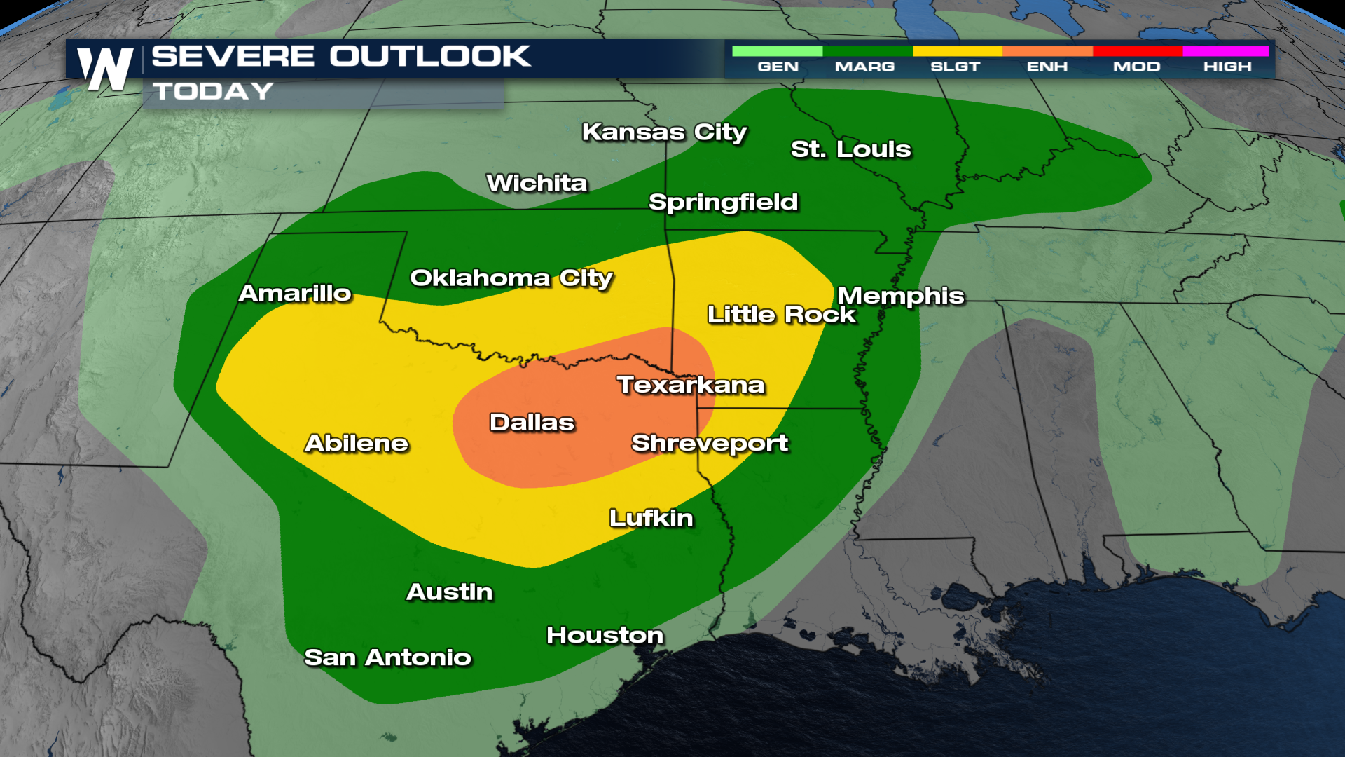
 While the most intense storms from Wednesday morning are expected to diminish, another round of severe weather across the south-central U.S. by the afternoon is possible. The threat for damaging winds, large to very large hail, and tornadoes will remain in play. The Storm Prediction Center has issued an Enhanced risk (level 3 out of 5) for the metro of Dallas, TX.
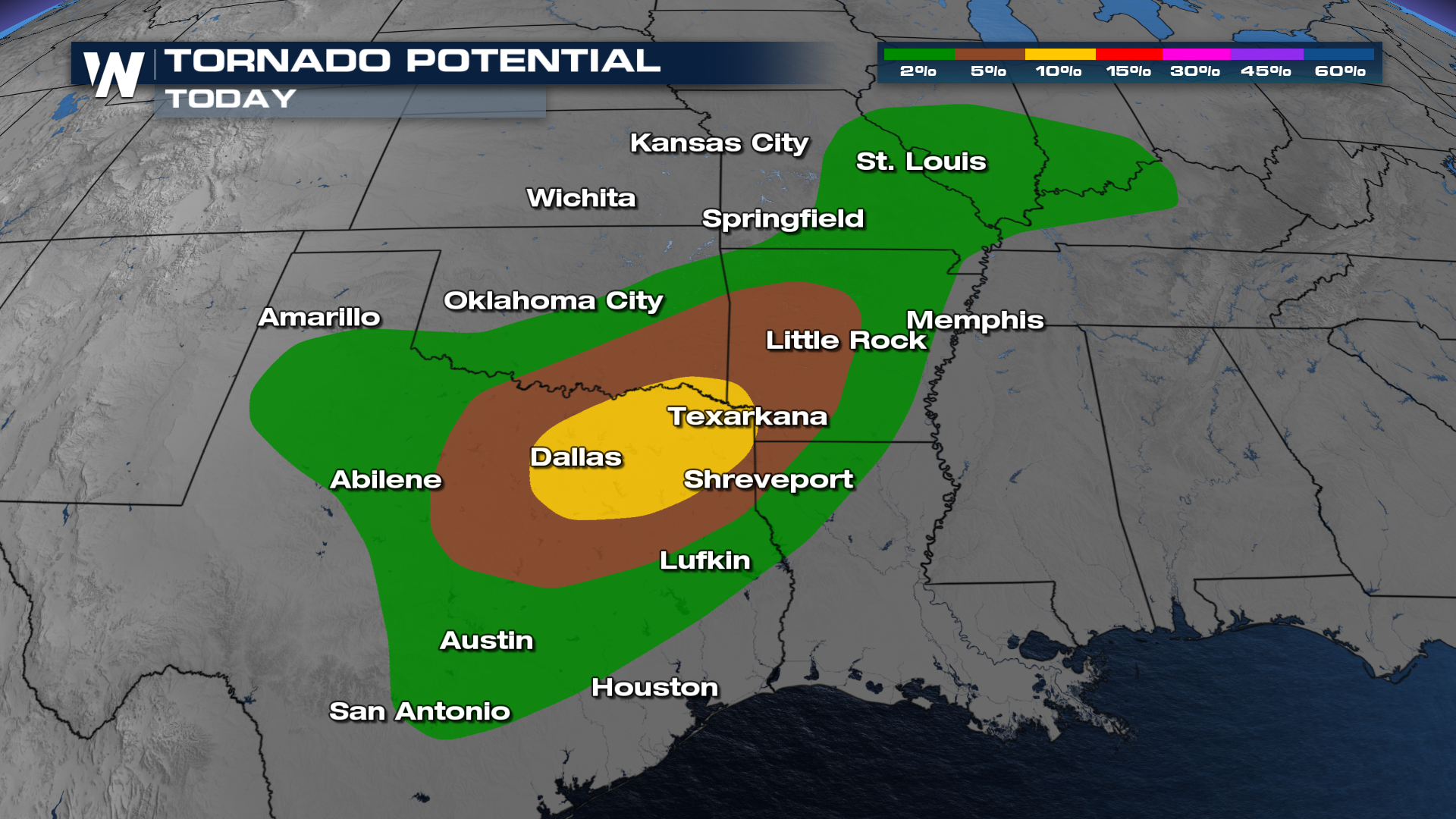 As mentioned, Wednesday Morning, a significant threat for severe weather remains, as storms move through northern Texas and Oklahoma. These storms from overnight are also known as a mesoscale convective system (MCS). This system could bring damaging winds, hail, and a few tornadoes as it moves east across western Oklahoma.
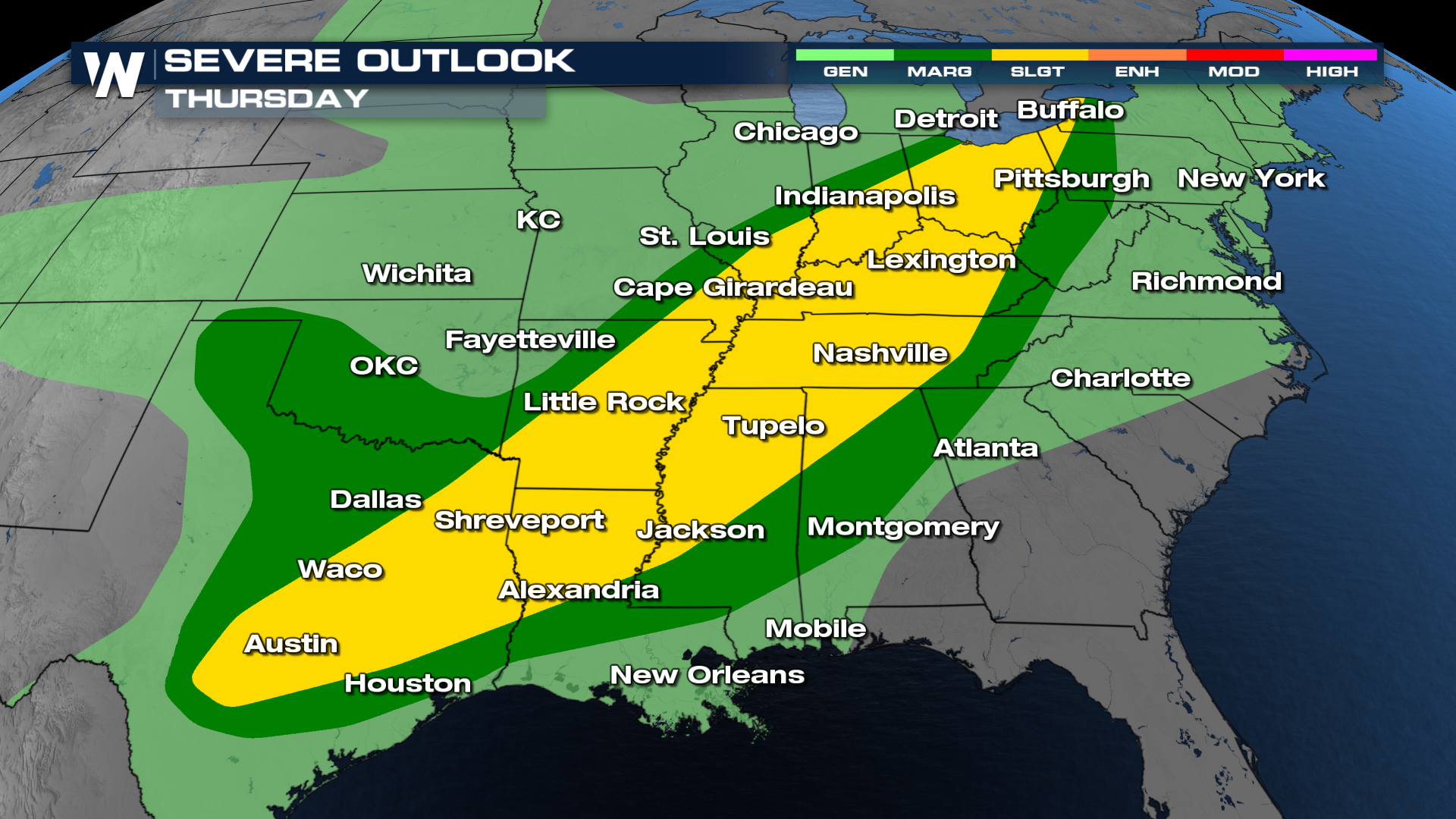
By late morning through early afternoon the threat will shift into the Mississippi & Ohio Valleys. Scattered thunderstorms capable of producing damaging wind and hail will be possible. The afternoon heating and rich moisture will combine with weak but sufficient wind shear near a surging dryline, potentially allowing isolated supercells to develop in Central Texas. These storms may produce very large hail and strong wind gusts.
By Thursday the storms will reach the Great Lakes and the Northeast. Scattered thunderstorms will reach as far north as New England. While the severe threat is expected to lessen compared to earlier in the week, some embedded strong storms may still occur, particularly in areas where instability persists. A Slight risk is issued for Friday (level 2 out of 5). The threats for Thursday include gusty winds, localized heavy rainfall, and a hail risk.
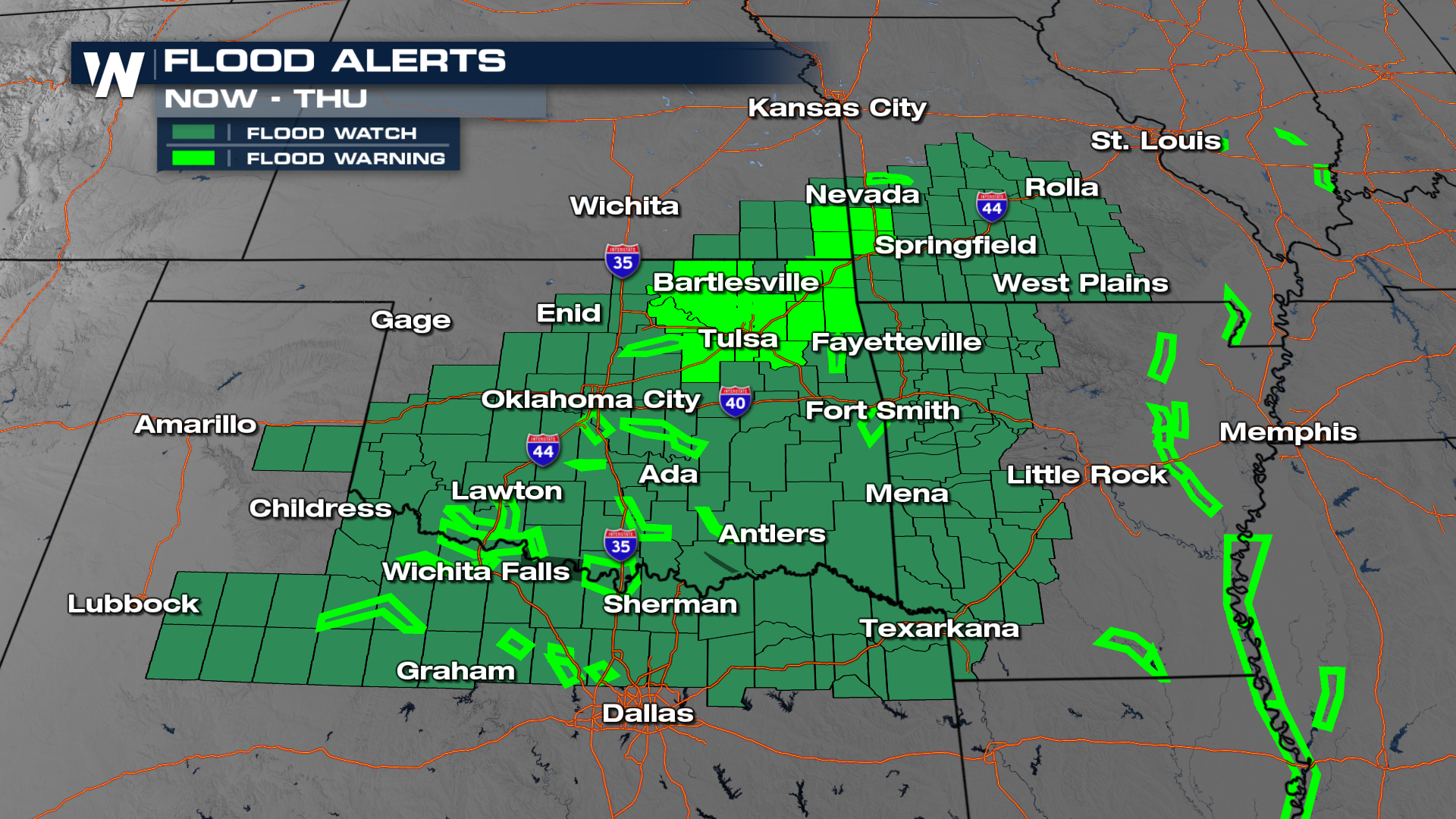
 The combination of repeated rounds of thunderstorms, especially earlier in the week, has left soils saturated in portions of eastern Oklahoma, northeast Texas, and western Arkansas. Though the severe threat shifts east, residual flooding concerns may continue into Thursday in these areas before drying out.
 For the latest information tune into WeatherNation.


