Massive Hail Hits Texas as Storms Threaten the South

TEXAS - Destructive warned thunderstorms brought hail up to 3 inches on Wednesday, and as drastic as that may be, it has been on the smaller side over the past several days. Hail up to 6 inches in diameter was reported Sunday in Afton, Texas, as powerful supercells developed strong updrafts capable of producing massive hail. On Monday, a hailstone reached 5 inches. A nearly stationary front stretching from the Southeast to the Central Rockies draws warm, moist air northward from the Gulf. This influx of moisture is fueling widespread showers and thunderstorms across the region. There is also a cold front that will be diving down across the lone star state on Thursday bringing additional storms.
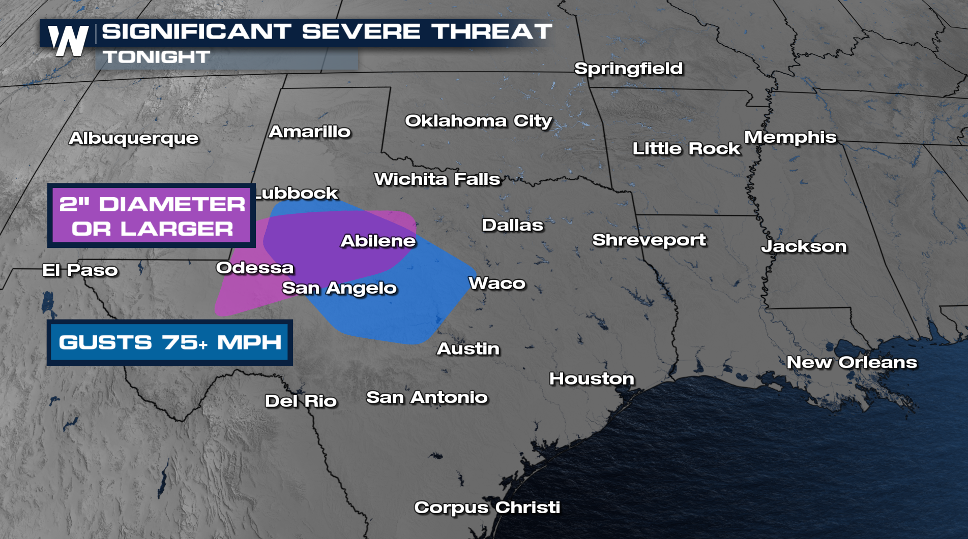
On Thursday, more large and destructive hail fell across parts of New Mexico and Texas. The large hail and damaging wind threat continues overnight.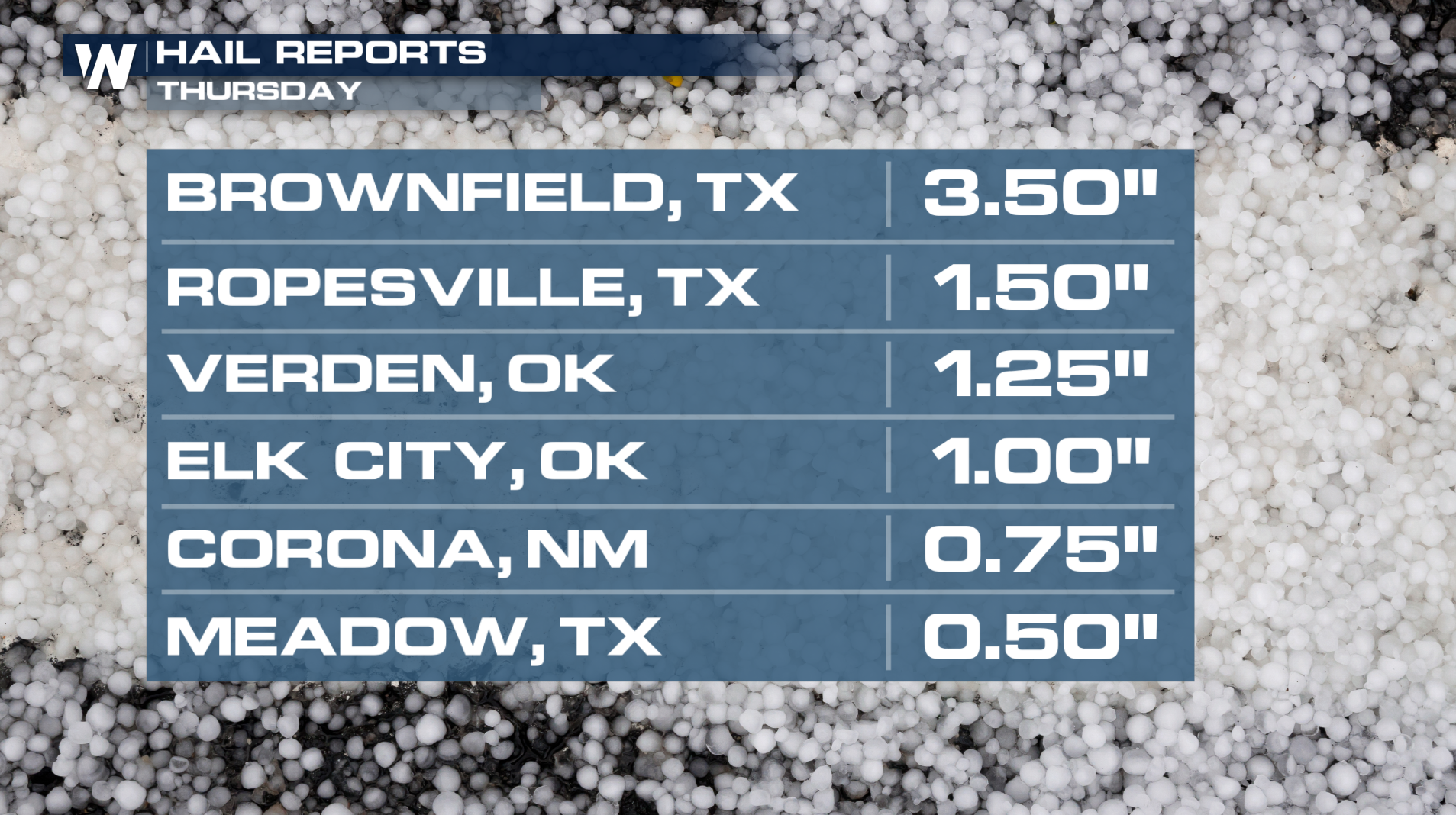
Timing
Tonight, thunderstorms will congeal into a line as it continues eastward towards the Interstate 35 corridor! As mentioned above, the biggest threats will be damaging winds and hail!
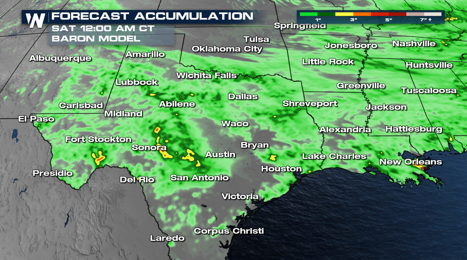
Flooding will also be a big story the next few days, with many locations already picking up 4-5 inches and more on the way. Download the WeatherNation app to stay informed by monitoring the radar and alerts.