Tropical Depression 19 Approaching Honduras
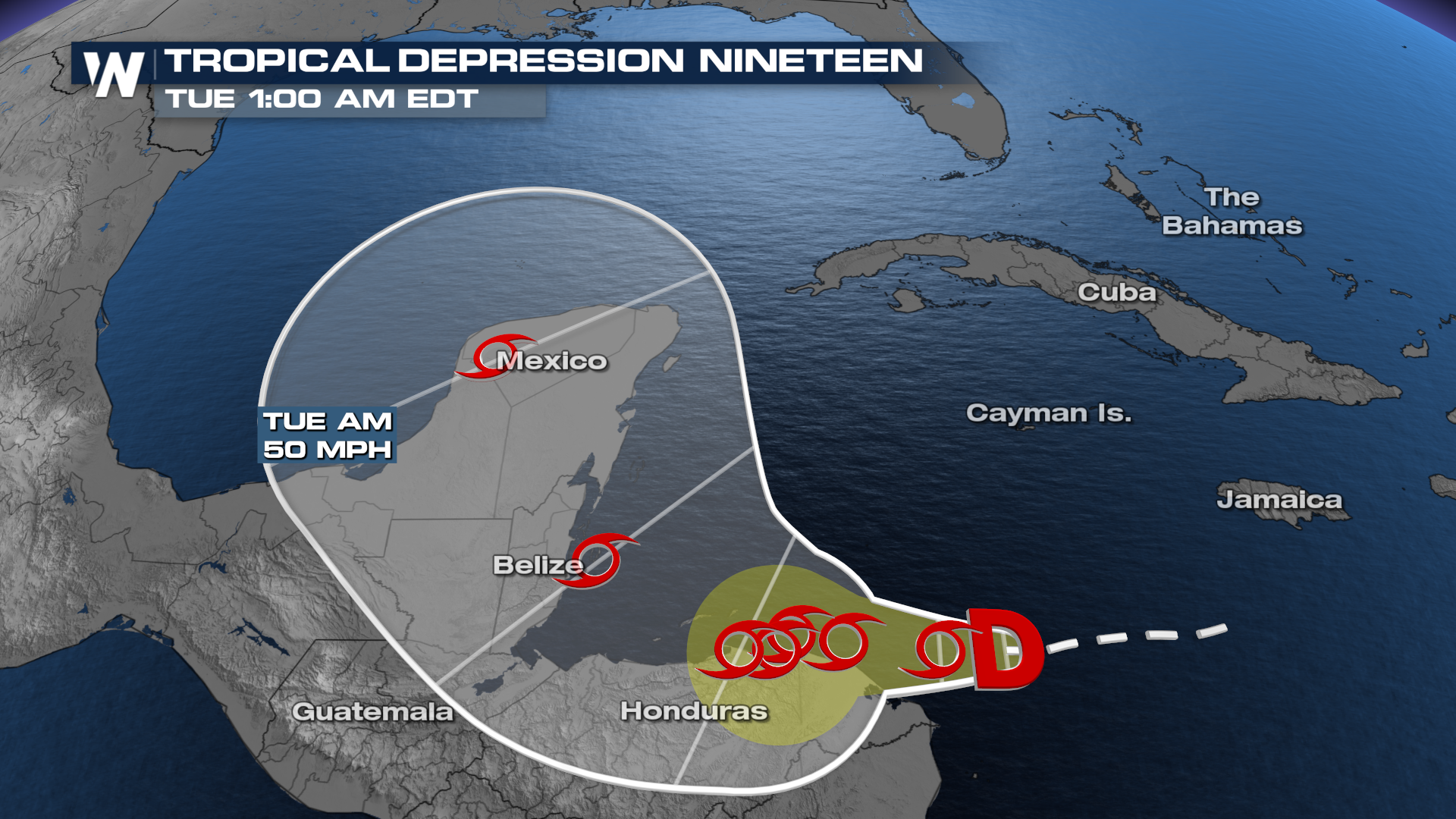 There are still big questions about the intensity of this system but the track is something that has been fairly consistent over the past day or so. High pressure looks to set up to its northeast, blocking an escape out to the Atlantic. Where does that put it? Likely somewhere in the Gulf of Mexico, but it's still 6-7 days down the line.
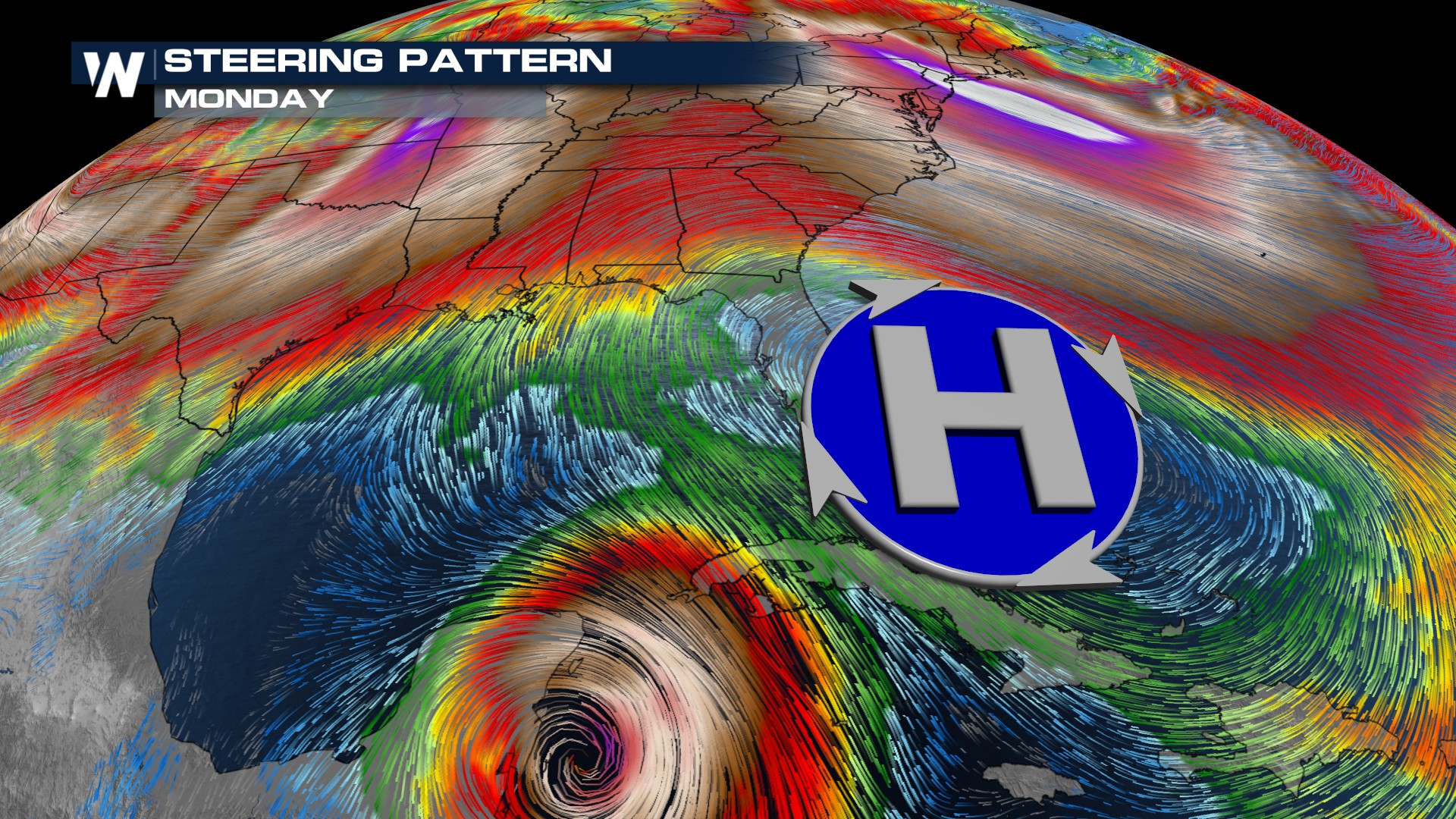
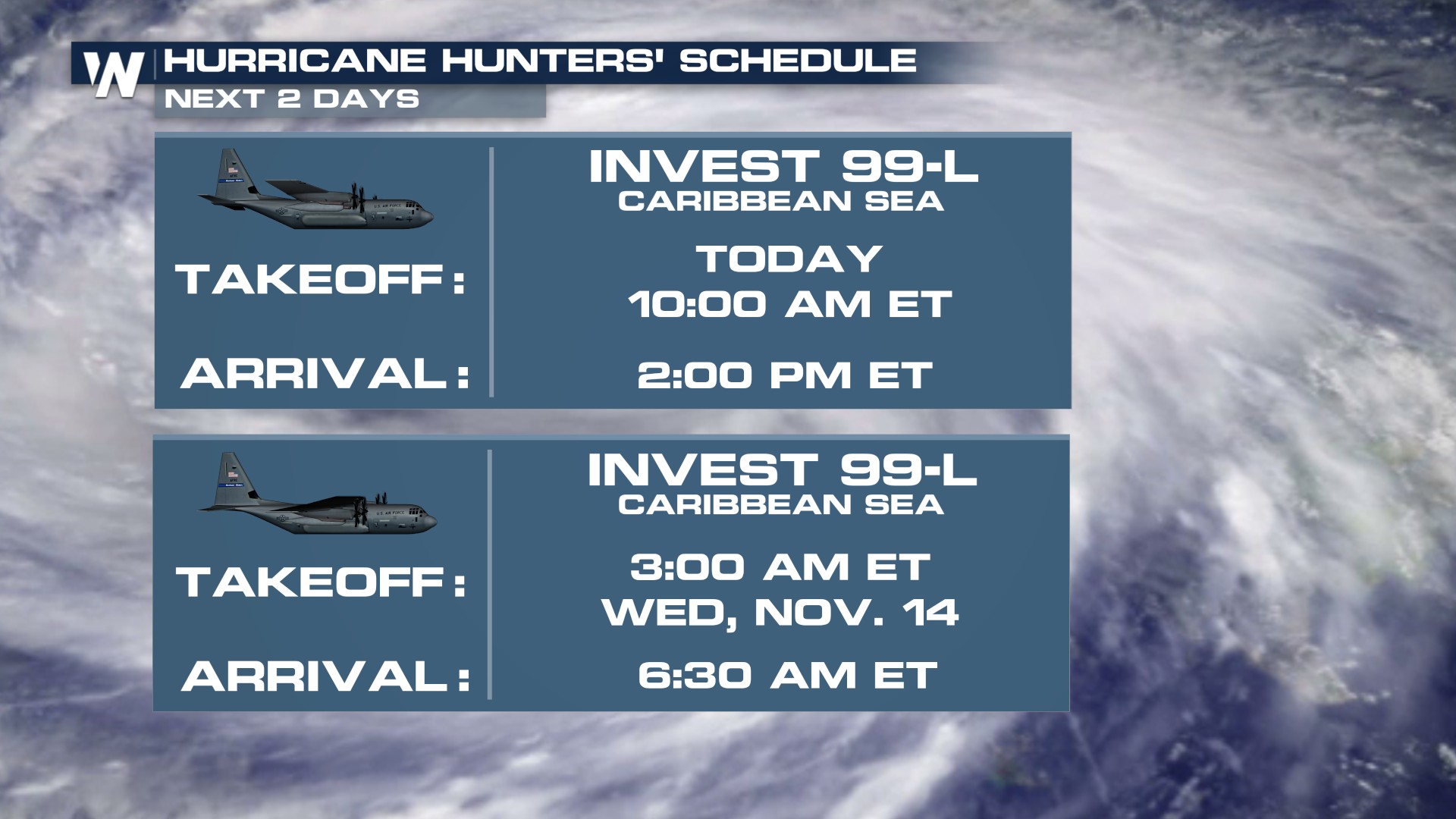
A lot still needs to be ironed out between now and then, and often models struggle with something that doesn't have a closed center of circulation. The Hurricane Hunters have flights scheduled to the Caribbean to help get a better idea of how this disturbance is built.
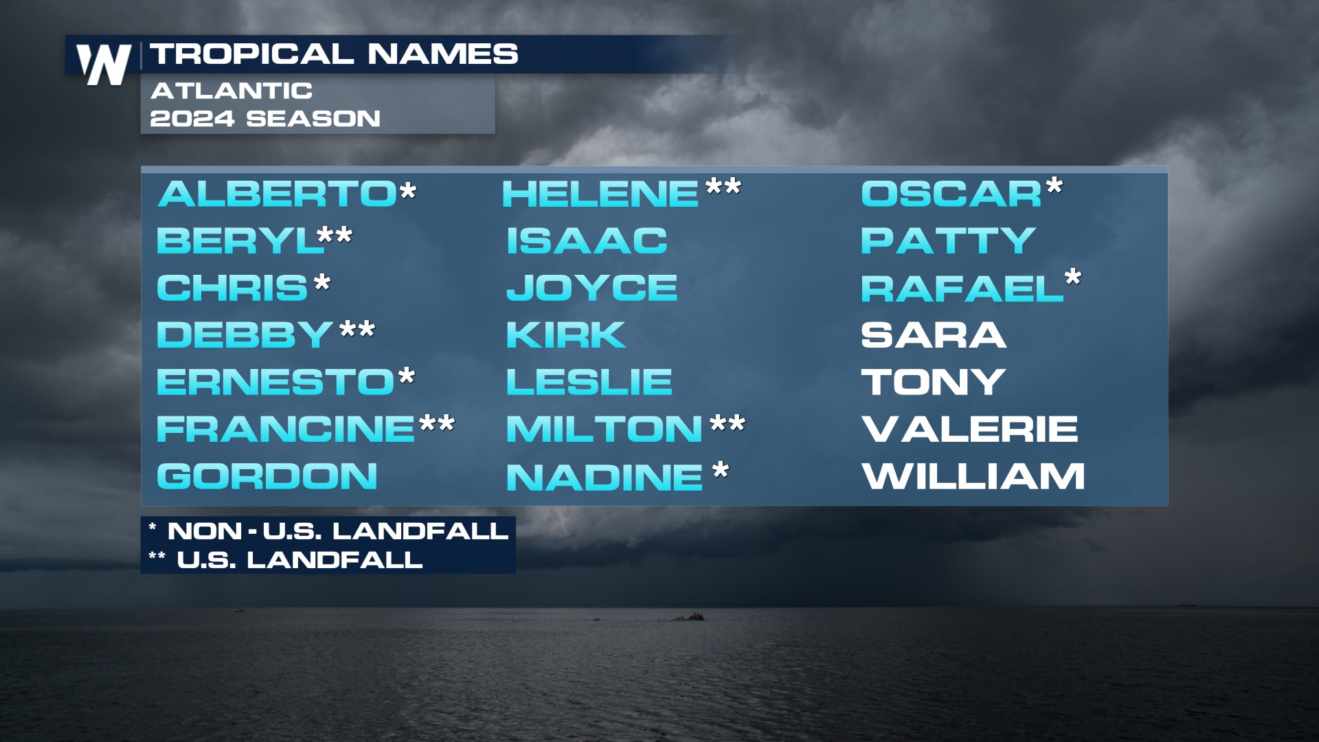
 If this area of interest develops tropical characteristics, it will be named Sara, the next name up on the list.
The 2024 Hurricane Season
According to climatology, less than 3% of the seasonal energy is left for hurricane season now that we're in late October. Seasonal energy is measured by accumulated cyclone energy, also known as ACE. According to NOAA, ACE is essentially a "wind energy index" and based on that, the season can be defined as extremely active, above-average, near-average, and below-normal. With Rafael's recent activity, the seasonal ACE value has jumped into the "Extremely Active" category, the highest value we've seen since 2020.
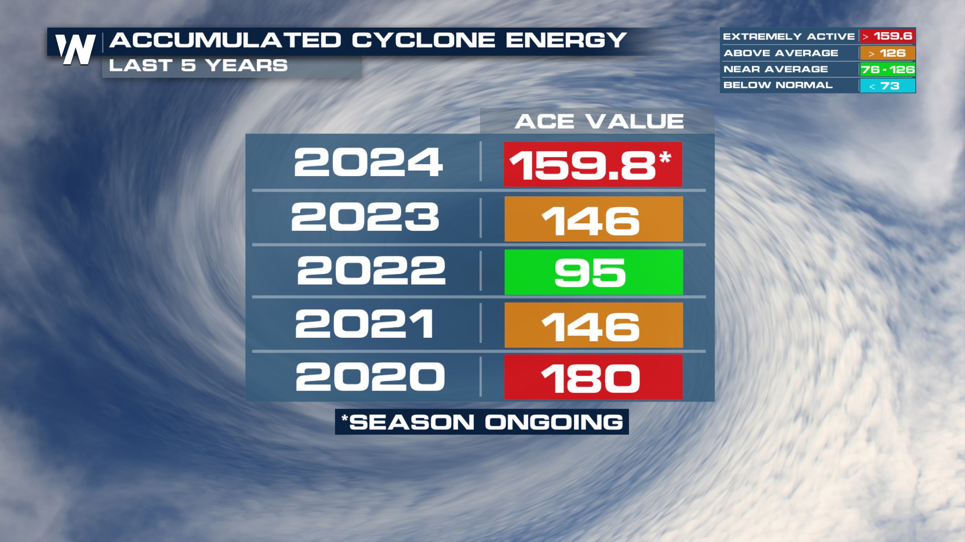
The forecast for the season called for above-average activity, so that wasn't a surprise. What was a surprise was the number of landfalls so far, especially along the Gulf Coast.
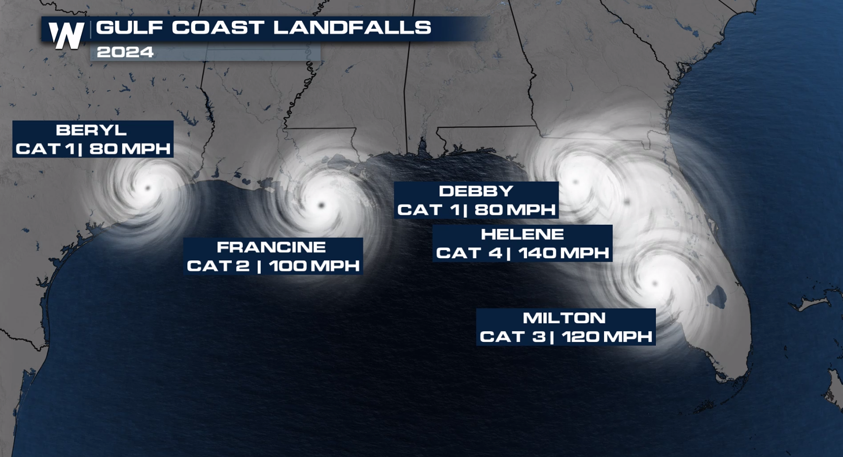
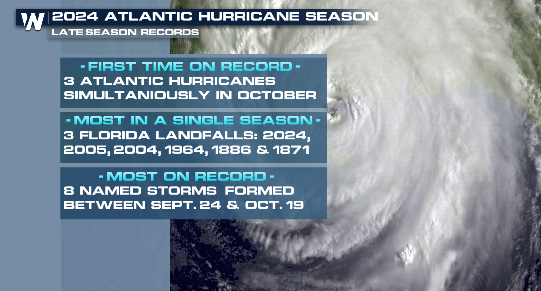 So far, here is a look at the U.S. landfalls for the 2024 hurricane season. However, we still have a month to go...
 For more details on the Tropics be sure to join us on WeatherNation for the latest.