Another Winter System Targets Midwest and Northeast

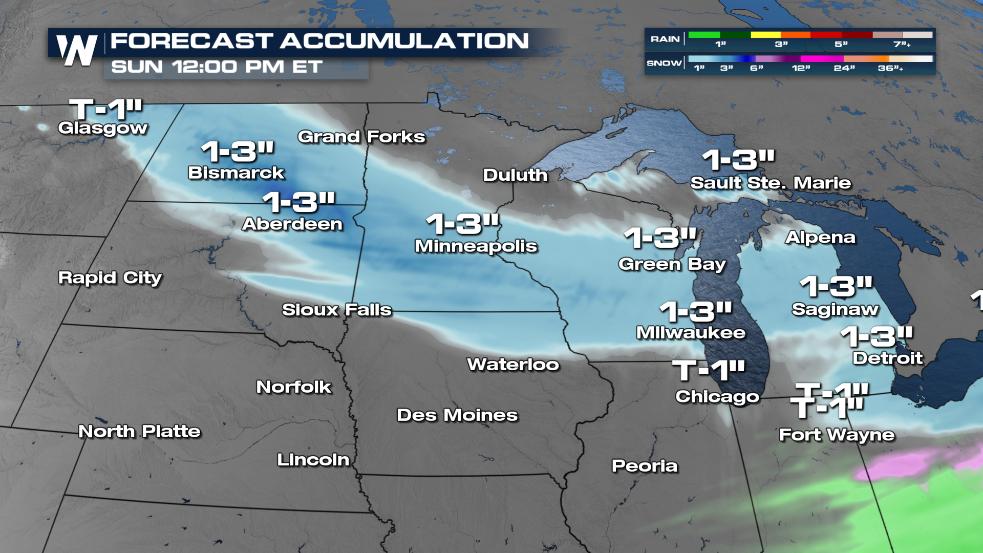
A new round of winter weather is set to aim the Midwest and Northeast as March begins, continuing an active stretch of storms across the eastern half of the country. Another clipper is likely to dive in from the northern Plains through the Great Lakes and Ohio Valley, then back into the northeast through Saturday. A few inches of snow will be possible from Montana to Michigan.
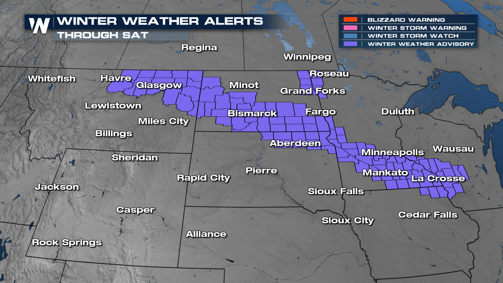
Winter Weather Advisories have been issued for northeastern Montana, across the Dakotas, and into southern Minnesota and Wisconsin.
Snow is expected to start first across portions of the Midwest, including Minneapolis and Milwaukee, before spreading into parts of Ohio, western Pennsylvania, and upstate New York. As the system shifts east, accumulating snow could extend into major Northeast metro areas.
Temperatures are expected to remain cold enough to support snow rather than rain in many areas, particularly north of major metropolitan corridors. That means the wintry feel will stick around, and melting will be limited until a more sustained warm-up arrives. However, farther south, the setup could support a messy mix of precipitation. Warmer air wrapping into the system may lead to sleet or freezing rain along parts of the storm’s southern edge, increasing the risk for slick roads. Residents are encouraged to allow extra time for travel and use caution on untreated roads as the Northeast continues to navigate a persistently snowy stretch of winter weather.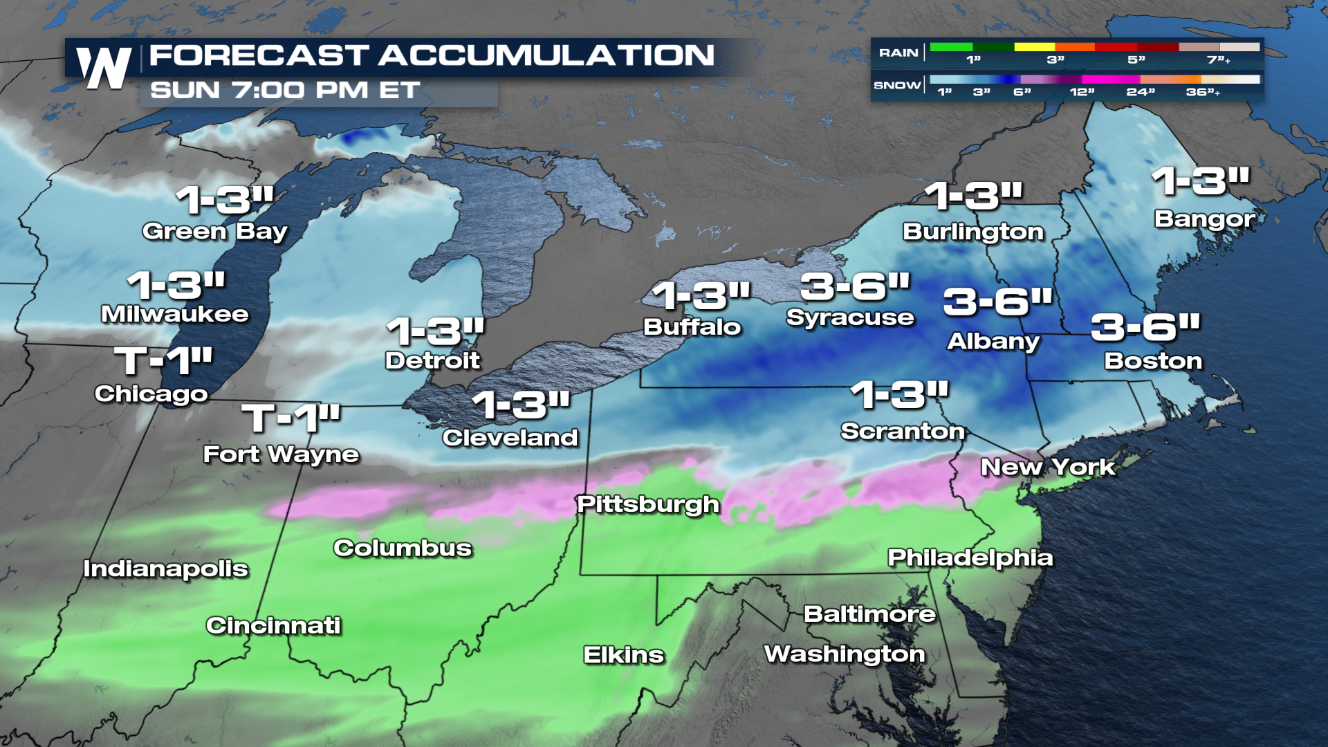
This latest system is part of a broader, active late-winter pattern that continues to send disturbances across the country.
Stay tuned to WeatherNation for more details.


