Spring: Frost Alerts Post Winter Alerts in High Country

Top Stories
19 May 2026 2:55 AM
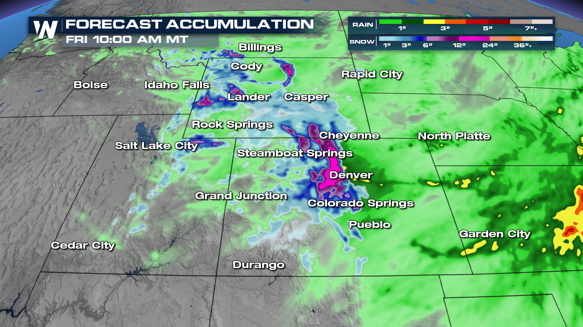
ROCKIES - The precipitation will continue to slow down through Tuesday morning, but more precipitation and snow will be possible on Tuesday afternoon. Totals may still be heavier in the Rocky Mountains.
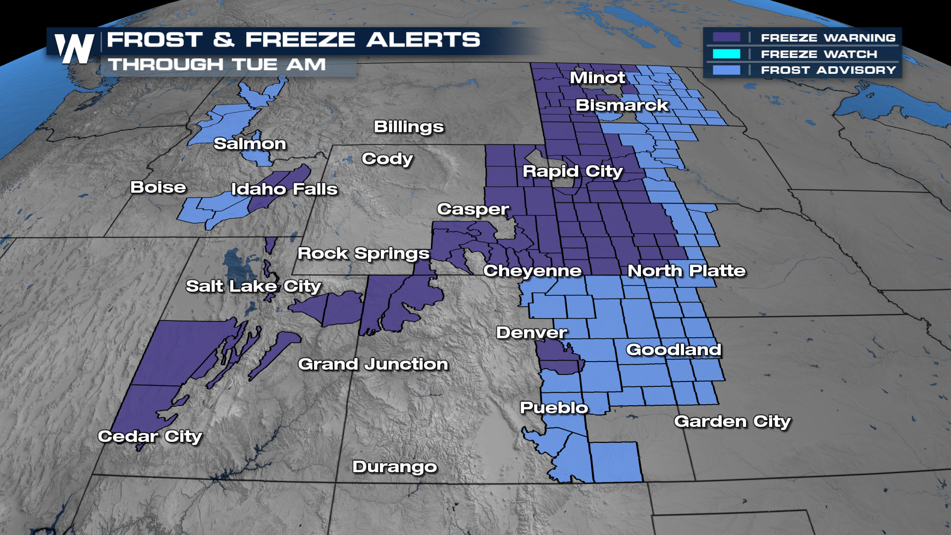
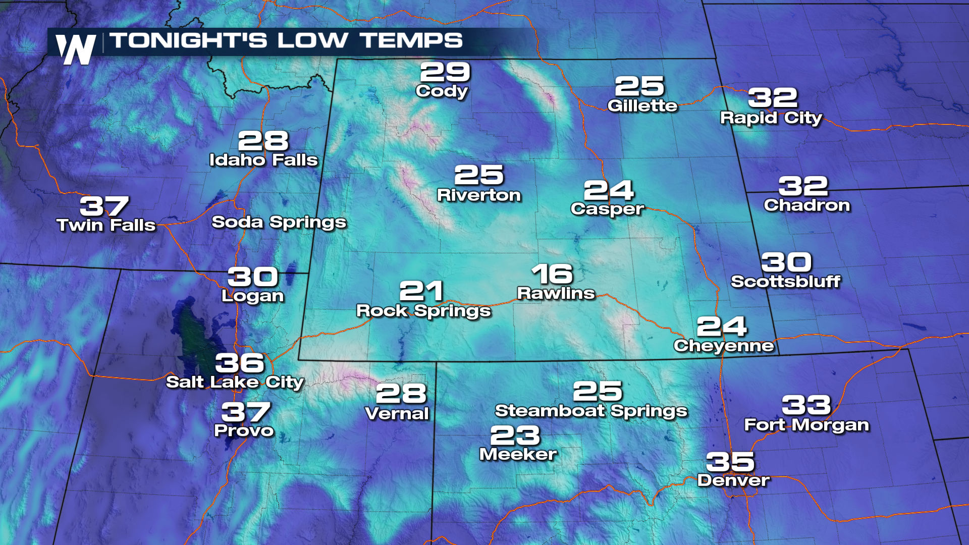
 Behind this wintry, rainy weather, temperatures will be at their coolest through Tuesday morning. This has prompted frost and freeze alerts for Tuesday morning for the High Country. Be sure to protect any sensitive vegetation overnight if you want it to last this freeze!
 Check back in to WeatherNation for the latest.
All Weather News
More
Dangerous Stretch of Heat Shaping Up This Week
The hottest temperatures of the year are loom
30 Jun 2026 2:00 AM

Massive Fires Burn in the Four Corners
Photo: Iron Fire getting doused with a retard
30 Jun 2026 1:50 AM

Slow-Moving Front Could Turn Tropical This Week
Early in the season, we watch closer to the c
30 Jun 2026 12:50 AM

Severe Storms Keep Northern U.S. Active
Monday morning, one storm brought significant
30 Jun 2026 12:45 AM

Storms Spark up in the Northeast Ahead of Heatwave
Severe storms will be possible Tuesday and We
29 Jun 2026 10:30 PM

'MCS' Season Brings Severe and Flooding Threats Across the Southeast
As Summer settles in across the Central U.S.,
28 Jun 2026 2:10 AM

Severe Threat Tracks into the Northeast Friday
Another day, another Illinois tornado. That's
26 Jun 2026 2:25 AM