Severe Storms Leave Trail of Destruction on the Plains

SUNDAY
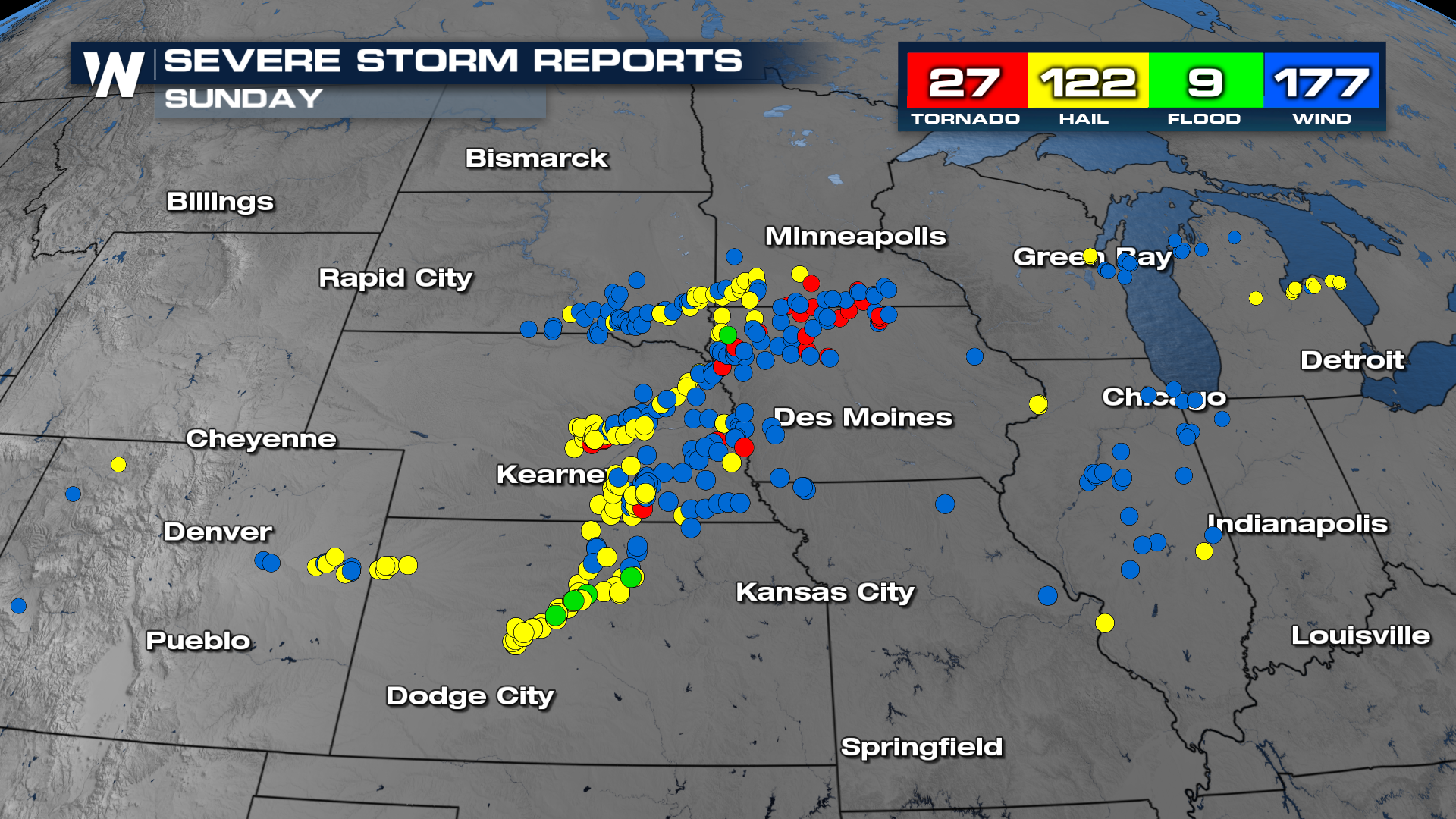
A potent setup, fueled by record hot temperatures, lead to destructive severe storms this past weekend. The worst of the days was easily Sunday, with over 300 reports of severe weather, including hail, damaging winds, and a few tornadoes.
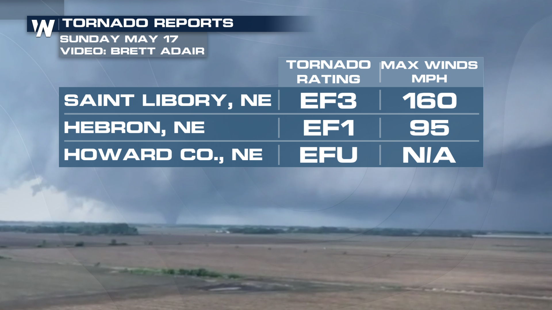
 A strong tornado touched down in Nebraska as a part of the outbreak. Even with all of this damage, no injuries were reported Sunday afternoon.
In a recent update after the damage survey labeled that Saint Libory tornado and EF3!
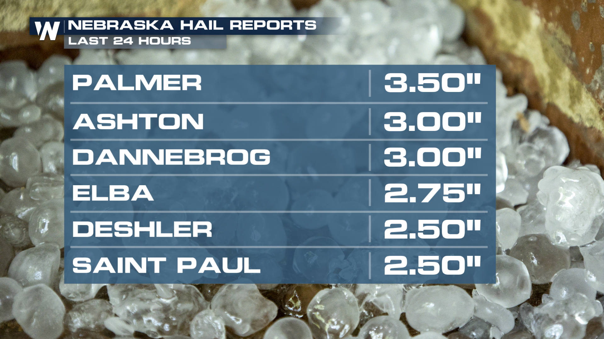
Other places were spared tornado damage but picked up MASSIVE hailstones. It's not a surprise that the cell responsible for the damage in Palmer also produced the largest hailstone on the day.
 All of this severe weather came on the heels of an active day to start off the weekend! Severe storms lead to baseball-plus-sized hail in Missouri and Kansas, and prompted a Flash Flood Emergency in the Trenton, MO area after 6+ inches of rain fell.
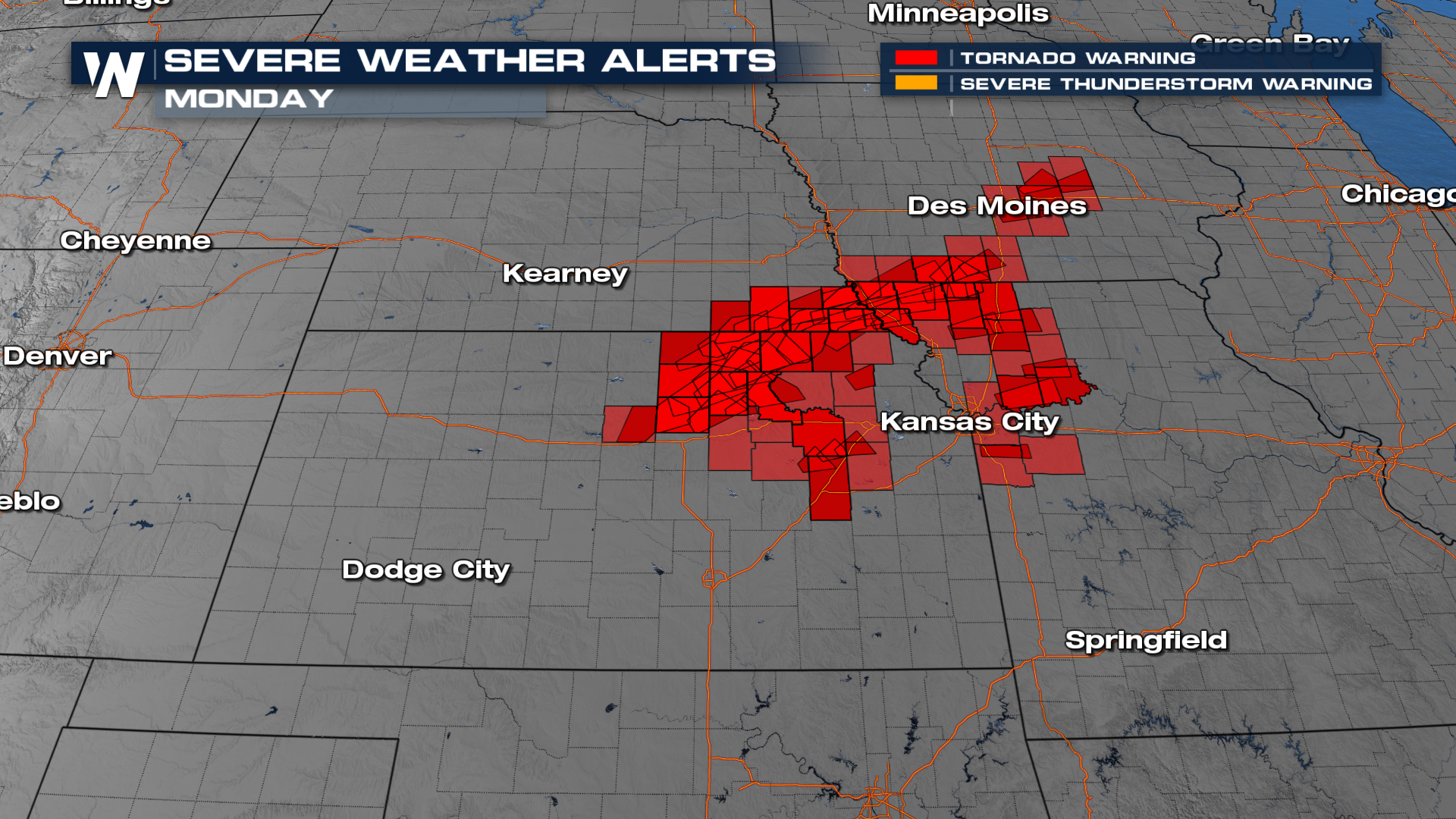
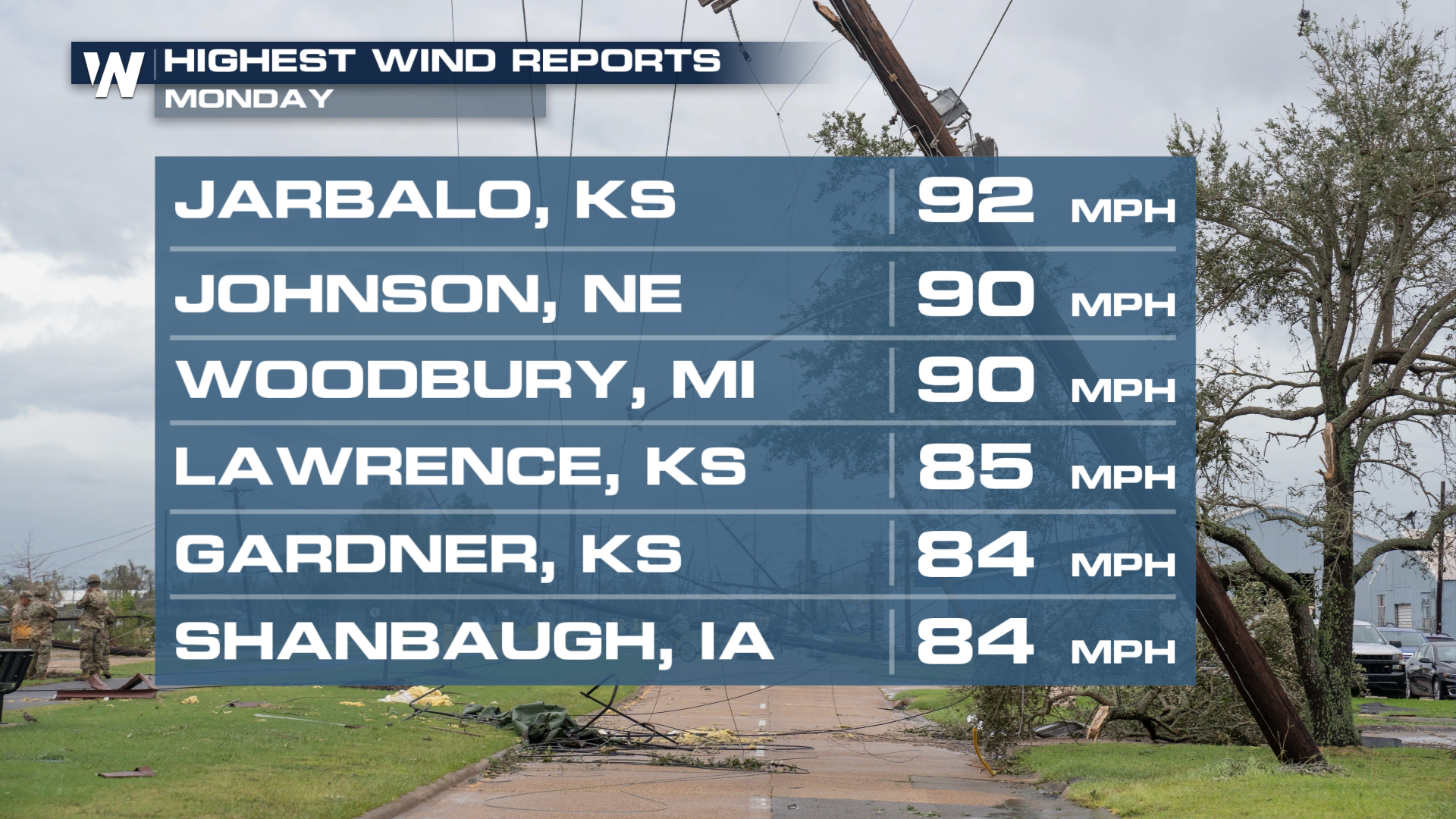
MONDAY
Yet another big severe weather day was felt across the Midwest. We received roughly 20 tornado reports across Iowa, Nebraska, Missouri and Kansas. Hefty damaging winds and large hail reports came pouring out yesterday as well!
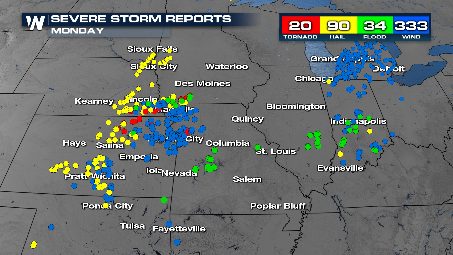
A Particularly Dangerous Situation Tornado Watch was issued ahead of several tornado-warned storms. Some touched down, giving us views just like this one out of Blue Rapids, Kansas!