Severe Threat Tracks into the Northeast Friday

Another day, another Illinois tornado. That's just how this spring has gone in the Midwest. A low pressure system brought numerous severe storms to the Midwest on Wednesday, including large hail and flooding in Wisconsin, with strong winds, a tornado, and flooding in Illinois.
Forecast
The low pressure system that spawned Wednesday's storms is now moving east into New England bringing severe weather chances for Friday. A new low forms along the same front to also produce a severe risk across the Ohio River Friday. This is primarily for the threat of damaging winds but an isolated tornado or two will be possible (top of page).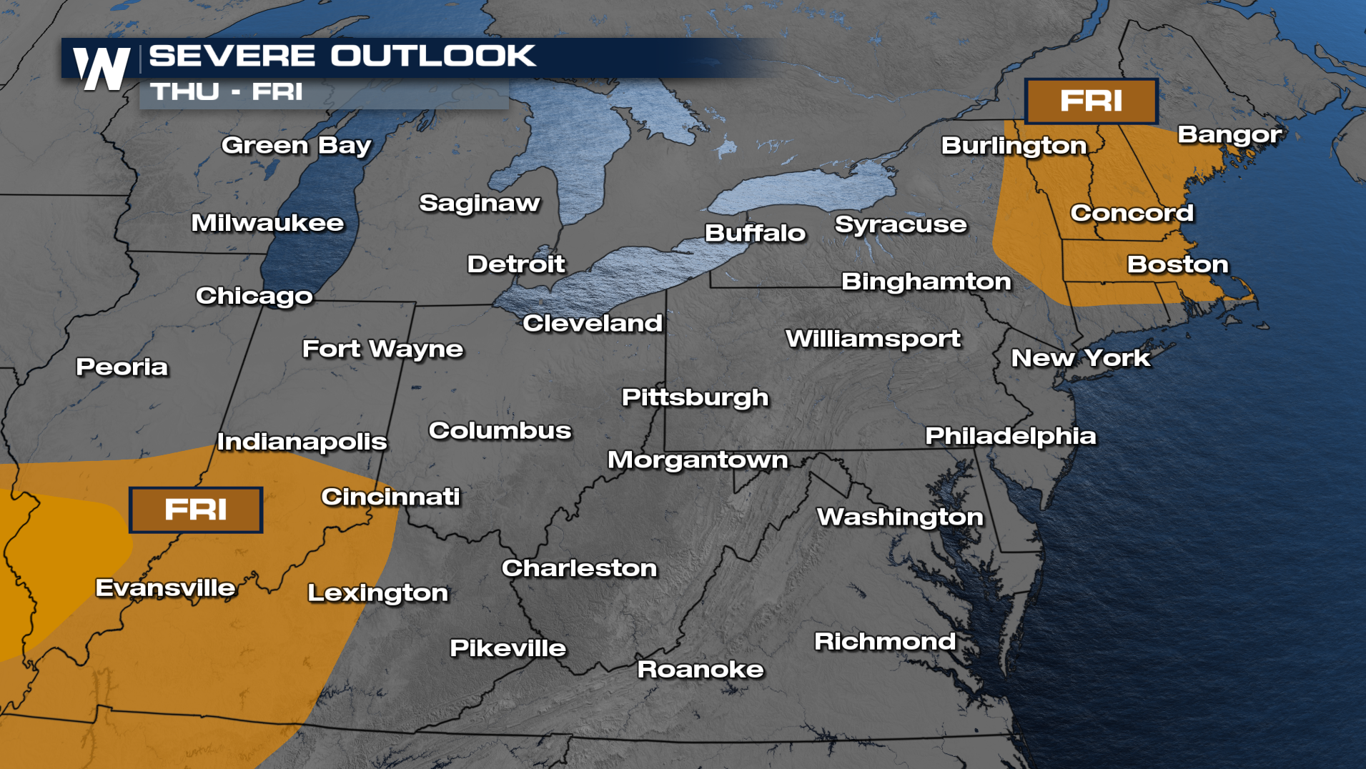
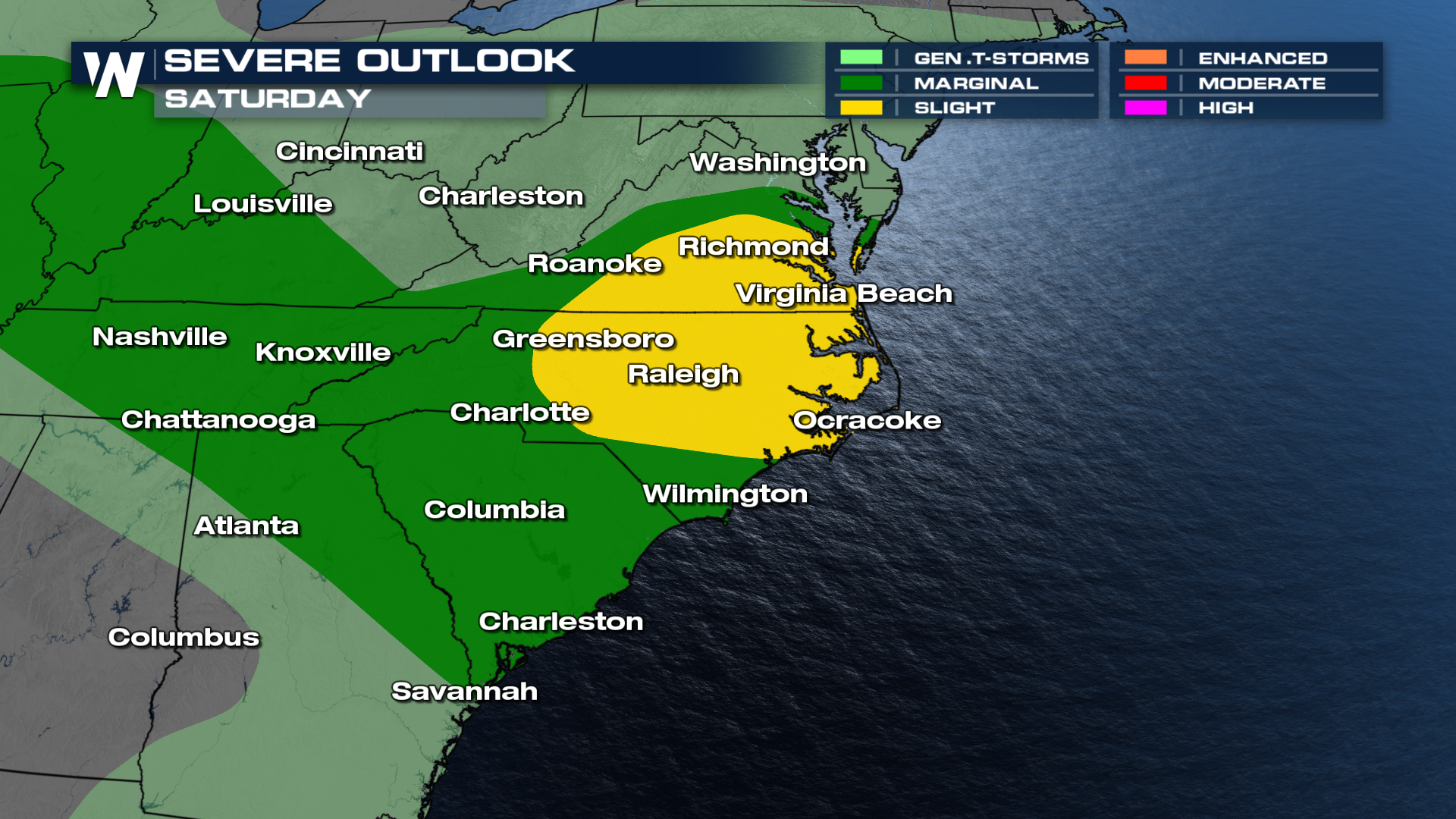
The stalled boundary will the focal point for storms on Friday. The first low moving across the Northeast will produce severe storms across parts of New England. Secondly, as the new coming out of Missouri will produce severe weather for Southern Indiana, Southern Illinois, and Kentucky during the afternoon and evening hours. All modes will be possible. The front slides into the Carolinas bringing the Carolinas at play for severe weather on Saturday.
As a trailing low moves in on Saturday, a few more severe storms will be possible as the low tracks into the Southeast.
Heavy rainfall will accompany strong storms, leading to isolated flood potential. The higher chance for flooding will stick to areas along and west of the Appalachians, through the Ohio River, and up to I-70.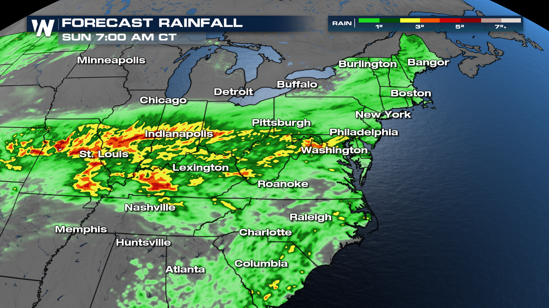
You Eastern Regional Forecast can be viewed on demand anytime with the WeatherNation app, or tune in live at :10 past the hour!


