'MCS' Season Brings Severe and Flooding Threats Across the Southeast

As Summer settles in across the Central U.S., MCSs, also known as Mesoscale Convective Systems, become more prevalent. These large clusters of thunderstorms can organize and persist for hours, travel hundreds of miles, and produce all modes of severe weather. The weather pattern over the next few days will favor repeated rounds of these storm complexes across the Plains & Midwest.
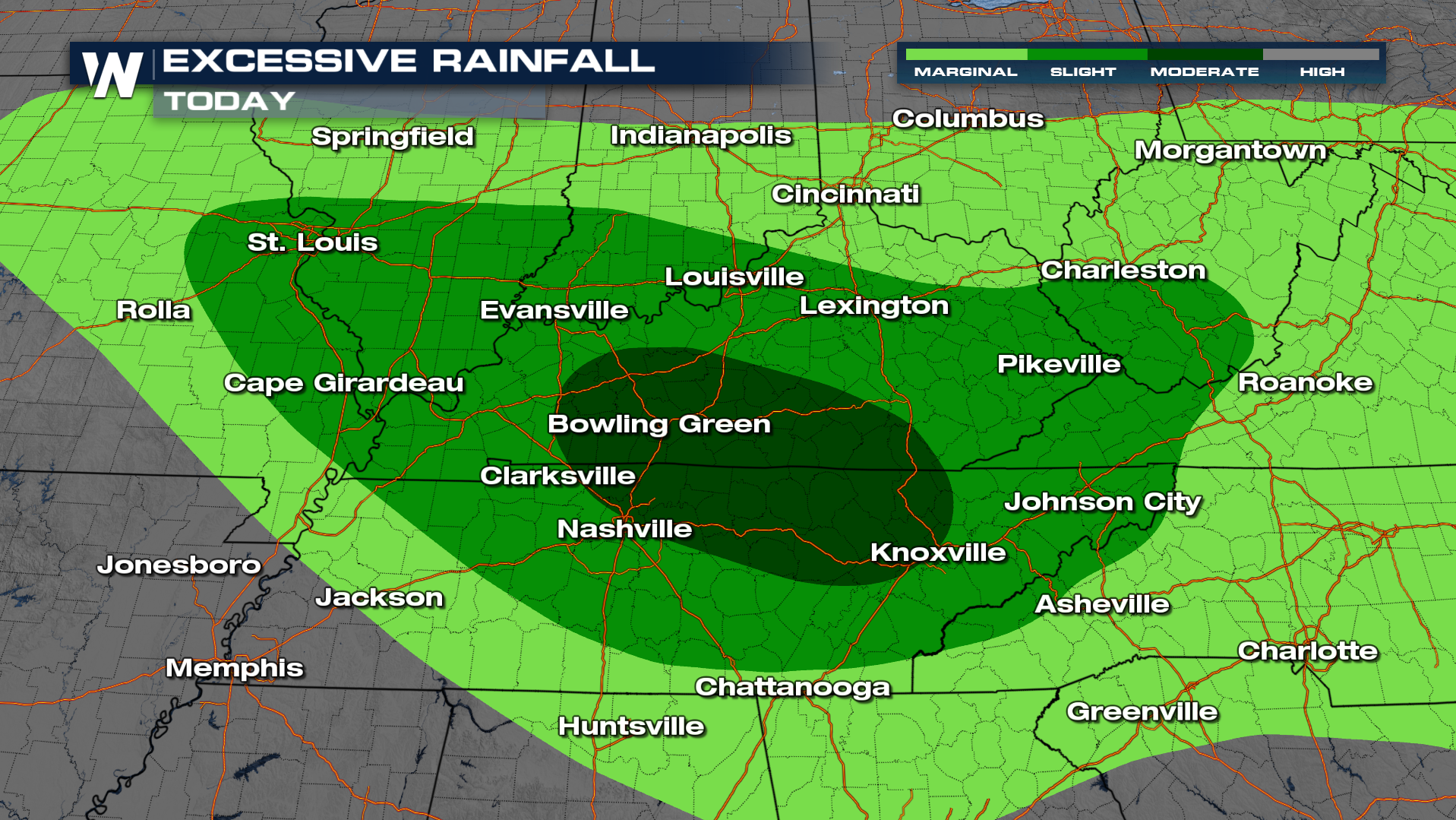
Strong and severe thunderstorms remain possible in the Mid South over the next few days as storms ride a ridge of high pressure. This will target the same areas through the end of the week to see severe weather.
WHAT IS AN MCS: READ MORE HERE
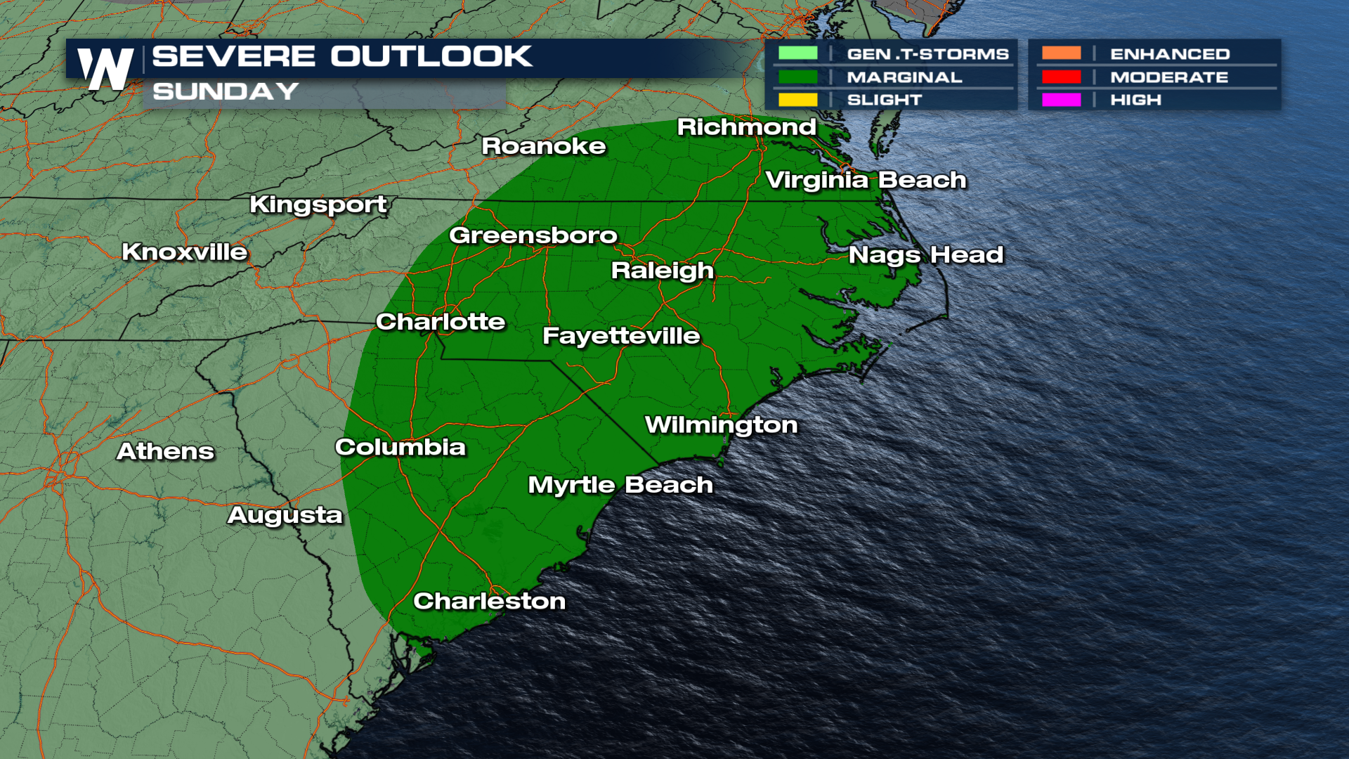
For the overnight, a few storms could still be severe across parts of the Ohio Valley before being steering into the Carolinas for Sunday.
These storms will dump rain on the same areas, increasing the risk of flooding in some of the same spots that already flooded earlier this week. For more on the flooding risk, read this related article on the flood potential.