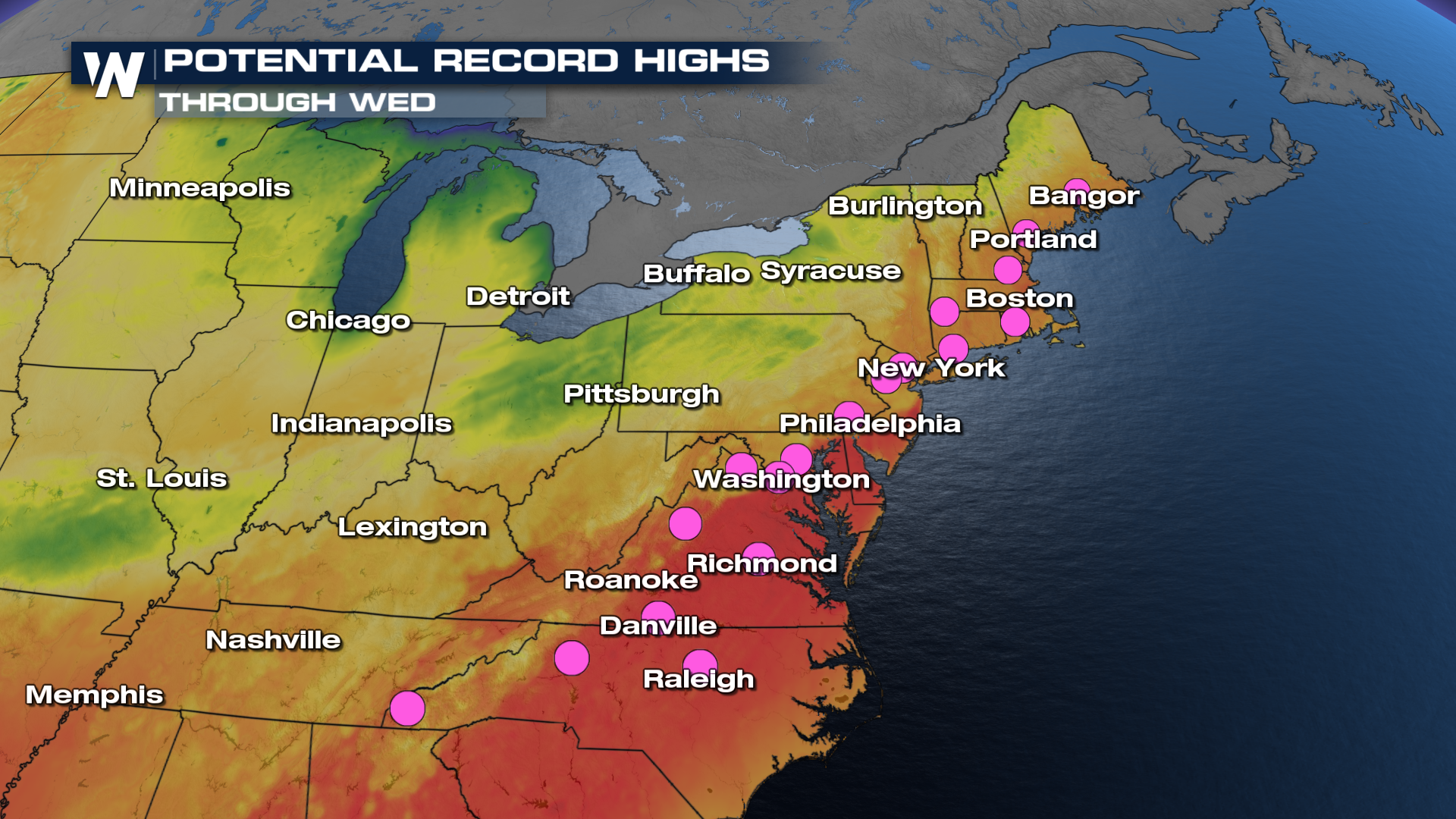
One More Day of Blistering Temperatures

A big warmup is taking hold across the eastern United States, bringing temperatures that will feel more like midsummer than mid-May. Much of the East Coast, Mid-Atlantic, and Northeast saw temperatures surge into record-breaking territory as a strong area of high pressure settled over the region.
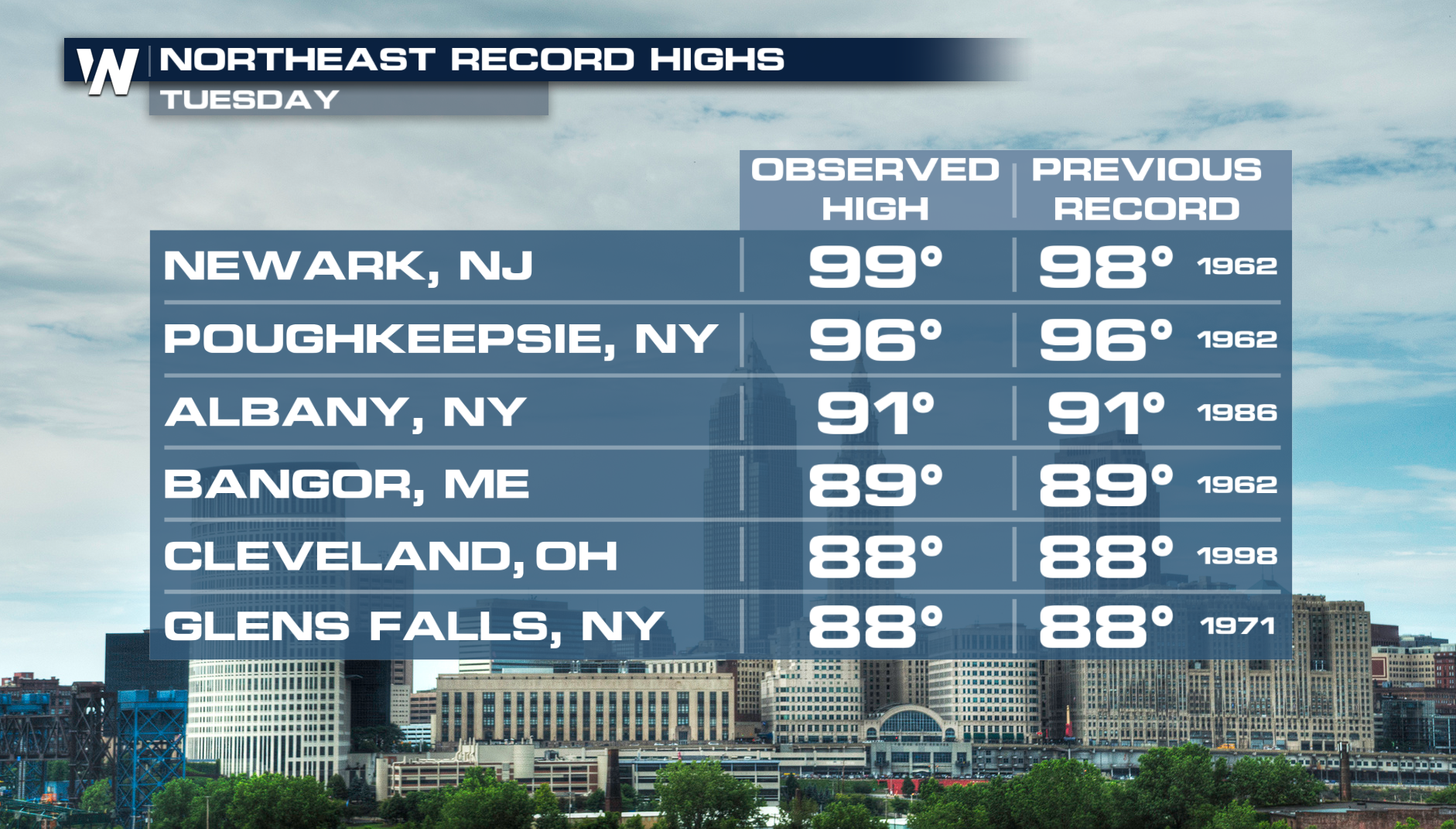
Numerous records were broken on Tuesday afternoon, including Newark, NJ, which hit a high of 99 degrees. The NE can see one more day of record warmth before temperatures cool off.
 RELATED: Severe Chances on the Plains
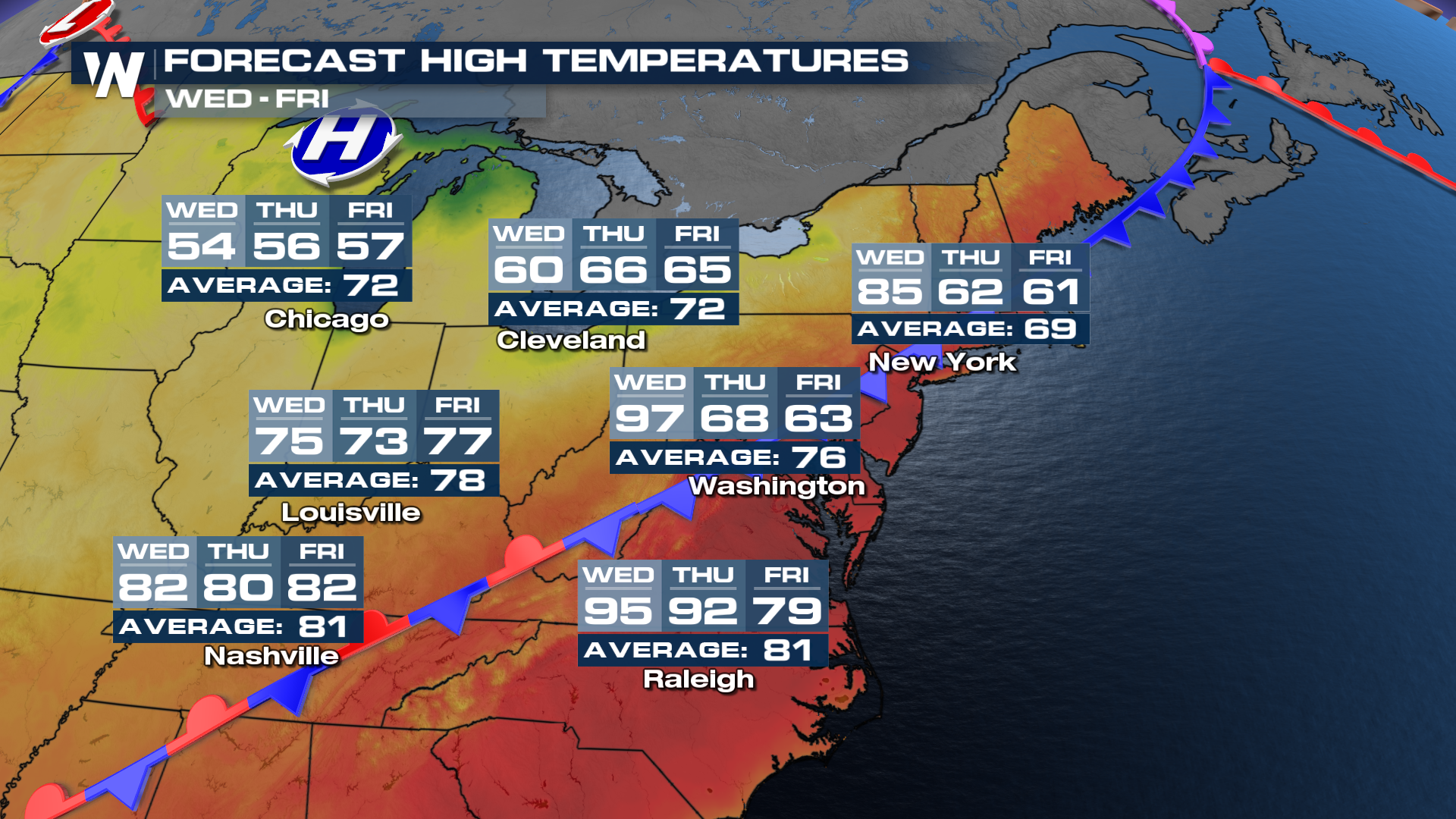
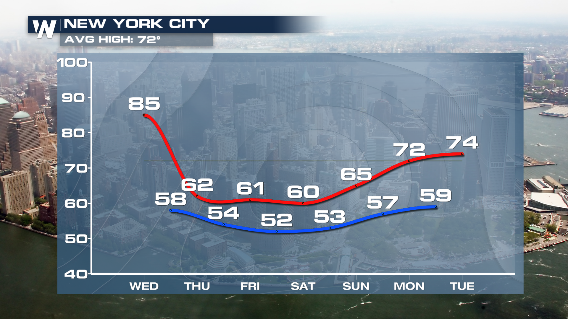
High temperatures are forecast to climb into the 80s across many areas, while some cities could approach or even reach 90 degrees for the first time this year in the Northeast. The normal average for New York City this time of year is 72°, but the forecast high is expected to be 85° on Wednesday. Temperatures will dip back down to the 60s on Thursday, once a front passes.
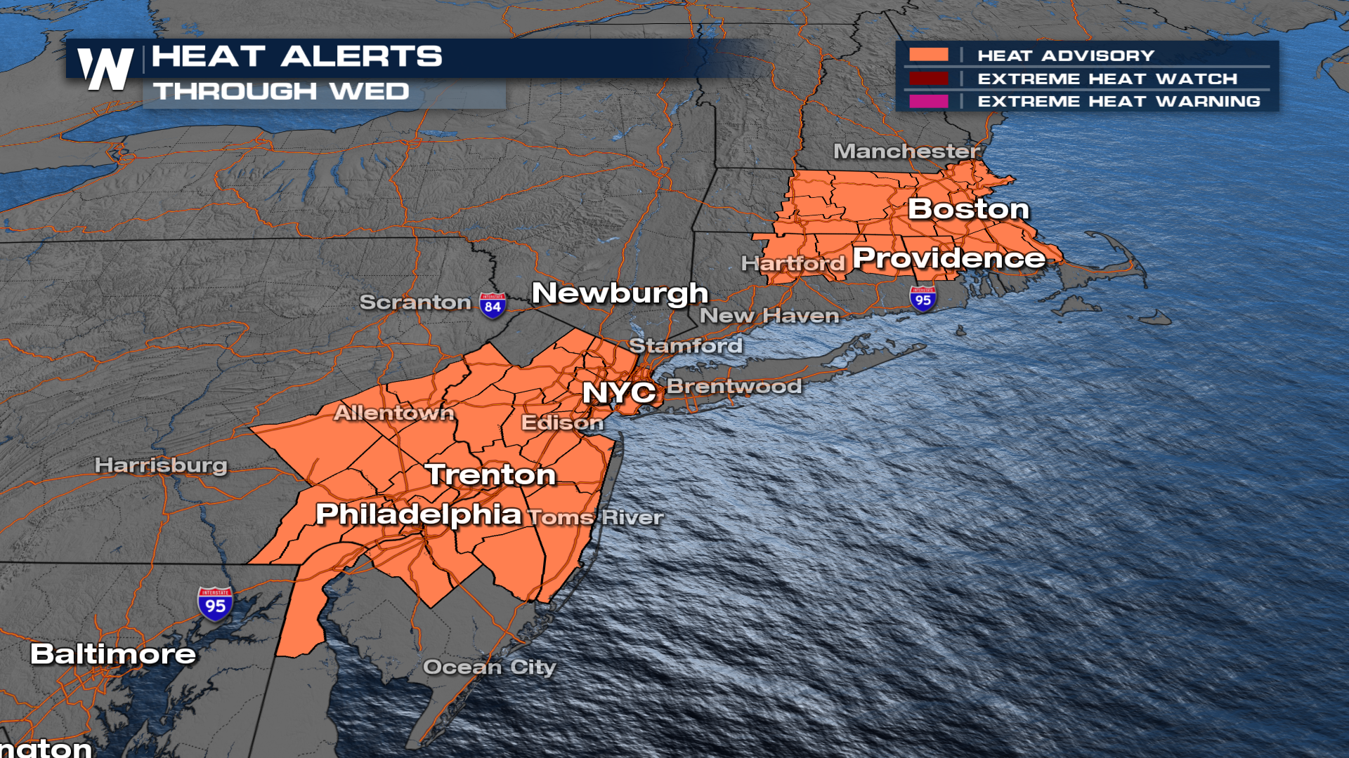
On Wednesday, more records will be broken with some locations up to 20 to 30 degrees warmer than what is typical for this time of year. This has prompted heat advisories through Wednesday afternoon. Major cities along the Interstate 95 corridor, including Philadelphia and New York City, will come close to daily temperature records if the heat intensifies enough.
Additional records are likely to fall through mid-week across the East before our central U.S. cold front draws in cooler air and stormy weather.
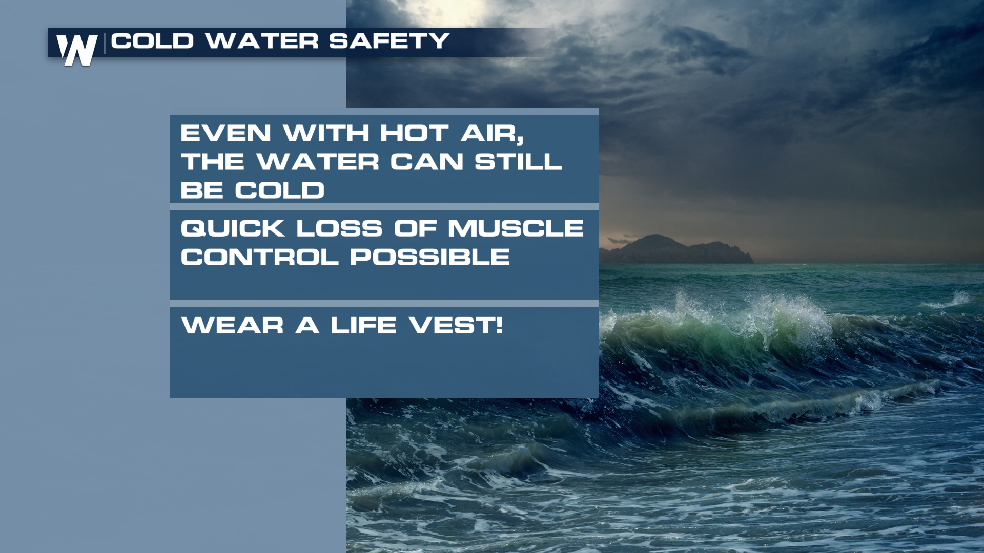
Despite the urge, stay out of the waters in the area. Many bodies of water are barely above freezing, which could shock the system into paralysis if you jump in
 The unusually warm pattern will come to an end after our front passes through on Thursday. By the end of the week, many spots will be closer to seasonal norms in the 70's