Hurricane Season Begins in the Eastern Pacific, Atlantic Soon To Follow

Ready for hurricane season? As a reminder, waters in the tropical Pacific tend to warm faster than in the Atlantic; thus, the season starts about two weeks earlier in the Eastern Pacific.
The CPC has moderate confidence in the formation of a tropical system in the Eastern Pacific going through the end of May into June. If you have travel plans along the SW coast of Mexico, stay up to date with the forecast.
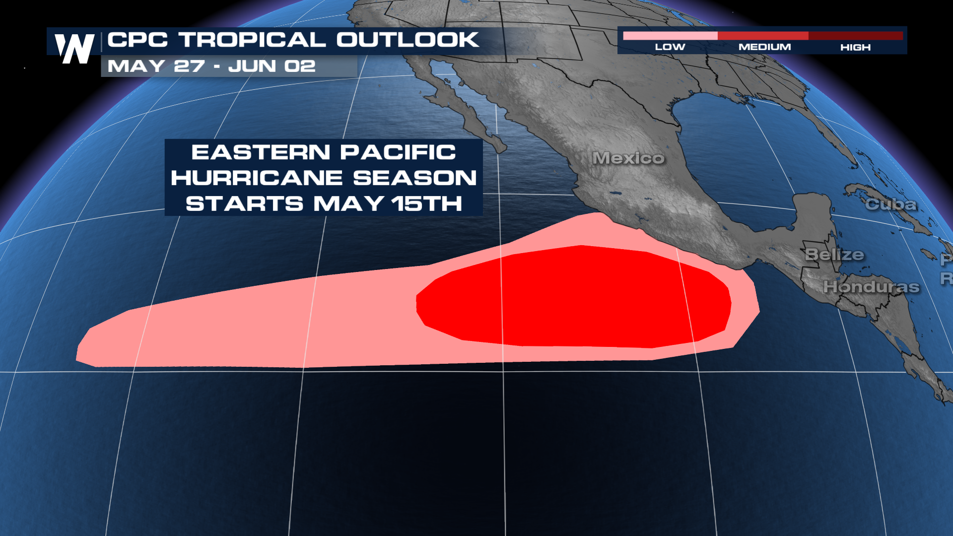
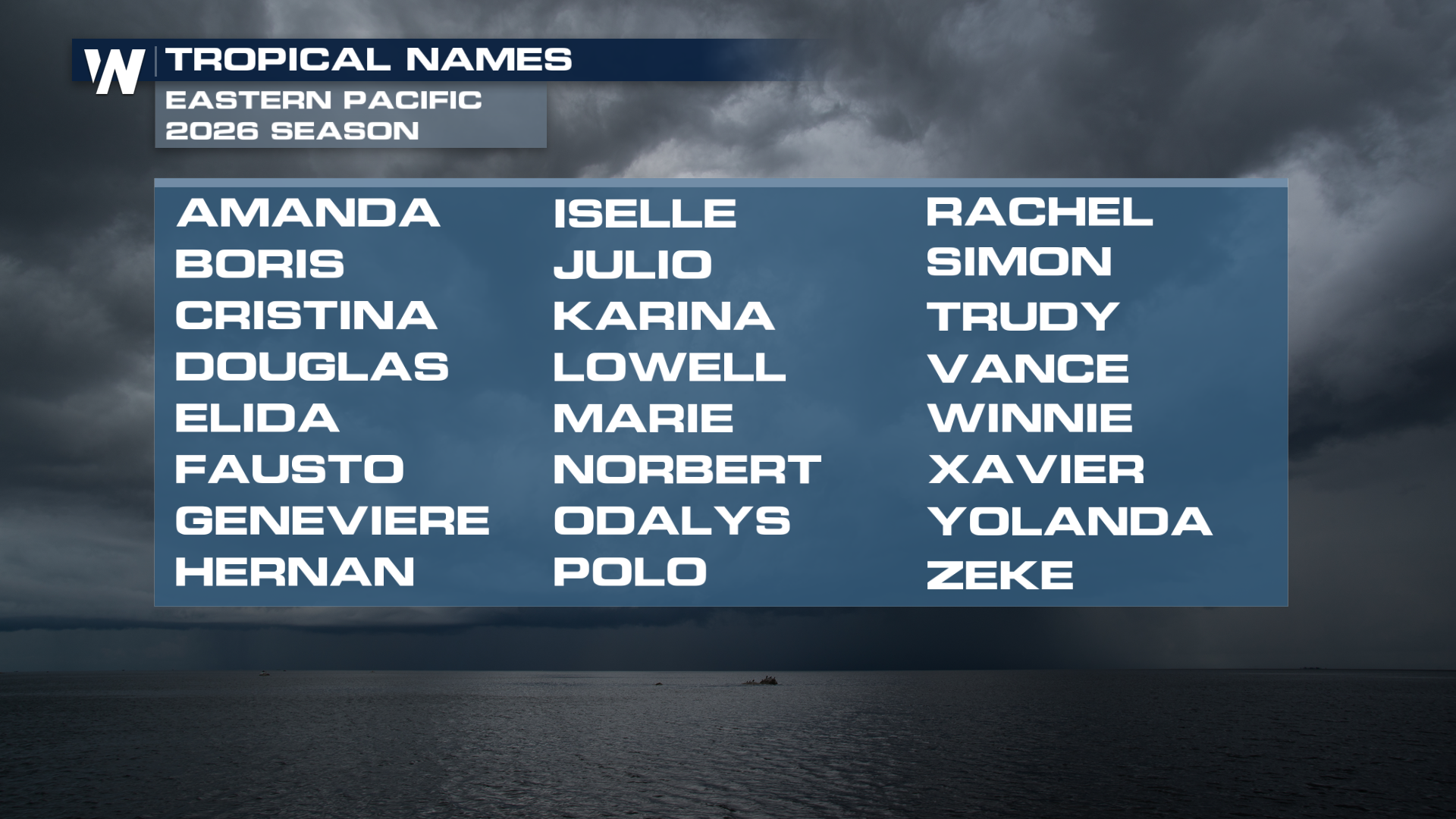
If a storm were to form and reach tropical storm status, it would be named Amanda.
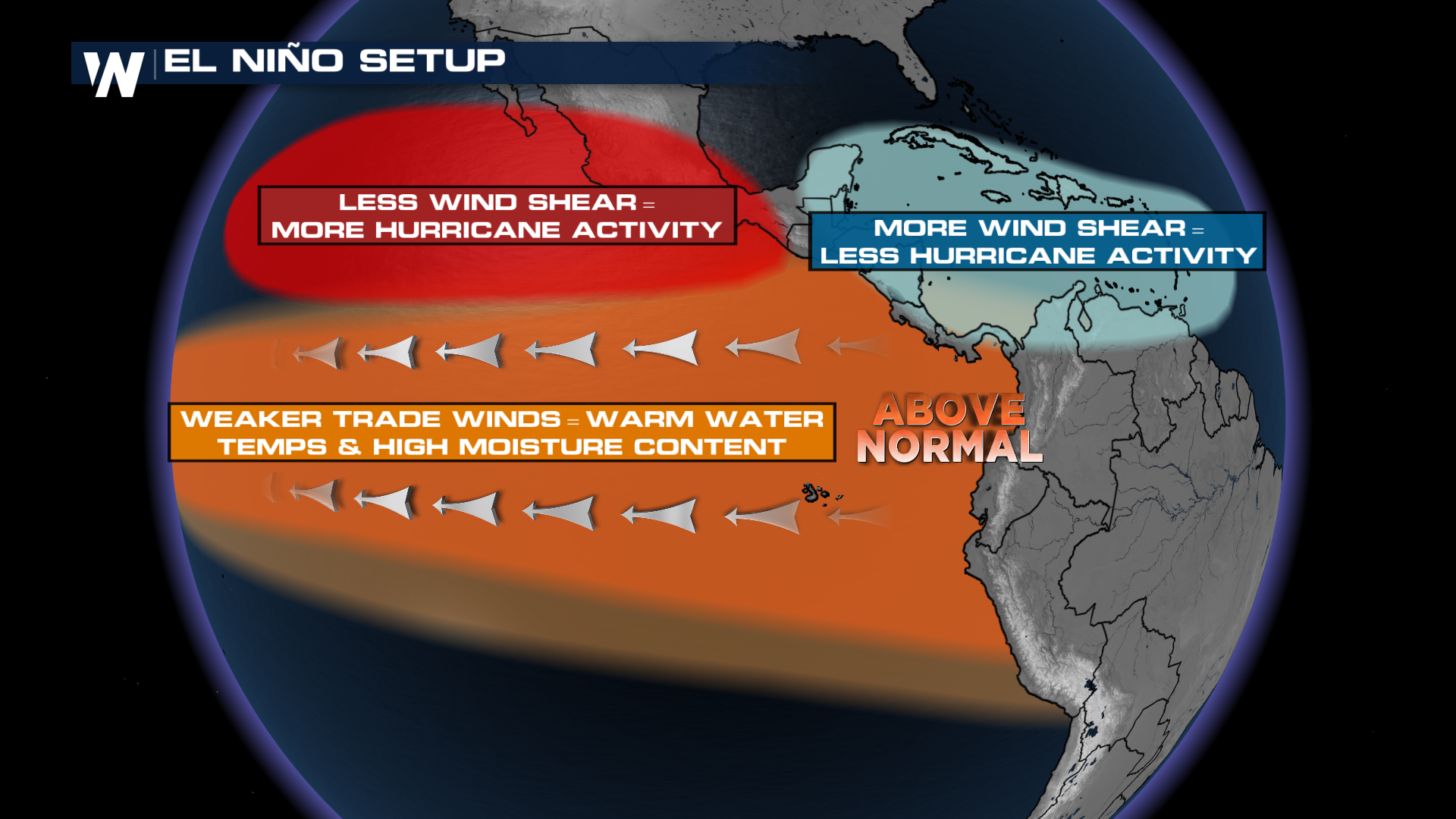
Ocean heat content has been rapidly increasing in the Eastern Pacific this Spring, which is not surprising. You might've heard about the potential for a "super" El Niño this summer. Well, the warm water created in the Eastern/Central Pacific by El Niño can lead to supercharged hurricane seasons in those regions.
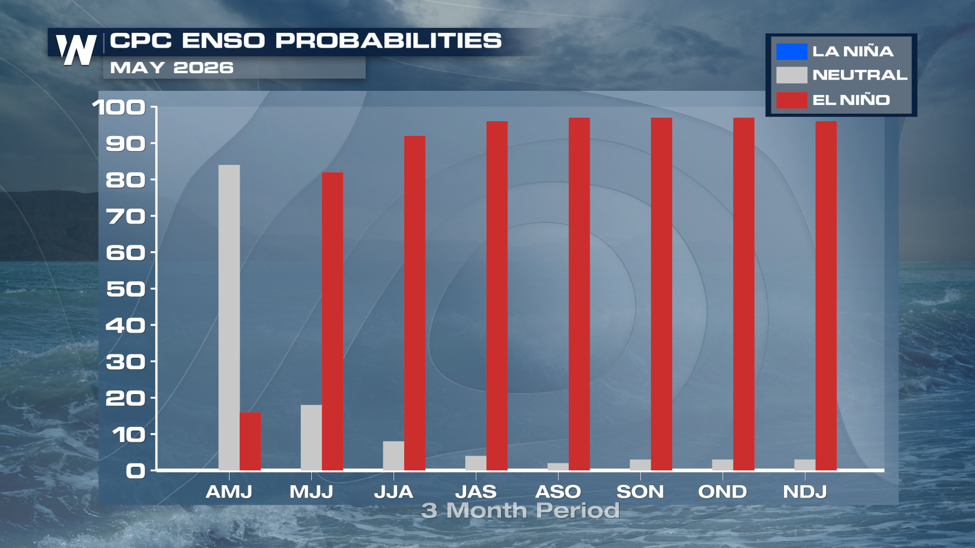
Global circulations influenced by El Niño tend to create less disruptive wind shear in the Eastern Pacific as well. Weak upper-level winds combined with warm waters tend to lead to the development of many tropical systems. At the same time, wind shear tends to increase in the Caribbean during these events, making it tougher for tropical systems to form and survive.
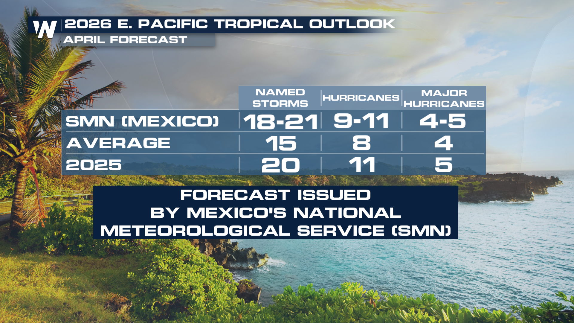
Last season was quite active in the Eastern Pacific, with 20 named storms and 5 major hurricanes. The Mexican National Meteorological Service issued an early outlook for the 2026 season in April, calling for another active year with roughly 20 named storms.
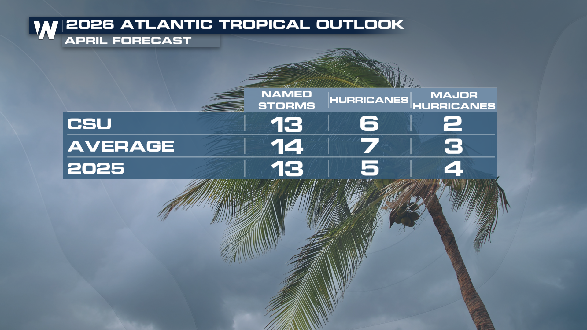
El Niño typically increases wind shear in the Atlantic, which is a primary reason why some forecasts are calling for a slightly less active season. The Atlantic averages 14 named storms a season. Despite the El Niño, the forecast is just slightly below average with 13 named storms.
We're going to get you ready for hurricane season at the beginning of June. Be sure to tune in for updated forecasts, information, and tips to prepare.