Saturday Severe Storms; Midwest to the Ohio Valley

Scattered severe storms have been moving through portions of the Great Plains and Midwest over the last few days. The same low pressure system will hardly move on Saturday, prompting another round of severe storms. Saturday's storms have produced winds between 60-70 mph and and up to 3.00" hail in Nebraska.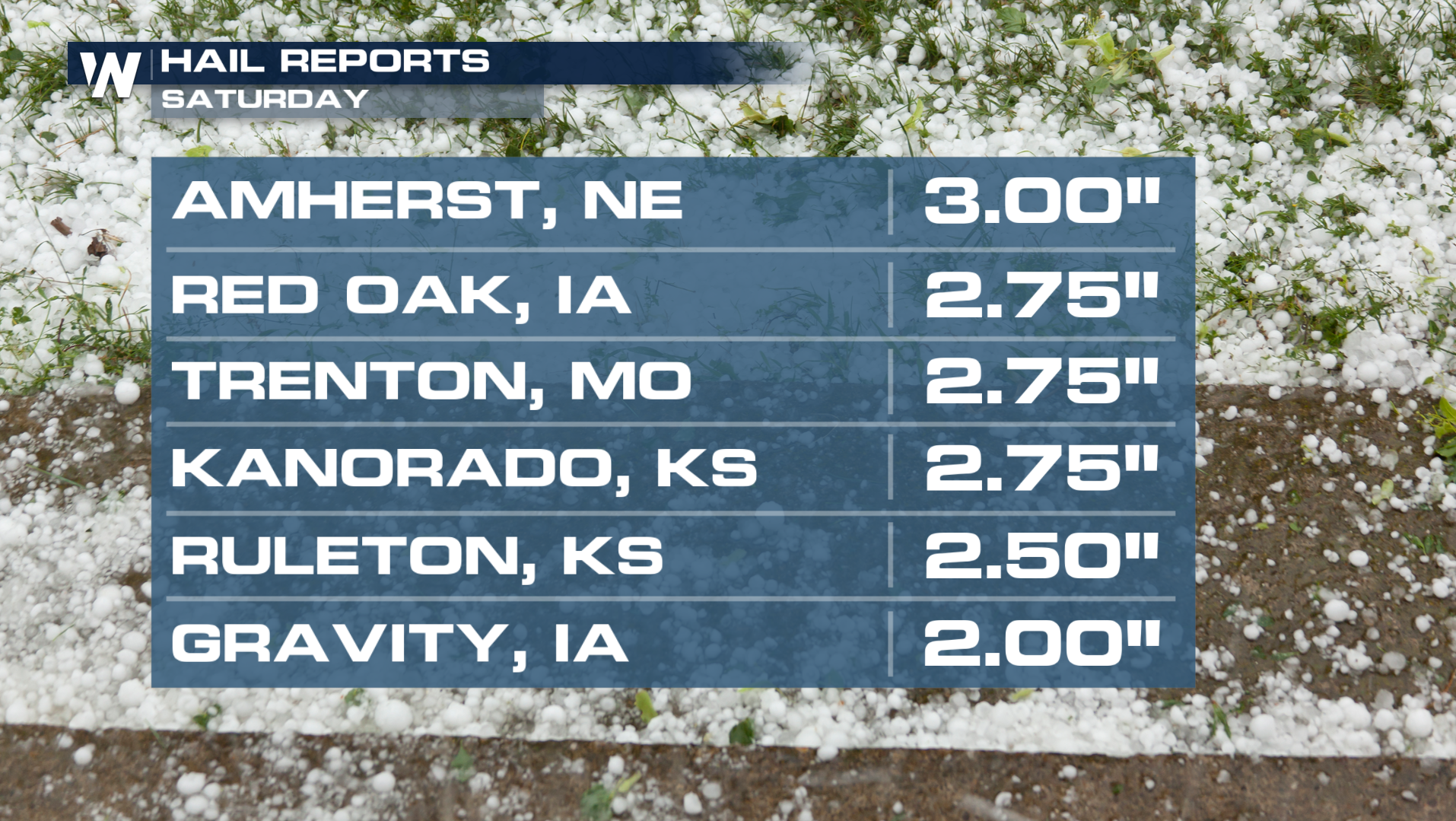
Outlook Overnight
There is an Enhanced risk (level 3 out of 5) across parts of Nebraska and Kansas. Additionally, a Slight risk (level 2 out of 5) includes the surrounding areas to Central Iowa and Northern Missouri.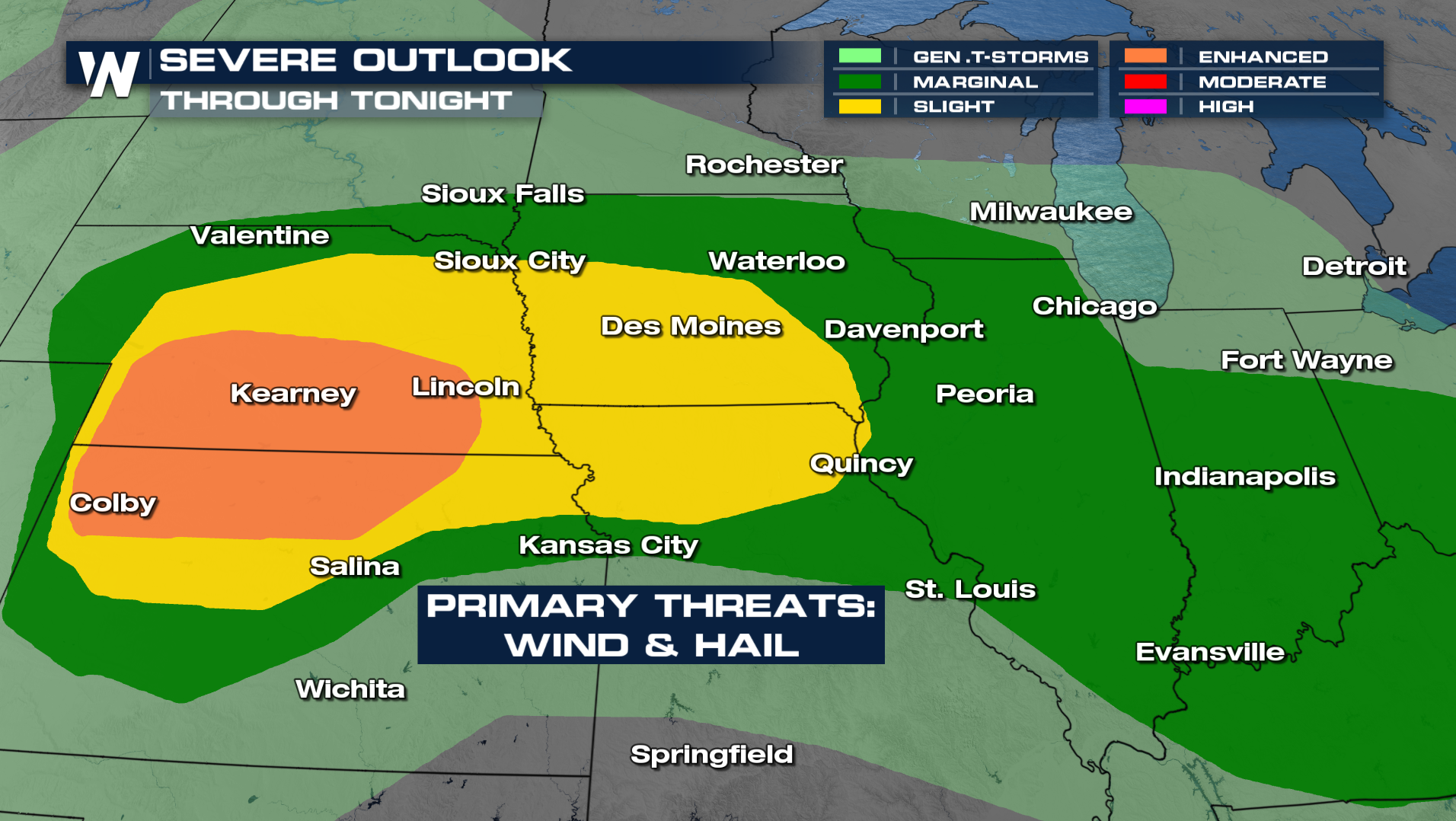
Extra large hailstones (over golf ball size - 2"+) and hurricane force gusts (74+ mph) are possible for areas below, which should be the more widespread hazards.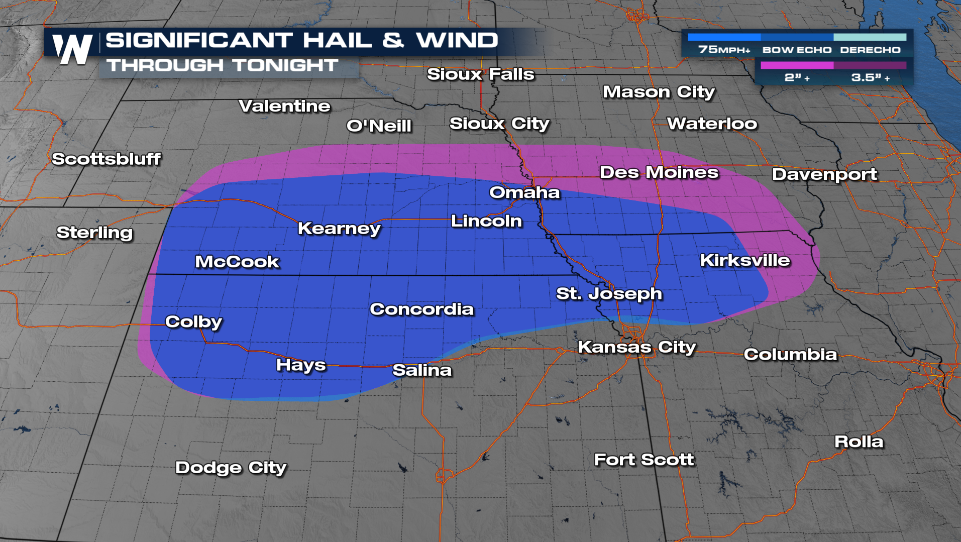
Several tornadoes are possible as well especially between Interstate 70 and 80. A tornado or two could be strong if they form!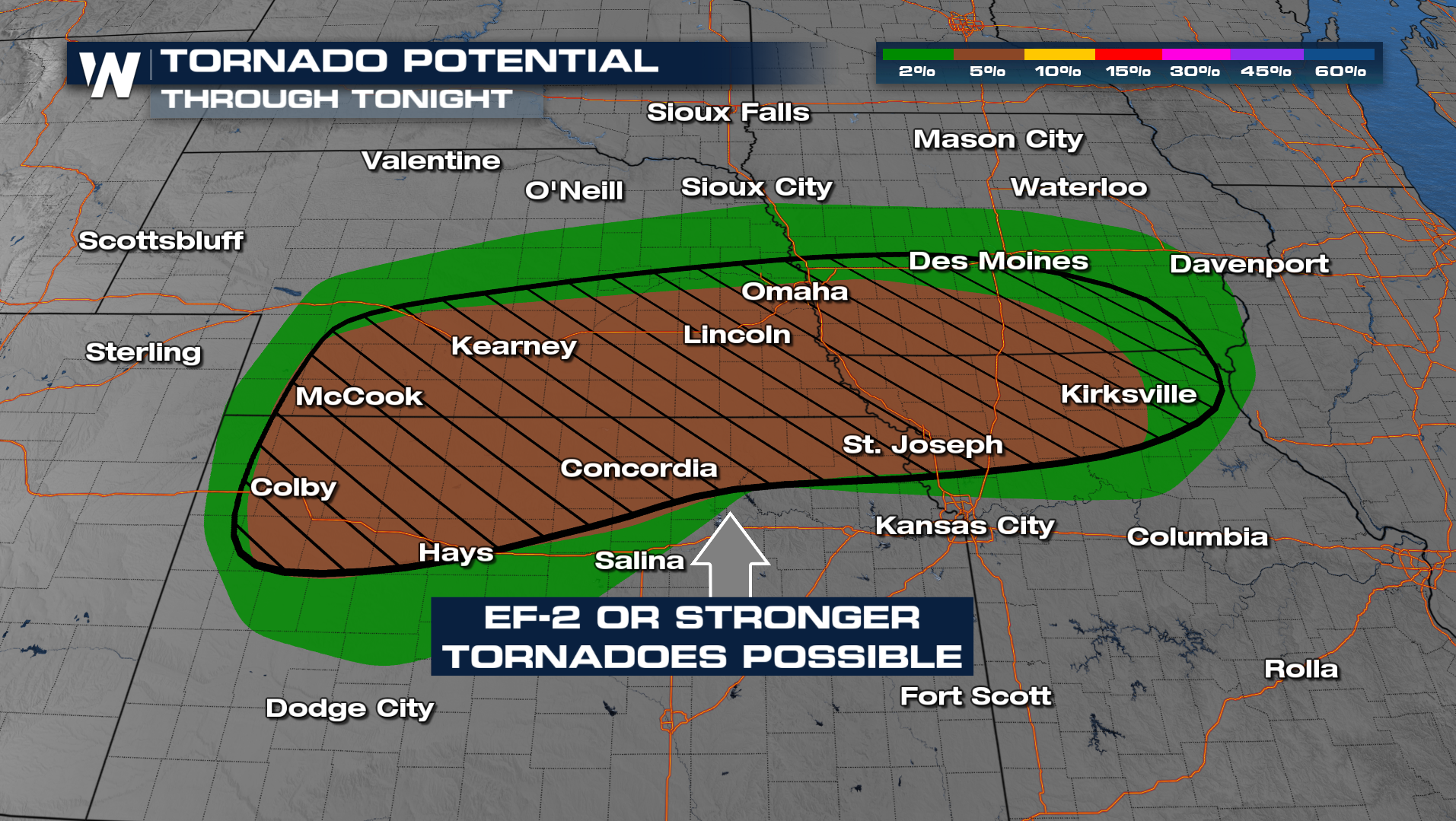
Forecast
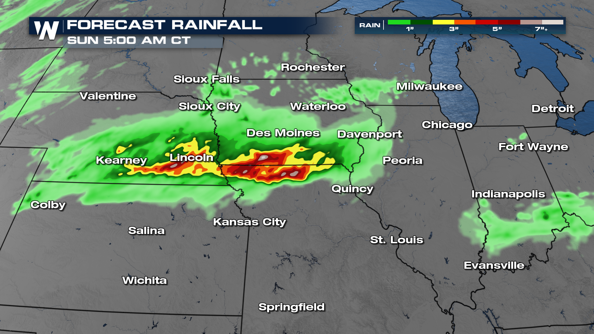
Storms in the Plains and Midwest could persist well into the overnight hours, so please have multiple ways to get severe weather alerts that can wake you up! In addition the heavy rain and flooding threat will be around so remember turn around don't drown.
Since storms won't be widespread, only spotty heavy rain is expected. Isolated flash flooding is possible.