Wrapping Up Another Cool and Wet Weekend for the Northeast

Clear skies provided perfect viewing conditions for Manhattanhenge this year. The biannual event took place on Thursday, May 28, and Friday, May 29, when the setting sun aligned with the east-west street grid of Manhattan. The timing couldn't have been better, as clouds and rain showers moved into the Northeast over the weekend, obscuring the view.
While some saw rain for the first half of the weekend, high elevations in New Hampshire actually saw some snowfall on Saturday! Mount Washington reported nearly 6" of snowfall.
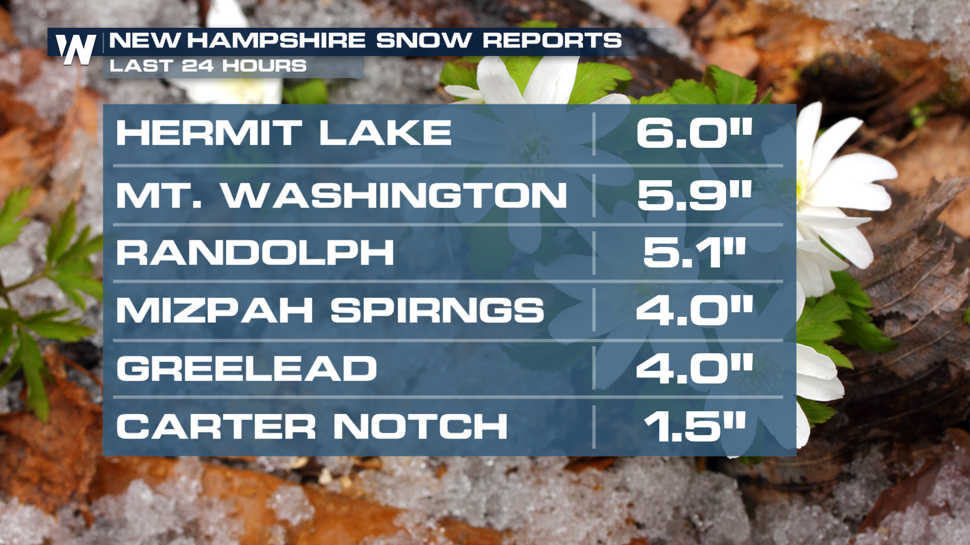
The next quick-moving system moves in on Sunday, bringing rain showers and some embedded storms. The chance for additional snow has lowered for these spots.
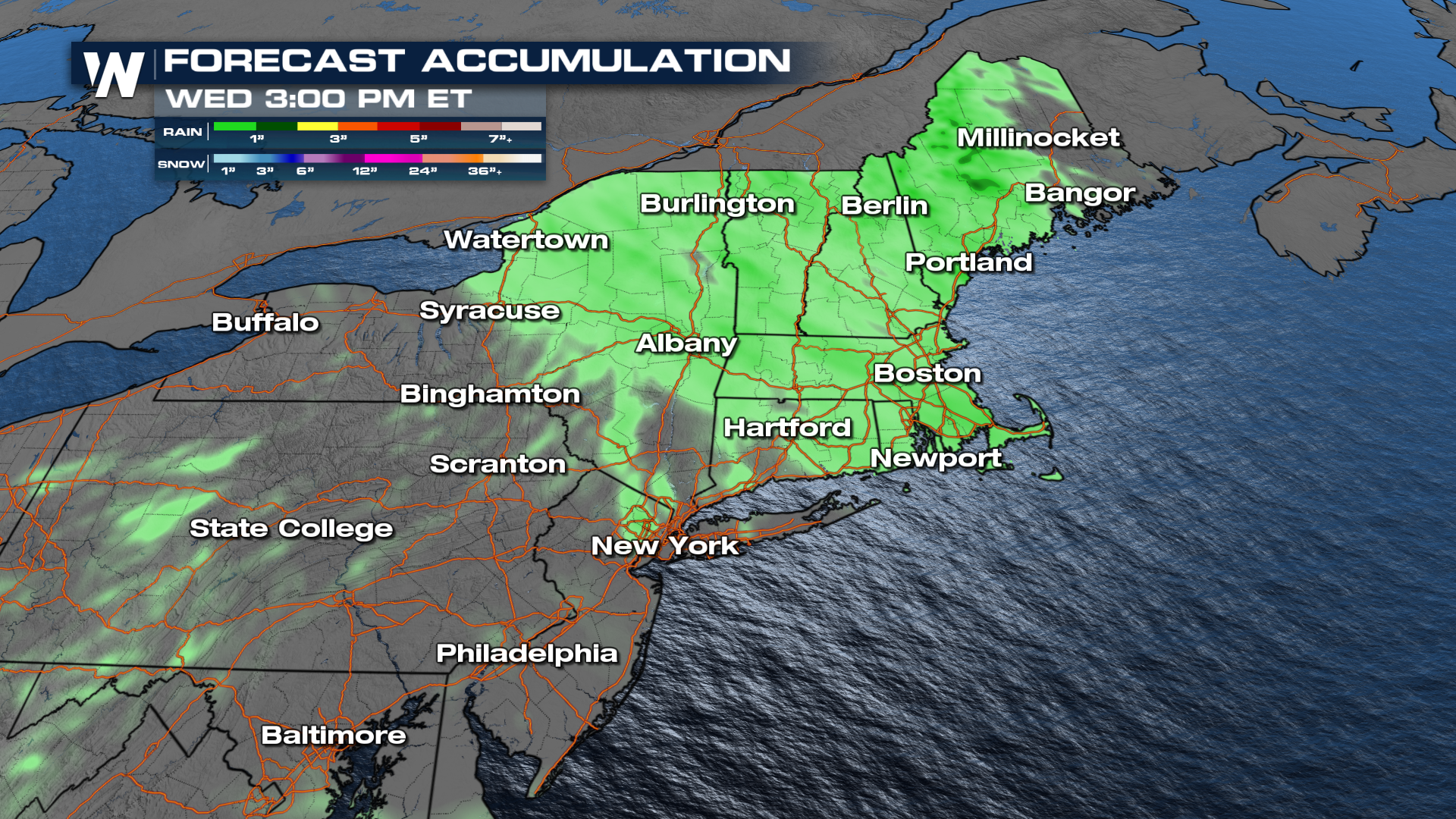
On Sunday, a quick-moving cold front brings New York and northern New England rain chances. Some start in the Champlain Valley as early as daybreak and continue to follow the front throughout the day into more of New England.
The pattern ahead will also keep temperatures on the comfortable side as we wrap up meteorological spring and move into meteorological summer on Monday, June 1st!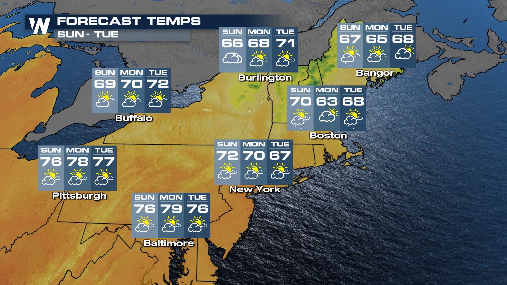 For more on this be sure to join us on WeatherNation at :10 past the hour for your eastern regional forecast.


