Heat & Front Fuels Thunderstorms In The Northwest

WHAT TO EXPECT
The SPC has issued a slight risk across the Northwest and portions of Utah. Unusually warm temperatures, combined with a frontal boundary, will help enhance winds in the area by this afternoon. Winds could gust in excess of 75 mph in some locations that get caught underneath a strong storm. 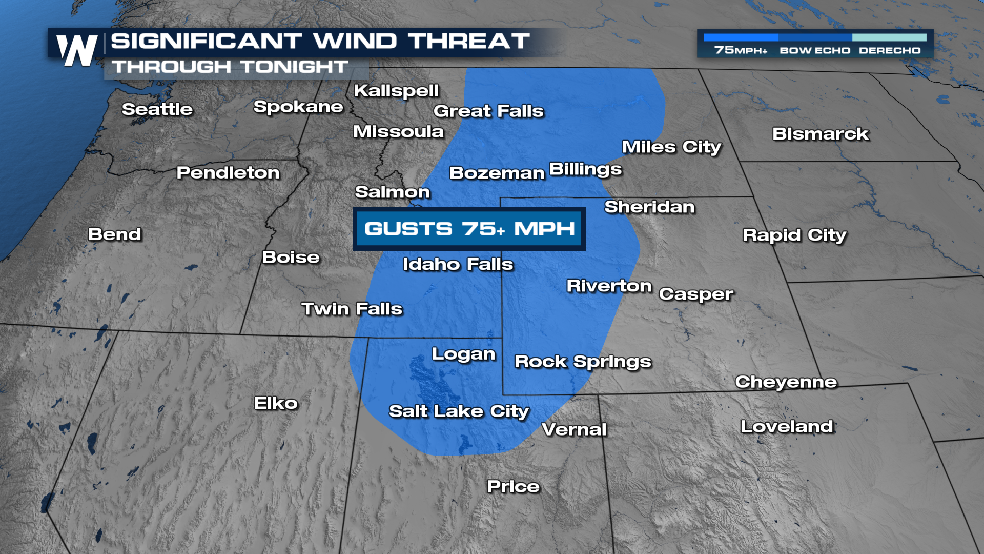 The low and its associated frontal boundary are moving onshore, bringing rain and storms along with it. As highs soar into the 90's, storms will strengthen with the potential of damaging winds and hail. By Thursday morning, the frontal boundary will move out.
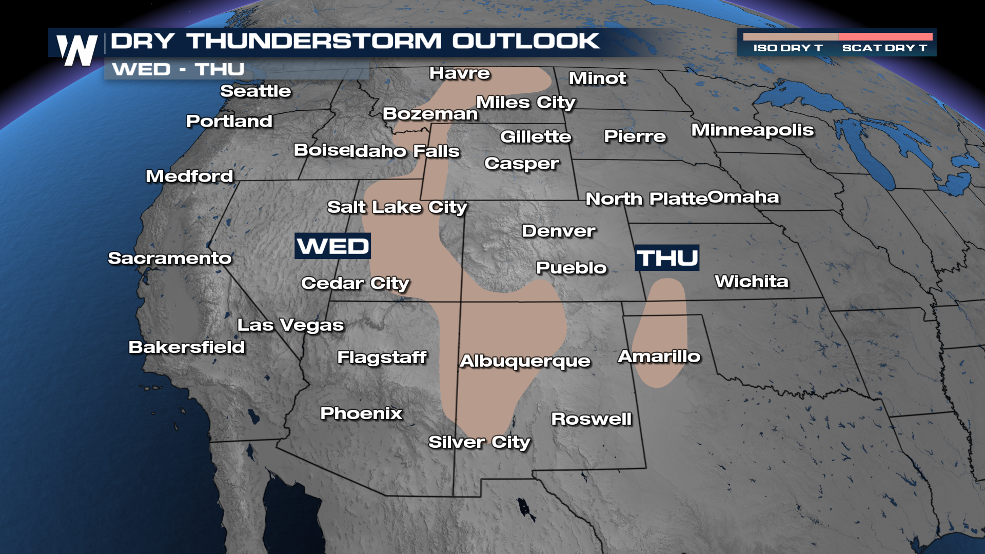
Rain is not much of a concern with this system. In fact, the lack of rain actually is a concern - some of these thunderstorms could be completely dry, meaning we get the harm of lightning and the winds without the help of rainfall.
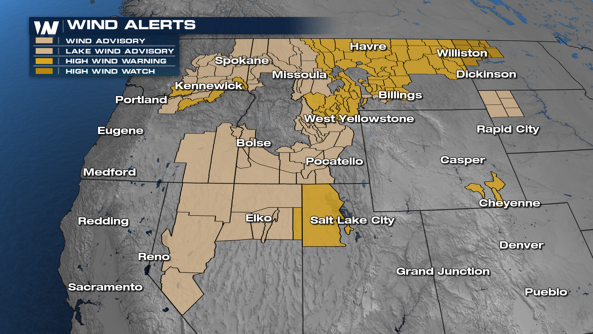
It will be windy regardless; High Wind Warnings cover areas that could see 65 mph winds, and areas that have a wind advisory could see gusts approaching 45-50 mph.