The Severe Storm Risk Continues Across the Southeast

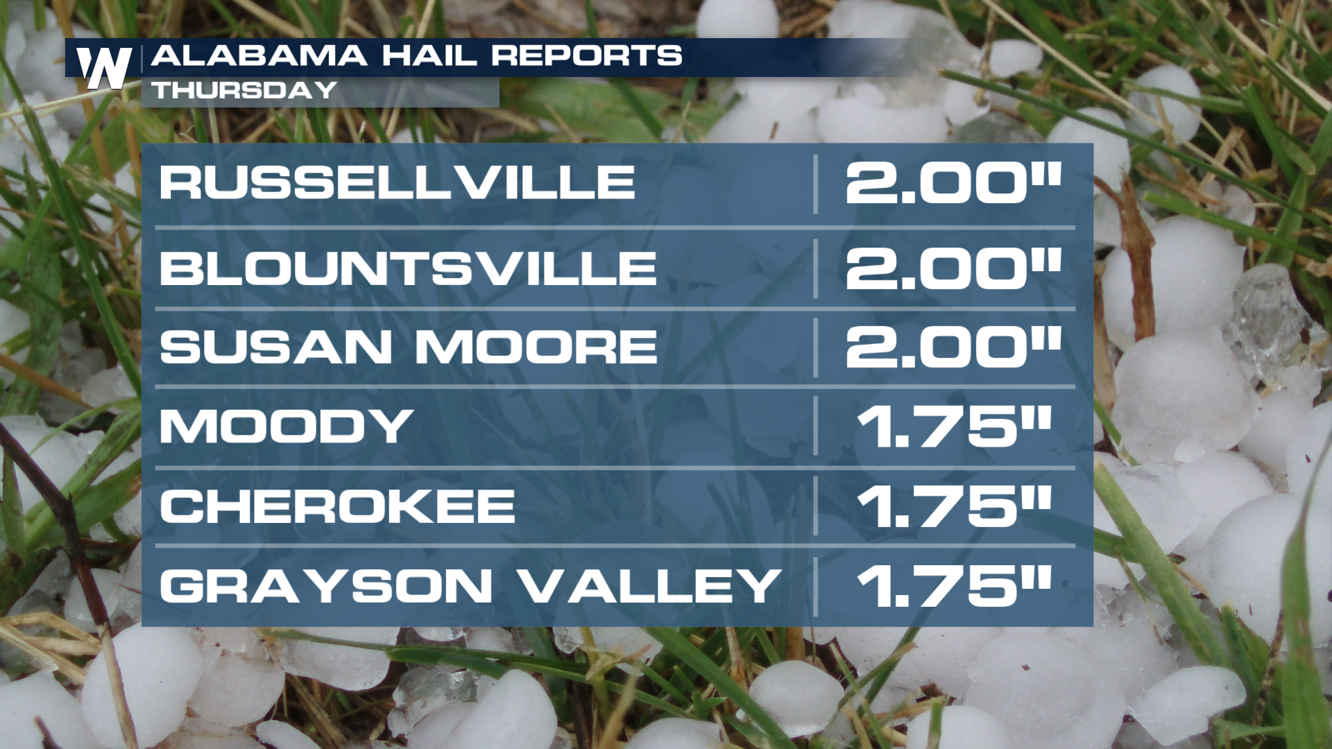
A busy day on Thursday resulted in several reports of large hail, gusty winds, and a possible tornado touchdown in Trussville, AL. Our Field Meteorologist Brett Adair was on the scene of wind and hail damage in Pinson, outside of Birmingham, AL. The same supercell produced an EF-0 tornado in Trussville, AL, with winds of 85mph.
Outside the Birmingham metro, thunderstorms produced large hail from south of Memphis, TN, out to North Georgia on Thursday afternoon and evening.
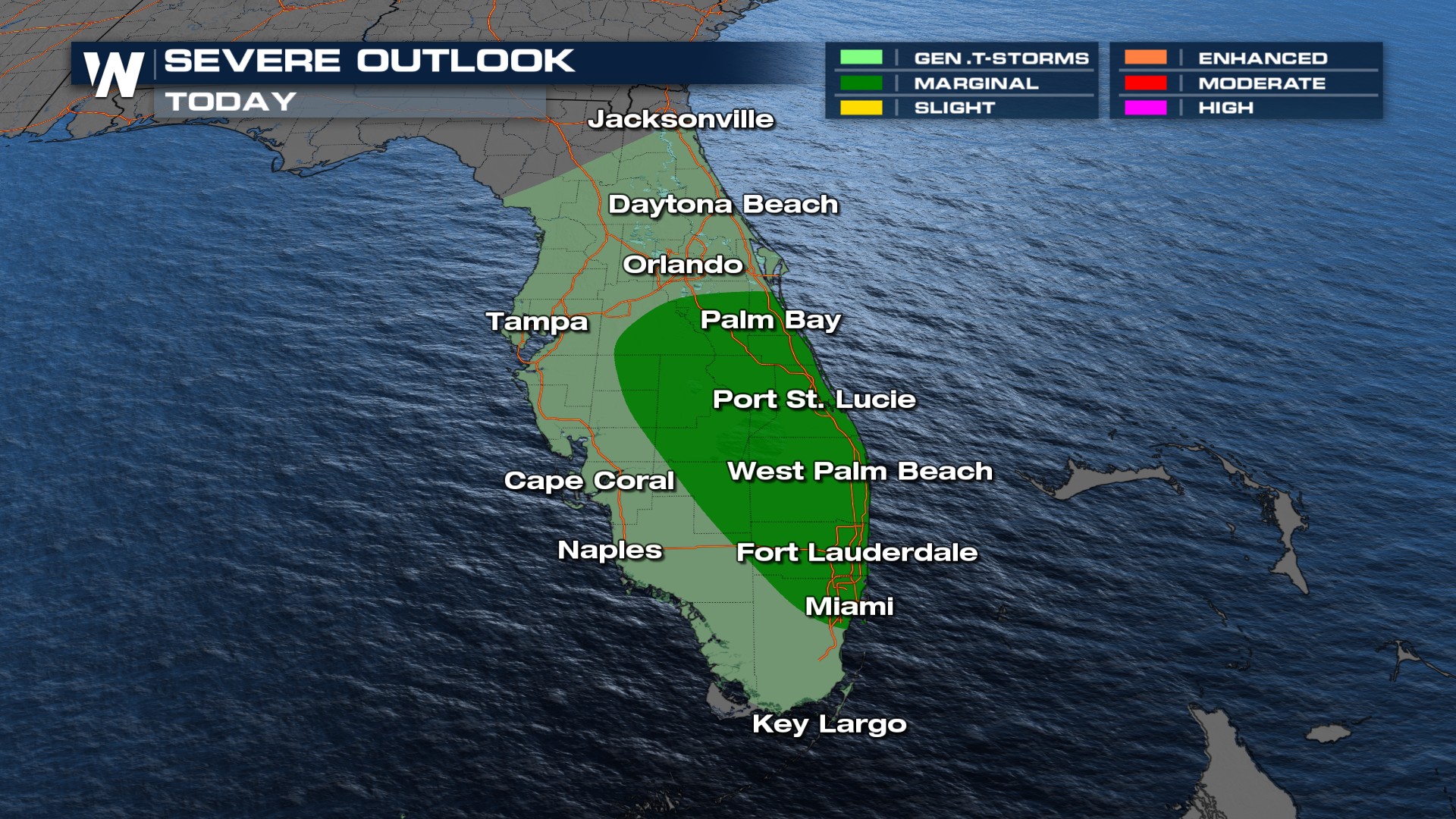
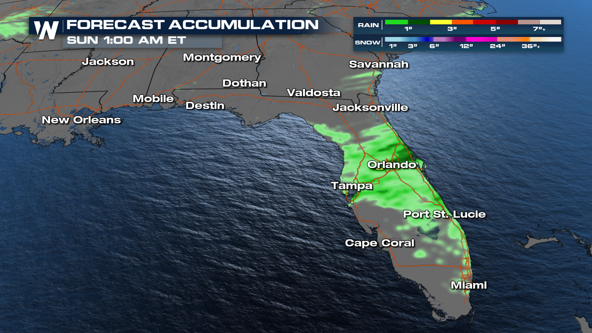
The stalled front will be the focus for showers and storms across Florida on Saturday. Some storms for Southeast Florida could get up to severe strength.
The Storm Prediction Center has upgraded some areas of Florida to a Marginal Risk of severe storms on Saturday. Locations include Palm Bay down to Miami along the Atlantic seaboard.