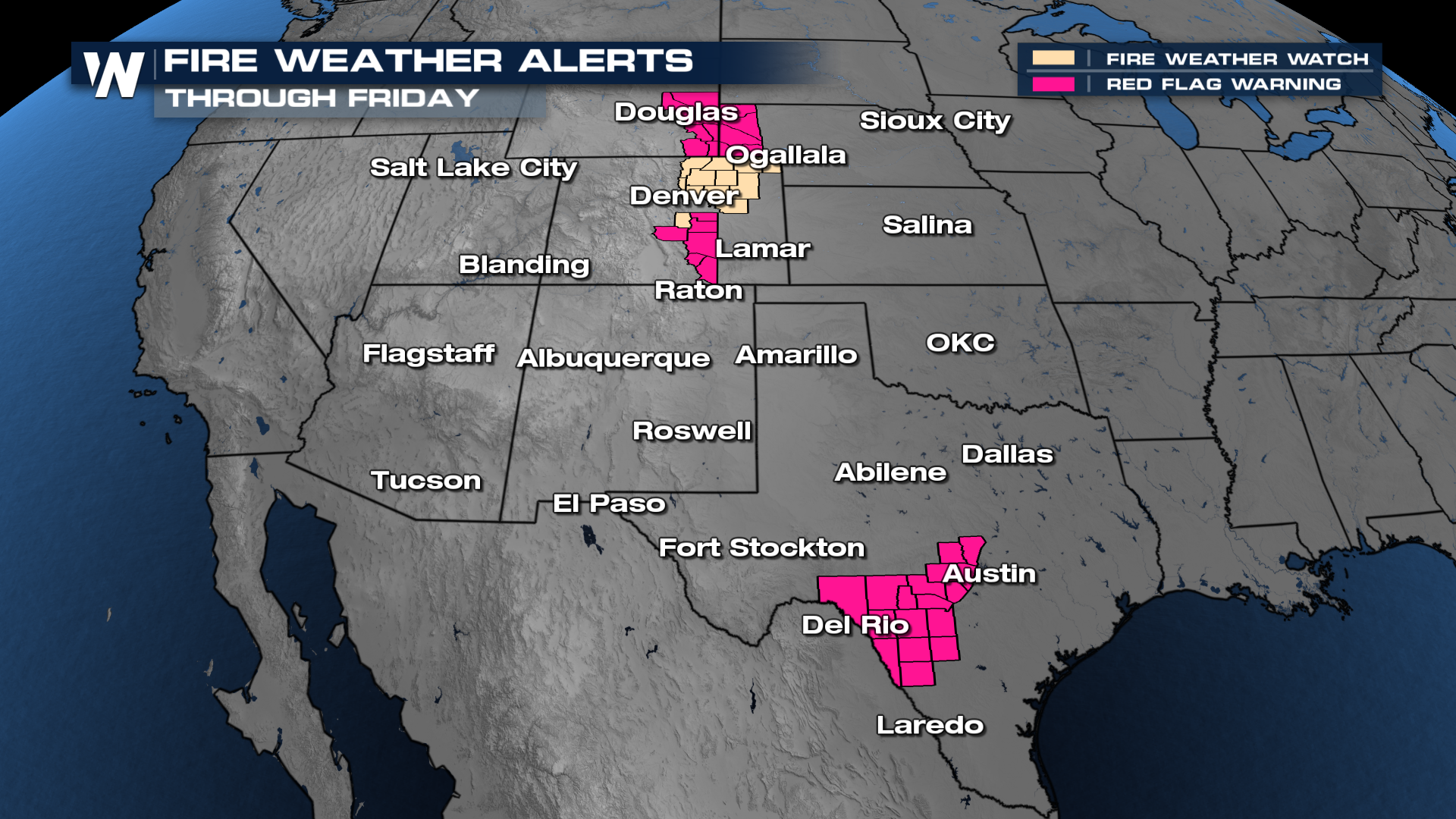
Elevated Fire Danger Across Southern Plains

Last week, multiple fires broke out across the central plains, burning over 325,000 acres. The Ranger Road Fire has been completely contained after torching over a quarter million acres. The fire threat is back, and an elevated fire weather outlook is in place across New Mexico and Texas. Dry conditions and gusty winds have led to dangerous fire conditions. Red flag warnings and fire weather watches remain in place through Friday. Fires that do develop can spread rapidly.
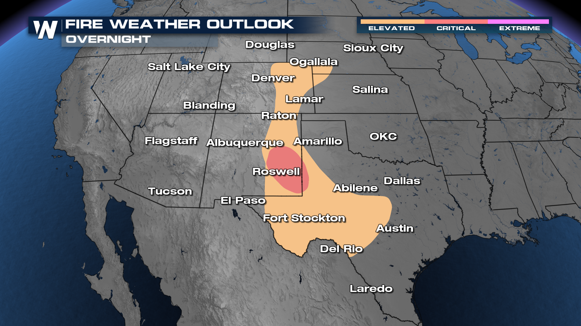
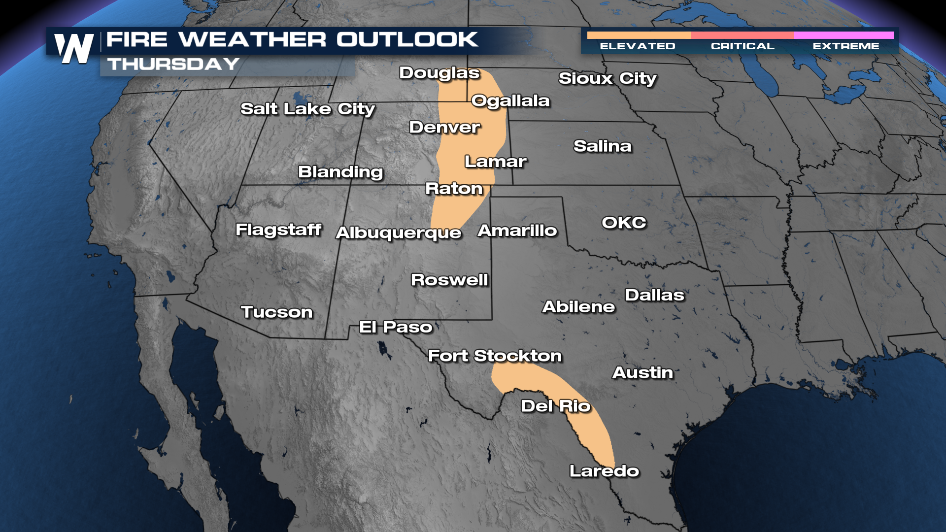
 Fire outlooks have been extended into Thursday, also at a critical risk, but not covering as much real estate. The same areas are likely to be impacted.
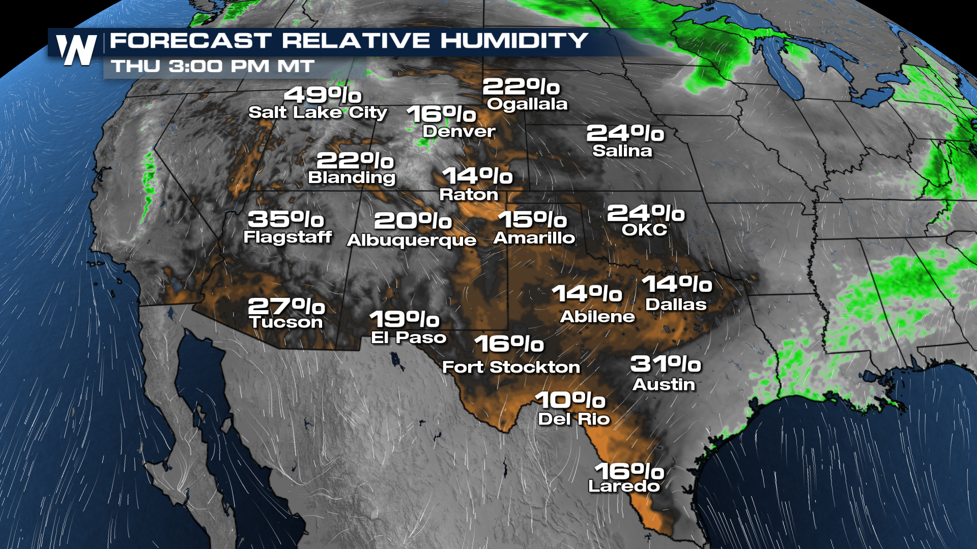
FORECAST MOISTURE:
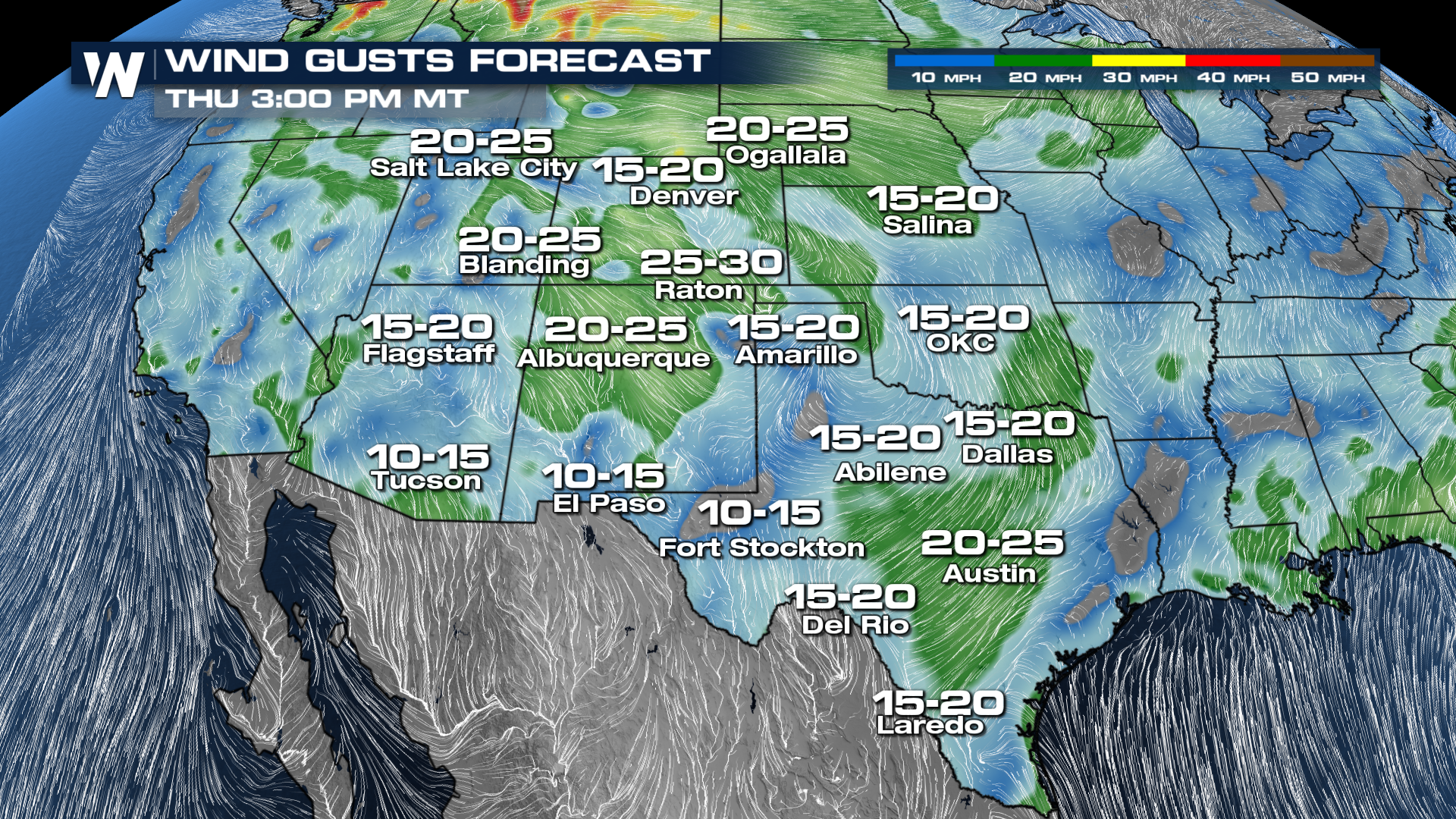
The combination of relative humidity in the teens and single digits, combined with gusty winds, will increase the fire threat. Please use caution if burning, as any fire that develops can spread rapidly.
FORECAST WIND GUSTS: