A Cold Start To The New Year For The Plains and Upper Midwest
Special Stories
1 Jan 2019 9:15 AM
WIND CHILL ALERTS
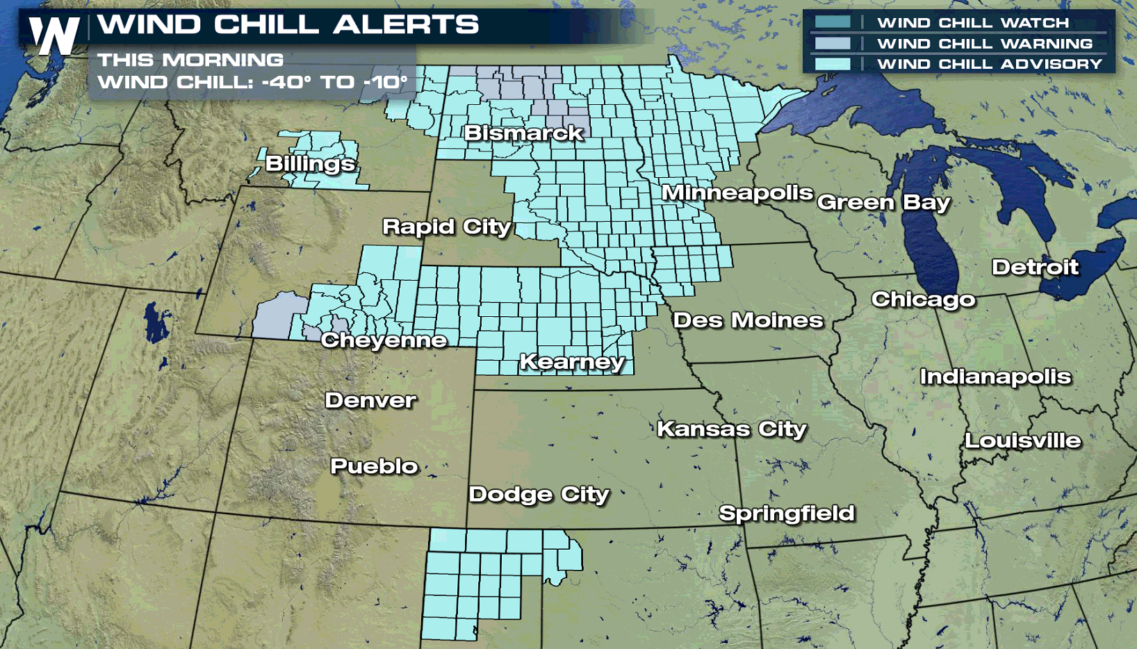 Wind chill alerts are in effect from the northern Plains to the South. Winds will be picking up over the next 36 hours, bringing bone chilling temperatures to the area.
TEMPERATURE FORECAST
Wind chill alerts are in effect from the northern Plains to the South. Winds will be picking up over the next 36 hours, bringing bone chilling temperatures to the area.
TEMPERATURE FORECAST
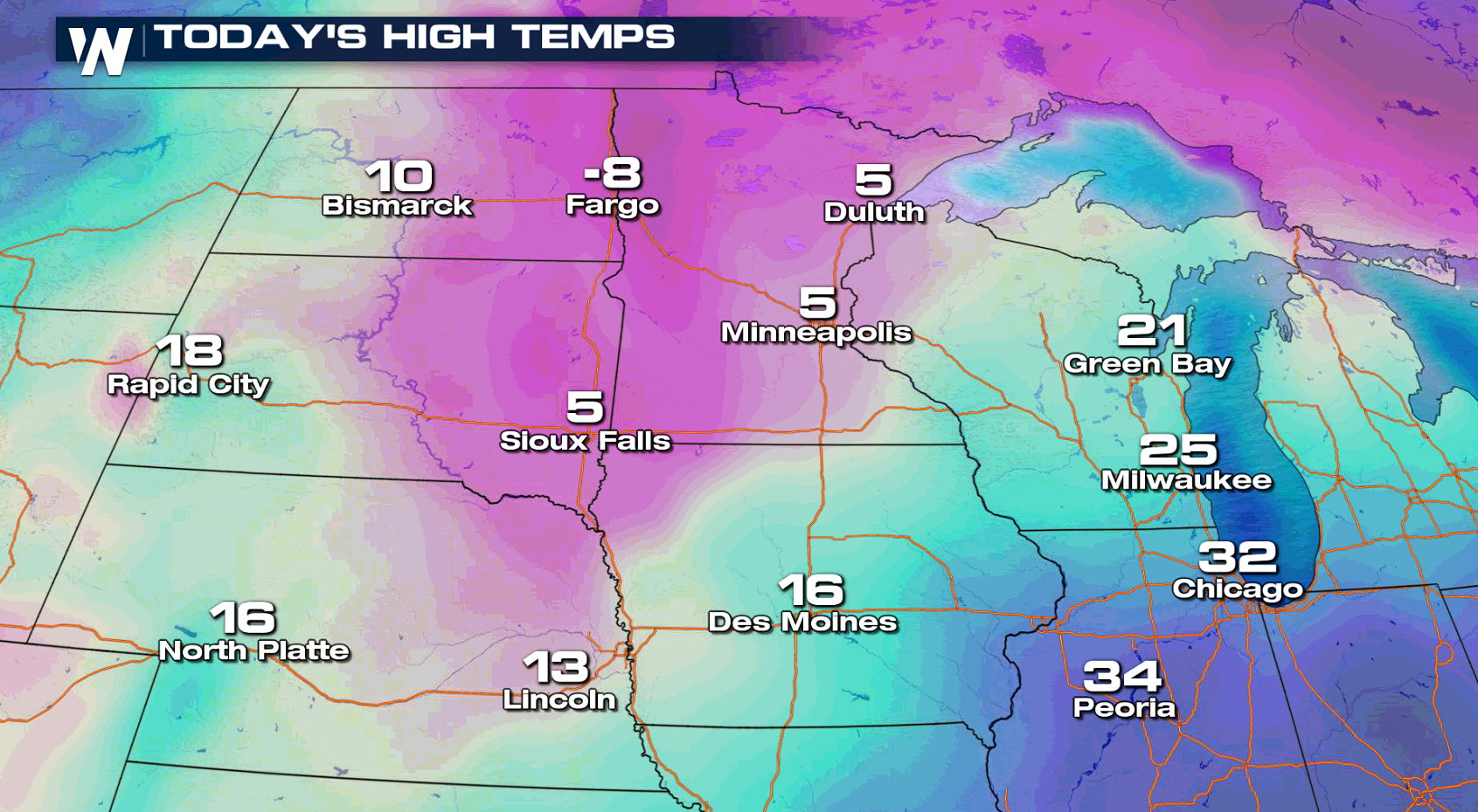
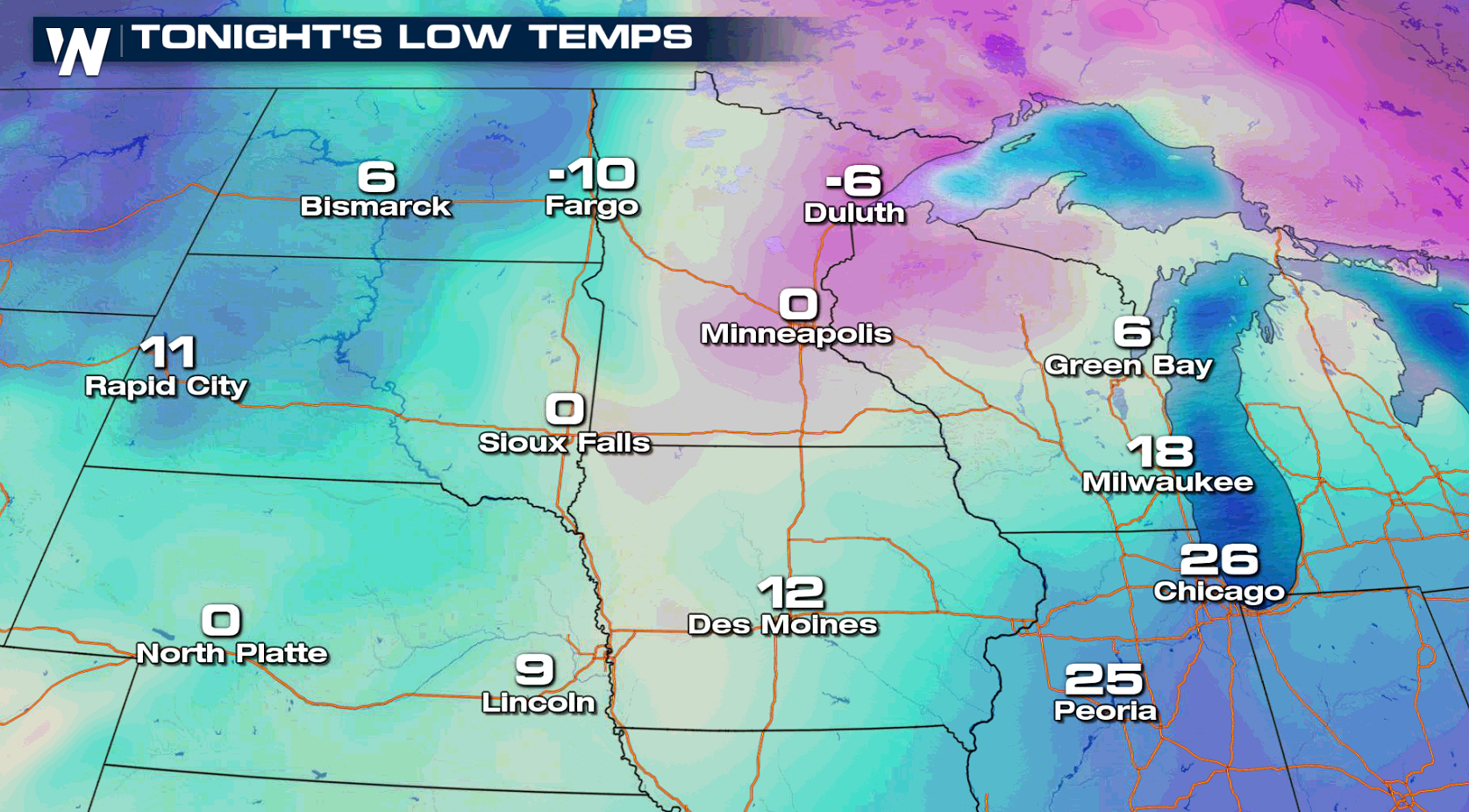
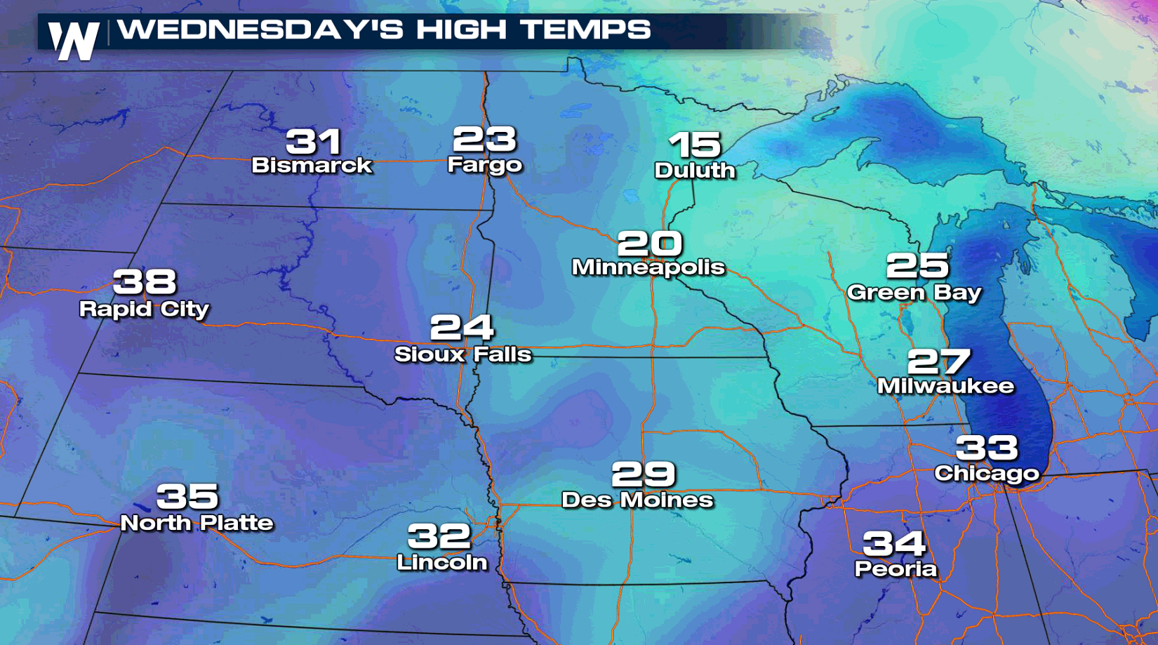 Most high temperatures will be struggling to move above zero in the Upper Midwest. Lows won't be as cold as Tuesday morning, but single digit readings are likely.
WIND CHILL FORECAST
Most high temperatures will be struggling to move above zero in the Upper Midwest. Lows won't be as cold as Tuesday morning, but single digit readings are likely.
WIND CHILL FORECAST
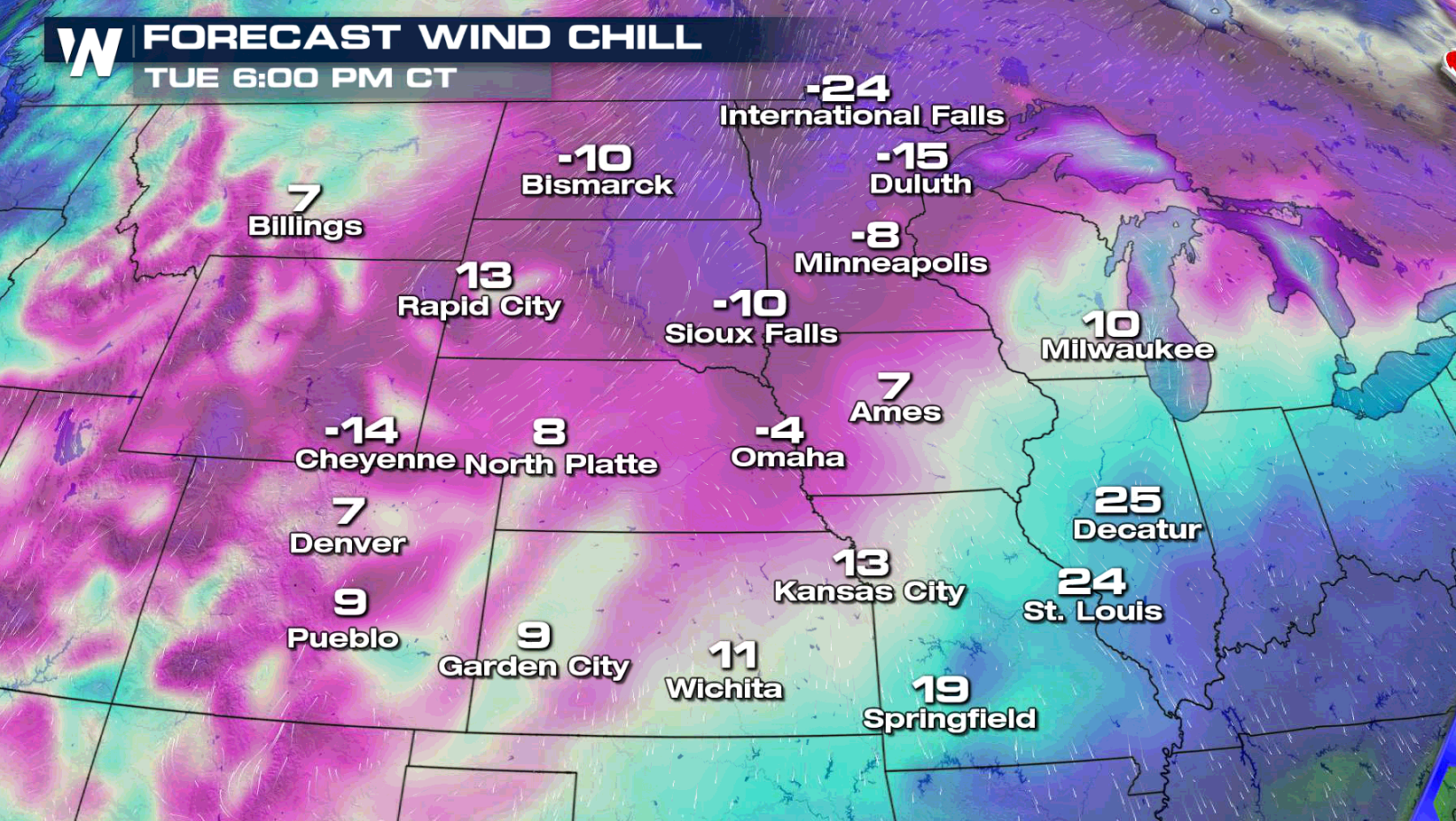
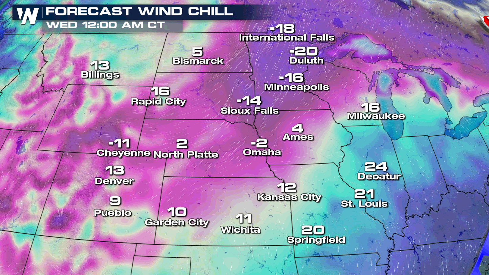
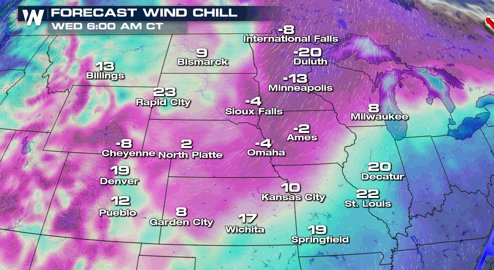 As winds pick up, temperatures will seem much colder than the actual temperature outside. Anywhere from -10 to -20 degree wind chill might be seen as we head into Wednesday. With the wind chill temperatures so low, frostbite could happen. Remember to bundle up and stay safe. With these temperatures, frostbite could occur in less than 30 minutes!
Wind chill alerts are in effect from the northern Plains to the South. Winds will be picking up over the next 36 hours, bringing bone chilling temperatures to the area.
TEMPERATURE FORECAST
Most high temperatures will be struggling to move above zero in the Upper Midwest. Lows won't be as cold as Tuesday morning, but single digit readings are likely.
WIND CHILL FORECAST
As winds pick up, temperatures will seem much colder than the actual temperature outside. Anywhere from -10 to -20 degree wind chill might be seen as we head into Wednesday. With the wind chill temperatures so low, frostbite could happen. Remember to bundle up and stay safe. With these temperatures, frostbite could occur in less than 30 minutes!All Weather News
More
Warmer Than Average: Above-Normal Temperatures Across the Central U.S. This Week
WHAT TO EXPECTA ridge of high pressure linger
24 Oct 2026 12:35 AM

SW Low Moves East, Brings Flood Threat to the Plains
A powerful low pressure system has been movin
23 Oct 2026 8:40 PM

Hurricane Vance Strengthens In The Pacific
After becoming a hurricane Friday, Vance quic
23 Oct 2026 8:30 PM


Several Fires Break Out in SoCal Last Week Amid Santa Ana Wind Event
Santa Ana winds helped several fires grow qui
19 Oct 2026 1:25 PM

Another Cold Morning Before Things Warm Back Up
Across portions of the Ohio Valley through th
19 Oct 2026 10:15 AM

Severe Risk Diminishing Saturday Morning for the Northeast
Severe Storm PotentialSevere risk is decreasi
16 Oct 2026 10:20 AM