A Look at USCRN Weather Observing Stations
Special Stories
28 Aug 2018 11:00 AM
From NOAA
 NCEI monitors the performance of the entire network on a daily basis and partners with the NOAA Atmospheric Turbulence and Diffusion Division in Oak Ridge, Tennessee to address any technical problems as quickly as possible.
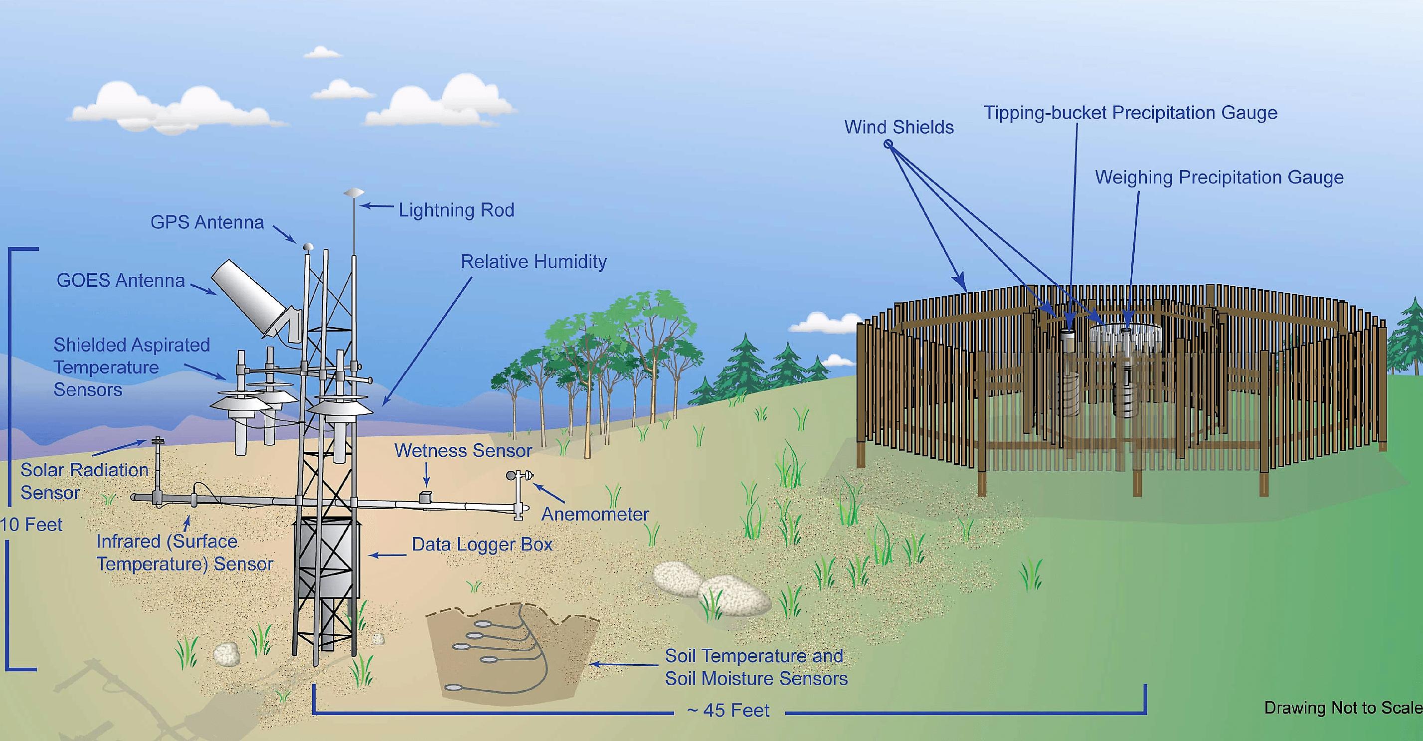
The USCRN instrument suite measures air temperature, precipitation, soil moisture and temperature, solar radiation, wind speed, surface temperature, and relative humidity in open, pristine environments around the country that are most likely to have stable land cover and usage conditions for years to come like National Parks and Wildlife Refuges. A few of the sensors at each site that take these observations include:
NCEI monitors the performance of the entire network on a daily basis and partners with the NOAA Atmospheric Turbulence and Diffusion Division in Oak Ridge, Tennessee to address any technical problems as quickly as possible.
The USCRN instrument suite measures air temperature, precipitation, soil moisture and temperature, solar radiation, wind speed, surface temperature, and relative humidity in open, pristine environments around the country that are most likely to have stable land cover and usage conditions for years to come like National Parks and Wildlife Refuges. A few of the sensors at each site that take these observations include:
 Most of these sensors are placed on a 10-foot tall instrument tower on arms at 4.5 feet above the ground. Some locations, like those that experience high snowfall and snow depth, are given special consideration when placing the instruments to account for those conditions. Air temperature, precipitation, and soil moisture and temperature are all primary variables measured using triple redundancy. In other words, three separate sensors measure each of these variables to ensure an accurate and consistent observation. If one sensor fails, there are still two others to back it up without missing a beat until it can be repaired.
The data logger is also attached to the tower, and it electronically stores five-minute and hourly observations. A geostationary satellite transmitter then sends the data to NCEI hourly, where they undergo a quality-control check and are placed online. The entire site design allows for future additions of new sensors on the tower without disrupting the physical site, ensuring the creation of an impeccable record of climate conditions in the United States far into the future.
Edited for WeatherNation by Meteorologist Mace Michaels
Most of these sensors are placed on a 10-foot tall instrument tower on arms at 4.5 feet above the ground. Some locations, like those that experience high snowfall and snow depth, are given special consideration when placing the instruments to account for those conditions. Air temperature, precipitation, and soil moisture and temperature are all primary variables measured using triple redundancy. In other words, three separate sensors measure each of these variables to ensure an accurate and consistent observation. If one sensor fails, there are still two others to back it up without missing a beat until it can be repaired.
The data logger is also attached to the tower, and it electronically stores five-minute and hourly observations. A geostationary satellite transmitter then sends the data to NCEI hourly, where they undergo a quality-control check and are placed online. The entire site design allows for future additions of new sensors on the tower without disrupting the physical site, ensuring the creation of an impeccable record of climate conditions in the United States far into the future.
Edited for WeatherNation by Meteorologist Mace Michaels
First implemented in 2002, the U.S. Climate Reference Network, or USCRN, is a sophisticated climate-observing network of 114 stations across the Lower 48, which NOAA's National Center for Environmental Information (NCEI) specifically designed and deployed for quantifying weather conditions and changes on a national scale. The USCRN is still expanding in Alaska with 20 out of 29 planned stations already in place. Two stations on the Big Island of Hawaii are also part of the network. But what exactly is a USCRN station and what does one entail?
Every USCRN observing site is equipped with a standard set of sensors as well as a data logger, a satellite communications transmitter, and appropriate shielding and power infrastructure for making reliable observations. When each site is deployed, all of the sensors are calibrated and put on a maintenance plan that includes routine replacement of aging sensors and annual maintenance visits.
NCEI monitors the performance of the entire network on a daily basis and partners with the NOAA Atmospheric Turbulence and Diffusion Division in Oak Ridge, Tennessee to address any technical problems as quickly as possible.
The USCRN instrument suite measures air temperature, precipitation, soil moisture and temperature, solar radiation, wind speed, surface temperature, and relative humidity in open, pristine environments around the country that are most likely to have stable land cover and usage conditions for years to come like National Parks and Wildlife Refuges. A few of the sensors at each site that take these observations include:
- Platinum resistance thermometers to measure air temperature within fan-aspirated shields that keep out the sun and draw in the air
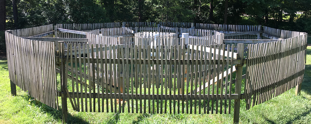
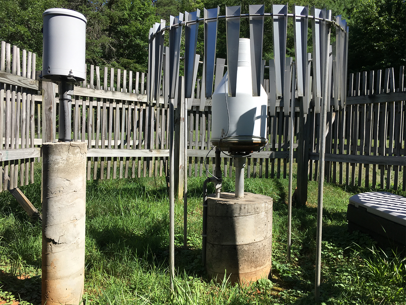
- An all-weather weighing precipitation gauge with three devices weighing the collection bucket simultaneously (right); a backup tipping bucket gauge also measures precipitation for additional redundancy (left)
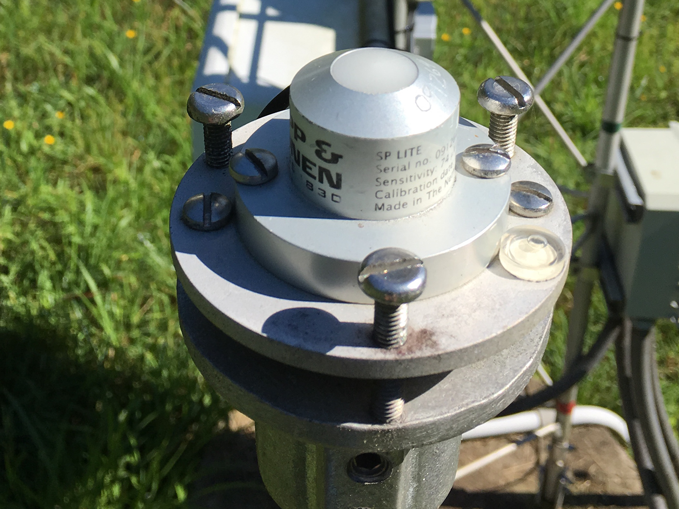
- A pyranometer to measure incoming solar radiation
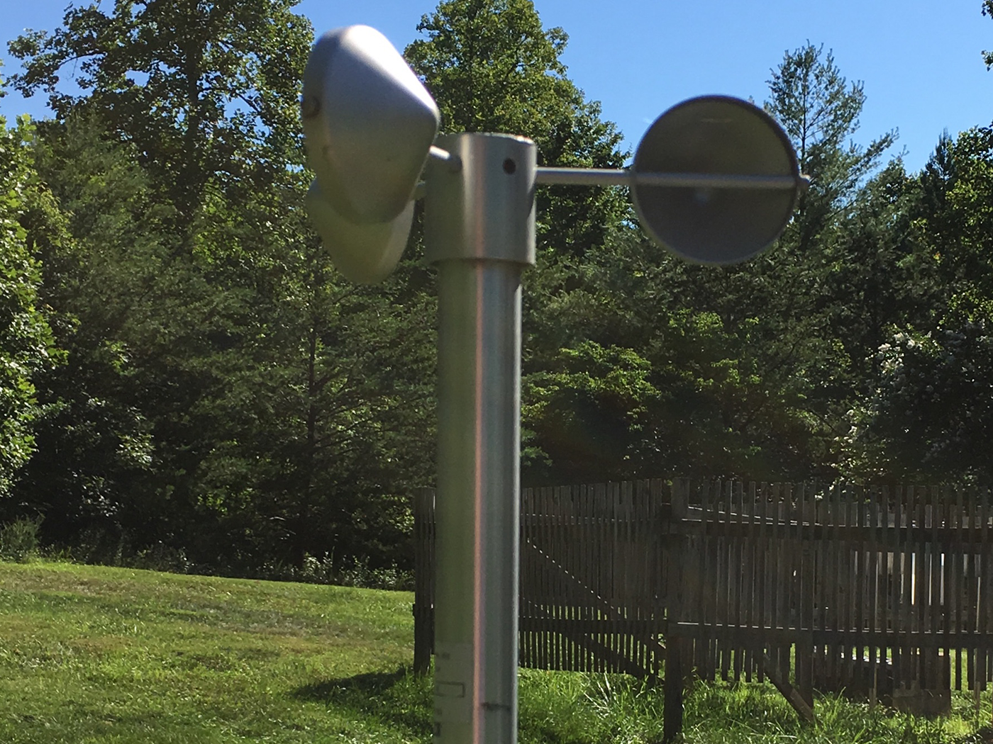
- A three-cup anemometer to measure wind speed at the station height of 1.5 meters or nearly 5 feet
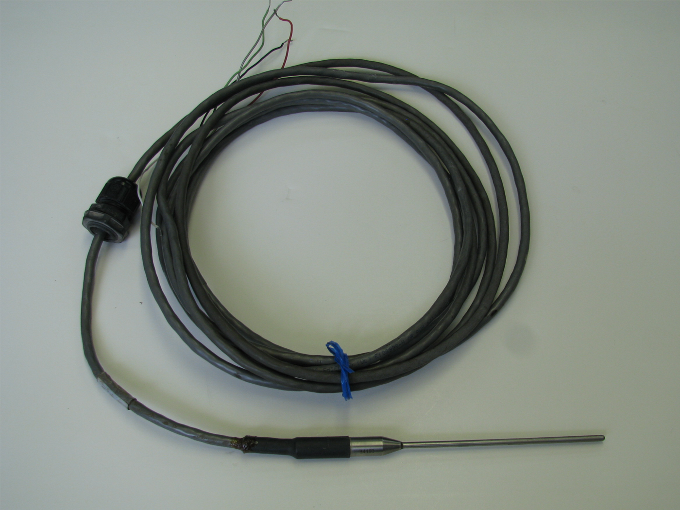
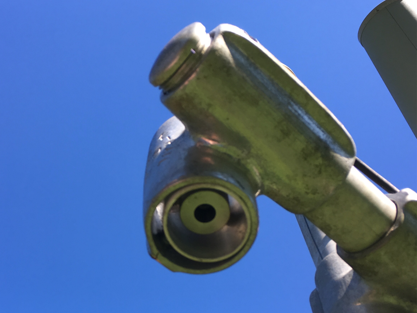
- A precision infrared temperature sensor to measure ground surface temperature
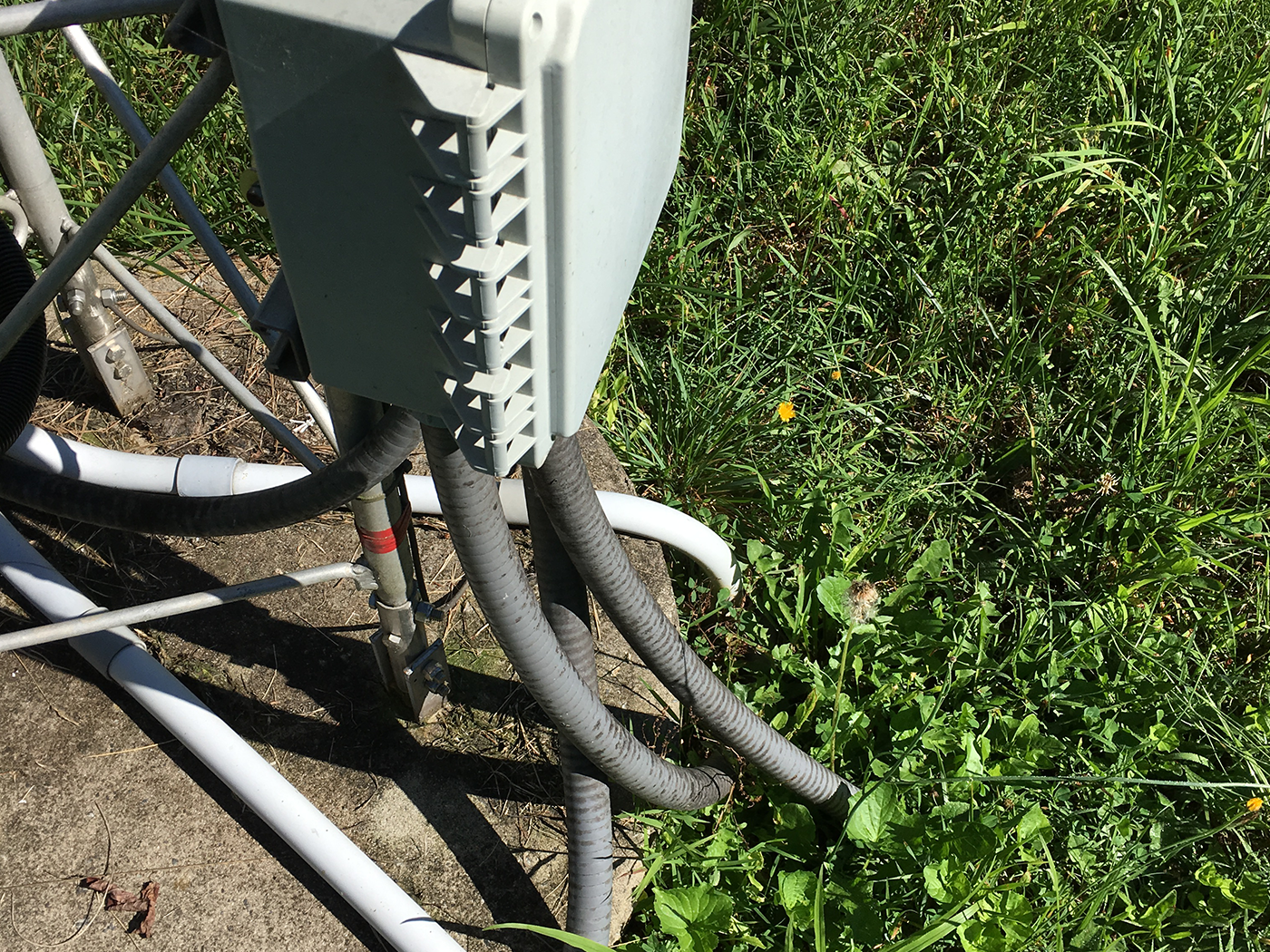
- Sensors to measure soil temperature and soil moisture at various depths (gray conduits lead to three sets of soil probes at each station)
Most of these sensors are placed on a 10-foot tall instrument tower on arms at 4.5 feet above the ground. Some locations, like those that experience high snowfall and snow depth, are given special consideration when placing the instruments to account for those conditions. Air temperature, precipitation, and soil moisture and temperature are all primary variables measured using triple redundancy. In other words, three separate sensors measure each of these variables to ensure an accurate and consistent observation. If one sensor fails, there are still two others to back it up without missing a beat until it can be repaired.
The data logger is also attached to the tower, and it electronically stores five-minute and hourly observations. A geostationary satellite transmitter then sends the data to NCEI hourly, where they undergo a quality-control check and are placed online. The entire site design allows for future additions of new sensors on the tower without disrupting the physical site, ensuring the creation of an impeccable record of climate conditions in the United States far into the future.
Edited for WeatherNation by Meteorologist Mace MichaelsAll Weather News
More
Fronts Continue To Spark Severe Weather Across the Plains
A cold front that brought record lows to the
18 Jul 2025 10:40 PM

Extreme Heat Impacts for the East Coast & South
Extreme heat continues to impact several area
18 Jul 2025 10:05 PM

Flooding Threat Remains Elevated in the East
A cold front pushing through the Eastern Seab
18 Jul 2025 9:10 PM

EF-2 Firenado from the Deer Creek Fire in Utah
A fire tornado was spotted near La Sal, Utah
18 Jul 2025 7:30 AM

Tropical System Brings Flood Risk to the Central Gulf
Time has run out for notable tropical develop
18 Jul 2025 3:05 AM

Heavy Rain, Flooding Threat Returns to Florida
Keep the rain boots handy in Florida - heavy
13 Jul 2025 12:50 PM

Severe Storm Risk Pushes into the Great Lakes, Ohio Valley
Friday was another busy day with severe weath
12 Jul 2025 8:00 PM