A Stormy Monday for Southeast Louisiana

Special Stories
4 Feb 2019 3:10 AM
Warm and humid conditions along the Gulf Coast will allow the chance for shower and thunderstorms across Southeast Louisiana today and tonight. The severe risk is low, but some strong storms can't be ruled out. Here is the very latest.
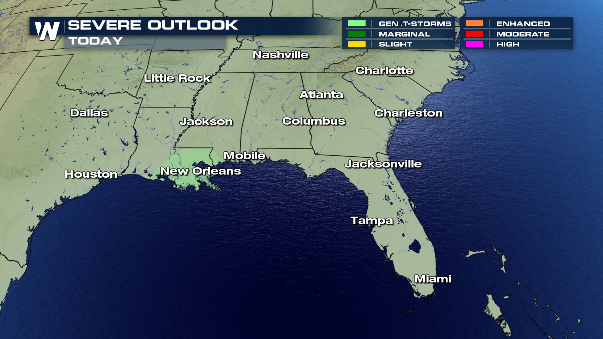 General storms are in the forecast today, meaning any storm that develops will be below severe limits. That doesn't mean we can't see a strong storm with gusty winds and small hail.
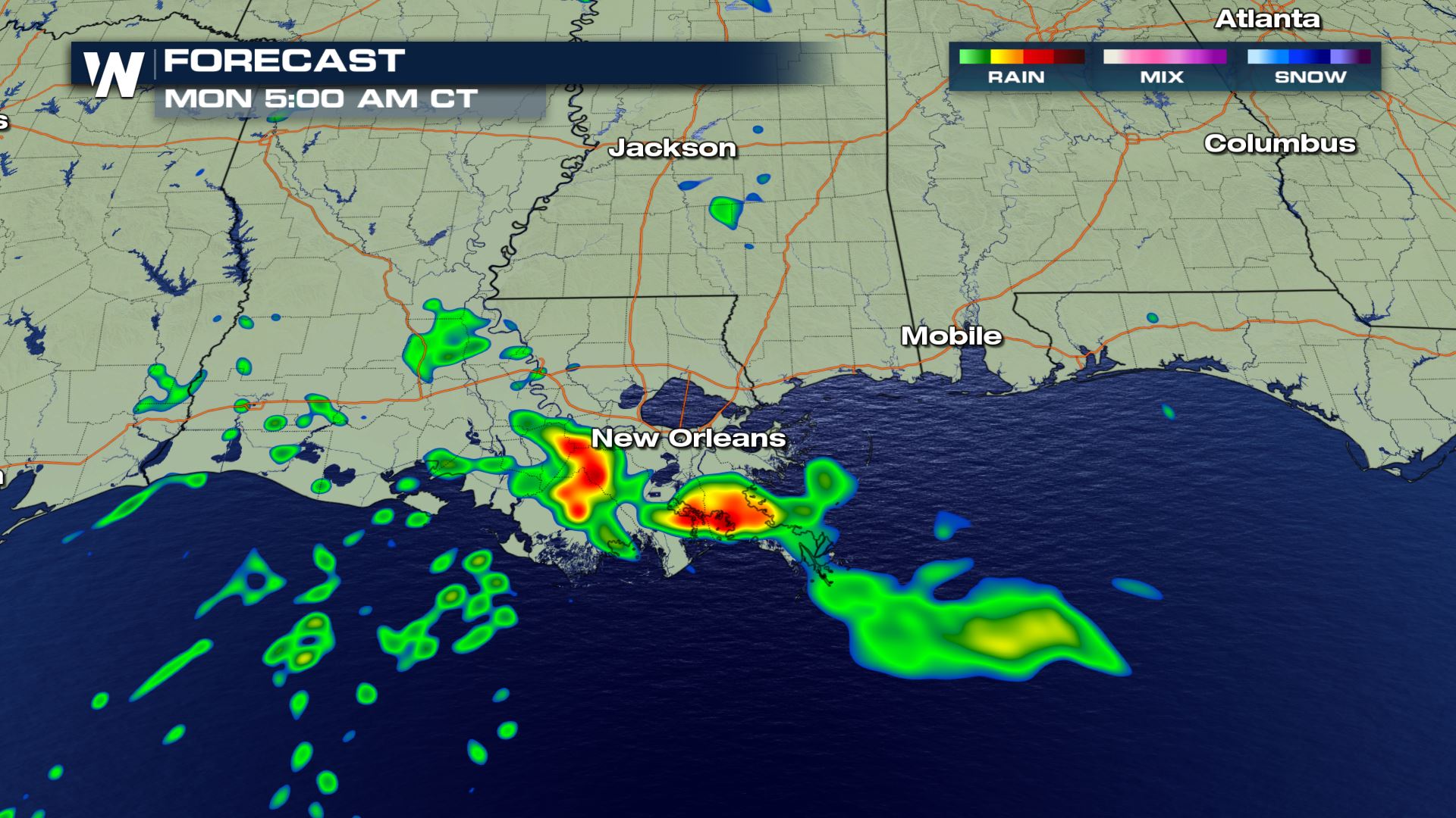
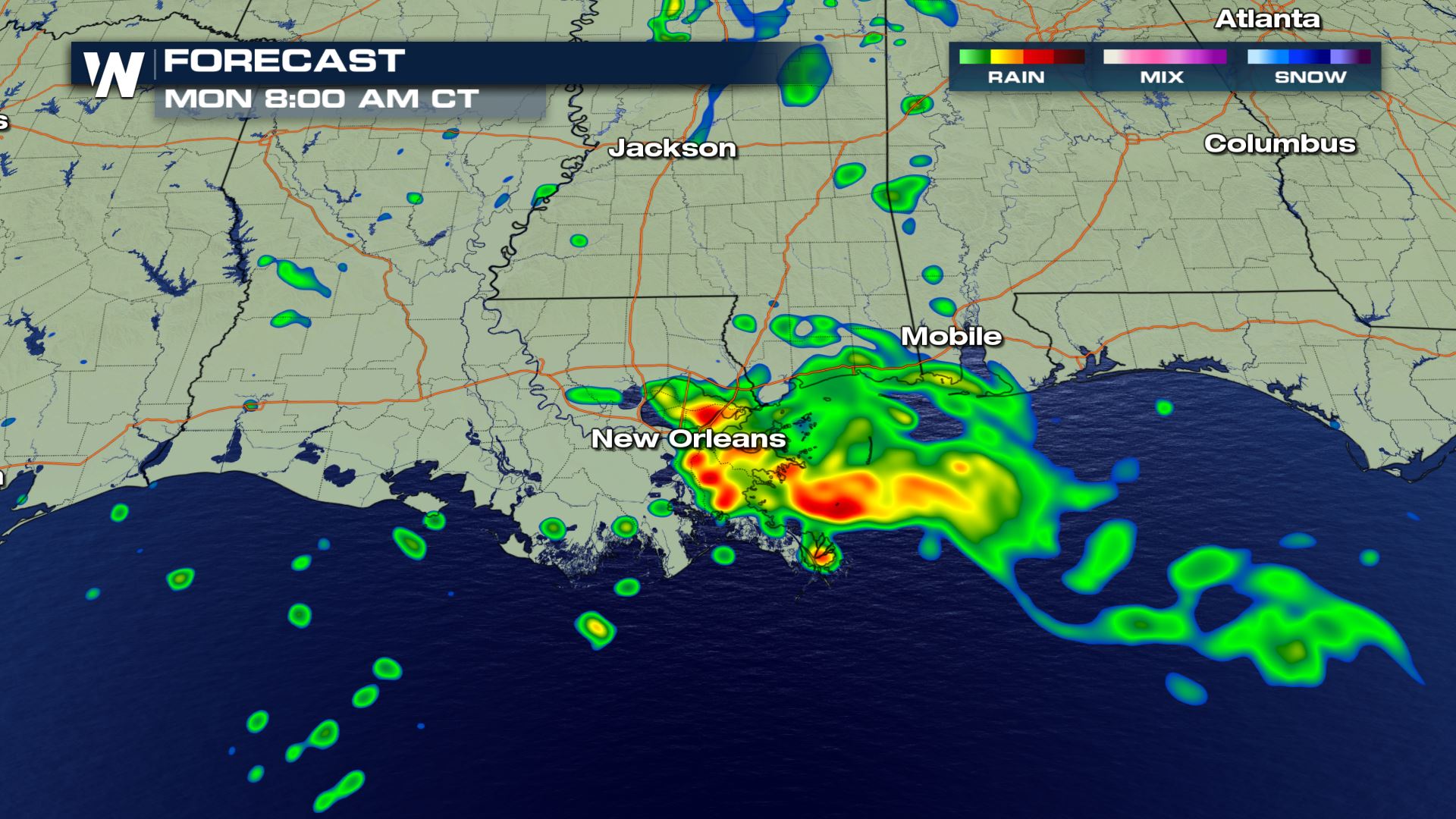
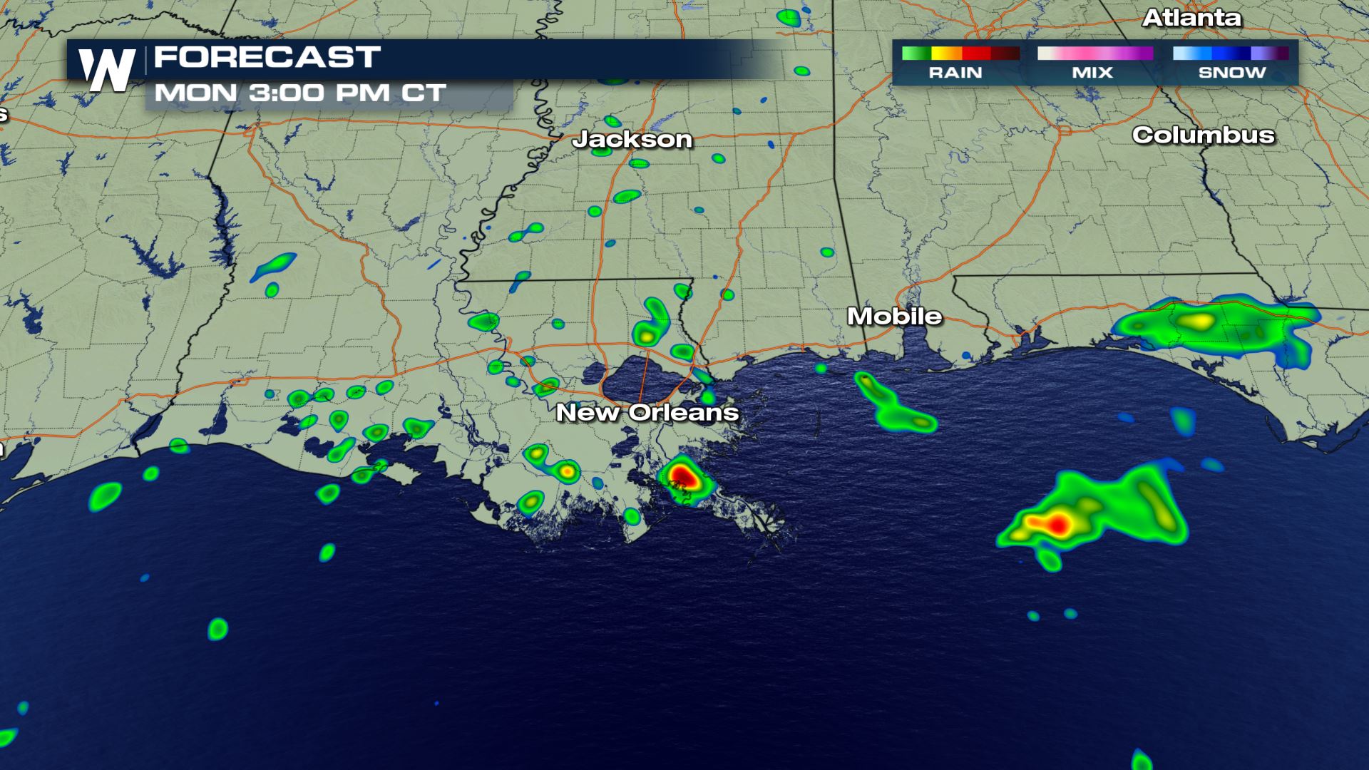
 The latest forecast is showing morning showers and storms with a change to isolated storms through the afternoon and evening. Some of these storms could be strong so you will want to be on alert if you are in these areas. The isolated afternoon and evening storms are the ones we will need to keep an eye on to see if they turn severe.
Keep checking with WeatherNation for more updates through the day.
The latest forecast is showing morning showers and storms with a change to isolated storms through the afternoon and evening. Some of these storms could be strong so you will want to be on alert if you are in these areas. The isolated afternoon and evening storms are the ones we will need to keep an eye on to see if they turn severe.
Keep checking with WeatherNation for more updates through the day.
Severe Outlook
General storms are in the forecast today, meaning any storm that develops will be below severe limits. That doesn't mean we can't see a strong storm with gusty winds and small hail.
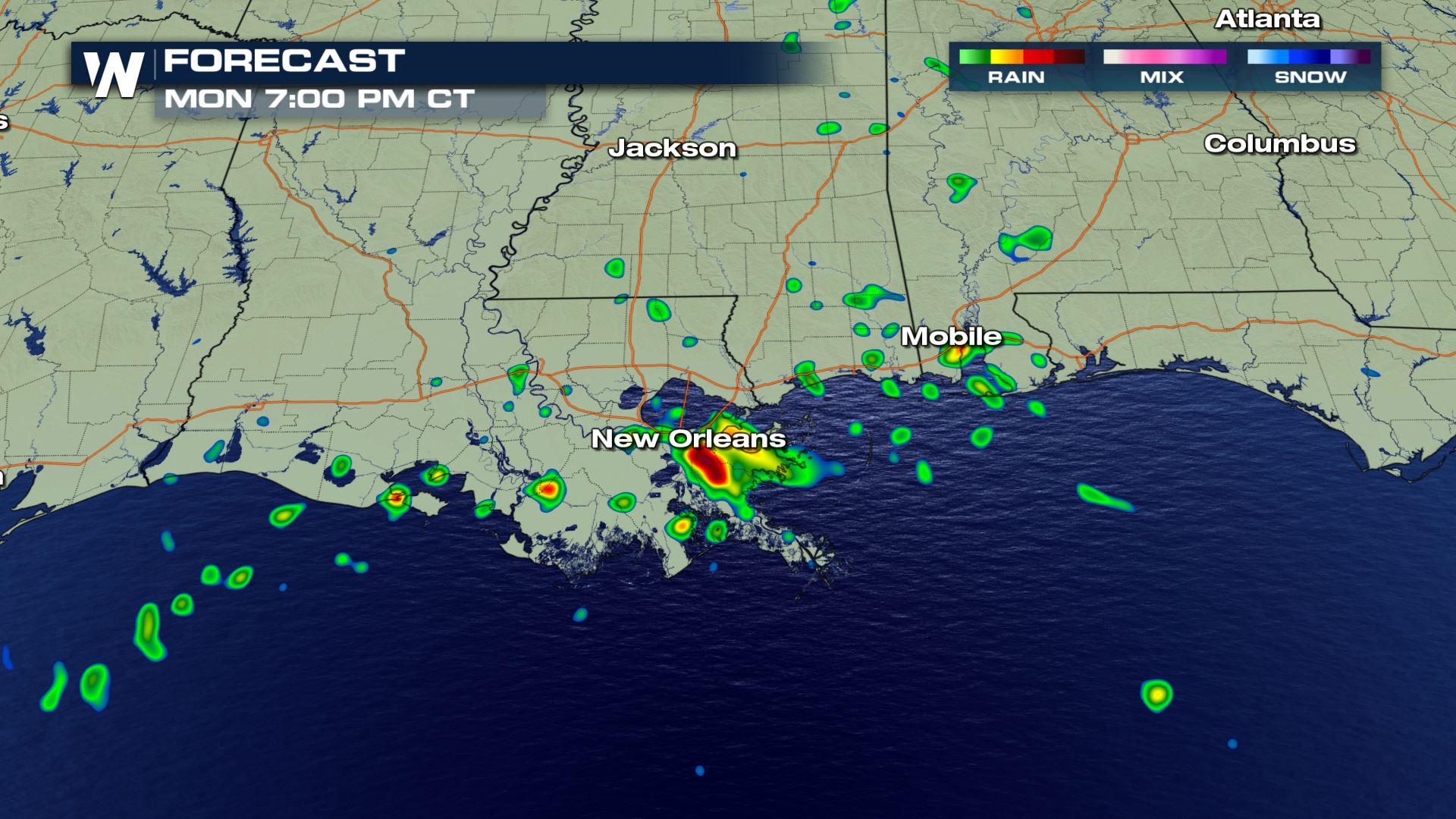
Forecast
The latest forecast is showing morning showers and storms with a change to isolated storms through the afternoon and evening. Some of these storms could be strong so you will want to be on alert if you are in these areas. The isolated afternoon and evening storms are the ones we will need to keep an eye on to see if they turn severe.
Keep checking with WeatherNation for more updates through the day.All Weather News
More

Severe Storms Target the Midwest to the Northeast This Week
Extreme heat will be a big story this week ac
26 Jul 2026 9:50 PM


Tropics: Fausto Heads to Hawaii; Genevieve Rapidly Intensifying
Atlantic BasinBertha has dissipated after mov
26 Jul 2026 8:45 PM

Southeast Flood Risk Lingers Near Stalled Front
A stalled boundary over the Southeast will ke
25 Jul 2026 10:55 AM

Another Round of Storms Targets the Northeast
Tuesday brought severe weather again across p
23 Jul 2026 1:15 AM

Another Round of Severe Weather for the Upper Midwest and Great Lakes
The upper-level low train continues to keep t
21 Jul 2026 1:45 AM