Accumulating Snow This Weekend From the High Plains to Great Lakes
Special Stories
2 Feb 2018 3:35 PM
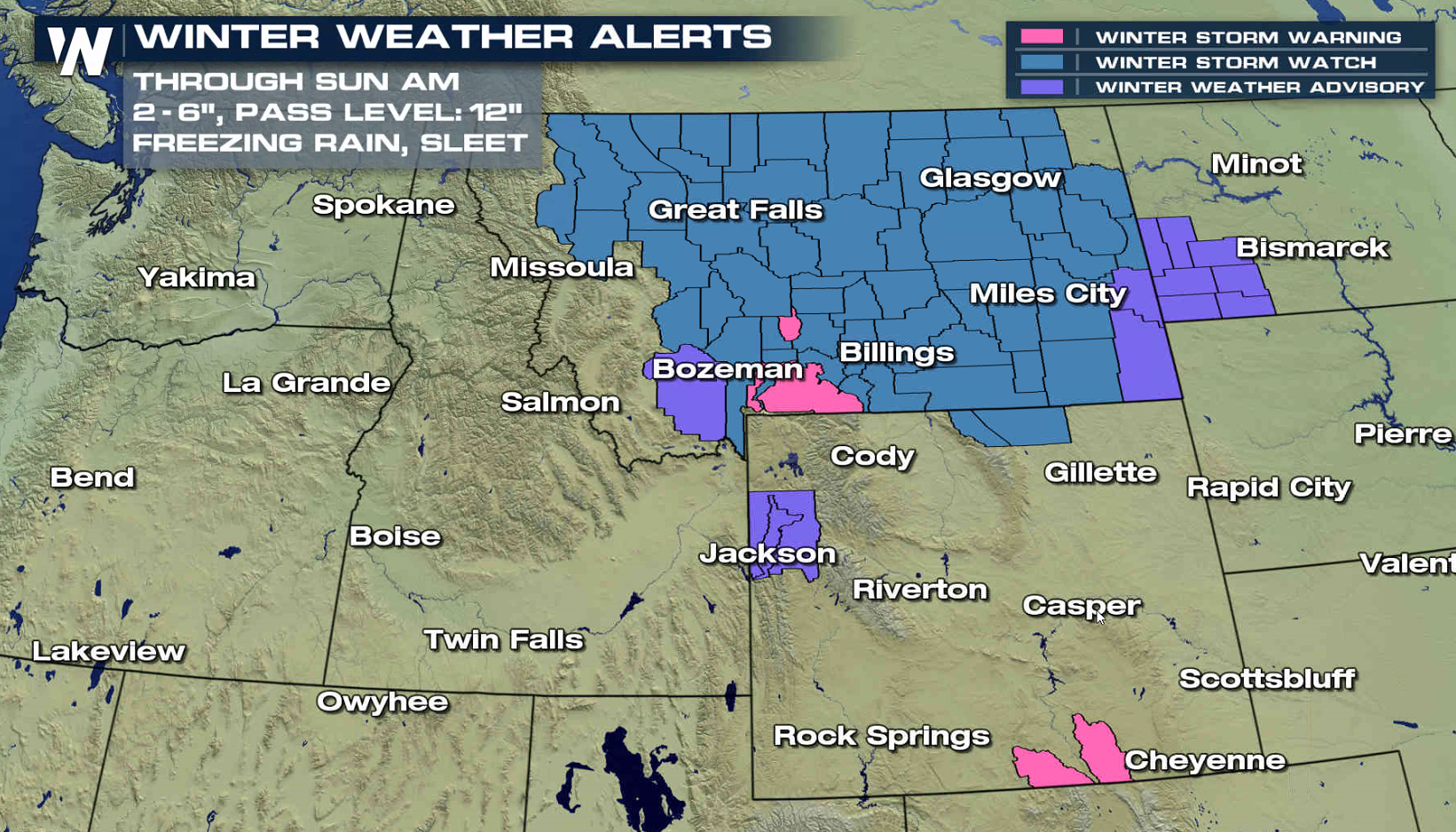
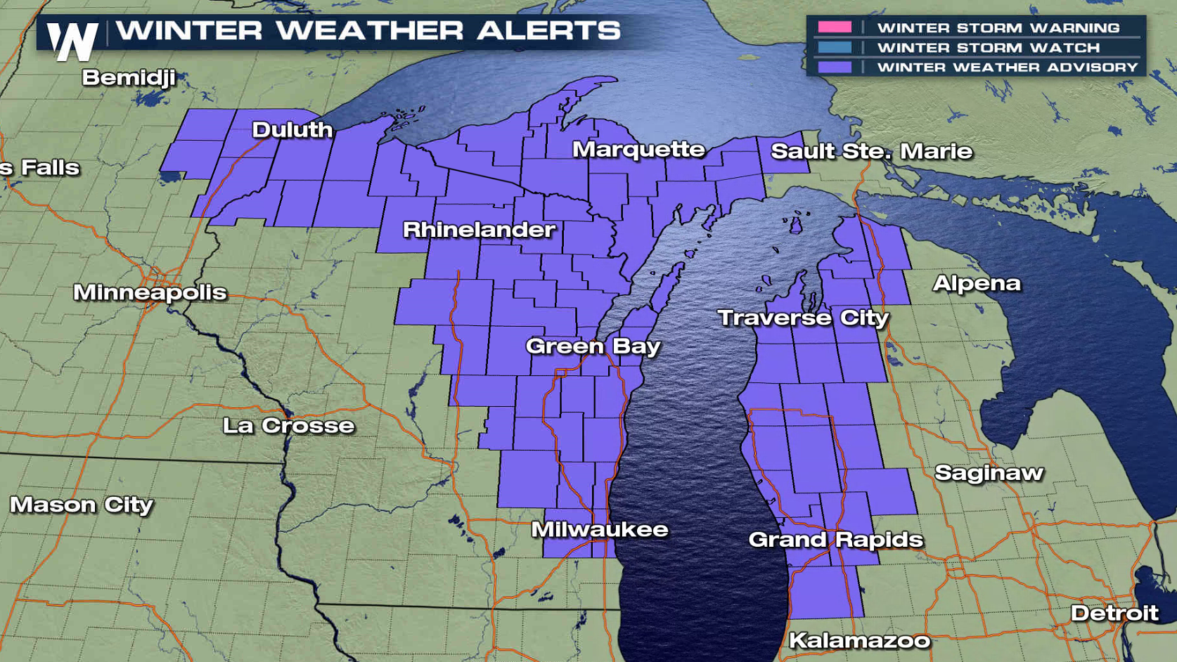
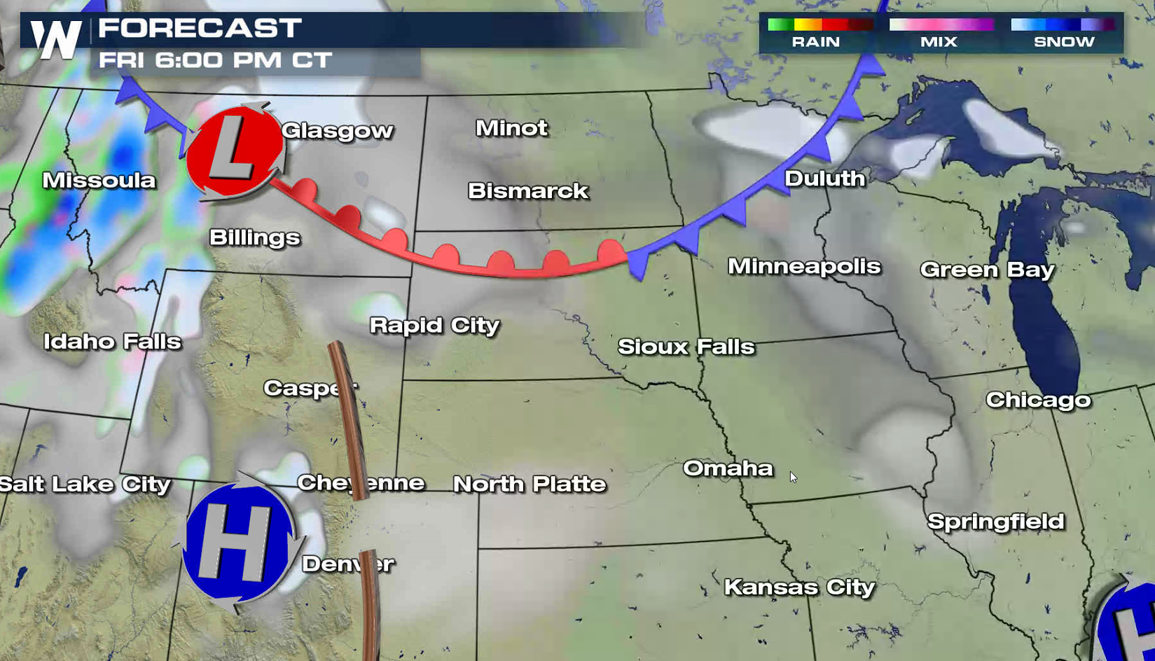
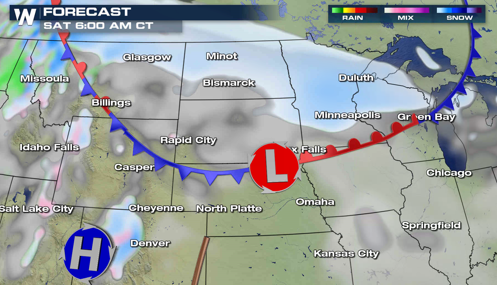
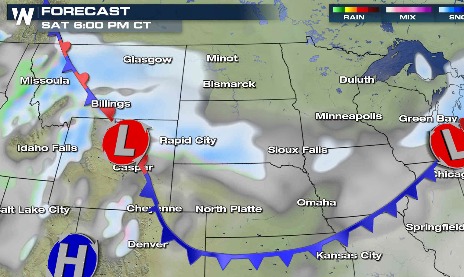
A series of fast moving storm systems will move from the High Plains to the Great Lakes this weekend, spreading fluffy snow over the region. A few areas could see as much as 6", with the highest mountain peaks approaching a foot. Some sleet and freezing rain is possible in Montana. Winter weather alerts extend from Wyoming to Michigan.
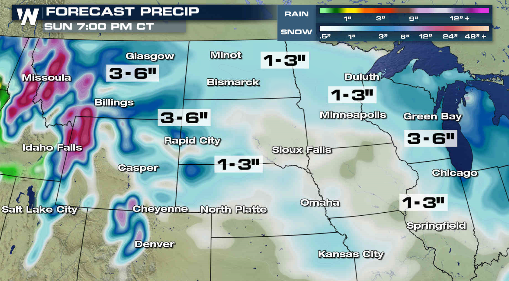
 The first low will push out of Canada this evening and across the Northern Plains Saturday morning. This will bring the first wave of precipitation to the area. The second low will develop near the Tetons Saturday and push into the Great Lakes Sunday, producing additional accumulations throughout the region.
The first low will push out of Canada this evening and across the Northern Plains Saturday morning. This will bring the first wave of precipitation to the area. The second low will develop near the Tetons Saturday and push into the Great Lakes Sunday, producing additional accumulations throughout the region.
All Weather News
More
Wildfire Outbreak in the Pacific Northwest
SPOKANE, WA - On Saturday, August 1st, the Ol
3 Aug 2026 1:55 AM

More Storms for the East Through Monday
A low-pressure system that moved through the
3 Aug 2026 1:50 AM


After Reaching Category 5, Genevieve Weakens in the Pacific
PacificGenevieve formed last Friday south of
3 Aug 2026 12:30 AM

Flooding, Severe Storms Target the Midwest Again
After an active week of storms across the nor
1 Aug 2026 1:40 AM

Flooding Risk Increases as Heavy Rain Targets the Tri-State Area
Tuesday, heavy rainfall moved across the Nort
30 Jul 2026 12:25 AM

Severe Weather: Energy From the Midwest Now in the Southeast
UPPER MIDWEST - Through Monday, dangerous tor
29 Jul 2026 10:30 PM