Heavy Snow to Continue Over the West
Special Stories
25 Jan 2021 6:00 AM
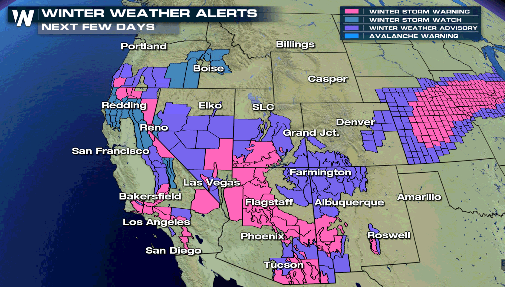
An active pattern will continue in the West with more rain and snow ahead to start this week. Winter weather alerts have been issued for portions of almost every Western state with accumulating snow in the forecast.
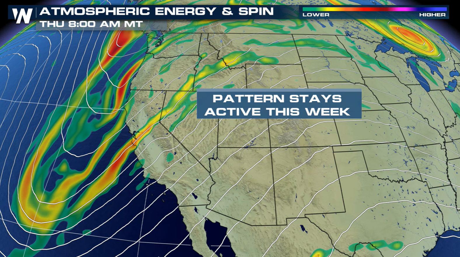
 An active jet stream pattern will continue across the West. One wave of energy will push through the region today (Monday) into Tuesday, with another system in the Pacific set to move ashore later this week.
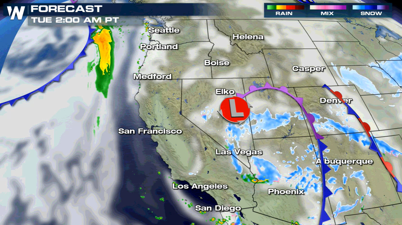
 Heavy snow will continue through the mountains near the low pressure center and front into early Tuesday. The system will begin to weaken after sunrise Tuesday, with precipitation becoming more scattered.
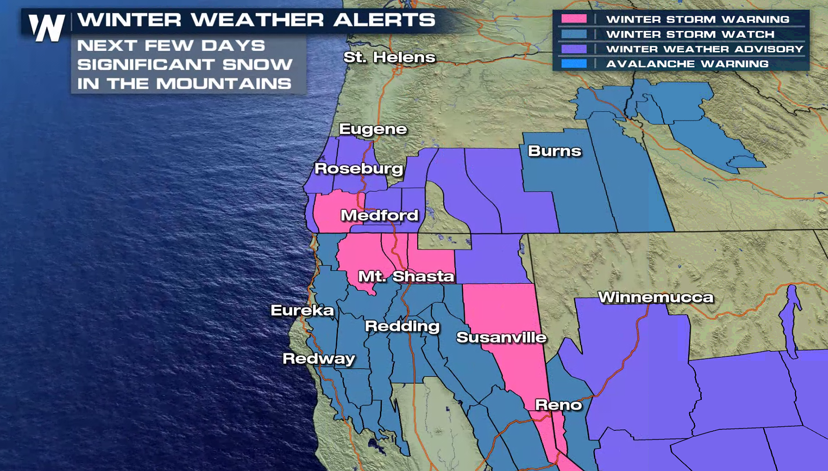
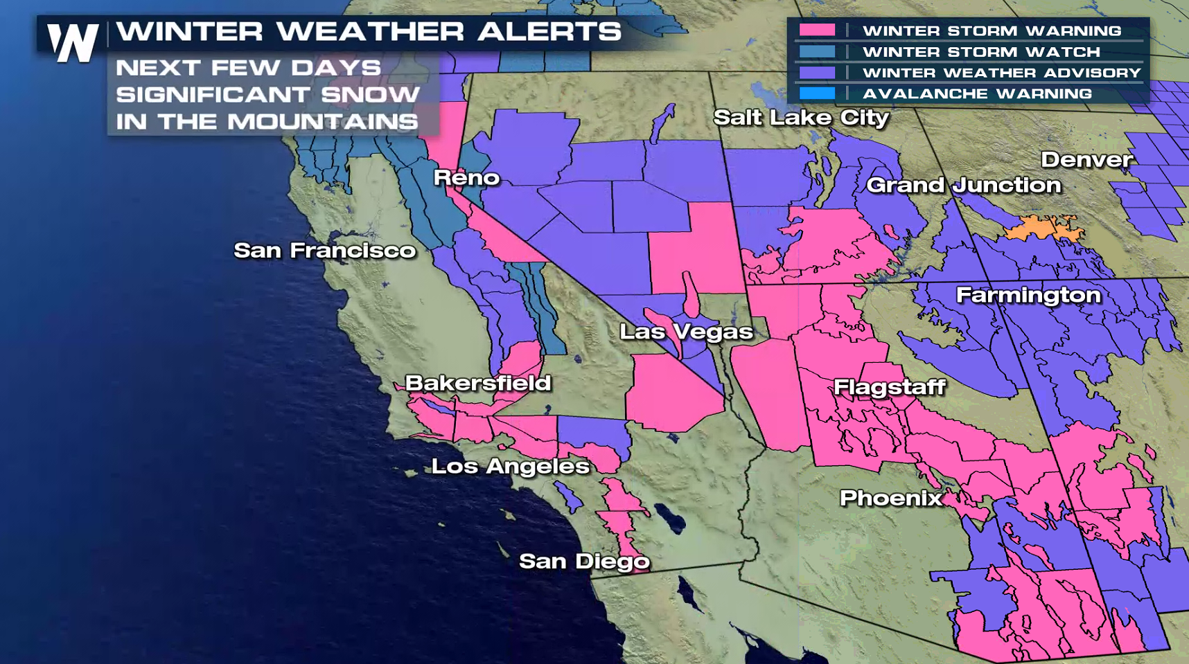
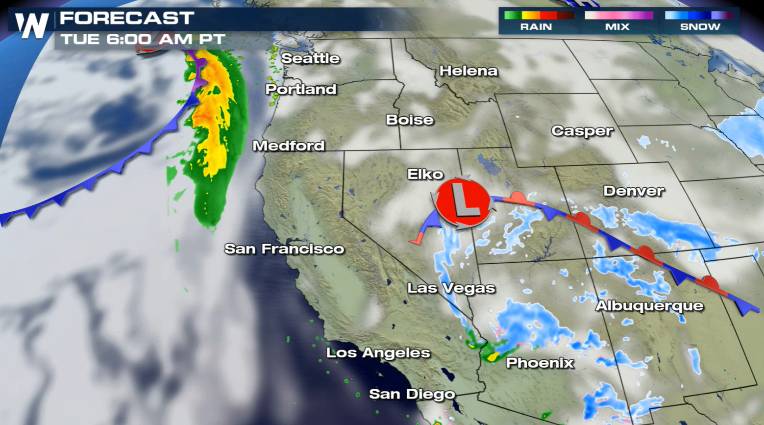 Snowfall will be heavy to start the work week in the mountains, with more than a foot likely in the higher elevations. Travel will be impacted, especially through the foothills and passes.
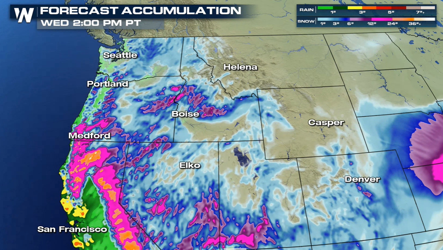
 Check back with WeatherNation for updates on the expected snowfall. We will keep you up to date on-air and online.
An active jet stream pattern will continue across the West. One wave of energy will push through the region today (Monday) into Tuesday, with another system in the Pacific set to move ashore later this week.
Forecast
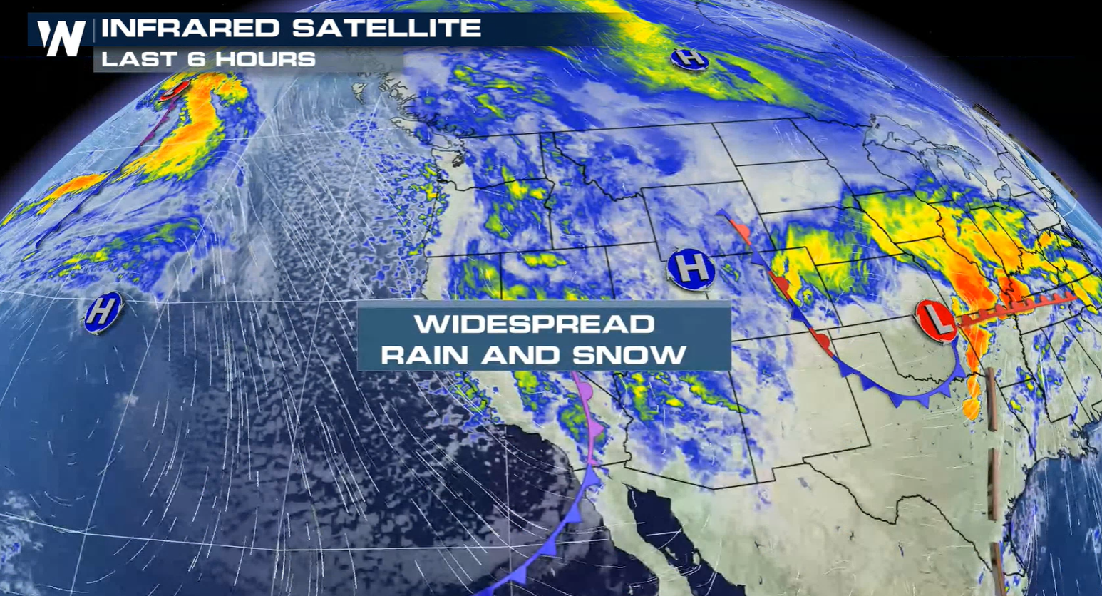
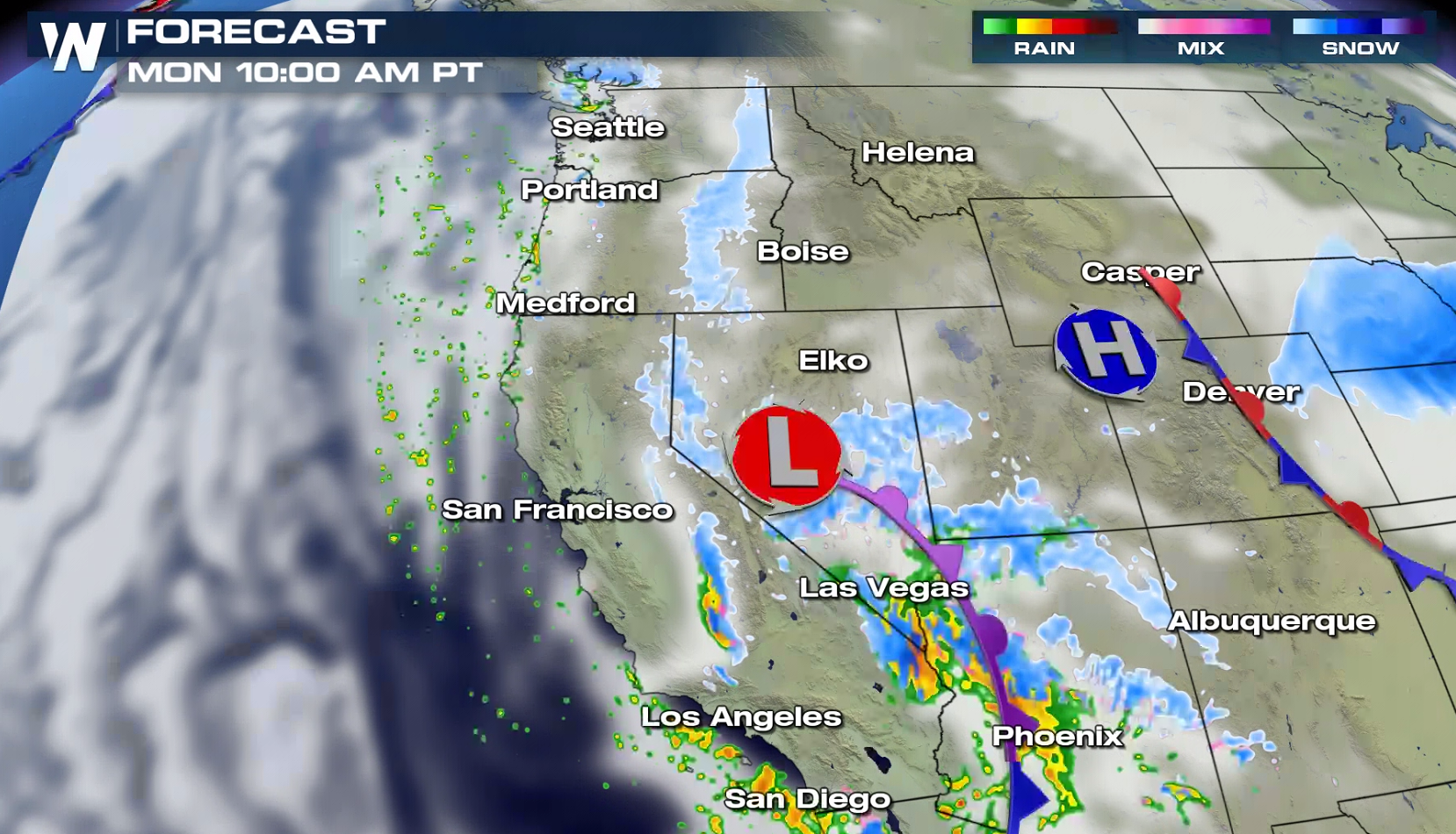
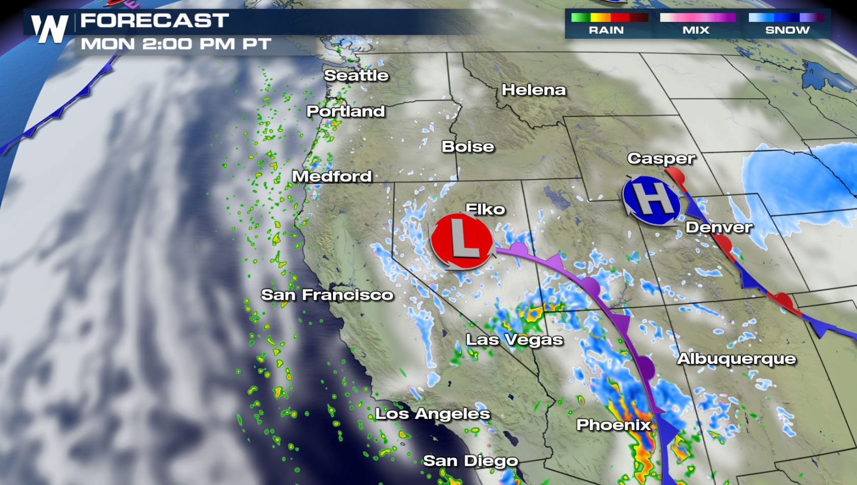
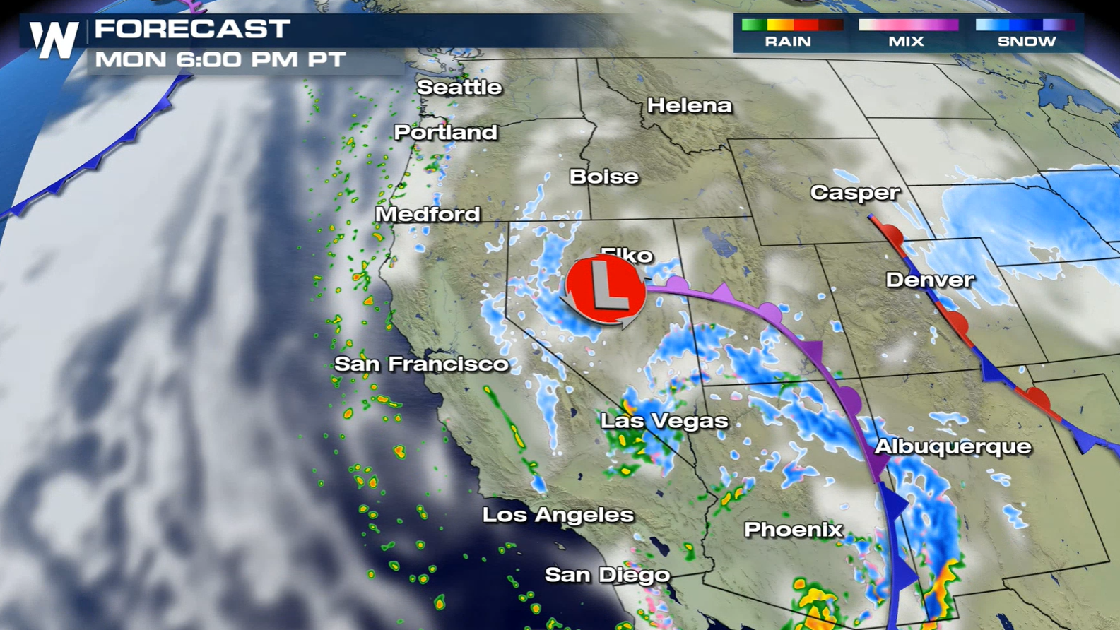
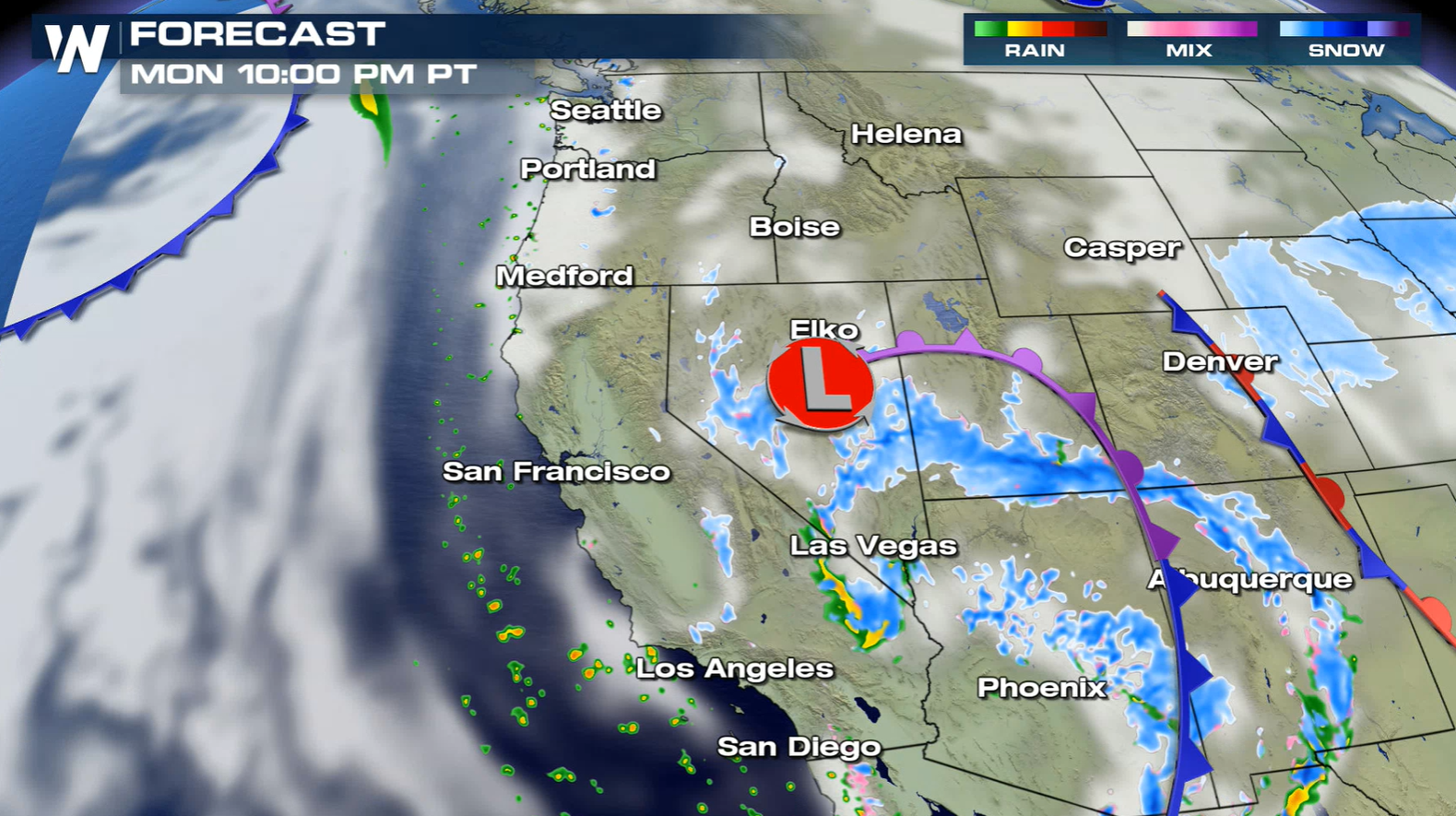
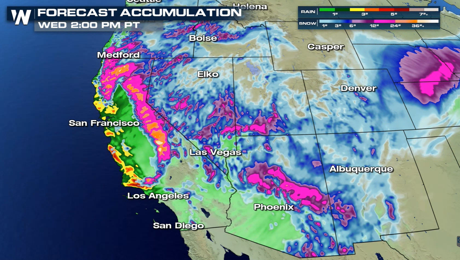
The first batch of rain and snow to start this week will slowly move through the region. Most of the moisture today (Monday) will be focused near a cold front and low pressure center.
Heavy snow will continue through the mountains near the low pressure center and front into early Tuesday. The system will begin to weaken after sunrise Tuesday, with precipitation becoming more scattered.
Snowfall will be heavy to start the work week in the mountains, with more than a foot likely in the higher elevations. Travel will be impacted, especially through the foothills and passes.
Check back with WeatherNation for updates on the expected snowfall. We will keep you up to date on-air and online.All Weather News
More

Severe Storm Threat Returns to the Midwest
After several tornadoes ripped through the Mi
31 Jul 2026 12:10 AM


After Reaching Category 5, Genevieve Weakens in the Pacific
PacificFausto is now a post-tropical cyclone.
30 Jul 2026 11:20 PM

Flooding Risk Increases as Heavy Rain Targets the Tri-State Area
Tuesday, heavy rainfall moved across the Nort
30 Jul 2026 12:25 AM

Severe Weather: Energy From the Midwest Now in the Southeast
UPPER MIDWEST - Through Monday, dangerous tor
29 Jul 2026 10:30 PM

Southeast Flood Risk Lingers Near Stalled Front
A stalled boundary over the Southeast will ke
25 Jul 2026 10:55 AM