Heavy Rain + Storms Target Texas and the Central U.S.

A stormy pattern has developed across the Southern Plains and Midwest, thanks to large troughs of low pressure moving from the Four Corners east of the Rockies. Severe storms developed on Thursday, producing gusty winds and MASSIVE hail in portions of Oklahoma. Hail topped baseball size in a few areas!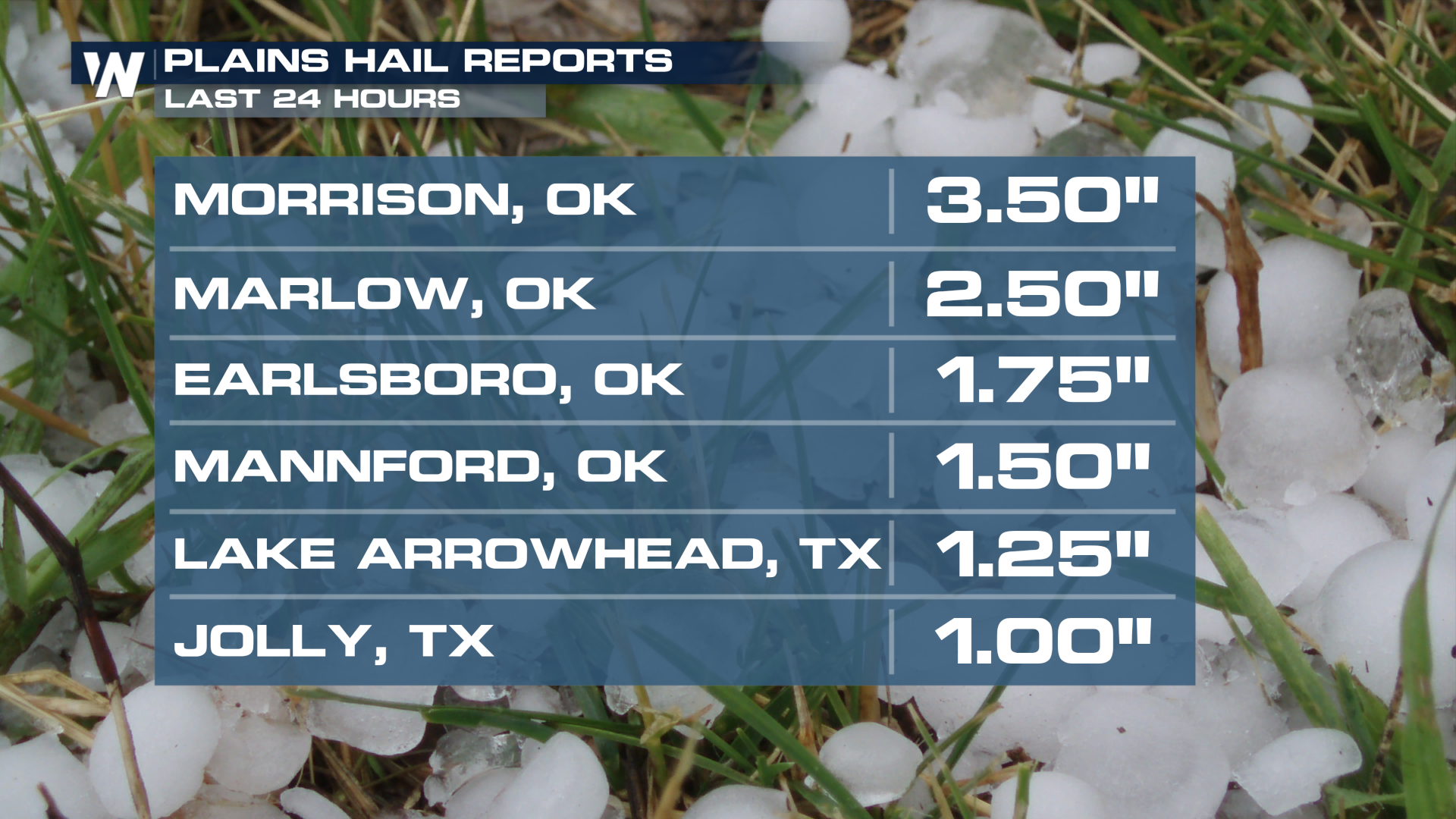
WHAT TO EXPECT
Another round of heavy downpours and a few severe storms can be expected Thursday from Texas into Missouri. As the low lifts north and east, the heaviest showers will follow into Thursday night and early Friday. Storms should subside for the start of the weekend before returning in earnest late Saturday into Sunday.
SEVERE THREAT
The SPC has issued a MARGINAL (level 1 out of 5) risk for severe weather on Thursday for portions Texas, Oklahoma, and Arkansas as the front moves east.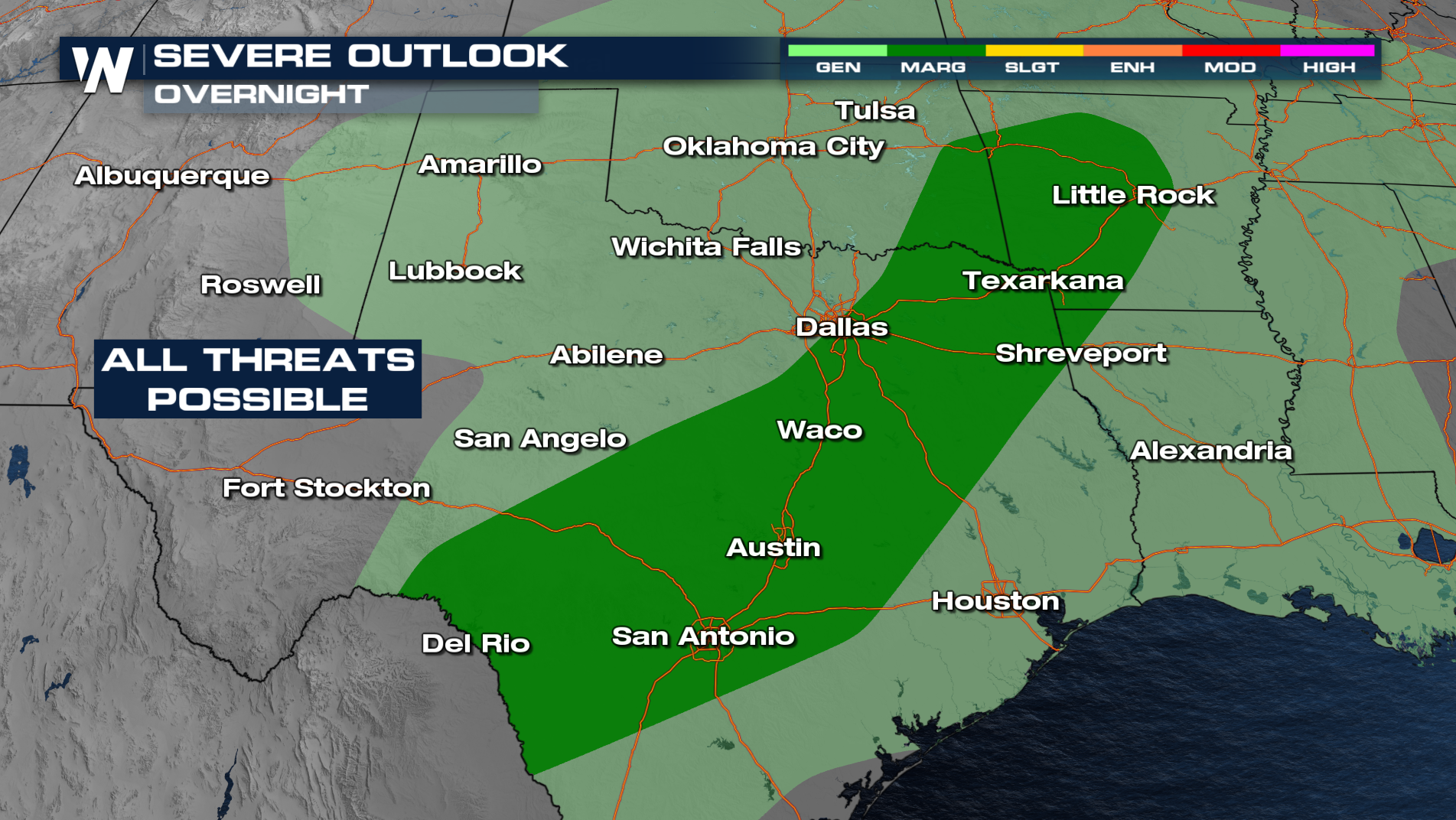
There are a few things that might hinder the severity of these storms. Questionable timing on the storms could keep them from reaching their full potential. Since storms could hold off until after sunset, the window to tap into the unstable air that builds up during the day could be narrow. One ingredient we know we have plenty of is moisture.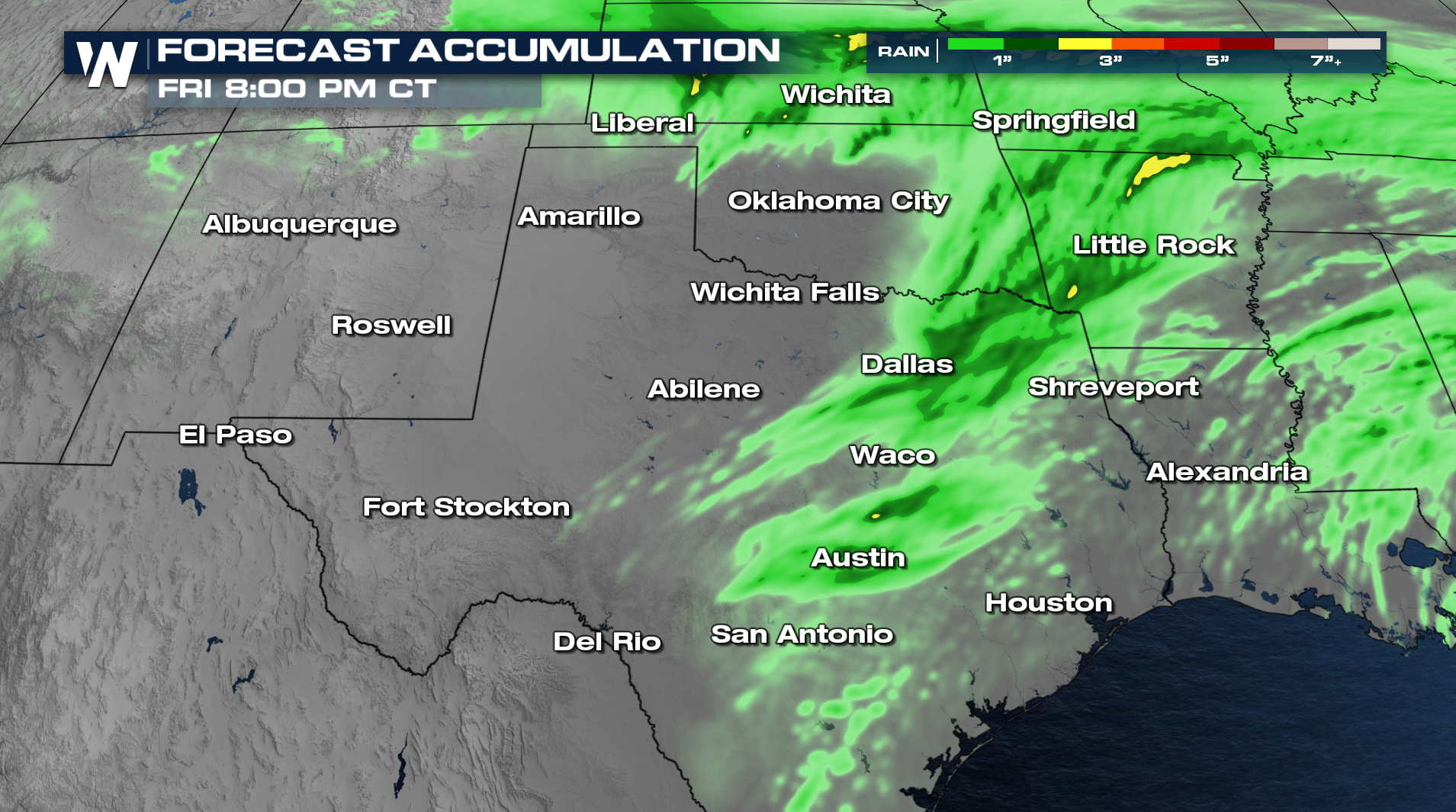
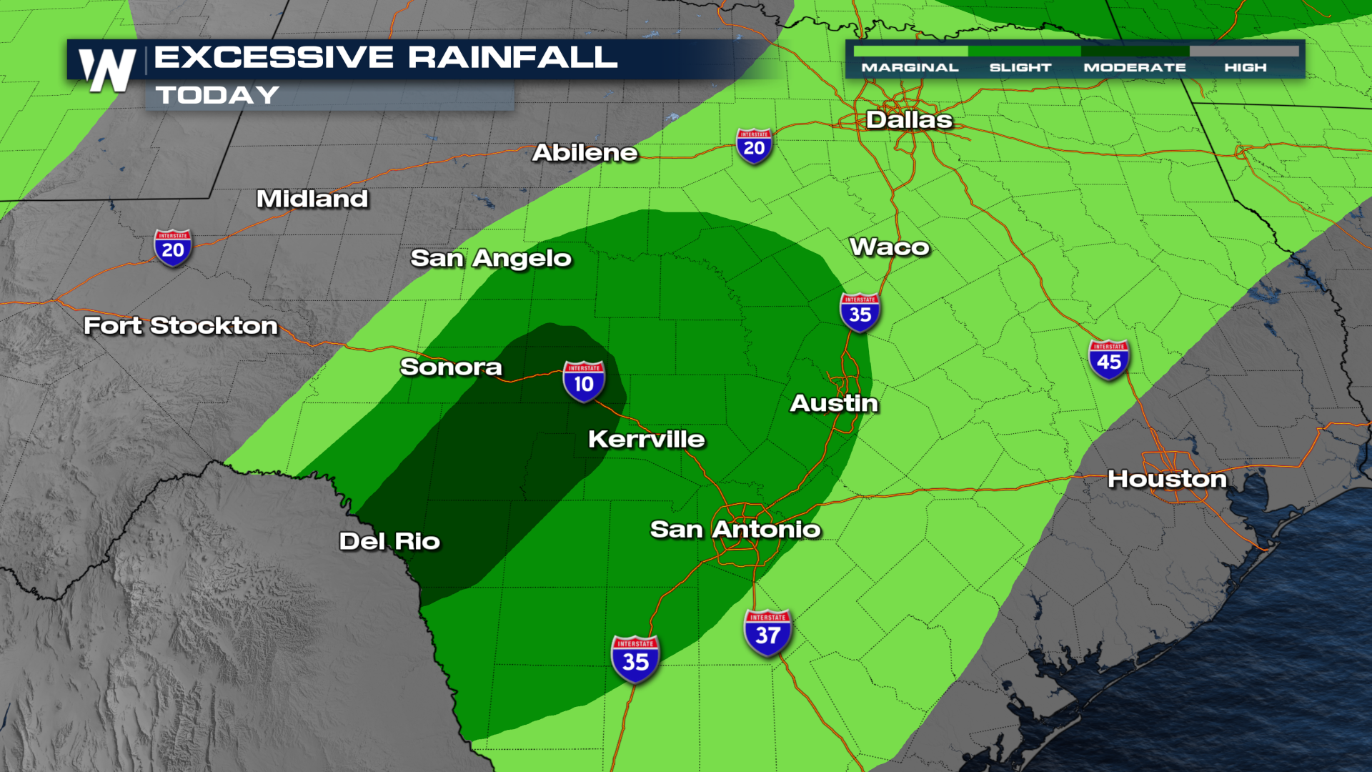
The Weather Prediction Center has also issued excessive rainfall outlooks starting now and continuing through the end of the week. The main concern for flash flooding will be on Thursday, when the second big push of widespread storms will move through.
 We'll have the latest updates on this developing situation at :30 past the hour in your Central Regional Forecast!


