Agatha Made Landfall in Mexico Monday

Top Stories
31 May 2022 12:50 PM
ABOVE: Agatha made landfall as a category 2 hurricane with maximum winds sustained at 105 mph, pressure of 974 mb. Agatha rapidly intensified this weekend into a category 2 hurricane with winds topping 110 mph. It is now weakening (wind wise) as it moves inland and brining heavy rain to Central Mexico.
https://twitter.com/WeatherNation/status/1531697013674242048
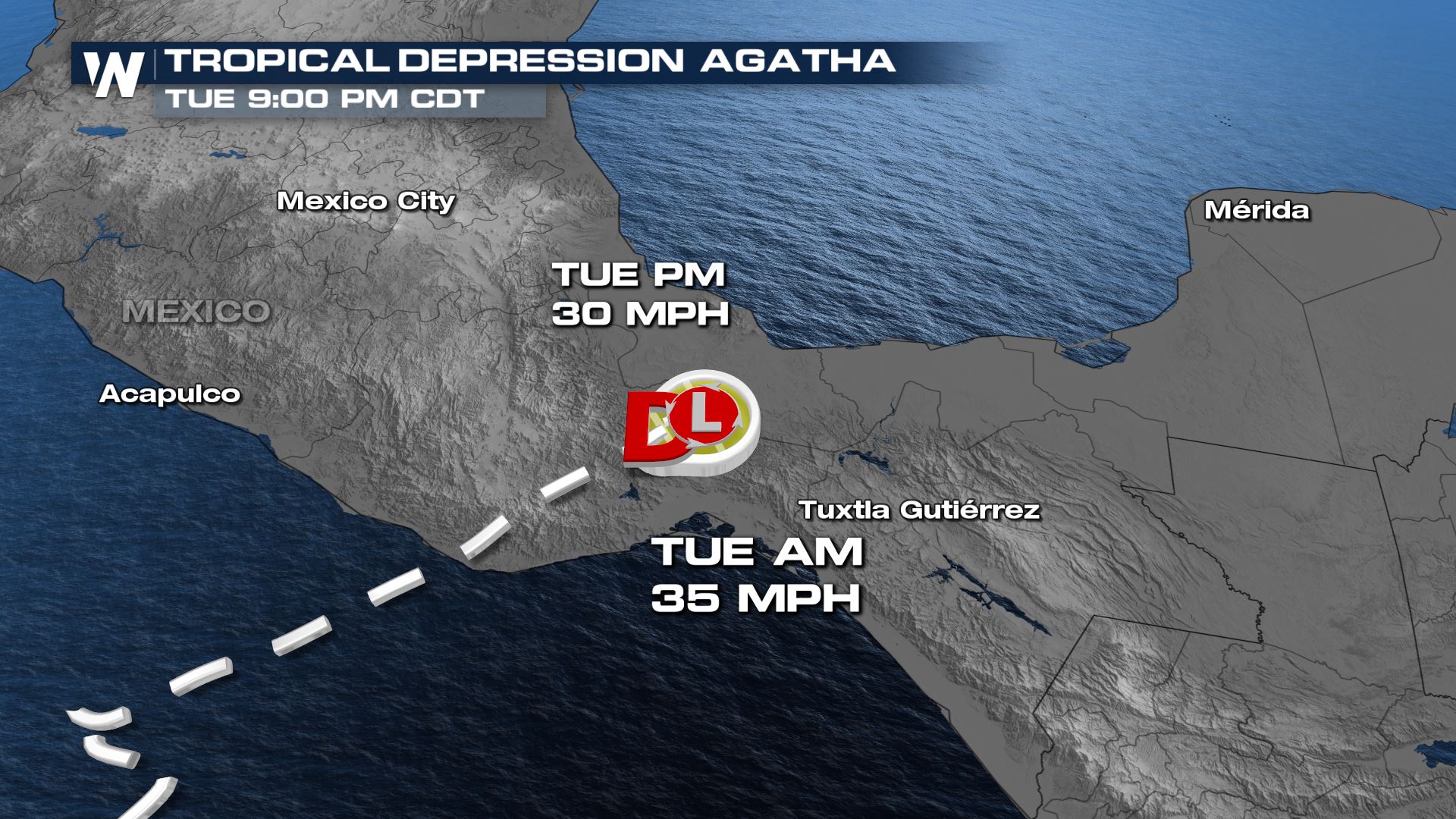
Since interacting with the land, maximum winds have decreased to 35 mph with locally higher gusts.
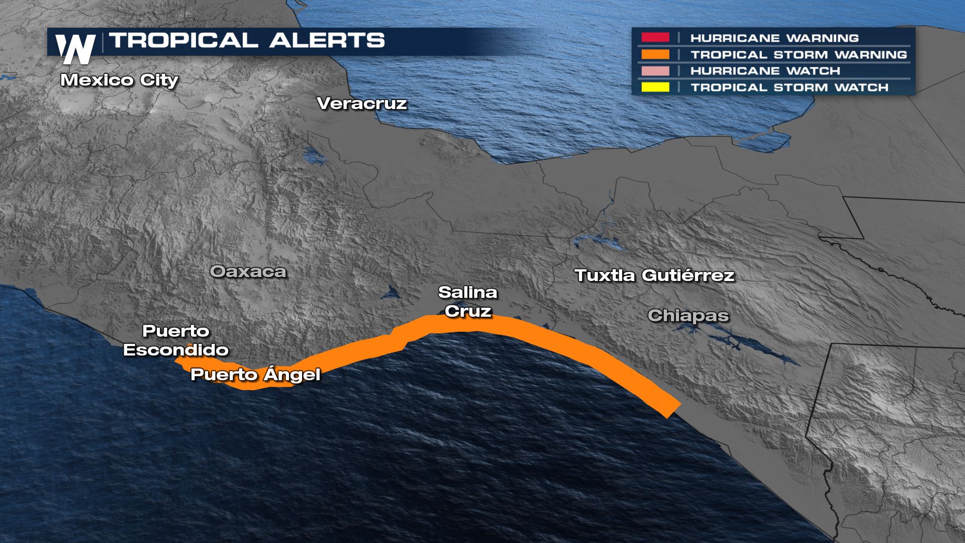
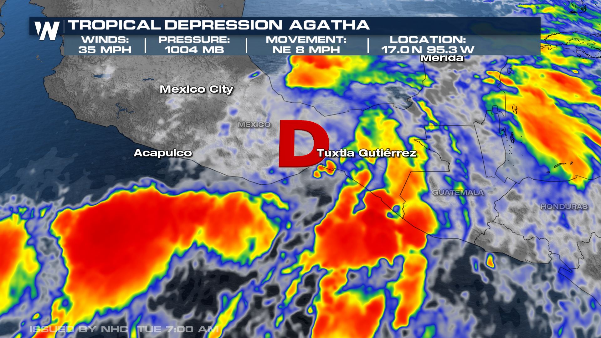 Tropical Storm Warnings are in effect from Salina Cruz to Lagunas de Chachua, Salina Cruz to Boca de Pijijiapan, and Lagunas de Chachua to Punta Maldonado. Additional information in specific areas can be found by clicking/tapping here.
 Forecasts for Agatha are ceasing today as the storm has weakened significantly from a wind perspective. Damaging rains can still cause trouble in central Mexico, so please make sure you think of all the hazards with a tropical system.
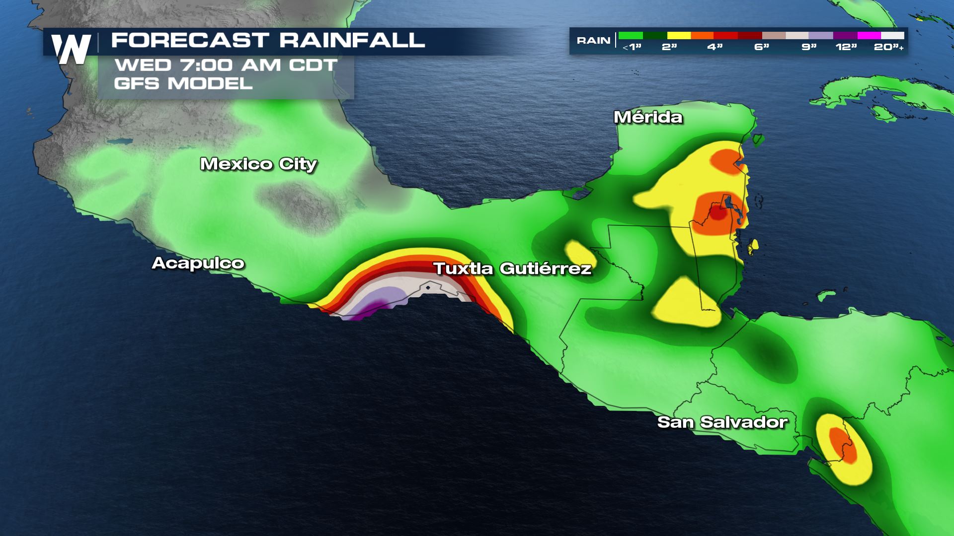
 Rainfall totals could top 6-12 inches where Agatha tracks, particularly in Oaxaca and Vera Cruz. Flash flooding and mudslides are likely.
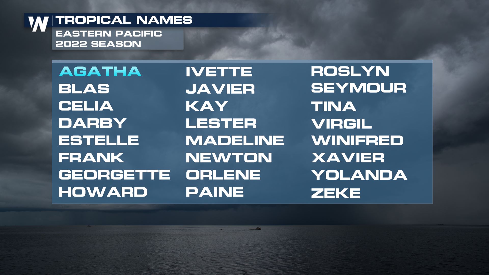
 The next tropical storm in the Pacific Basin will receive the name "Blas."
 For more on where the remnants of Agatha are going, click here. For the latest tropical news, join WeatherNation streaming 24/7.
Tropical Storm Warnings are in effect from Salina Cruz to Lagunas de Chachua, Salina Cruz to Boca de Pijijiapan, and Lagunas de Chachua to Punta Maldonado. Additional information in specific areas can be found by clicking/tapping here.
Forecasts for Agatha are ceasing today as the storm has weakened significantly from a wind perspective. Damaging rains can still cause trouble in central Mexico, so please make sure you think of all the hazards with a tropical system.
Rainfall totals could top 6-12 inches where Agatha tracks, particularly in Oaxaca and Vera Cruz. Flash flooding and mudslides are likely.
The next tropical storm in the Pacific Basin will receive the name "Blas."
For more on where the remnants of Agatha are going, click here. For the latest tropical news, join WeatherNation streaming 24/7.All Weather News
More


More Storms for the East Through Monday
A low-pressure system that moved through the
3 Aug 2026 1:50 AM

After Reaching Category 5, Genevieve Weakens in the Pacific
PacificGenevieve formed last Friday south of
3 Aug 2026 12:30 AM

Flooding, Severe Storms Target the Midwest Again
After an active week of storms across the nor
1 Aug 2026 1:40 AM

Flooding Risk Increases as Heavy Rain Targets the Tri-State Area
Tuesday, heavy rainfall moved across the Nort
30 Jul 2026 12:25 AM

Severe Weather: Energy From the Midwest Now in the Southeast
UPPER MIDWEST - Through Monday, dangerous tor
29 Jul 2026 10:30 PM